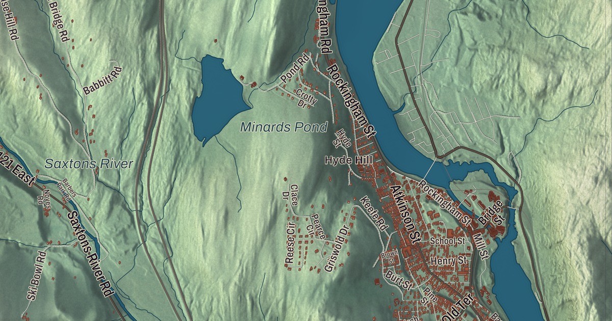
Rockingham runs along the Connecticut River, where the Williams River and the Saxtons River come down out of the hills, and it holds two incorporated villages, Bellows Falls and Saxtons River, plus a wide rural stretch west of Interstate 91. This map prints Bartonsville, Brockways Mills and Hyde Hill, with Rockingham Street, Atkinson Street, Old Terrace and Saxtons River Road.
Rockingham is a town in Windham County, Vermont.
KNOWOL made this map in 2026 from public survey data and gave it the look of an old county atlas, shading the hills from United States Geological Survey elevation data and drawing the roads and town line from the Census Bureau. The town covers 42.3 square miles, and 4,832 people lived here at the 2020 census. Click here to purchase a print of this map for your wall.
A grant on the Connecticut
New Hampshire’s governor, Benning Wentworth, chartered Rockingham on December 28, 1752, to Samuel Johnson and 72 others, and named it for Lord Rockingham. The town organized on March 25, 1761, and by 1771 it had 225 people. Its rivers were fishing places for salmon and shad, as they had been for the Native people who lived here first. The Williams River is named for John Williams, a Deerfield minister who preached the first Christian sermon in what became Vermont near its mouth on March 5, 1704, while he and part of his congregation were being taken north to Quebec as captives; a marker was placed near the spot in 1912.
In 1785 Colonel Enoch Hale built the first bridge across the Connecticut River at Bellows Falls, and until another was built at Springfield, Massachusetts, in 1796, it was the only one. A company dug the Bellows Falls Canal around the Great Falls from 1791 to 1802, one of the first canals built in the United States. Two railroads met at Bellows Falls in 1849, the village grew into a major mill town, and by 1858 the canal ran entirely to power its paper mills. Rockingham has no formal town center today; the town offices and the Rockingham Public Library are in Bellows Falls.
The Meeting House
The old center of town was laid out on a terrace above the Williams River, with the first meeting house, cemetery and post office. It became a busy stop on the road along the river, now Route 103, with shops, taverns, a gristmill and blacksmiths, but by the 1820s Bellows Falls had passed it, as water power drew people to the villages on the rivers. On April 14, 1908, a fire destroyed most of what was left of the old village, and the houses, hotel and store that burned weren’t rebuilt.
The fire came close to the Rockingham Meeting House, but it was spared. Approved by town meeting in 1787 and built between then and 1801, it served both the Congregational church and the town; services ended in 1839, and town meetings went on there until 1869. Restored in 1906, it keeps its box pews, the gallery on three sides and the original sounding board over the pulpit, and it shares its four acres with the town’s first burial ground, where the oldest graves with markers date to 1776. It was named a National Historic Landmark in 2000 as an exceptionally well-preserved meeting house of the “second period.” The village around it on Meeting House Road, bypassed by the new Route 103 in the 1950s, is a historic district with one of Vermont’s best groups of late Georgian houses.
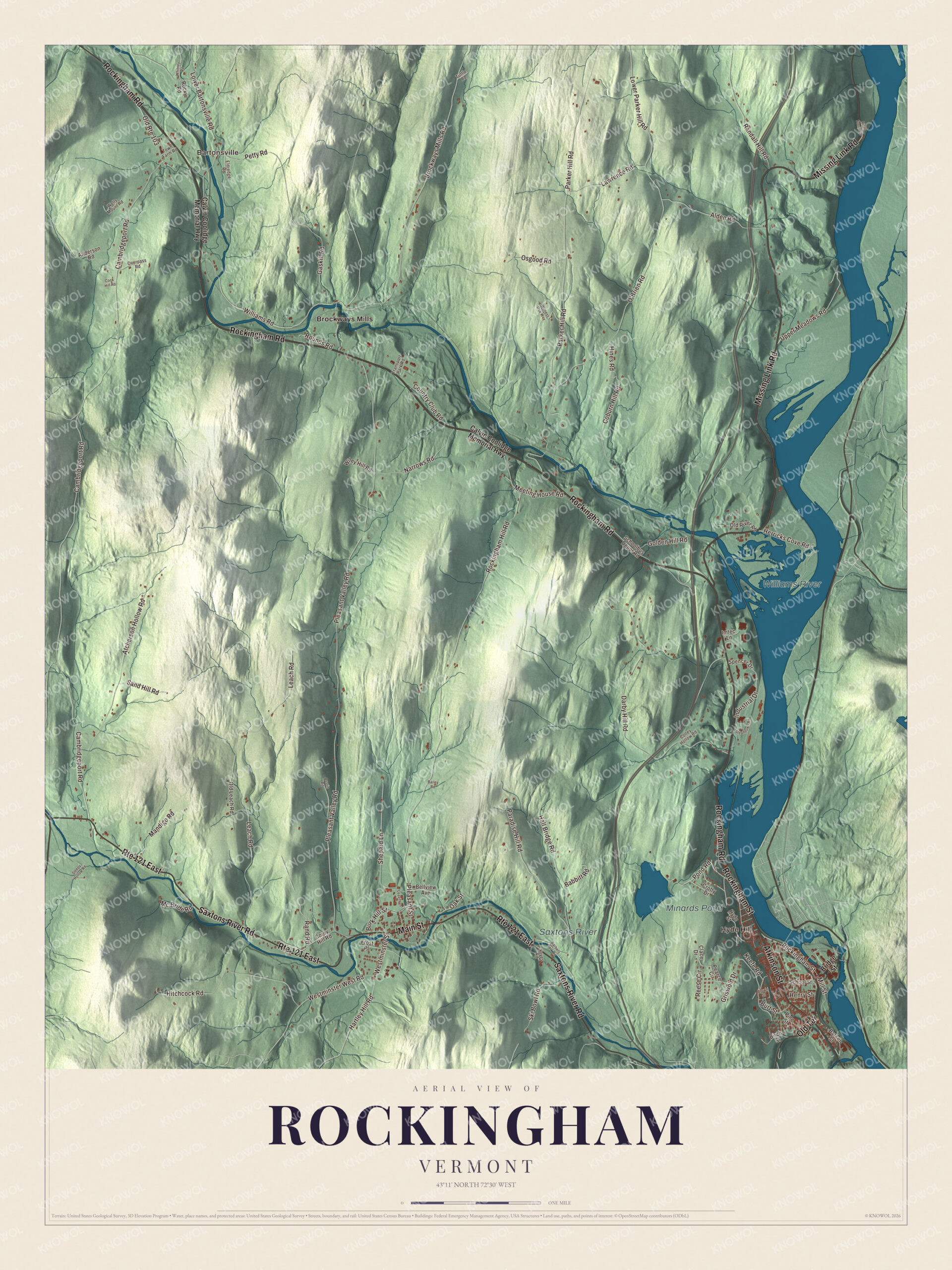
Click to explore a larger preview. The digital watermark does not appear on printed maps.
Names on this map
These names are printed on this map.
Places: Hyde Hill, Bartonsville, Minards Pond, Williams River, Saxtons River and Brockways Mills.
Streets and roads: Rockingham Road, Missing Link Road, Rockingham Street, Atkinson Street, Old Terrace, Route 121 East, Saxtons River Road, Main Street, Rand Road, Westminster Street, Narrows Road, Lower Parker Hill Road.
More street names, A to Z
Alden Road, Anderson Road, Atcherson Hollow Road, Austin Road, Babbitt Road, Bailey Road, Barbers Park Road, Barker Street, Bellview Avenue, Birch Street, Bridge Street, Brockways Mills Road, Brown Street, Burk Hill Street, Burt Street, Calvin Coolidge Memorial Highway, Cambridgeport Road, Clace Drive, Coburn Hill Road, Colley Hollow Road, Cook Hill Road, Corey Hill Road, Country Club Road, Crotty Drive, Darby Hill Road, Eldredge Road, Frost Place, Gaskill Road, Golden Hill Road, Griswold Drive, Hall Bridge Road, Hartley Hill Road, Henry Street, Herricks Cove Road, Hines Road, Hitchcock Road, Hyde Street, Imtec Lane, Industrial Drive, Keefe Road, Lawrence Road, Leach Road, Leavitt Lane, Lower Bartonsville Road, Mandigo Road, Mc Bride Road, Meeting House Road, Mill Street, Noyes Road, O'Brien Road, Oak Street, Old Leach Road, Old River Road, Old Route 103, Osgood Road, Overpass Road, Paradise Hill Road, Parker Hill Road, Pearce Circle, Petty Road, Pine Street, Pleasant Street, Pleasant Valley Road, Pond Road, Randall Hill Road, Reese Circle, River Front Drive, Rockingham Hill Road, Rocky Road, Rounds Road, Sand Hill Road, Schoolbus Depot Road, School Street, Shepard Lane, Ski Bowl Road, Sleepy Hollow Road, Spencer Drive, Steamtown Road, Town Farm Road, Transport Park Road, Tuttle Road, Upper Meadows Road, Wells Mount Road, Westminster West Road, Whitney Road, Wiley Hill Road, Williams Road, Witness Oak Way.
See it on a wall
The Rockingham map as a framed print. Swipe for more.


Rockingham people
Jonathan Blanchard was born in Rockingham in 1811. He became a preacher against slavery, helped publish the abolitionist newspaper The Philanthropist in Cincinnati, represented Ohio at the 1843 World Anti-Slavery Convention, and is credited with founding Wheaton College in Illinois in 1860, which he led until 1882. Selim Peabody, the educator, and the federal judge Henry Franklin Severens were also born here, and John S. Barry, later the fourth governor of Michigan, grew up on his father’s farm in town. Hetty Green, the financier known as “the richest woman in America” in the Gilded Age, settled in her husband’s hometown of Bellows Falls in 1873, and she is buried there beside him.
Around the map
Bartonsville, a hamlet with mills that Jeremiah Barton set up about 1840, was once a stop on the Rutland Railroad. Its covered bridge on Lower Bartonsville Road, built over the Williams River by Sanford Granger in 1870, was lost to flooding from Hurricane Irene in 2011; the town voted to use the insurance money for a new covered bridge, which opened in January 2013. Granger also built the Worrall Covered Bridge on Williams Road, a little to the east, in 1870, and it’s the only one of the town’s seventeen 19th-century covered bridges still standing. Below those bridges the river flows over Sokoki Falls, named for the local band of the Abenaki, and through the gorge at Brockways Mills, a mill site and former stop on the Rutland Railroad.
In Bellows Falls, the Miss Bellows Falls Diner sits on Rockingham Street, just northwest of the business district; it arrived in the village on May 14, 1944. Atkinson Street, which carries Route 5, forms the western edge of the Bellows Falls Neighborhood Historic District, which was enlarged in 2007 to take in Old Terrace.
On the map, start with Hyde Hill and Bartonsville, then follow Rockingham Road, Missing Link Road, Rockingham Street, Atkinson Street, Old Terrace and Saxtons River Road across town. Then look outward toward Brockways Mills. Minards Pond, the Williams River and the Saxtons River are printed too. Rockingham dates to 1752.
This map of Rockingham is made for everyone who calls Rockingham home, and it shows the town as it looks today, from Rockingham Street and Old Terrace out to Bartonsville and Brockways Mills. Hang it in an office, library or den, or use it to teach children the geography and history of their town. It’s printed on museum quality archival paper. Zoom in on the preview above to explore the details, then click here to get your copy of the Rockingham, Vermont map.

Sources
- Rockingham, Vermont, Wikipedia
- Town histories and representatives, R towns, Vermont Legislature
- Williams River (Vermont), Wikipedia
- Bellows Falls, Vermont, Wikipedia
- Rockingham Village Historic District, Wikipedia
- Rockingham Meeting House, Wikipedia
- Jonathan Blanchard, Wikipedia
- Selim Peabody, Wikipedia
- Henry Franklin Severens, Wikipedia
- John S. Barry, Wikipedia
- Hetty Green, Wikipedia
- Bartonsville Covered Bridge, Wikipedia
- Worrall Covered Bridge, Wikipedia