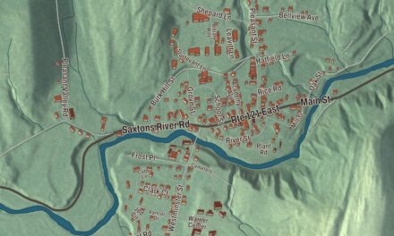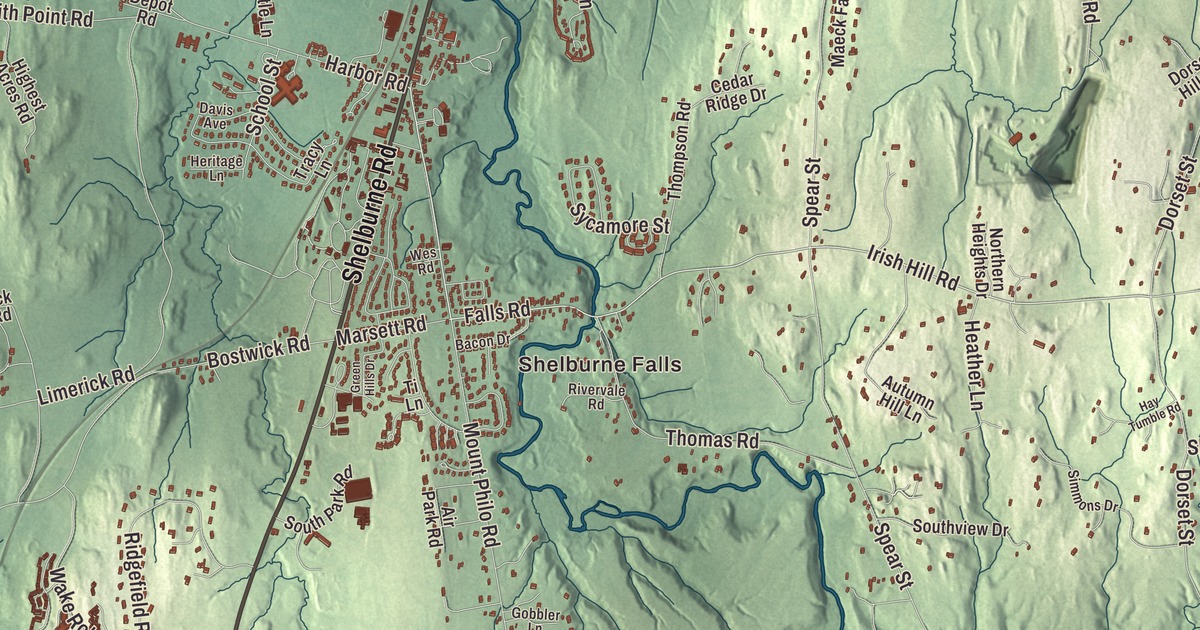
Shelburne runs along Lake Champlain south of Burlington, and its village grew up where Harbor Road and Falls Road meet Shelburne Road. This map prints Shelburne Falls, Burlington Road, Irish Hill Road and Spear Street, with Shelburne Pond, Duck Pond and the La Platte River.
Shelburne is a town in Chittenden County, Vermont.
KNOWOL made this map in 2026 from public survey data and gave it the look of an old county atlas, shading the hills from United States Geological Survey elevation data and drawing the streets and town line from the Census Bureau. The town covers 45.1 square miles, nearly half of it water, mostly Lake Champlain, and 7,717 people lived here at the 2020 census. Click here to purchase a print of this map for your wall.
Farms, falls and a lake shipyard
New Hampshire’s governor, Benning Wentworth, chartered Shelburne on August 18, 1763, to Jesse Hallock and 64 associates, and the town was named for William Petty, 2nd Earl of Shelburne, a British prime minister. A surveyors’ blunder cost it a large part of the land its charter promised. Ira Allen first surveyed the town, early settlers fled during the Revolution, and permanent settlement resumed in the 1780s. The town organized on March 29, 1787, and Caleb Smith went to the legislature that year. Benjamin Harrington, an early settler, farmed the land where the village stands, laid out the stagecoach road between Rutland and Burlington in the 1790s, roughly today’s Route 7, and built the Shelburne Inn, which dates to 1796 and is the oldest surviving building in the Shelburne Village Historic District. That district centers on the junction of Route 7 with Harbor Road and Falls Road and reaches north to the LaPlatte River. Close by on Route 7 stands the Lee Tracy House, a brick house built in 1875 for a local wool trader in a blend of the Gothic and Italianate styles.
Farming carried Shelburne’s economy from the start. Clearing the land brought a potash boom, a few Merino sheep imported from Spain in 1811 set off a rise in sheep raising, and by 1880 the town’s orchards counted some 17,740 trees. A mile southeast of the village, Shelburne Falls was the center of industry, with a carding and fulling mill, a gristmill, a sawmill and a blacksmith shop on the La Platte River. Ezra Meech, a fur trader who served in Congress in the 1820s, farmed in Shelburne, raised cattle and horses and made potash, and he’s buried in the Shelburne Village Cemetery. Benjamin Sutton of Greenwich, Connecticut, took up land in 1788 on what’s now Dorset Road, and one family worked the Sutton Farm into the late 20th century.
After the War of 1812, trade on the lake grew quickly. The Lake Champlain Transportation Company set up its shipyard at Shelburne Harbor and launched its first steamboat, the General Green, in 1825. Ten more followed, and the last was the Ticonderoga, built there in 1906. She’s 220 feet long, and she’s one of just two sidewheel passenger steamers left with an intact walking beam engine.
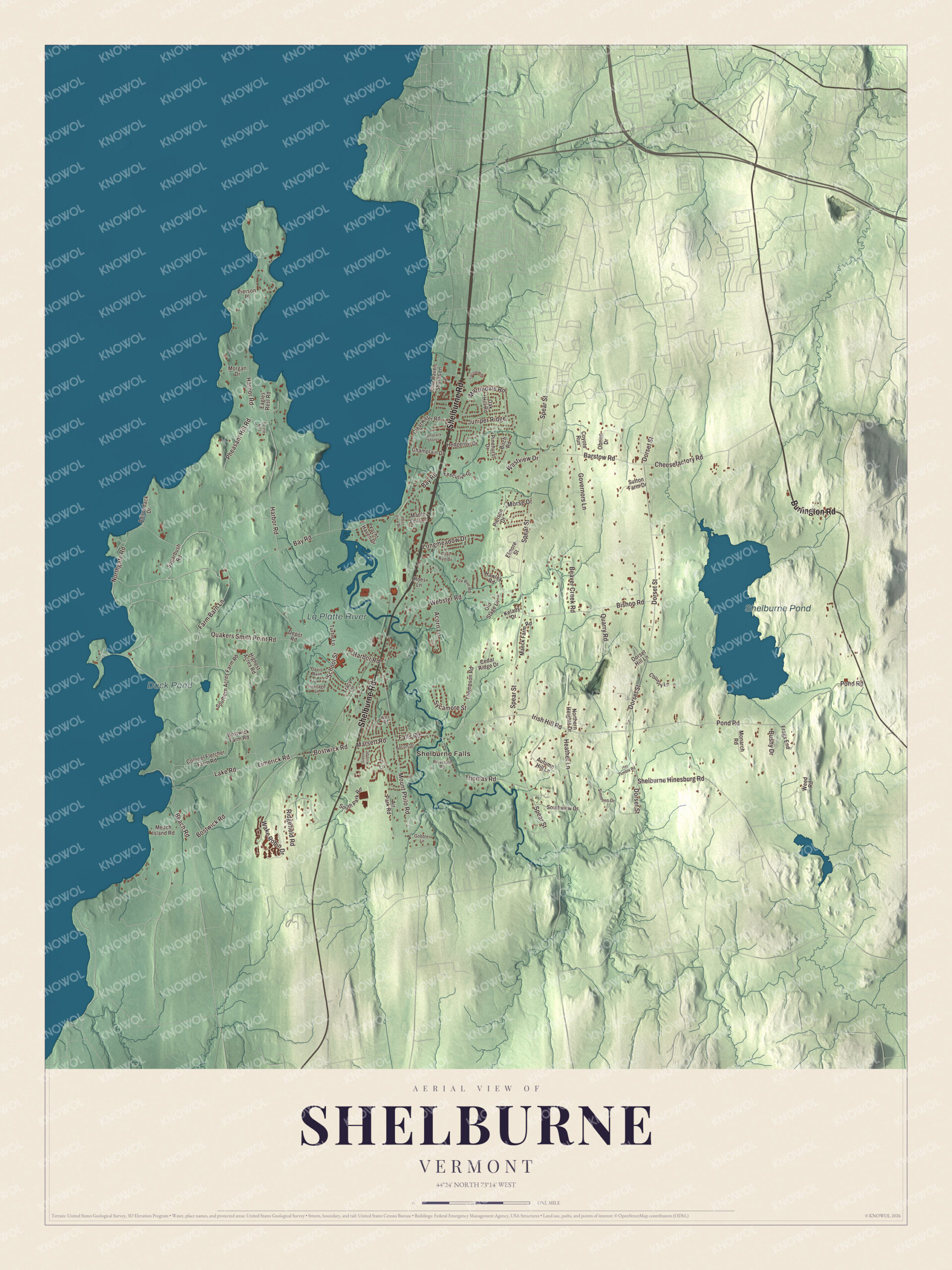
Click to explore a larger preview. The digital watermark does not appear on printed maps.
Names on this map
These names are printed on this map.
Places: Shelburne Falls, Shelburne Pond, Duck Pond and La Platte River.
Streets and roads: Shelburne Road, Burlington Road, Falls Road, Irish Hill Road, Harbor Road, Spear Street, Dorset Street, Pond Road, Northgate Road, Bostwick Road, Quakers Smith Point Road, Bay Road.
More street names, A to Z
Acorn Lane, Adirondack Drive, Air Park Road, Autumn Hill Lane, Bacon Drive, Barstow Road, Beach Road, Beaver Creek Road, Birch Road, Bishop Road, Bostwick Farm Road, Bushy Drive, Cedar Ridge Drive, Champlain Drive, Cheesefactory Road, Clearwater Road, Colonel Fletcher Farm Road, Country Lane, Coyote Run, Davis Avenue, Deer Run Drive, Depot Road, Dorset Hill Lane, Eagles Rest Road, Elmore Street, Executive Drive, Farm Barn Lane, Fox Run Road, Frogs End, Gobbler Lane, Governors Lane, Green Hills Drive, Hawley Road, Hay Tumble Road, Heather Lane, Hedgerow Drive, Heritage Lane, Highest Acres Road, Hoes Lane, Juniper Ridge, Kelady Drive, Lake Road, Lark Hill Road, Limerick Road, Locust Hill, Longmeadow Drive, Maeck Farm Road, Maple Leaf Lane, Marsett Road, Martindale Road, Meach Island Road, Monarch Road, Morgan Drive, Morse Drive, Mount Philo Road, Northern Heights Drive, Oak Hill Road, Obrien Drive, Old Stage Lane, Pheasant Hill Road, Pierson Drive, Pierson Place, Pine Haven Shores Lane, Pinehurst Drive, Point View Drive, Quarry Road, Ridgefield Road, Rivervale Road, School Street, Shelburne Hinesburg Road, Simmons Drive, Southern Acres Farm Road, South Park Road, Southview Drive, Sugarbush Road, Sutton Farm Drive, Sycamore Street, Tamarack Shores, Thomas Road, Thompson Road, Ti Lane, Tracy Lane, Turtle Lane, Wake Robin Drive, Webster Road, Weed Road, Wes Road, Westview Drive, Yacht Haven Drive.
See it on a wall
The Shelburne map as a framed print. Swipe for more.


The Webbs’ Shelburne
In 1886 Dr. William Seward Webb and Eliza Osgood Vanderbilt Webb created Shelburne Farms as a model agricultural estate on the lakeshore, with Frederick Law Olmsted guiding the layout of 3,800 acres and Robert Henderson Robertson designing the buildings. It’s a National Historic Landmark today, a well-preserved Gilded Age “ornamental farm,” and since 1972 a nonprofit education center for sustainability, with 1,400 acres and a dairy herd of Brown Swiss cows whose milk becomes farmhouse cheddar. The village grew most between about 1880 and 1910, when industry developed near the railroad and the town benefited from the Webbs’ philanthropy.
Electra Havemeyer Webb, a pioneering collector of American folk art, founded the Shelburne Museum in 1947. She moved historic buildings from New England and New York to its 45 acres near the lake, among them houses, barns, a meeting house, a one-room schoolhouse, a lighthouse, a jail, a general store and a covered bridge. In 1954 the museum decided to bring the Ticonderoga ashore. The steamboat floated into a basin dug off Shelburne Bay and settled onto a railroad carriage, and in the winter of 1955 she was hauled across highways, a swamp, woods and fields to the museum grounds, where she’s on display. With Shelburne Farms and the Vermont Teddy Bear Company, the museum is one of the town’s three major tourist attractions.
On the map, start with Shelburne Falls, then follow Shelburne Road, Burlington Road, Falls Road, Irish Hill Road, Harbor Road and Spear Street across town. Shelburne Pond, in the eastern part of town, Duck Pond and the La Platte River are printed too. Shelburne dates to 1763.
This map of Shelburne is made for everyone who calls Shelburne home, and it shows the town as it looks today, from Shelburne Falls and Harbor Road to Shelburne Pond. Hang it in an office, library or den, or use it to teach children the geography and history of their town. It’s printed on museum quality archival paper. Zoom in on the preview above to explore the details, then click here to get your copy of the Shelburne, Vermont map.

Sources
- Shelburne, Vermont, Wikipedia
- Town histories and representatives, S towns, Vermont Legislature
- Shelburne Village Historic District, Wikipedia
- Lee Tracy House, Wikipedia
- Ezra Meech, Wikipedia
- Sutton Farm (Shelburne, Vermont), Wikipedia
- Ticonderoga (steamboat), Wikipedia
- Shelburne Farms, Wikipedia
- Shelburne Museum, Wikipedia
- Electra Havemeyer Webb, Wikipedia