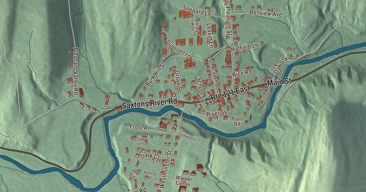
Saxtons River is a small village on the river of the same name in the town of Rockingham, and for more than a hundred years it has been the home of Vermont Academy. This map prints Main Street, Westminster Street, Pleasant Street, Burk Hill Street, Clark Court and Saxtons River Road.
Saxtons River is a village in Windham County, Vermont.
KNOWOL made this map in 2026 from public survey data and gave it the look of an old county atlas, shading the hills from United States Geological Survey elevation data and drawing the streets and village line from the Census Bureau. Saxtons River is an incorporated village within the town of Rockingham, and it has its own incorporated-place boundary, half a square mile, all of it land. At the 2020 census 479 people lived here. Click here to purchase a print of this map for your wall.
From two houses to a mill village
The Bellows Falls historian Lyman Simpson Hayes wrote in 1907 that settlement here began in 1783, when Amos P. Cummings cut the first trees in what Hayes called an “entirely unbroken wilderness.” Growth was slow, and as late as 1795 the village had only two houses. A meeting house went up and the village cemetery was laid out in 1810, and in 1815 the first textile mill opened at the Middle Falls, now officially Saxtons River Falls. The town set the village bounds in 1820. By 1828 there were grist, saw and fulling mills, a tannery, a forge, a tavern, a distillery, two stores, a post office, a law office and forty-five houses, and the old meeting house had become the public school. By 1907 it was described as a “flourishing village” of about 950 people, with a variety of mills and other industries. Saxtons River was formally incorporated as a village in 1905, governed by a board of trustees the village’s voters elect.
From 1900 to 1924, an electric railway, the Bellows Falls and Saxtons River Railroad, linked Rockingham’s two incorporated villages. The company built Barbers Park east of the Saxtons River, about halfway between them, and summer crowds rode the trolleys out for baseball games and amusement rides. Much of the village’s industry had failed by the 1920s.
Vermont Academy
The Vermont Baptist State Convention voted on November 10, 1869, to found a school for young men and women of the Baptist community. The largest gift, $20,000, came from Charles L. Jones, a native of Saxtons River then living in Cambridge, Massachusetts, and the first building, Jones Hall, carries his name and still stands. William M. Pingry founded Vermont Academy in 1876. Jones Hall was its only building until Fuller Hall went up in 1888, and the architect Frank Lyman Austin designed Alumni Hall in 1921. Early in the 1900s the school started an annual Winter Carnival, which contributed to the creation of New England’s winter recreation culture. The campus lies mostly inside the village, bounded on the east by Pleasant Street; it covers more than 450 acres and was listed on the National Register as a historic district in 2015.
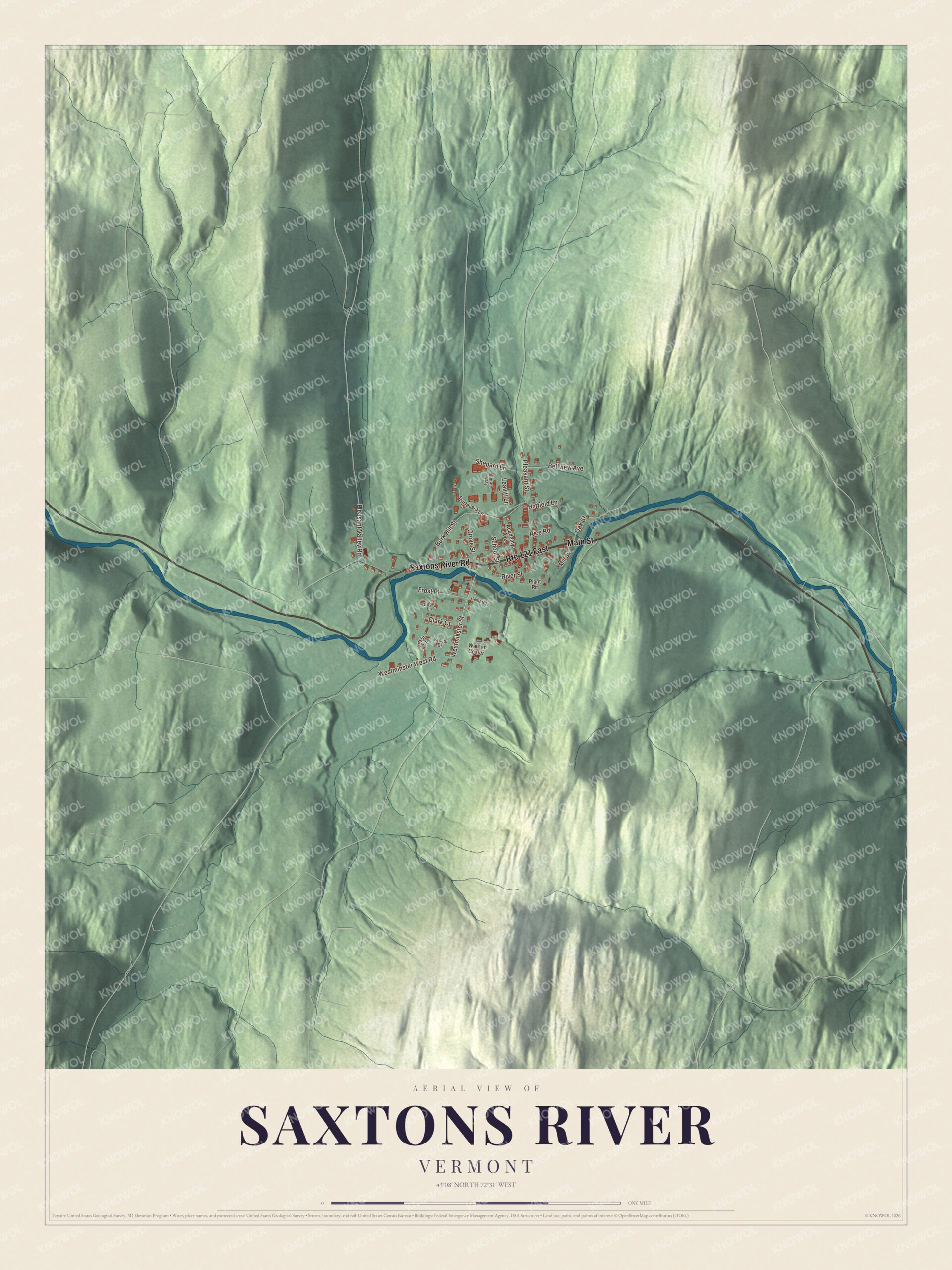
Click to explore a larger preview. The digital watermark does not appear on printed maps.
Names on this map
These names are printed on this map.
Places: Cemetery.
Streets and roads: Saxtons River Road, Route 121 East, Main Street, Westminster Street, Clark Court, Burk Hill Street, Pleasant Street, Pleasant Valley Road, Westminster West Road, Leavitt Lane, Bellview Avenue, River Street.
More street names, A to Z
Academy Avenue, Cobb Lane, Frost Place, Grove Street, Hatfield Lane, Jed Circle, Library Way, Mill Street, Oak Street, Plant Road, Rice Road, School Street, Shepard Lane, Sturtevant Lane, Vancor Drive, Warner Center.
See it on a wall
The Saxtons River map as a framed print. Swipe for more.


Main Street and Westminster Street
Most of the village is a historic district on the National Register. Along Main Street stand the Congregational Church of 1836, rebuilt in 1871 and now home to the Saxtons River Historical Society; the Baptist church of 1840, now Christ’s Church; the Fuller Hardware Store from about 1830; the Warner Block from about 1850; and the Saxtons River Inn of 1903, at the corner of Academy Avenue. In 1974 the Campbell family, then about a fortieth of the village’s population, reopened the aging inn, and after a year-long effort with help from the community it became a mainstay of the village for decades, with a bar, a dining room and ten guest rooms. It has changed hands since and still survives. Out Westminster Street are the site of the Old South Meetinghouse, the Saxtons River Cemetery, Tenney’s Lumber Mill of 1870 and the Thompson Gristmill from about 1850.
Horace Henry Baxter, born in the village in 1818, graded and laid track for the Rutland and Burlington Railroad, bought the Rutland Marble Company and served as Adjutant General of Vermont at the start of the Civil War. John Butler Smith, born in 1838, owned the Contoocook Mills Company in Hillsborough, New Hampshire, and was that state’s governor from 1893 to 1895. Charles C. Tillinghast Jr., born in 1911, became president of Trans World Airlines in 1961, later its chairman, and served as chancellor of Brown University.
About 1.2 miles east of the village, the Hall Covered Bridge carries Hall Bridge Road over the Saxtons River. Sanford Granger built the original bridge in 1867; an overweight truck destroyed it in 1980, and Milton S. Graton built a replica in 1982, using oxen to move the finished bridge into place.
On the map, start with Saxtons River Road, then follow Main Street, Westminster Street, Clark Court, Burk Hill Street and Pleasant Street across the village. All six names are printed on the map.
This map of Saxtons River is made for everyone who calls Saxtons River home, and it shows the village as it looks today, from the inn on Main Street to Westminster Street and Pleasant Street. Hang it in an office, library or den, or use it to teach children the geography and history of their village. It’s printed on museum quality archival paper. Zoom in on the preview above to explore the details, then click here to get your copy of the Saxtons River, Vermont map.

Sources