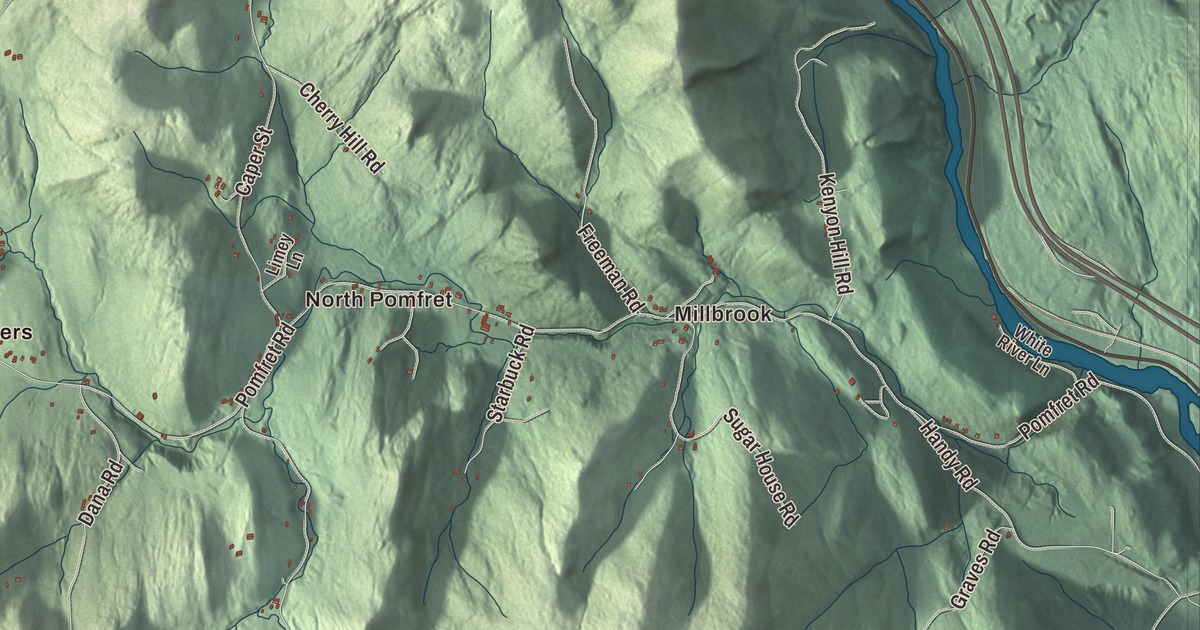
Pomfret’s town hall stands on the height of land in the middle of town, with North Pomfret draining toward the White River and South Pomfret toward the Ottauquechee. This map prints River Road, Webster Hill Road, Joe Ranger Road, High Pastures Road, Wild Apple Road and Johnson Road, with Millbrook, Hewitts Corners and Amity Pond.
Pomfret is a town in Windsor County, Vermont.
KNOWOL made this map in 2026 from public survey data and gave it the look of an old county atlas, shading the hills from United States Geological Survey elevation data and drawing the roads and town line from the Census Bureau. The town covers 39.5 square miles, and 916 people lived here at the 2020 census. Click here to purchase a print of this map for your wall.
New Pomfret
Benning Wentworth, governor of New Hampshire, chartered the town on July 8, 1761, and it was named after the Earl of Pomfret. The first settler, in 1770, was Bartholomew Durkee from Pomfret, Connecticut, and because most of the people who followed him came from that same town, the place was called New Pomfret at first. Pomfret organized on March 17, 1773. John Throop, who came from Connecticut in the early 1770s, became justice of the peace in 1773 and town clerk in 1778; he went to the convention that wrote Vermont’s constitution in 1777, sat on the state’s Supreme Court from 1778 to 1780, and died in Pomfret in 1802. He and John Winchester Dana were Pomfret’s representatives in the legislature in 1778.
The town hall is in the center of Pomfret, on the watershed line between the White River on the North Pomfret side and the Ottauquechee River on the South Pomfret side, and the Ottauquechee runs along part of the town’s southern edge. The Appalachian Trail crosses Pomfret from southwest to northeast.
A ski tow on a farm
In January 1934 a rope tow powered by a Ford Model T engine was set up on a hill on Clinton Gilbert’s farm in South Pomfret. The town’s page calls it one of the earliest ski tows in the United States, and the ski area’s page calls it the first. Within a month Wallace “Bunny” Bertram, a former Dartmouth ski coach who had helped build it, took over and put in an electric motor, and a few years later he moved to a steeper hill nearby, known as Hill 6. Today the ski area is called Saskadena Six. It was the site of the first National Snow Surfing Championships in 1982, an event that later became the U.S. Open Snowboarding Championships. In the center of South Pomfret, at Library and Stage Streets, the brick and stone Abbott Memorial Library opened in 1905, paid for by a bequest from Ira Abbott, a local attorney.
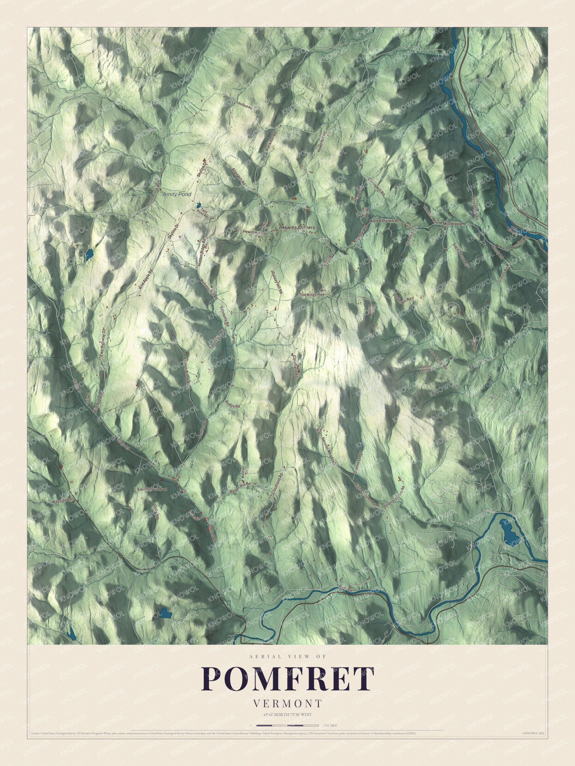
Click to explore a larger preview. The digital watermark does not appear on printed maps.
Names on this map
These names are printed on this map.
Places: Millbrook, South Pomfret, North Pomfret, Amity Pond and Hewitts Corners.
Streets and roads: Joe Ranger Road, Webster Hill Road, High Pastures Road, Johnson Road, Wild Apple Road, River Road, Freeman Road, Pomfret Road, Cloudland Road, Allen Hill Road, Stage Road, Twp Highway 33.
More street names, A to Z
Barber Hill Road, Bartlett Brook Road, Birch Tree Circle, Blackmer Road, Broad Brook Road, Bunker Hill Road, Caper Street, Cherry Hill Road, Clay Road, Dana Road, Galaxy Hill Road, Granite Ledge, Graves Road, Gully Road, Handy Road, Hewitt Hill Road, Hewitt Street, Hidden Ridge Road, Howe Hill Road, Kenyon Hill Road, Labounty Road, Leonard Road, Limey Lane, Log Cabin Drive, Lois Lane, Maxham Road, Old Kings Highway, Pomfret Farms Drive, Rudge Road, Session Meadows, Skyline Drive, Starbuck Road, Sugarbush Farm Road, Sugar House Road, Thistle Hill Road, Tom White Hill, Twin Pond Road, Wayside Road, White River Lane.
See it on a wall
The Pomfret map as a framed print. Swipe for more.


A summer visitor and Pomfret’s own
In the summer of 1976, Cardinal Karol Wojtyła, the archbishop of Kraków, spent a vacation in North Pomfret, kayaking and enjoying the outdoors as he did at home in Poland. In October 1978 he was elected pope, taking the name John Paul II, and he was later canonized a saint.
Judah Dana, son of John Winchester Dana, was born in Pomfret in 1772 and became a judge and a United States senator from Maine. Rush Hawkins, born here in 1831, raised the 9th New York Infantry, known as Hawkins’ Zouaves, in the Civil War and was also a book collector and art patron. Elmer B. Adams, born in Pomfret in 1842, became a judge of the federal appeals court for the Eighth Circuit. Crosby P. Miller grew up here, enlisted in the 16th Vermont Infantry and rose to brigadier general in the Army. John C. Sherburne, born in Pomfret in 1883, was the first Vermonter to become a Rhodes Scholar and served as chief justice of the Vermont Supreme Court from 1949 to 1955. Joe Perry, guitarist for Aerosmith, keeps a home in Pomfret.
On the map, start with Millbrook, follow Joe Ranger Road, Webster Hill Road, High Pastures Road, Johnson Road, Wild Apple Road and River Road across town, and look out toward South Pomfret, North Pomfret and Hewitts Corners. Amity Pond is printed as well. Pomfret dates to 1761.
This map of Pomfret is made for everyone who calls Pomfret home, and it shows the town as it looks today, from North Pomfret over the divide to South Pomfret. Hang it in an office, library or den, or use it to teach children the geography and history of their town. It’s printed on museum quality archival paper. Zoom in on the preview above to explore the details, then click here to get your copy of the Pomfret, Vermont map.

Sources
- Pomfret, Vermont, Wikipedia
- Town histories and representatives, P towns, Vermont Legislature
- John Throop, Wikipedia
- Saskadena Six, Wikipedia
- Abbott Memorial Library (Pomfret, Vermont), Wikipedia
- Pope John Paul II, Wikipedia
- Judah Dana, Wikipedia
- Rush Hawkins, Wikipedia
- Elmer B. Adams, Wikipedia
- Crosby P. Miller, Wikipedia
- John C. Sherburne, Wikipedia
- Joe Perry (musician), Wikipedia