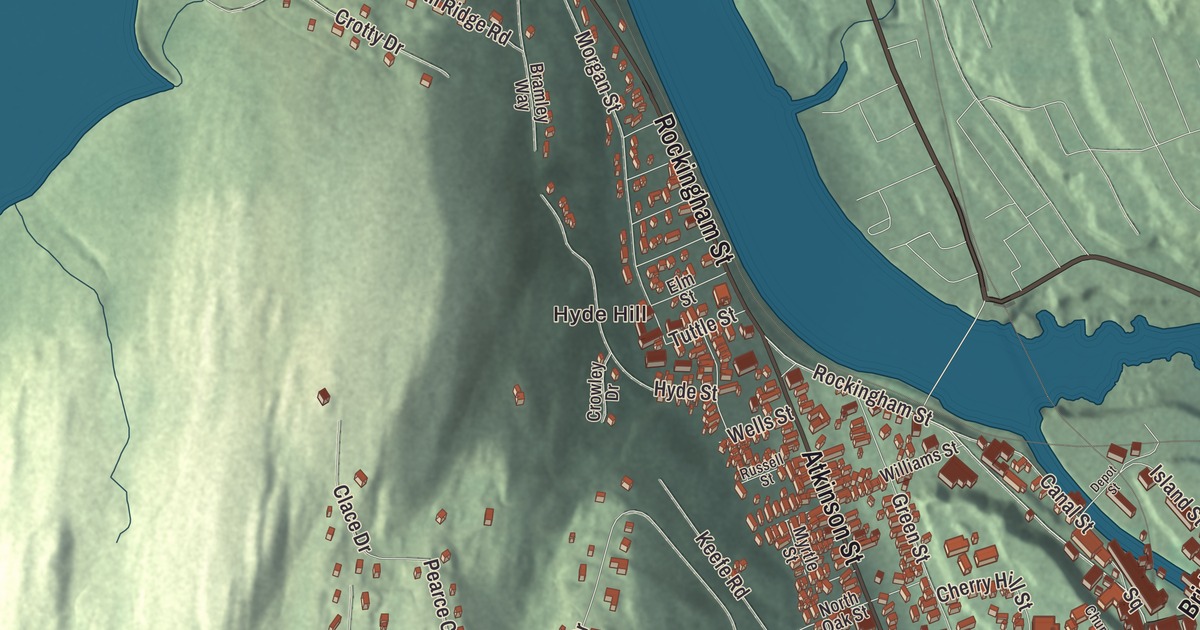
At the east end of Bridge Street, the Connecticut River squeezes through Great Falls, the gorge that Bellows Falls grew up beside. This map prints Bridge Street, Rockingham Street, Westminster Street and Atkinson Street, along with the Square, Old Terrace and Hyde Hill.
Bellows Falls is one of two incorporated villages in the town of Rockingham, in Windham County.
KNOWOL made this map in 2026 from public survey data and gave it the look of an old atlas. The shaded terrain comes from United States Geological Survey elevation data, and down on the river, Great Falls drops 52 feet through a gorge that’s the narrowest point along the whole Connecticut. The streets come from the Census Bureau, and so does the village line, since Bellows Falls has its own incorporated-place boundary. The village covers 1.4 square miles, and it had 2,747 people at the 2020 census. Click here to purchase a print of this map for your wall.
The falls, the bridge and the canal
Colonists of English descent settled here in 1753 and called the place Great Falls, a translation of its Abenaki name, Kitchee pontegu. The settlement was later renamed for Colonel Benjamin Bellows, a landowner, while the waterfall kept the old name, which became official in 2016. Much older are the faces carved into the bedrock beside the falls. The Bellows Falls Petroglyph Site holds two panels of precontact Native American figures, read as human heads with eyes, mouths and radiating lines, just south of the Vilas Bridge. Its page says the group is believed to be unique in New England, and the site was listed on the National Register of Historic Places in 1990.
The narrow gorge was also the site of the first bridge across the river. Colonel Enoch Hale built it in the mid-1780s, and it stayed the only one across the Connecticut until another went up at Springfield, Massachusetts, in 1796. Then came the Bellows Falls Canal, one of the first canals built in the United States, dug by a British-owned company from 1791 to 1802. Its nine locks lifted boats 52 feet around the falls. River traffic fell off after the railroads reached the village in 1849, and by 1858 the canal carried only water power, for the paper mills that had grown up along it. The first paper mill in Windham County had been built here in 1802.
A mill village and its people
By 1859 the village also had a woolen mill and factories making furniture, marble, iron castings, carriages, rifles, harness, shoe pegs and organs. The wealth of those years built the Victorian houses and business blocks that bring visitors today. The commercial center, the canal and its bridges, and several neighborhoods of houses are listed on the National Register as historic districts, and so are single landmarks such as the railroad station and the Adams Gristmill Warehouse.
Hetty Green, the financier known in the Gilded Age as “the richest woman in America,” settled in Bellows Falls in 1873, in her husband Edward’s hometown, and she’s buried beside him in the cemetery of the village’s Immanuel Episcopal Church. Carlton Fisk, the Hall of Fame catcher, was born here, he said, only because Bellows Falls had the nearest hospital to his hometown of Charlestown, New Hampshire, across the river; in 1965 he played for the village’s American Legion Post 37 team. The old Rutland line west of the village is run by the Green Mountain Railroad, founded in 1964 by F. Nelson Blount of Steamtown, U.S.A., and its offices are in the former Railway Express Agency building beside the station.
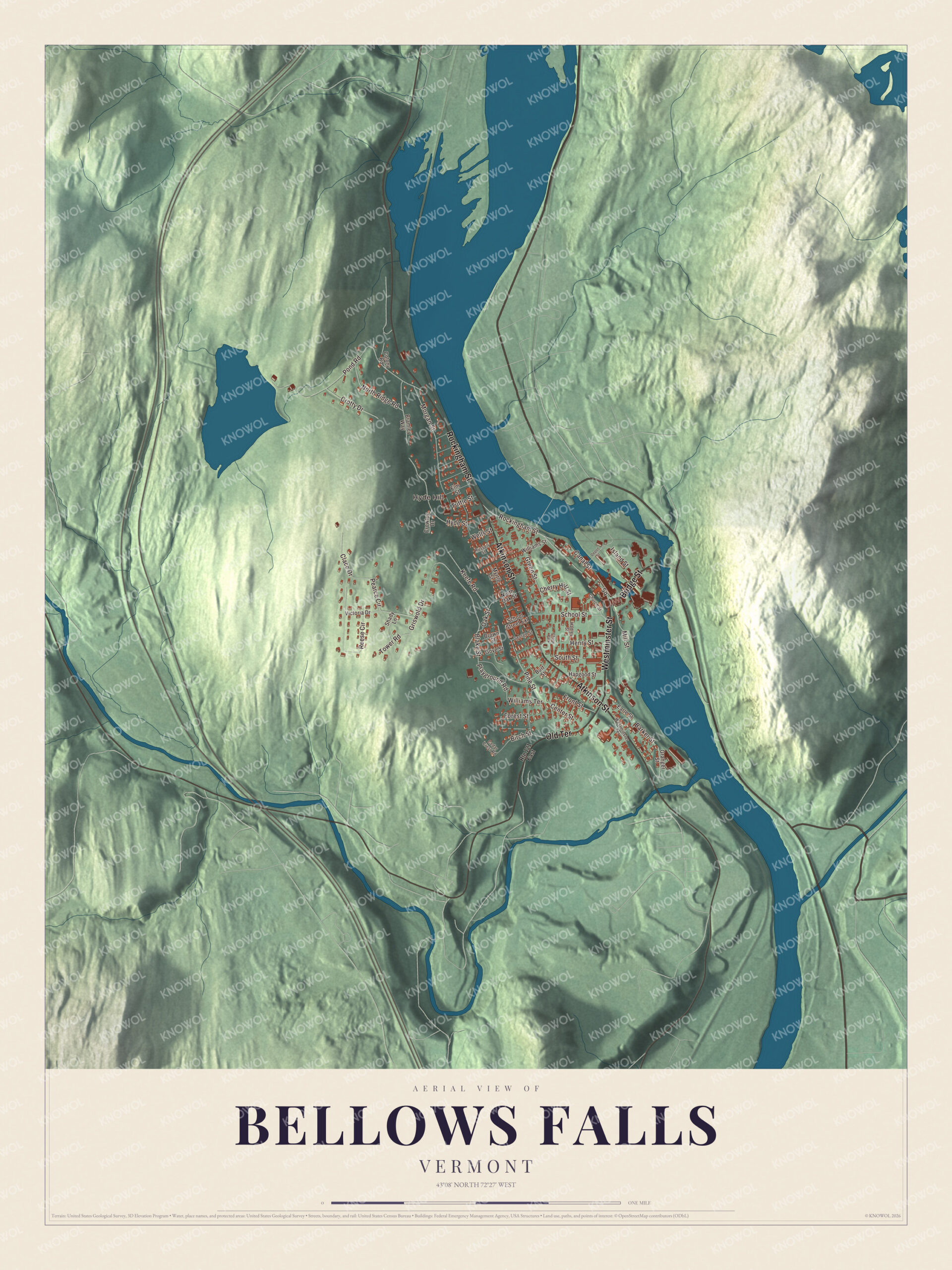
Click to explore a larger preview. The digital watermark does not appear on printed maps.
Names on this map
These names are printed on this map.
Places: Hyde Hill and Chase Park.
Streets and roads: Westminster Street, Atkinson Street, Rockingham Street, Bridge Street, Old Terrace, Square, Blake Street, Pine Street, Playground Road, Pond Road, Griswold Drive, Morgan Street.
More street names, A to Z
Barker Street, Birch Street, Bramley Way, Brown Street, Burt Street, Canal Street, Cedar Crest Road, Center Street, Cherry Hill Street, Church Street, Clace Drive, Colony Road, Crotty Drive, Crowley Drive, Depot Street, Earle Street, Elm Street, Forest Street, Front Street, George Street, Gove Street, Granger Street, Green Street, Hadley Street, Hapgood Street, Henry Street, Hyde Street, Island Street, Keefe Road, Mill Street, Myrtle Street, North Oak Street, North Ridge Road, Oak Street, Pearce Circle, Reese Circle, Route 121 East, Russell Street, School Street, School Street Extension, Shady Lane, South Street, Tower Road, Tuttle Street, Victoria Drive, Wells Street, Westminster Terrace, Williams Street, Williams Terrace.
See it on a wall
The Bellows Falls map as a framed print. Swipe for more.


Around the village on the map
Bridge Street runs east across the island formed by the river and the canal. The Adams Gristmill Warehouse, built about 1925 to store flour and grain, stands on its north side, and the Adams Gristmill itself is now home to the Bellows Falls Historical Society Museum. A marker on Bridge Street tells the canal’s story, and the hydroelectric plant at the canal’s south end has a fish ladder, with a visitors center and viewing window that’s usually open in summer. From near the eastern end of the street, with binoculars and the right river level, you may be able to see the petroglyphs below the Vilas Bridge, which has been closed to all traffic since 2009.
The Vermont Valley Railroad tunneled under the town square when it opened its line to Brattleboro in 1851, and the station near the Square still sees Amtrak’s Vermonter, one round trip a day. It was a filming location for the 1999 movie The Cider House Rules. Just northwest of the business district, on Rockingham Street, the Miss Bellows Falls Diner is a barrel-roofed lunch car that the Worcester Lunch Car Company built in 1941 as number 771. It reached the village on May 14, 1944, and its page calls it the only known Worcester barrel-roofed diner in Vermont that’s still intact.
South of downtown, Westminster Street on the east and Atkinson Street, which carries U.S. Route 5, on the west frame the Bellows Falls Neighborhood Historic District: about 42 acres of mostly wood-frame houses, much of it built between 1850 and 1920, when the village was at its economic peak. Its page counts it among the largest concentrations of well-preserved 19th century homes in southern Vermont, and in 2007 the district grew to take in Old Terrace to the southeast. At Westminster and Hapgood streets, the William A. Hall House was built in the early 1890s for a paper company executive and is one of Vermont’s finest early Colonial Revival houses; it’s an inn now. Hyde Hill is printed on the map as well.
This map of Bellows Falls would sit well in an office, library or den, and it can even help teach children the geography and history of a mill village on the Connecticut. It’s made for everyone who calls Bellows Falls home, and it shows the village as it looks today, from the Square to Old Terrace. KNOWOL created it in 2026, and it’s printed on museum quality archival paper. Zoom in on the preview above to explore the details, then click here to get your copy of the Bellows Falls, Vermont map.

Sources
- Bellows Falls, Vermont, Wikipedia
- Great Falls (Connecticut River), Wikipedia
- Bellows Falls Petroglyph Site, Wikipedia
- Bellows Falls Canal, Wikipedia
- Adams Gristmill Warehouse, Wikipedia
- Bellows Falls station, Wikipedia
- William A. Hall House, Wikipedia
- Vilas Bridge, Wikipedia
- Hetty Green, Wikipedia
- Carlton Fisk, Wikipedia
- Green Mountain Railroad, Wikipedia
- Rockingham, Vermont, Wikipedia