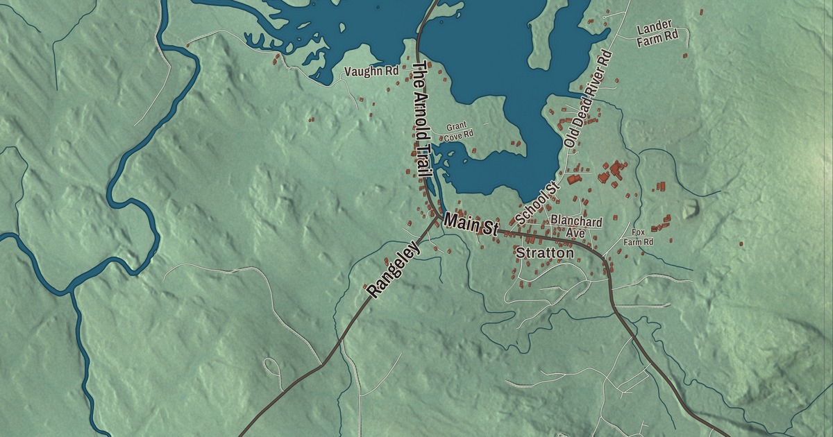
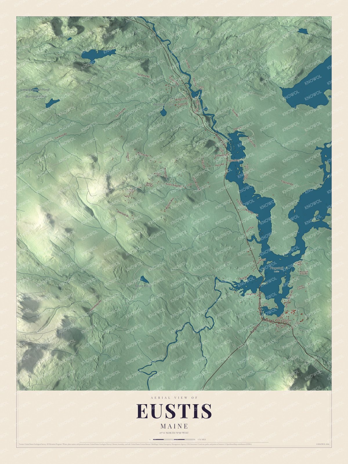
Stratton is the village to find first on this map of Eustis, Maine, along with Main Street and Arnold Trail. Then look for Old Dead River Road and Scott Road, and for Barnard Pond, Little Barnard Pond, Wethern Pond and Reed Pond. Click here to purchase a print of this map for your wall.
Eustis is a town in Franklin County, with 641 people at the 2020 census.
KNOWOL made this map in 2026 from public survey data and gave it the look of an old atlas. The Census Bureau measures the town at 41.48 square miles, 2.35 of them water, and its files give the roads and the town line. United States Geological Survey elevation data shades the ground, and Eustis has a listed elevation of 1,437 feet.
Arnold’s march
On October 19, 1775, Benedict Arnold and his troops passed through this country on their way up the North Branch of the Dead River, bound for the attack on Quebec. Progress up the river was slow. The men were already on half rations when rain began that day, and within three days the Dead River had risen to the level of their camp. Major Timothy Bigelow, one of his officers, climbed the mountain now named for him that month “for the purpose of observation.” The expedition’s route through the Maine woods was added to the National Register of Historic Places in 1969 as the Arnold Trail to Quebec, and a marker in Eustis, on the western shore of Flagstaff Lake, remembers it.
From township to town
Eustis began as Township No. 1 of Range 4, West of Bingham’s Kennebec Purchase. Its first settler was Caleb Stevens of New Hampshire, who came with his wife and nine children. About 1831 Charles L. Eustis of Lewiston and a partner bought the northern half of the township from the state, and that year Eustis built a sawmill and a gristmill. The township was organized as Hanover Plantation in 1840 and became part of Jackson Plantation about 1850, then was set off on March 30, 1857, as Eustis Plantation, named for its early proprietor. On February 18, 1871, with 342 people, it was incorporated as a town.
Click to explore a larger preview. The digital watermark does not appear on printed maps.
See it on a wall
The Eustis map as a framed print. Swipe for more.


Lumber was big business in Stratton late in the 19th century. Ora Blanchard owned the village sawmill and later the water and power companies, and in 1892 he built the house at the junction of Routes 16 and 27 in the center of Stratton. Also known as Widow’s Walk, it has a three-story octagonal tower and a widow’s walk railing on its roof, and it was listed on the National Register in 1980.
Bigelow and Flagstaff Lake
Eustis, which takes in Stratton, is a popular place for the outdoors. The Bigelow Preserve, 36,000 acres of state land, was created in 1976 to stop a planned ski resort, and it holds Mount Bigelow, one of Maine’s highest mountains at 4,145 feet. Flagstaff Lake lies below the range. It was a smaller natural lake until the Long Falls Dam held back the Dead River in 1950, and the reservoir now covers parts of the old townships of Flagstaff, Bigelow, Dead River and Carrying Place. The lake is shallow and mostly undeveloped, with landlocked salmon and brook trout, and it’s a good one for kayaks. The Dead River Area Historical Society is among the town’s places of interest.
Around Eustis
Main Street and Arnold Trail are printed on the map, and so are The Arnold Trail, Scott Road, Old Dead River Road and Otter Lane. Stratton is printed too, and Barnard Pond, Little Barnard Pond, Wethern Pond and Reed Pond are labeled on the map. Arnold Trail and The Arnold Trail share their name with the expedition’s route, and Old Dead River Road with the river. The smaller roads and lanes are drawn in as well.
This Eustis map makes a fine addition to an office, library or den, and it can help teach children the geography and history of the area. It’s made for everyone who calls Eustis home, from Stratton to Barnard Pond, as it looks today. Zoom in on the preview above to explore the details, then click here to get your copy of the Eustis, Maine map.

Sources