If you know Monmouth, you know Main Street and the tower of Cumston Hall, and this map lays out Main Street with Cobbossee Road, Wilson Pond Road and Cochnewagon Lake. Click here to purchase a print of this map for your wall.
Monmouth is a town in Kennebec County.
KNOWOL made this map in 2026 from public survey records, United States Geological Survey elevation data and Census Bureau files. Its atlas layout brings together Monmouth’s roads, buildings, ponds and waterways, and terrain, the town boundary and the pattern of buildings.
Freetown, Wales and then Monmouth
Families from Brunswick settled here as Freetown in 1776 and 1777, on land of the Plymouth Patent. The place was also called Bloomingborough and Wales before the Massachusetts General Court incorporated it as Monmouth on January 20, 1792. The name came from landowner General Henry Dearborn, who had fought in the Battle of Monmouth in New Jersey on June 28, 1778.
Monmouth was considered one of the best agricultural towns in the state, raising hay, apples and potatoes along with beef cattle and dairy products, and it had good sites for watermills. The Androscoggin & Kennebec Railroad, later part of the Maine Central, opened to the town in 1849. By 1859 Monmouth had two factories making boot-webbing and binding, a shovel and hoe factory, a tannery, a carpet factory and a sleigh and carriage factory, among other shops.
Cumston Hall and the Academy
Cumston Hall, at 796 Main Street, was finished in 1900 as a gift to the town from Dr. Charles M. Cumston, a former headmaster at the English High School in Boston. He chose Harry Hayman Cochrane, a muralist who had gone to school in Monmouth, to design and decorate it, and Cochrane’s work is most noted in the cherubs on the ceiling and the molded plaster around the stage. A square tower about 70 feet tall rises from one corner. The hall is home to the Cumston Public Library and the Theater at Monmouth, and it’s on the National Register of Historic Places.
Monmouth Academy was founded as a private school in 1803, and its brick building with a belfry went up in 1855. In 1976 the academy became the town’s public high school.
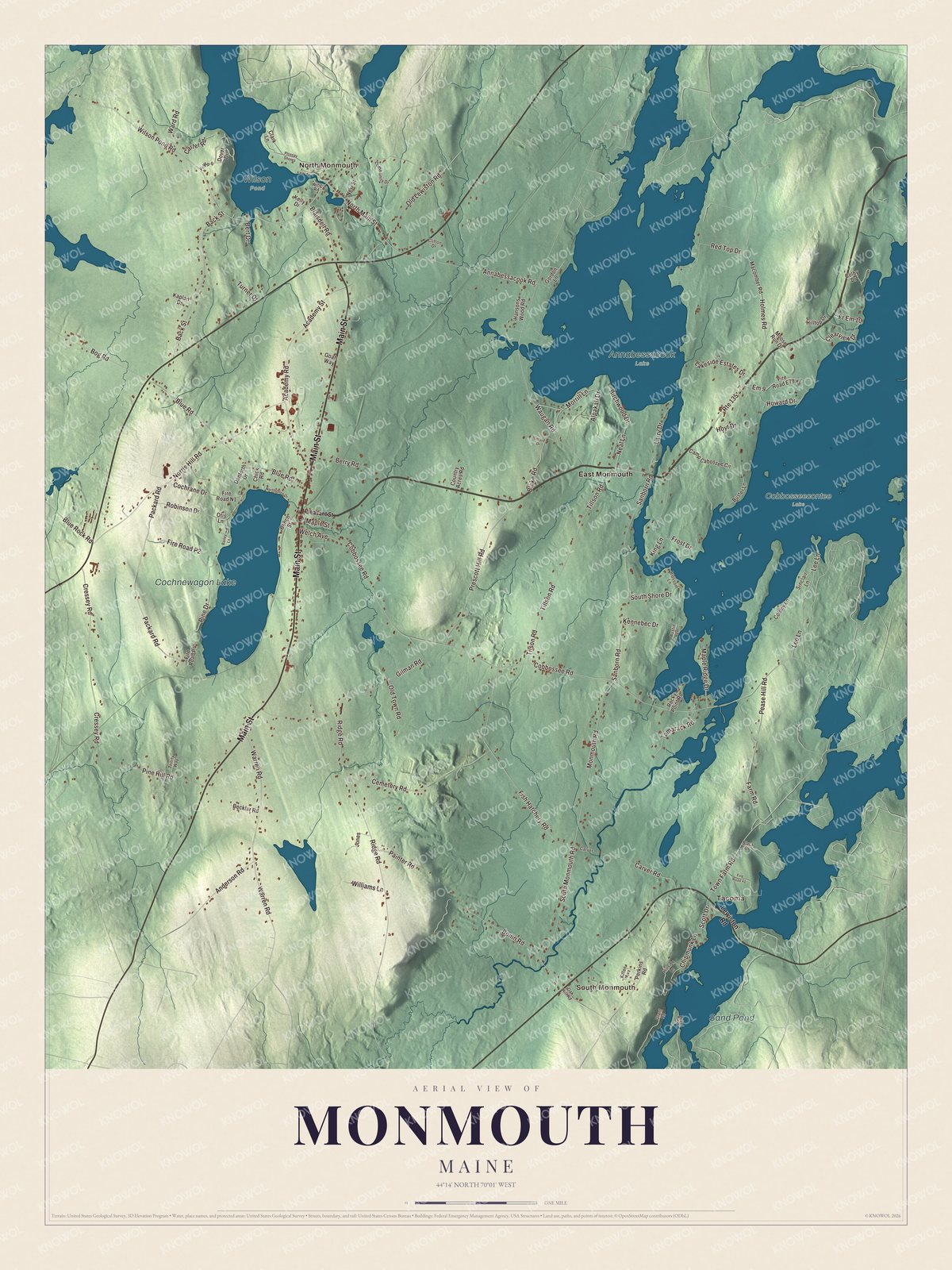
Click to explore a larger preview. The digital watermark does not appear on printed maps.
See it on a wall
The Monmouth map as a framed print. Swipe for more.


Explore the Monmouth map
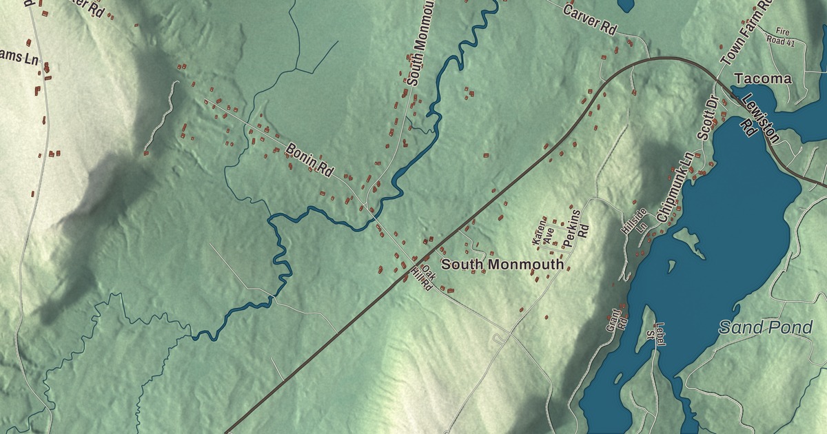
Start with South Monmouth and Tacoma, then follow Main Street, Wilson Pond Road, North Main Street, Lee Lane, Cobbossee Road and Blue Rock Road across town. Those are printed names, and North Monmouth and East Monmouth sit farther out.
Cochnewagon Lake and Sand Pond are labeled on the map too. Monmouth reaches Cobbosseecontee, Annabessacook and Cochnewagon lakes and the Tacoma Lakes, and with its many lakeside cottages it’s a popular summer resort area in the Winthrop Lakes Region. Follow the shorelines and compare the cottages with the farms inland.
For people who call Monmouth home, this map shows the town as it looks today. Put it in your office, library, or den, or use it to teach children the geography and history of the area. Zoom in on the preview above to explore the details, then click here to get your copy of the Monmouth, Maine map.

Sources