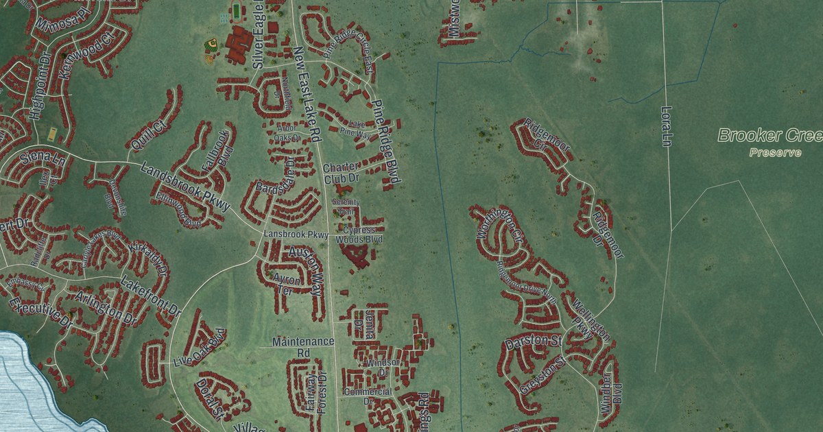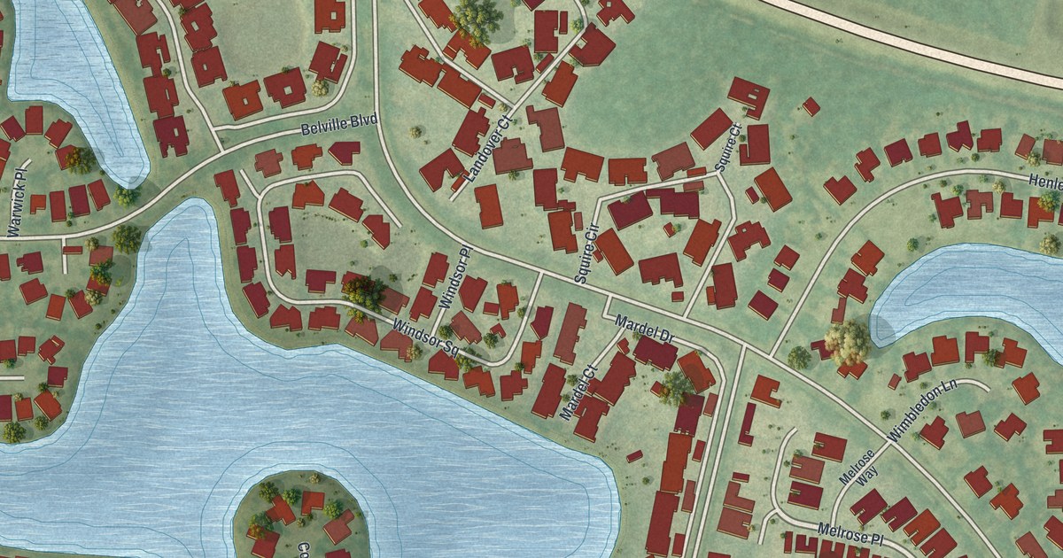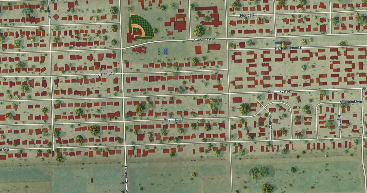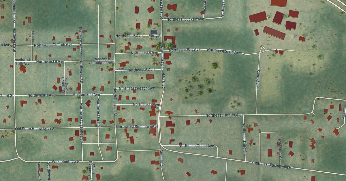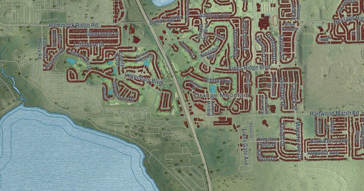
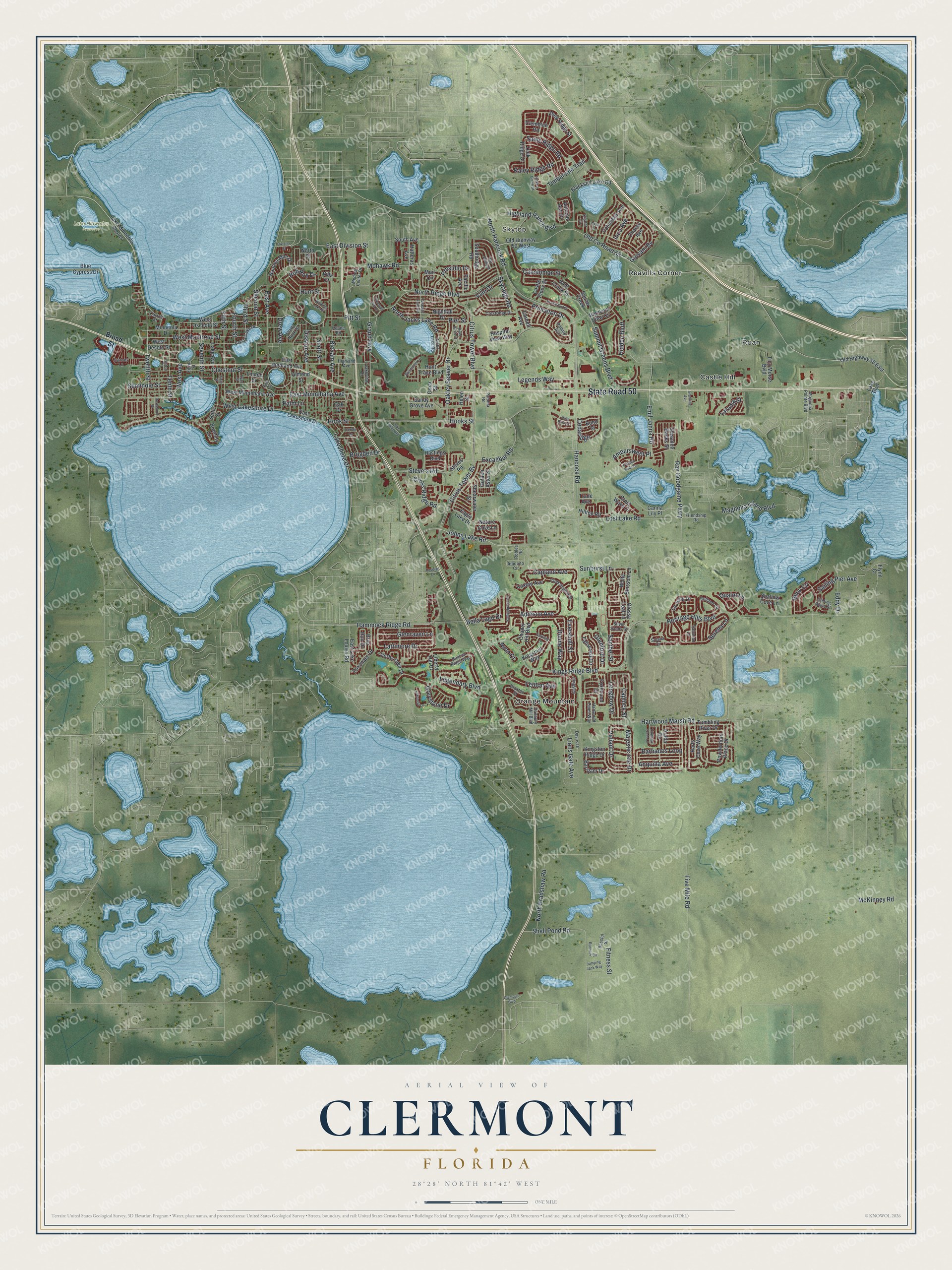
This beautifully detailed map of Clermont, Florida was created in 2026 using aerial imagery combined with modern topographical, census, street and landmark data. It’s a one-of-a-kind view of Clermont that combines accurate data with a vintage aesthetic. The map shows every building in its true location, many of the roads carry their names, and the shaded topographic relief shows the shape of the land.
Explore an aerial view of Clermont, Florida
On the map you’ll find Skytop, Lake Hiawatha Preserve, Castle Hill, Orange Mountain, Reavills Corner, and Roan, along with State Road 50, Johns Lake Road, Lost Lake Road, Emil Jahna Road, Caplock Street, East Minnehaha Avenue, and more. If you look closely you can even find your house accurately drawn in its correct location. Zoom in on the preview to look for yours.
Did You Know?
The Clermont Improvement Company, a land development firm, founded the town in 1884. Its manager named the new town for his birthplace in France. Clermont incorporated in 1891, disbanded in 1895 and came back as a city in 1916.
Take a closer look at the Clermont map
Names on this map
These names are printed on this map.
Places: Skytop, Lake Hiawatha Preserve, Castle Hill, Orange Mountain, Reavills Corner and Roan.
Streets and roads: State Road 50, Johns Lake Road, Lost Lake Road, Emil Jahna Road, Caplock Street, East Minnehaha Avenue, Fenton Avenue, Citrus Tower Boulevard, Hancock Road, Hartwood Marsh Road, North Hancock Road, Hammock Ridge Road.
More street names, A to Z
Addison Avenue, Aibonito Circle, Almond Street, Ambersweet Place, Anquilla Avenue, Aruba Bv, Autumn Ash Drive, Avon Court, Barbados Loop, Barrister Drive, Beacon Ridge Way, Bella Lago Drive, Belland Circle, Blackstill Lake Road, Blissful Street, Bloxam Avenue, Blue Cypress Drive, Bond Street, Brantley Circle, Braxton Street, Briarhaven Lane, Briar Run Drive, Broad Street, Brogden Drive, Buoy Circle, Caledonian Street, Canna Lily Place, Capland Avenue, Carroll Street, Cascade Falls Drive, Caspian Lane, Castle Pines Street, Caxton Avenue, Cedaridge, Center Lane, Chapel Hill Boulevard, Chavez Avenue, Chessington Street, Chestnut Street, Citrus Tower Bv, Clemblue Road, Columbus Avenue, Cornell Avenue, Crestridge Drive, Crest Wave Drive, Cross Ridge Road, Crystal Lake Drive, Danbury Mill Boulevard, Davos Drive, Derby Glen Drive, Disston Avenue, Division Street, Doune Way, Drew Avenue, Eagle Lake Drive, East Avenue, East Division Street, East Highland Avenue, East Lake Louisa Road, East Lakeshore Drive, Eddy Drive, Eighth Street, Eversholt Street, Excalibur Road, Fairfield Drive, Fallscrest Circle, Fifth Street, Fitness Street, Five Mile Road, Flynn Court, Fourth Street, Foxchase Drive, Foxhound Drive, Friendship Road, Garden Belle Drive, Giovani Bv, Glenford Drive, Glenraven Lane, Gliding Wave Street, Glossy Leaf Lane, Golden Aster Street, Grand Highway, Granville Avenue, Greystone Drive, Harts Cove Way, Hartwood Pines Way, Hastings Boulevard, Hatteras Avenue, Helen Street, Heritage Hills Boulevard, Hickory Grove Street, Hidden Bluff, Highland Avenue, Highland Ranch Boulevard, Highland View Circle, Hilltop Road, Holly Berry Cr, Hooks Street, Hook Street, Hospital View Way, Hunt Street, Hunt Trace Boulevard, Inca Avenue, Jacks Lake Road, Jumping Jack Way, Kaley Ridge Road, Kingsley, Kingsmill Way, Kings Ridge Boulevard, Kingston Ridge Drive, Kistler Circle, La Jolla Drive, Lake Avenue, Lake Boulevard, Lake Minneola Shores, Lakemist Lane, Lakeshore Drive, Lakeview Drive, Lake Wilma Road, Laranja Street, Lattimore Drive, Legendary Boulevard, Legends Way, Liberty Hill Drive, Linden Street, Linton Court, Linwood Trace Lane, Lions Gate Avenue, Longbow Drive, Magnolia Island Boulevard, Magnolia Pointe Boulevard, Majestic Isle Drive, McKinney Road, Medical Center Drive, Minneola Drive, Mohawk Road, Muir Circle, Nature Cove Lane, Nautica Mile Drive, Nightfall Drive, Nina Lane, North Bradshaw Road, North Jacks Lake Road, North Ridge Boulevard, North Street, Oak Drive, Oakley Seaver Drive, Old County Road 50, Old Highway 50 East, Old Highway 50 West, Olympus Boulevard, Omar Street, Pacific Avenue, Palm Lane, Paloma Road, Pier Street, Pine Street, Pitt Street, Pleasant Hill Drive, Powderhorn Place Drive, Prairie Dunes, Presidio Drive, Princeton Drive, Quaint Lane, Ray Goodgame Parkway, River Birch Court, Roane Road, Robles Road, Rob Roy Drive, Rollingbrook Street, Rollins Avenue, Rosewood Drive, Runners Circle, Ryan Street, Sadie Ridge Road, Sailing Pier Avenue, Saloman Lane, Sandy Grove Avenue, Sanibel Street, Scott Street, Second Street, Seminole Street, Serena Lane, Settle Street, Seventh Street, Shady Nook Drive, Shallow Cove Lane, Shearwater Street, Shell Pond Road, Silver Sands Street, Sixth Street, Skyridge Road, Sky Valley Street, Solana Circle, South Avenue, Southridge Road, Steve's Road, Steves Road, Summit Greens Boulevard, Sunburst Lane, Sunset Lane, Suwanee Banks Street, Tenth Street, Third Street, Timbervale Trail, Tiny Morse Bvld, Trade Avenue, Tumbling River Drive, Twelfth Street, Vale Drive, Valiant Drive, Villa Court, West Avenue, West Desoto Street, West Lakeshore Drive, West Minnehaha Avenue, West Montrose Street, West Osceola Street, White Blossom Lane, Winding Lake Drive, Wolf Creek Street, Zeek Ridge Court, Zeek Ridge Street.
See it on a wall
The Clermont map as a framed print. Swipe for more.


This beautifully detailed map of Clermont makes an attractive addition to your office, library, or den, and it can even be used to teach children the geography and history of the area. It also makes a great gift for someone who left Clermont and still calls it home. When you’re done exploring, click here to get your copy of the Clermont map.