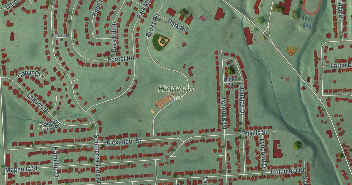
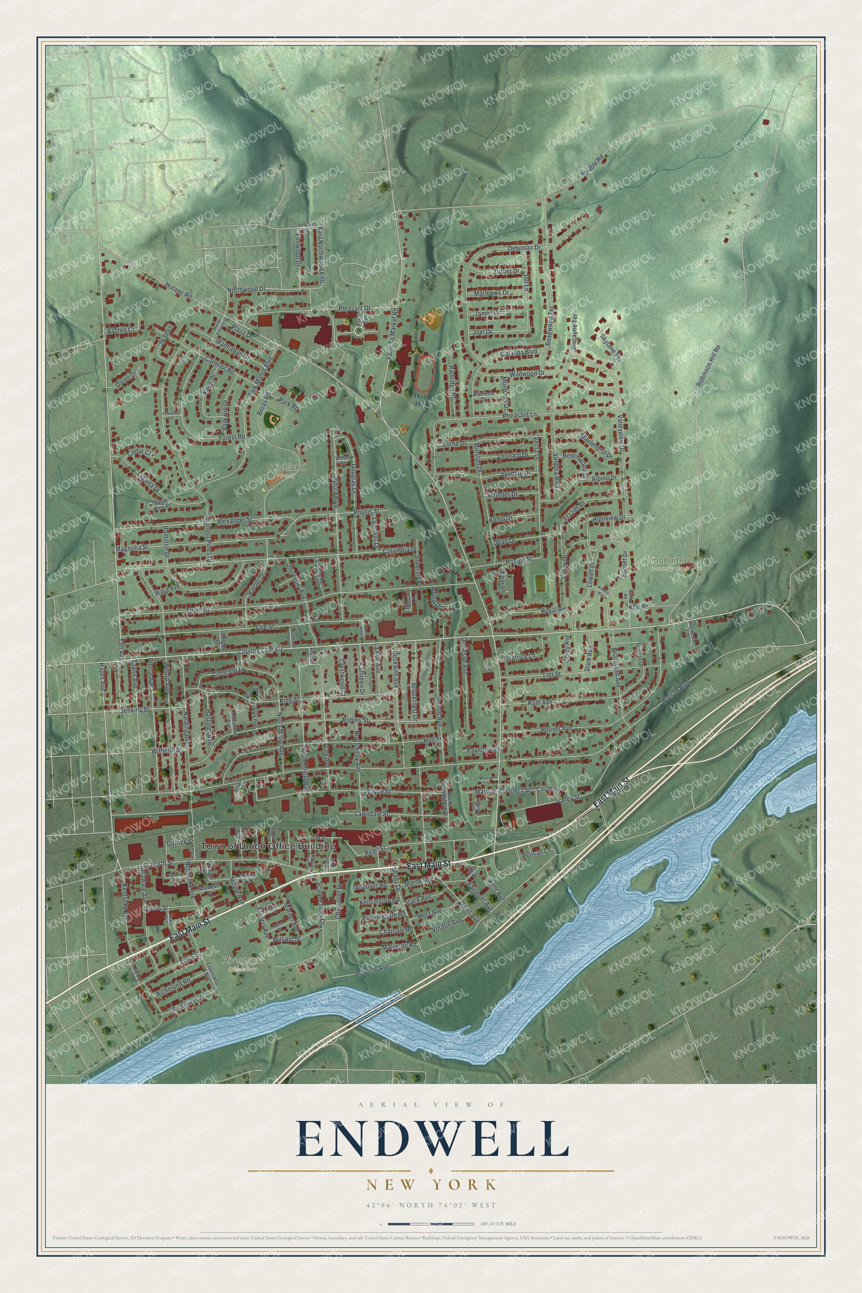
This beautifully detailed map of Endwell, New York was created in 2026 using aerial imagery combined with modern topographical, census, street and landmark data. It’s a one-of-a-kind view of Endwell that combines accurate data with a vintage aesthetic. The map shows every building in its true location, many of the roads carry their names, and the shaded topographic relief shows the shape of the land.
Explore an aerial view of Endwell, New York
On the map you’ll find Highland Park and Riverhurst Cemetery, along with Main Street, Country Club Road, Hayes Avenue, Northwood Drive, William Street, and more. If you look closely you can even find your house accurately drawn in its correct location. Zoom in on the preview to look for yours.
Did You Know?
Endwell began as a dense forest, and its first industry, from about 1800, was logging. Oxen dragged oak logs to the Susquehanna. In spring, when the river rose, the logs were lashed into rafts and floated to Harrisburg, Pennsylvania, to be sold as lumber. Settlers put down roots along Patterson Creek around 1820.
Take a closer look at the Endwell map
Names on this map
These names are printed on this map.
Places: Town of Union Office Building, Binghamton Country Club, Highland Park and Riverhurst Cemetery.
Streets and roads: East Main Street, Country Club Road, Hayes Avenue, Northwood Drive, William Street, Hooper Road, Watson Boulevard, Robinson Hill Road, Taft Avenue, Struble Road, Smith Drive, Columbia Drive.
More street names, A to Z
Alameda Drive, Alexander Street, Alfred Drive, Alice Avenue, Allan Court, Alpine Drive, Andover Road, Annette Way, Argonne Avenue, Ashton Court, Barteau Street, Beatrice Lane, Beckwith Avenue, Beechwood Drive, Biscayne Terrace, Briar Lane, Brink Street, Broas Road, Brookcrest Drive, Buckingham Road, Bundy Avenue, Bundy Circle, Burt Avenue, Byford Boulevard, Camelot Road, Catalina Boulevard, Cedar Court, Chatham Road, Chaumont Drive, Circle Drive, Colgate Drive, Corey Avenue, Crescent Drive, Crestwood Court, Daren Drive, Davis Avenue, Dean Drive, Debonair Drive, Delaware Avenue, Dencary Lane, Dittrick Street, Dogwood Court, Douglas Drive, Doyleson Avenue, East Northwood Entr, Elmwood Drive, Fairmont Avenue, Farm To Market Road, Forest Road, Foster Street, Francis Avenue, Frazier Drive, Groveland Avenue, Hall Street, Hamilton Drive, Harding Avenue, Harpur Drive, Hastings Avenue, Heath Avenue, Helena Avenue, Helen Street, Highland Avenue, Highview Drive, Hilltop Road, Hollerith Avenue, Hoover Avenue, Ironwood Drive, James Drive, Jenkins Street, Jfk Boulevard, Joel Drive, Jon Lane, Kathleen Drive, Kemp Drive, Kensington Road, Kent Avenue, Kentucky Avenue, King Street, Kirk Road, Knightlee Avenue, Knoll Drive, Lacey Drive, Laguna Drive, La Rue Avenue, La Salle Drive, Lawndale Street, Lee Avenue, Leona Avenue, Leonard Drive, Lewis Street, Lorne Drive, Lott Street, Louisiana Avenue, Lowell Drive, Luther Street, Lyncourt Drive, Lyndale Drive, Magnolia Street, Malverne Road, Manhattan Drive, Manor Entrance, Maplehurst Drive, Marion Avenue, Marne Avenue, Mary Street, Massachusetts Avenue, Matthews Drive, Metz Avenue, Monterey Drive, Moore Avenue, Nebraska Avenue, North Brookside Avenue, North Kathleen Drive, North Kelly Avenue, North Knight Avenue, North Street, North Willis Avenue, Norton Avenue, Park Hill Drive, Park Manor Boulevard, Park Road, Parkwood Road, Partridge Place, Patio Drive, Paynter Avenue, Pearl Street, Pelican Lane, Pheasant Lane, Phyllis Street, Pierce Avenue, Plaza Drive, Pleasant Drive, Prospect Street, Pruyne Street, Rath Avenue, Richmond Road, Riverview Drive, Robins Street, Rosemont Street, Rosewood Terrace, Royal Road, Scarborough Drive, Scribner Drive, Shady Drive, Shamrock Drive, Sherman Drive, Skylane Terrace, Southern Pines Drive, South Knight Avenue, Stack Avenue, Stark Avenue, Stonefield Road, Sugar Pine Place, Sunrise Drive, Sunset Drive, Taylor Avenue, Tracy Street, Turner Drive, Ulmer Street, University Avenue, Valley Street, Valleyview Drive, Ventura Boulevard, Verdun Avenue, Verna Drive, Virginia Avenue, Ward Avenue, Wayne Street, Wildwood Drive, Wilson Avenue, Winston Drive, Witherill Street, Yale Street, Youngs Avenue.
See it on a wall
The Endwell map as a framed print. Swipe for more.


This beautifully detailed map of Endwell makes an attractive addition to your office, library, or den, and it can even be used to teach children the geography and history of the area. It also makes a great gift for anyone who grew up in Endwell or moved away. When you’re done exploring, click here to get your copy of the Endwell map.