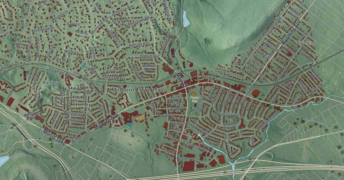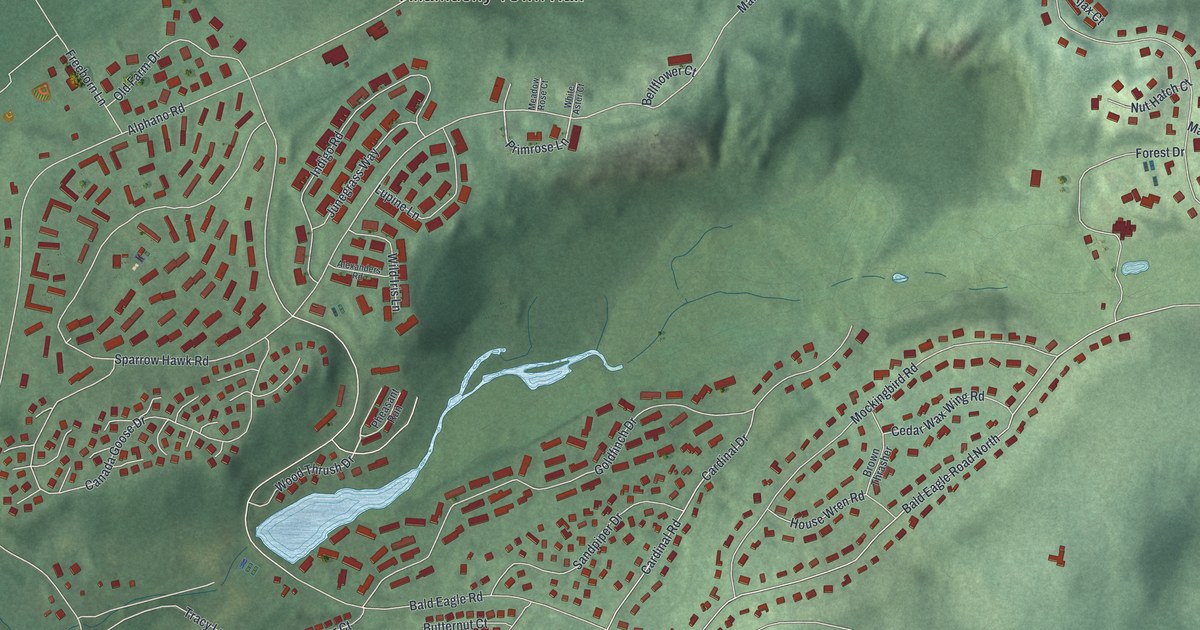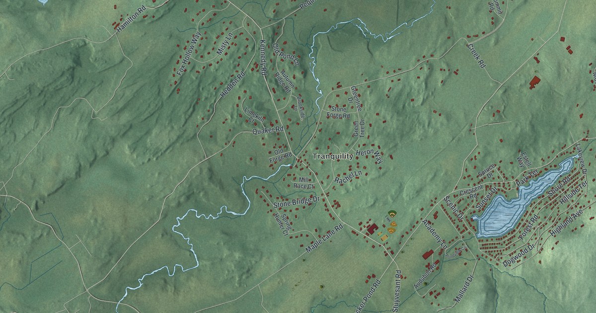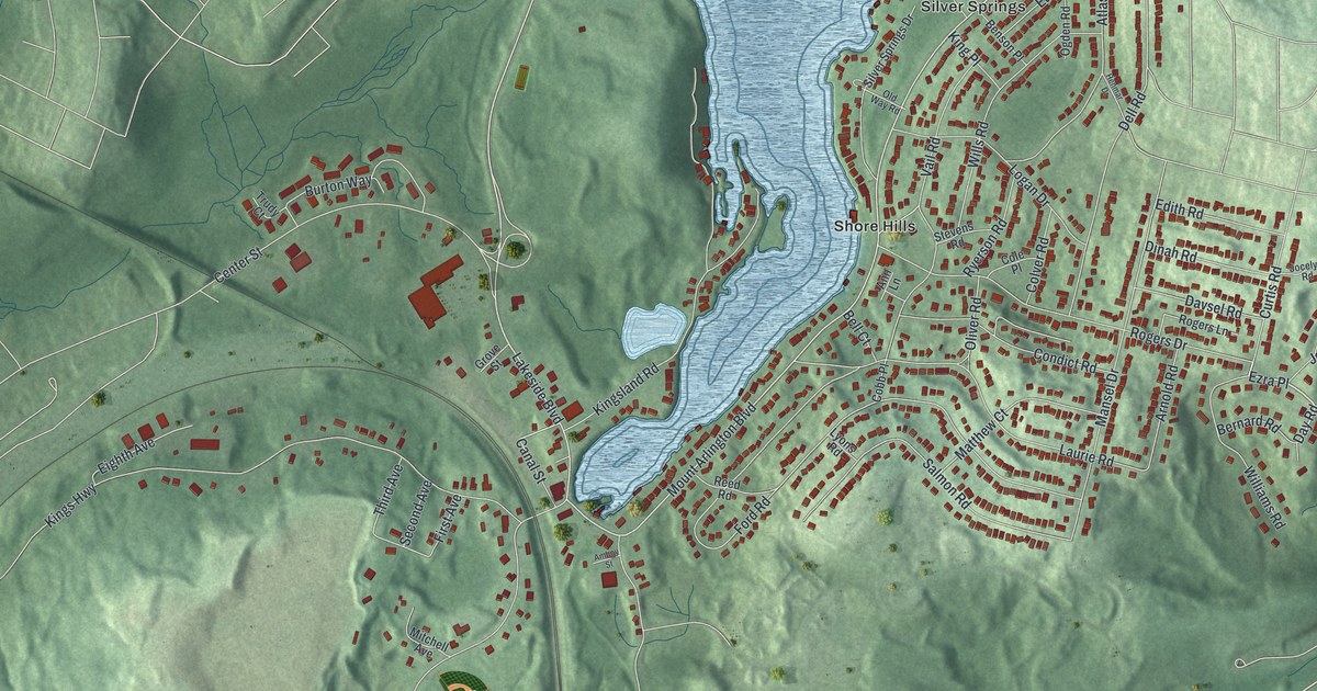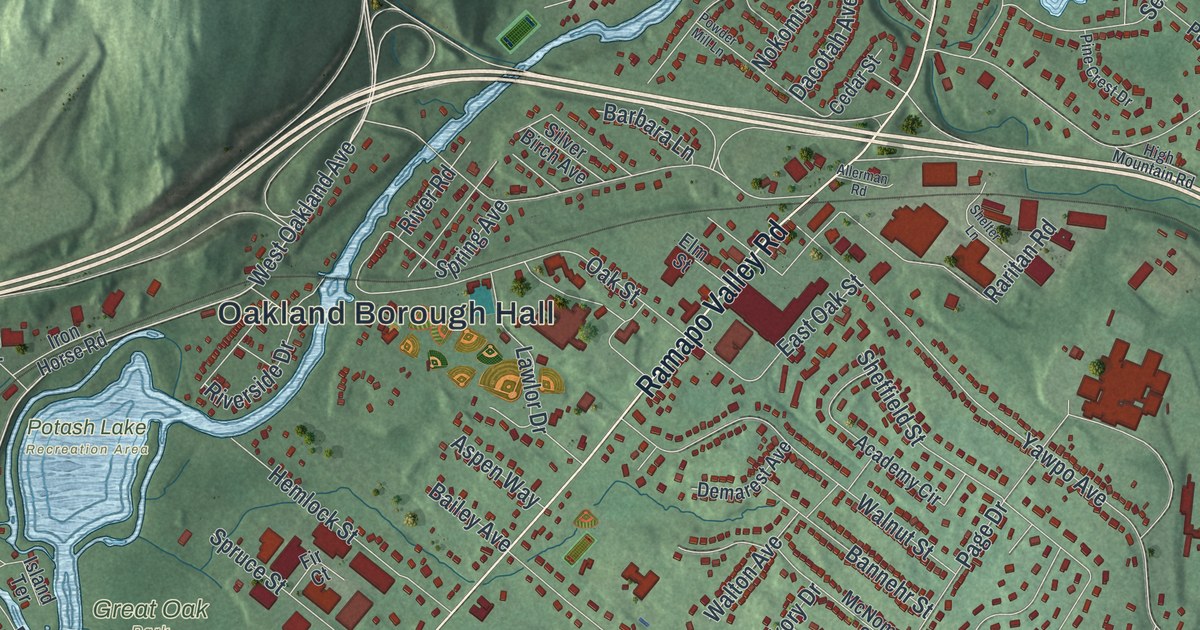
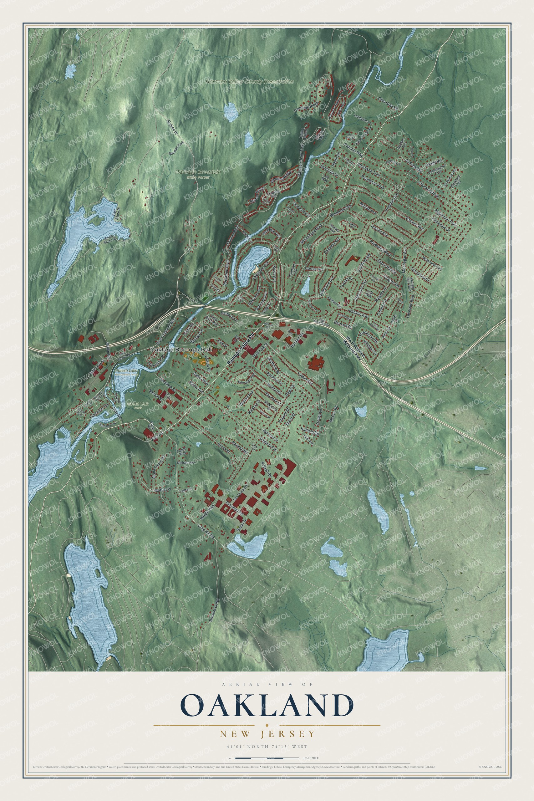
This beautifully detailed map of Oakland, New Jersey was created in 2026 using aerial imagery combined with modern topographical, census, street and landmark data. It’s a one-of-a-kind view of Oakland that combines accurate data with a vintage aesthetic. The map shows every building in its true location, many of the roads carry their names, and the shaded topographic relief shows the shape of the land.
Explore an aerial view of Oakland, New Jersey
On the map you’ll find Oakland Borough Hall, Great Oak Park, Potash Lake Recreation Area, and Ramapo Mountain State Forest, along with Ww II Veterans Memorial Highway, Oakland Avenue, Skyline Drive, Long Hill Road, and more. If you look closely you can even find your house accurately drawn in its correct location. Zoom in on the preview to look for yours.
Did You Know?
Oakland is one of the oldest communities in Bergen County, and it has worn many names. It was first called Yawpaw, a Native American word for wild plum. Later it was The Ponds, then Scrub Oaks, then Bushville, before it became Oakland. That’s from the 1939 WPA guide to New Jersey.
Take a closer look at the Oakland map
Names on this map
These names are printed on this map.
Places: Oakland Borough Hall, Great Oak Park, Potash Lake Recreation Area, Ramapo Mountain State Forest, Ramapo Valley County Reservation and Ramapo Park.
Streets and roads: Ramapo Valley Road, West Oakland Avenue, Skyline Drive, Long Hill Road, Hiawatha Boulevard, Lakeshore Drive, Ramapo River Trce, Page Drive, Manito Avenue, Franklin Avenue, Chuckanutt Drive, Andrew Avenue.
More street names, A to Z
Academy Circle, Acorn Avenue, Algonquin Trail, Allen Drive, Allerman Road, Arapaho Court, Arrowhead Road, Aspen Way, Bailey Avenue, Bannehr Street, Barbara Lane, Barnard Drive, Bauer Drive, Blackfoot Trail, Boulder Run, Brandywine Place, Breakneck Road, Brook Hollow Road, Calumet Avenue, Cardinal Drive, Cedar Street, Cherokee Trail, Cheyenne Court, Chicasaw Drive, Colgate Road, Columbia Way, Commanche Trail, Crooked Hill, Crosby Lane, Dacotah Avenue, Demarest Avenue, Dogwood Drive, Doty Road, Eaglecrest Place, East Oak Street, East Shore Drive, Edison Avenue, Elm Street, Falling Waters, Fir Court, First Street, Florence Avenue, Fordham Road, Fox Court, Glen Gray Road, Grove Street, Hannah Road, Hatfield Road, Heath Road, Hemlock Street, Hickory Drive, High Mountain Road, Hobby Lane, Hopper Street, Hunters Run, Iron Horse Road, Iroquois Avenue, Island Terrace, Lakeside Boulevard, Lakes Road, Lakeview Terrace, Laura Lane, Lawlor Drive, Lee Way, Lenape Lane, Lexington Lane, Loyola Place, Martha Place, Massasoit Trail, McCoy Road, McNomee Street, Minnehaha Boulevard, Mohawk Avenue, Monhegan Avenue, Mountain View Avenue, Muller Road, Navajo Way, Nielsen Avenue, Nokomis Avenue, Oak Street, Oneida Avenue, Osage Road, Oswego Avenue, Overlook Ridge, Patriots Way, Pawnee Avenue, Pine Crest Drive, Plaza Road, Ponds Way, Post Road, Potash Road, Powder Mill Lane, Powhatan Path, Princeton Terrace, Purdue Avenue, Raeben Avenue, Ramapo Hills Boulevard, Ramapo Terrace, Raritan Road, River Dell, River Road, Riverside Drive, Roosevelt Boulevard, Roth Avenue, Rutgers Drive, Ryerson Street, Saratoga Drive, Second Street, Seminole Avenue, Seneca Avenue, Seton Hall Drive, Sheffield Street, Shelter Lane, Silver Birch Avenue, Sioux Avenue, Skytop Ridge, South Shore Drive, Spear Street, Spring Avenue, Spruce Street, Stone Fence Road, Stony Point Road, Tecumseh Trail, Thackeray Road, Thornton Road, Thunderbird Drive, Truman Boulevard, Tuscarora Drive, Valley Forge Road, Van Vooren Drive, Walnut Street, Walton Avenue, Waters Edge, Wellesley Drive, Wenonah Avenue, Whittier Lane, Wilson Street, Winding Ridge, Winters Street, Wright Way, Ww II Veterans Memorial Highway, Yale Way, Yawpo Avenue.
See it on a wall
The Oakland map as an 18 x 24 inch print in a black frame.

This beautifully detailed map of Oakland makes an attractive addition to your office, library, or den, and it can even be used to teach children the geography and history of the area. It also makes a great gift for anyone who grew up in Oakland or moved away. When you’re done exploring, click here to get your copy of the Oakland map.