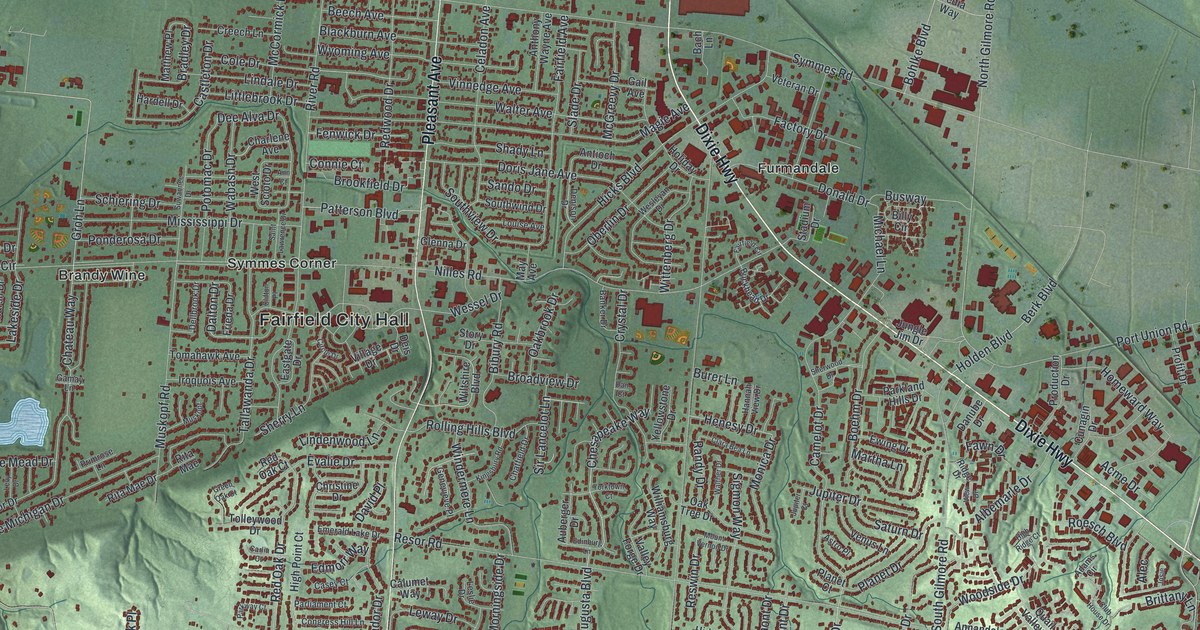
If you grew up in Fairfield, went to school here, or still drive Pleasant Avenue and Dixie Highway every week, this map has plenty for you to find. It's a modern aerial view of Fairfield in Butler County, Ohio, made from modern data and given a vintage look. Soft green hills are shaded all around the city. A river winds down the west side in blue, with a string of ponds beside it. More than 24,000 buildings are marked in red, from the neighborhood streets around Fairfield City Hall to the big buildings along Seward Road. Explore the print options for Fairfield.
From Fairfield City Hall to Ross Road
Start at Fairfield City Hall, near the middle of the map. Pleasant Avenue runs north and south right beside it. Nilles Road crosses Pleasant Avenue here and heads west to Symmes Corner. From there, River Road runs west past Brandy Wine to Fairplay. The river and the ponds aren't labeled, but the blue is easy to spot. Now go back to City Hall and follow Nilles Road east to Dixie Highway. Dixie Highway cuts a long slant across the sheet. Follow it southeast past Furmandale and Jungle Jim Drive. Down near Stockton, Ross Road and Mack Road branch off it. Along the bottom, look for William Harbin Park, Augusta Hills and Huffman Park. Many roads are named, and each red shape is a building, so zoom in on the preview and look for yours.
In that lower right corner, Ross Road runs between Mack Road and Woodridge Boulevard. An old farmhouse still stands there. Elisha Morgan bought 48.6 acres in Fairfield Township in 1817. The land was part of the Symmes Purchase. He built the house soon after he settled. The front is in the Federal style. A Greek Revival addition went on the back in 1858. The Ohio historical marker at the house says it was built earlier than most farmhouses in the township. It calls the house a rare early farmhouse that survived as the suburbs grew. It's on the National Register as the Morgan-Hueston House.
The house isn't labeled on the print. Find where Ross Road meets Woodridge Boulevard, then look at all the red around it. Out on the west side, near Fairplay, another marker stands at Miami Chapel Cemetery on River Road. Methodists started a church at Fair Play around 1843. Veterans of the Revolutionary War, the War of 1812 and the Civil War are buried there. Some lie in unmarked graves. The cemetery isn't labeled either, but Fairplay is printed right beside the river.
A Fairfield map from Fairplay to Stockton
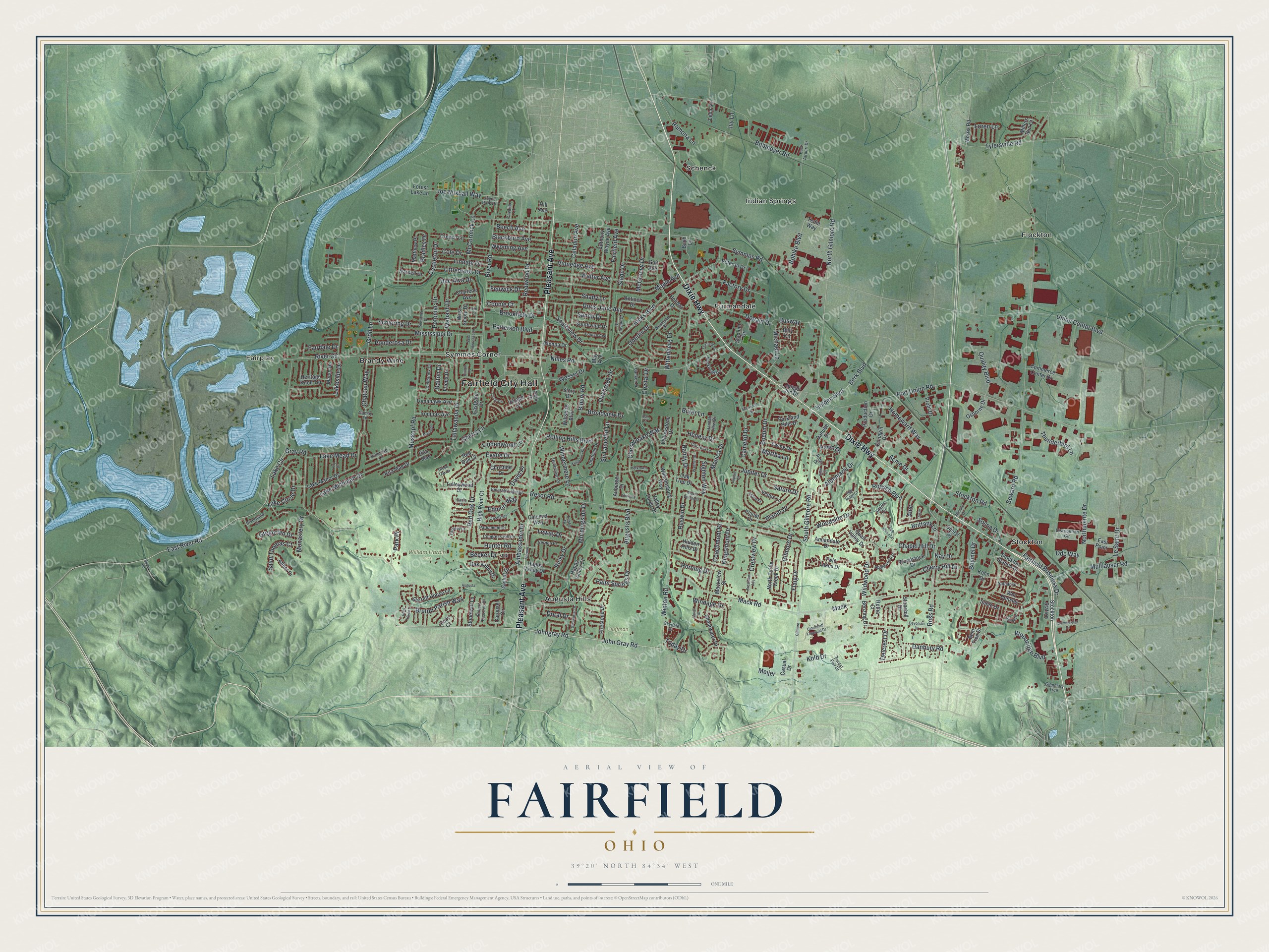
Created by KNOWOL in 2026, this Fairfield map shows the city's streets, with every building in deep red, over shaded green hills. The hills come from USGS elevation data, and the river and ponds on the west side are drawn in pale blue. The title panel reads "Aerial View of Fairfield, Ohio" with 39°20' North, 84°34' West and a one-mile scale bar.
It fits a family room, a home office or a hallway where people stop and look. It's a good gift for someone who grew up off Winton Road or Mack Road and moved away, or for a family that just settled in Fairfield. Open the preview, zoom in and find the street you know. Shop the Fairfield, Ohio map.