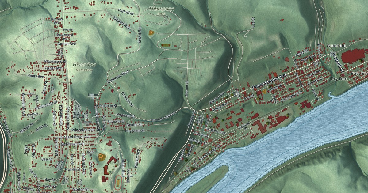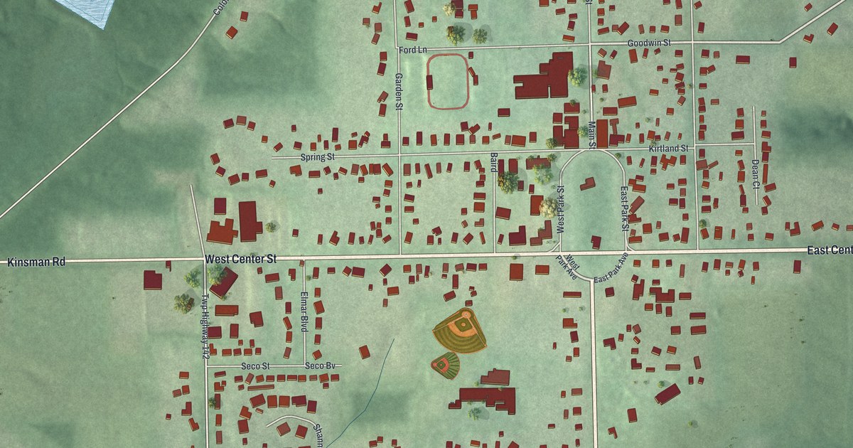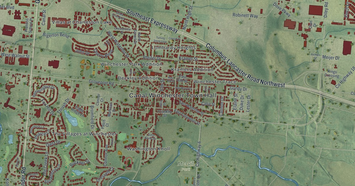
If you grew up in Canal Winchester, went to school on Washington Street, or still have family near the old downtown, this map gives you plenty to find. It's a modern aerial view of Canal Winchester in Franklin County, Ohio, made from modern data and finished with a vintage feel. More than 10,000 buildings are marked in deep red on soft green farm country. Canal Winchester Town Hall is printed near the middle. The Southeast Expressway cuts across the top of town, and a creek curls past the south side, though it isn't labeled. Explore the print options for Canal Winchester.
Washington Street, Kramer Street and Canal Winchester Town Hall
Start at Canal Winchester Town Hall, near the center of the sheet. Washington Street runs right past it, and Franklin Street and Liberty Street cross close by. North High Street, West Waterloo Street and East Waterloo Street fill in the old downtown. From Town Hall, Groveport Road heads west through Beckley Addition to Gender Road. Gender Road is the long road down the left side of the map. Follow it south past The Villages at Winchester and Greensview Villas, where the creek bends around the edge of town. Now go back to Town Hall and head a few blocks north to Kramer Street. It passes Kramers Addition, Lombardy Heights and Winchester Trace. Just above them, the Southeast Expressway comes in from the top left corner. Columbus-Lancaster Road Northwest carries on toward the right edge. Out on the right side, Diley Road runs past Meijer Drive and up to Howe Industrial Parkway. Many of the roads are labeled, and each red shape is a building, so zoom in on the preview and look for yours.
The town wasn't always called Canal Winchester. It started as Winchester. An Ohio historical marker at 19 South High Street tells the story. The Ohio and Erie Canal ran through here, and it helped the village do well in the mid-1800s. Local farmers shipped their grain out on the canal. Merchants brought in coffee, dishes and tools to sell. Later the town added "Canal" to its name. That set it apart from other Winchesters and honored the canal's part in its growth. The canal isn't drawn on the map. Canal Street is printed, though, near Gender Road on the west side.
Downtown has more of that story. The National Register lists the O. P. Chaney Grain Elevator at West Oak Street and North High Street. The elevator isn't labeled, but both streets are printed, so you can find the corner. Near West Waterloo Street, a second marker stands at the old Interurban Depot. It was built in 1905 for an electric railway that tied Canal Winchester to nearby towns. The marker says its arrival ended the gaslight era in the village. Better roads and cheaper cars shut the line down in 1930.
South of downtown, Washington Street runs past Washington Knoll and on toward the creek. In 1887, Franklin County built a covered bridge over Little Walnut Creek at a spot called Kramer's Ford. People in the area had asked for it so they could haul farm goods to the canal and the railroad. The Columbus Bridge Company built it for 2,690 dollars. Its vice president, Reuban L. Partridge, ran the job with his own patented truss made of pine and oak. That's all from the Bergstresser/Dietz Covered Bridge marker on Washington Street. The bridge was added to the National Register in 1974. Neither the bridge nor the creek is labeled on the map. The marker doesn't say whether Dietz Drive or Kramer Street got their names from this story, but both are printed on the map.
For someone who knows North High Street and Gender Road
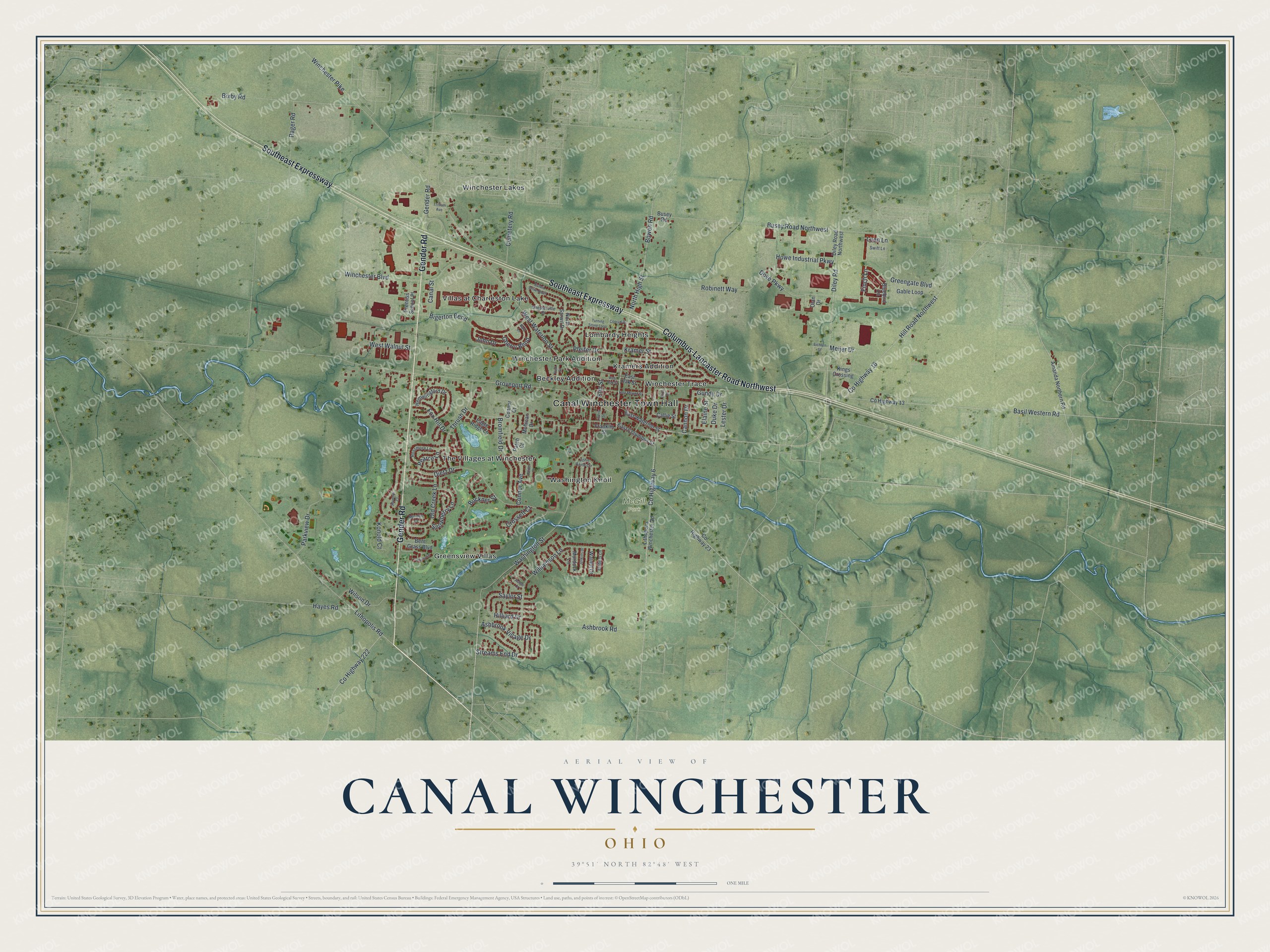
Created by KNOWOL in 2026, this Canal Winchester map takes its shaded ground from USGS elevation data and its roads from Census Bureau records. The town stands out in deep red against green fields, with the creek winding along its south edge. The title panel reads "Aerial View of Canal Winchester, Ohio" with the coordinates 39°51' North, 82°48' West and a one-mile scale bar.
It suits an office, a den or a kitchen wall where someone can stop and find their street. It's a good gift for a Canal Winchester graduate, for someone who moved away, or for anyone with family near downtown. Open the watermarked preview and follow Washington Street south from Town Hall, then choose your print on the product page. Shop the Canal Winchester, Ohio map.