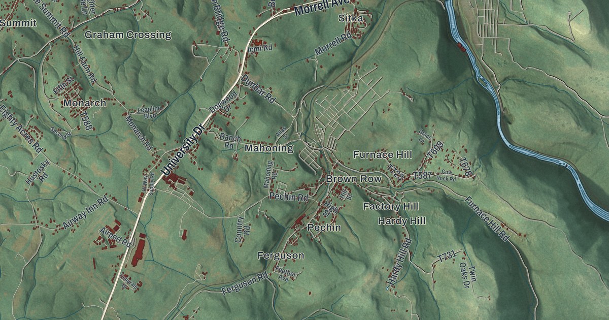
If you grew up in Leisenring, Monarch or Pechin, or you drive University Drive every day, this map gives you plenty to find. It's a modern aerial view of Dunbar Township in Fayette County, Pennsylvania, made from modern data and printed with a vintage feel. Green shaded hills cover the sheet, and each building is a small red shape. The Youghiogheny River is drawn in blue across the top and down the right side, though it isn't labeled. About two dozen small places are named, from Dickerson Run by the river to Irishtown in the southern hills. Explore the print options for Dunbar, Fayette County.
From Morrell Avenue to Hardy Hill and Irishtown
Start where Morrell Avenue meets University Drive, near the middle of the sheet. University Drive is the long pale road that runs from there to the bottom left corner. First, follow Morrell Avenue northeast. It passes Sitka and Wheeler on its way toward the river. Now go back and take University Drive southwest. Monarch Road branches off to the west, through Graham Crossing and Monarch. A little farther on, Pechin Road heads east toward Pechin. Just east of Pechin, Hardy Hill Road runs south past Brown Row and Hardy Hill, then down to Irishtown. Below that, Dunbar Ohiopyle Road climbs into the hills, and State Game Lands Number 51 fills the bottom of the map. Up in the top left, Dickerson Run and Liberty sit by the river. Leisenring Vanderbilt Road heads south from that corner down to Leisenring. Many of the roads are labeled, and each red shape is a building, so zoom in on the preview and look for yours.
The first settler in what's now Dunbar Township was Christopher Gist. The 1882 History of Fayette County says he led the way here in 1752. He was a land agent for the Ohio Company. His cabin was on land called Mount Braddock, and his family was living there by the fall of 1753. That November, George Washington wrote that he "passed Mr. Gist's new settlement." Gist was his guide on that trip. On January 2, 1754, Washington stopped at Gist's again and bought a horse and saddle. Later that year, Washington halted his troops there, then fell back to Fort Necessity. A state historical marker says the French who chased him destroyed the plantation. Gist came back in 1759, after the French had left.
In 1948, the state put up the Gist's Plantation marker on University Drive, near Cellurale Drive. Both roads are printed on the map, and Cellurale Drive meets University Drive in the left half of the sheet. The cabin site isn't marked, and the name Mount Braddock isn't printed. The township's own name comes from the same war. The book says it was named for Col. Thomas Dunbar, a British officer. His men followed General Braddock's army in 1755 with the heavy baggage. After Braddock's defeat, Dunbar destroyed his supplies and pulled back. Old Braddock Road is printed near the bottom of the map, west of State Game Lands Number 51. By 1882, the book called Dunbar "the banner township in Fayette County." Coke, coal and iron gave work to about 2,500 people here. Two railroads ran side by side through the township, "sometimes scarcely fifty feet apart."
For anyone who knows University Drive, Leisenring or Pechin
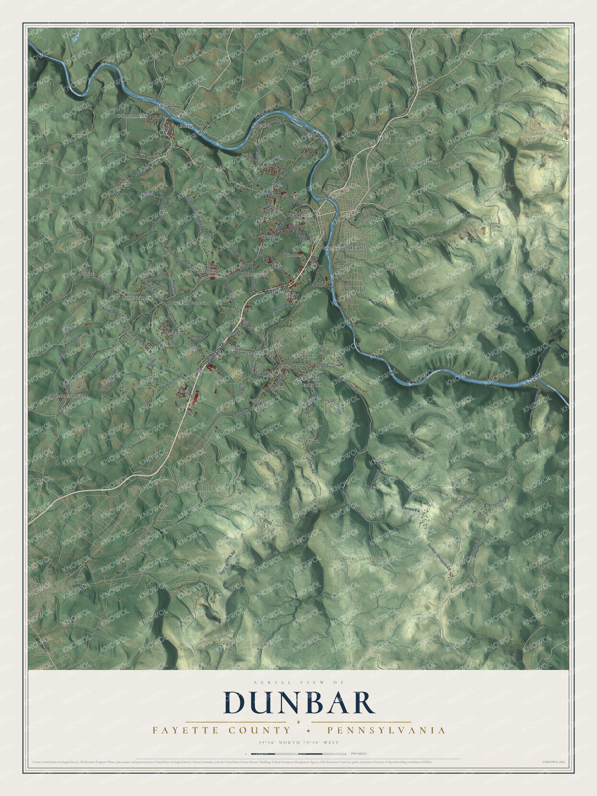
Created by KNOWOL in 2026, this Dunbar Township map suits an office, a den or a camp wall, anywhere someone can stop and trace a road home. The shaded hills come from USGS elevation data, so the steep ground in the south is the real shape of the land. The title panel reads "Aerial View of Dunbar" above "Fayette County, Pennsylvania," with the coordinates 39°58' North, 79°38' West and a two-mile scale bar.
It's a thoughtful gift for someone who grew up in Leisenring or Monarch, has family near Pechin or Hardy Hill, or moved away from Fayette County and still thinks about these hills. Open the preview and follow University Drive until you find your turn. Shop the Dunbar, Fayette County, Pennsylvania map.