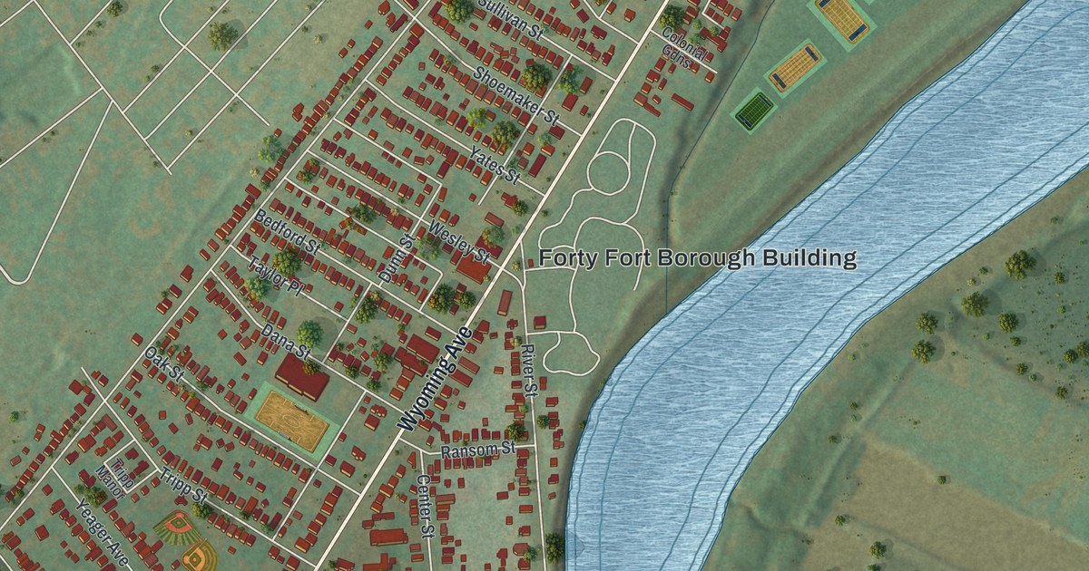
If you grew up in Forty Fort, live off Wyoming Avenue or have family on one of its side streets, this map lays the whole borough out in one view. It's a modern aerial view of Forty Fort in Luzerne County, Pennsylvania, made with modern data and given a vintage look. The town runs in a long, narrow band along Wyoming Avenue. The Susquehanna River curves past on the east side. It isn't labeled, but you can't miss it. The buildings are drawn in red, and the ball fields of the Luzerne County Recreational Complex sit in the green near the top. Explore the print options for Forty Fort.
From the Forty Fort Borough Building up Wyoming Avenue
Start at the Forty Fort Borough Building, printed near the middle of the sheet by the bend in the river. Wyoming Avenue runs past it on a long slant, from the bottom left corner to the top right. Murray Street runs beside it a few blocks to the west. Short streets link the two like the rungs of a ladder. Near the Borough Building, those rungs are Shoemaker, Dana, Wesley and Bedford Streets. Head northeast on Wyoming Avenue and you'll pass Filbert Street and Seminary Place, then Hughes Street and Owen Street. Near the top right, Dennison Street crosses the avenue, and the ball fields spread out toward the river. Now go back to the Borough Building and follow River Street south. It passes Walnut and Ransom Streets, then reaches Fort Street, Butler Street and Rutter Avenue near the bottom of the sheet. Many of the roads are labeled, and each red shape is a building, so zoom in on the preview and look for yours.
How Forty Fort got its name
Forty Fort is named for the first forty Connecticut settlers, who came in 1769. They began their fort in 1770. On July 3, 1778, the patriots marched out from this fort to the Battle of Wyoming. They were beaten, and captives were massacred. Survivors fled back to Forty Fort, and it surrendered the next day, July 4, to a force of British soldiers, Tories and Indians. A state historical marker for the fort stands at Wyoming Avenue and River Street. By 1893 the fort was long gone. "There is nothing now to mark the spot of the old historic fort," says an 1893 history of Luzerne County. "The ground has been plowed and now it is a part of a street in the borough." The same book says one of the first merchants, Robert Shoemaker, kept his store where River and Wyoming now meet. It also notes that the town had no licensed tavern and sold no liquor.
Shoemaker, Tripp and Pettebone in the 1893 history
The 1893 history says this land had been farms only a few years before. It lists some of the old farmers by name: R. McD. Shoemaker, Isaac Tripp, James Hughes, Berdon Shook and Noah Pettebone, Jr. Forty Fort became a borough in 1887, and George Shoemaker was the first president of its council. David Culver was its second burgess. John S. Pettebone was in charge of the streets. Now look at the labels on the map. Shoemaker Street, Tripp Street, Hughes Street and Shook Place are all printed. So are Culver Street and West Pettebone Street. The book doesn't say who each street was named for. Shook Place is a short one, just off Myers Street near the middle of the sheet.
For anyone who knows Wyoming Avenue and Murray Street
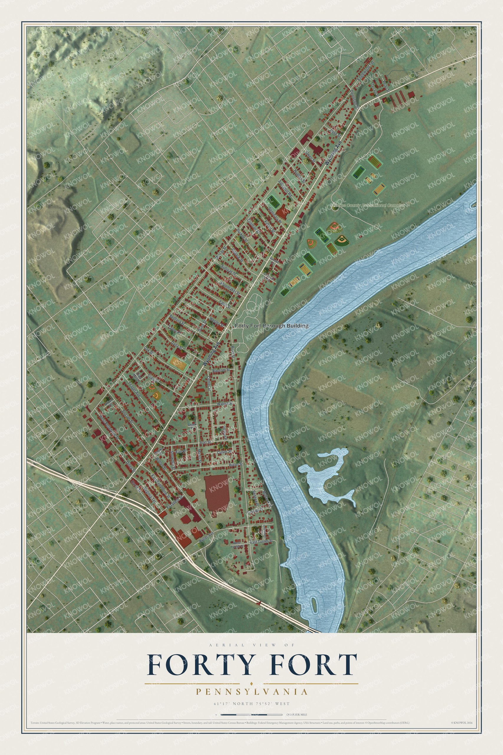
Created by KNOWOL in 2026, this Forty Fort map shows the borough's streets and buildings with the river and green hills around them. The shaded ground comes from USGS elevation data, and the streets from the Census Bureau. The title panel reads "Aerial View of Forty Fort, Pennsylvania," with the coordinates 41°17' North, 75°52' West and a quarter-mile scale bar.
It fits a front hall, a den or a home office. It's a good gift for someone who grew up between the river and Murray Street, or for family who moved away from the Wyoming Valley. Open the preview, zoom in and find the block you know. Shop the Forty Fort, Pennsylvania map.