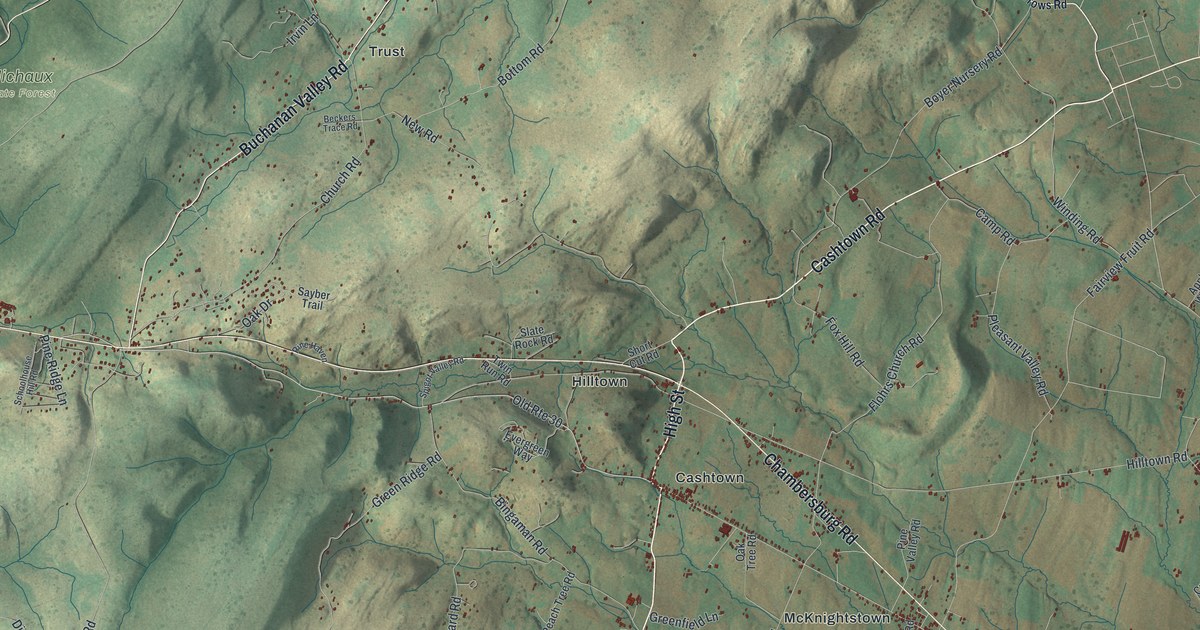
If you grew up in Cashtown, McKnightstown or Mummasburg, or have family on a farm along Buchanan Valley Road, this map gives you plenty to find. It's a modern aerial view of Franklin Township in Adams County, Pennsylvania, made from modern data and finished with a vintage feel. The shaded ridges of South Mountain fill the left side of the sheet, though the mountain itself isn't labeled. Michaux State Forest is named near the top left. Rolling farm country spreads out to the east, and each small red shape is a building. Explore the print options for Franklin, Adams County.
Chambersburg Road from Seven Stars to Graefenburg
Start at Cashtown, near the middle of the sheet. Old Rte 30 runs right through the village. High Street heads north from Cashtown up to Chambersburg Road at Hilltown. From Hilltown, Hilltown Road runs east to Mummasburg, and Cashtown Road heads off toward the top right. Now pick up Chambersburg Road at Hilltown and follow it west. It heads toward the ridges and reaches Graefenburg on the left side of the map. On the way, Buchanan Valley Road turns off to the north and runs up the valley past Trust. Then turn around and follow Chambersburg Road the other way. It runs southeast past McKnightstown and ends up at Seven Stars near the bottom right. Many of the roads are labeled, and each red shape is a building, so zoom in on the preview and look for yours.
How high Cashtown and Graefenburg sit
The 1886 History of Adams County lists how high each village sits. Mummasburg was at 542 feet, and McKnightstown was at 656. Hilltown was at 780 feet, and Cashtown was at 800. Graefenburg, which the book spells Graeffenburg, was at 1,020 feet. The top of the old pike over the mountain was higher still, at 1,440 feet. So when you follow Chambersburg Road west on the map, you're climbing. From McKnightstown up to Graefenburg, that's more than 350 feet.
The same book says clear little streams flowed everywhere. It wasn't unusual for a family to bring water from a mountain spring right into the house and garden. Stockslagger's hotel in Cashtown did just that. Marsh Creek, the book says, rose in Poplar Springs and flowed southeast to Seven Stars, where it formed the township line. The creek isn't labeled on this map. Poplar Springs Road is, down near the bottom center, and Seven Stars sits at the bottom right. The trees were big back then, too. In 1870, a chestnut tree near Rock Top measured 22 feet around, two feet off the ground.
For anyone who knows Cashtown and Buchanan Valley
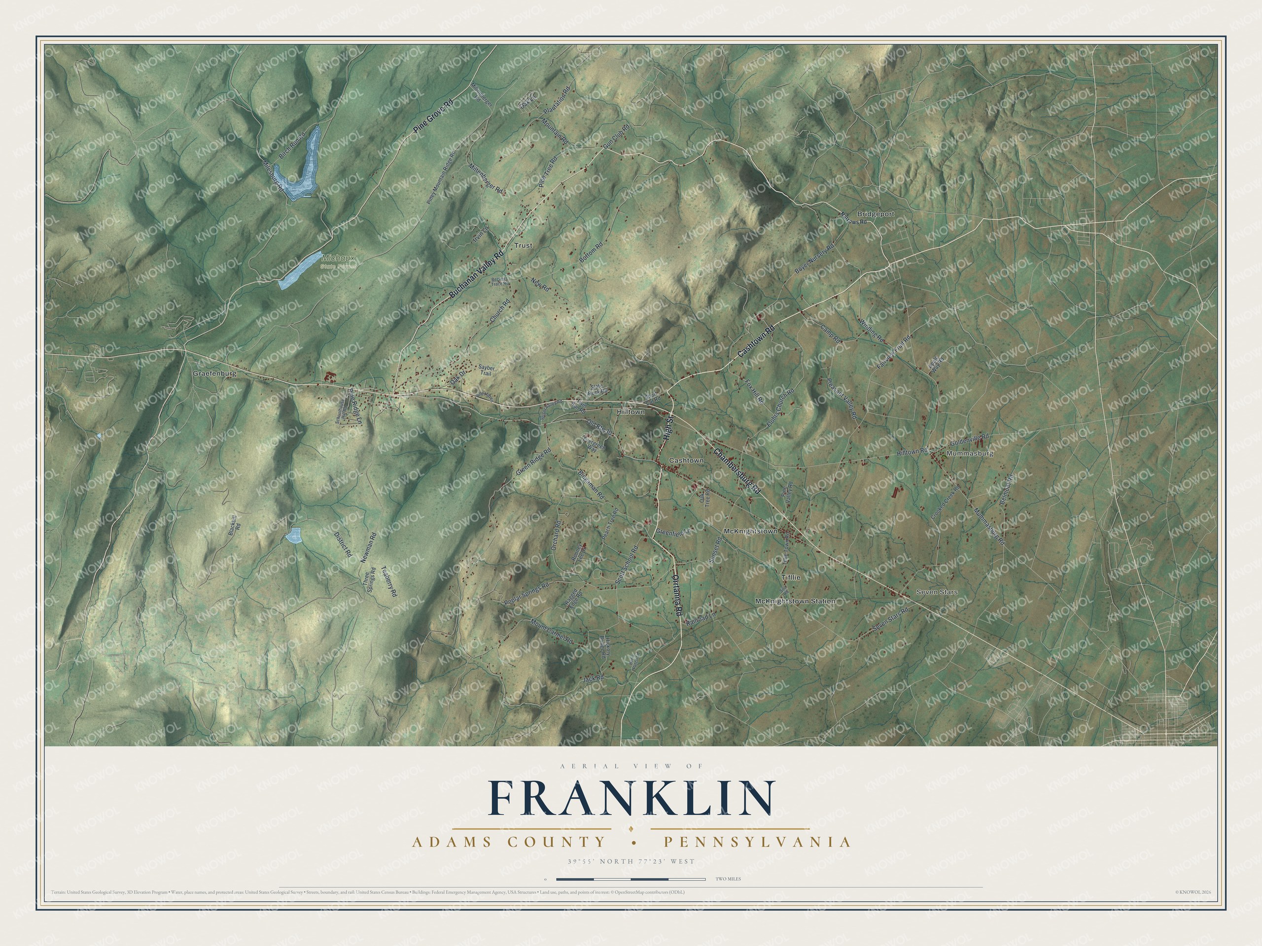
Created by KNOWOL in 2026, this map of Franklin Township shows the hills in shaded green, with the long ridges of South Mountain running down the left side. The shading comes from USGS elevation data. The title panel reads "Aerial View of Franklin, Adams County, Pennsylvania" with the coordinates 39°55' North, 77°23' West and a two-mile scale bar.
It suits a kitchen, a den or an office, and it makes a good gift for someone who grew up between Graefenburg and Mummasburg or moved away from Adams County. Open the preview, zoom in near Cashtown and find a road you know. Shop the Franklin, Adams County, Pennsylvania map.