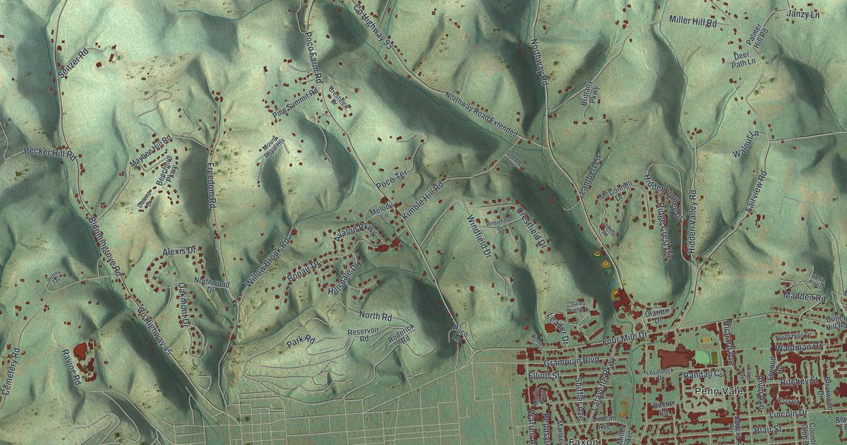
If you grew up in Loyalsock Township, or you still have family in Penn Vale, Faxon or up on Bloomingrove Road, this map gives you a lot to find. It's a modern aerial view of Loyalsock Township in Lycoming County, Pennsylvania, built from modern data and drawn with a vintage feel. Steep wooded hills fill the top of the sheet. Below them, the streets around the Loyalsock Township Building are packed with red buildings. A wide blue river curves along the bottom.
From the Township Building to Heshbon Park
Start at the Loyalsock Township Building, printed near the bottom right. Country Club Drive runs north from it past Lymehurst. Cross Reed Street and Blair Street, and you'll come to Sheridan Street. Follow Sheridan Street west through Kenmar and Faxon until it meets Northway Road. Turn north there. Lincoln Drive and Loyalsock Drive branch off to the east toward Penn Vale. Then Four Mile Drive crosses in the middle of the sheet.
Keep going north. Northway Road becomes Bloomingrove Road and climbs into the hills. Near the top left it meets Log Run Road. Take Log Run Road west, down to Lycoming Creek Road along the left edge. Heshbon Park is printed there, just off Heshbon Road. Now follow Lycoming Creek Road south. You'll pass Mound Cemetery, with Wildwood Cemetery just to the east. Many of the roads are labeled, and each red shape is a building, so zoom in on the preview and look for yours.
Daniel Hughes and Freedom Road Cemetery
Freedom Road runs north from Bloomingrove Road, near the middle of the sheet. A state historical marker stands on it, just south of Northwood Drive. It tells the story of Daniel Hughes. Hughes was a lumber raftsman on the Susquehanna, and he lived here from 1854 to 1880. In the years before the Civil War ended, he brought people escaping slavery up from Maryland. He kept them safe here until they went on north by the Underground Railroad. Hughes gave part of his land for a cemetery. Nine known African American veterans of the Civil War are buried there. It's been called Freedom Road Cemetery since 1936.
How Loyalsock and Heshbon got their names
The township's name is older than any of these roads. An 1892 History of Lycoming County says Loyalsock comes from an Indian word meaning the middle creek. The creek got that name because it lies midway between Muncy and Lycoming creeks. On the map you can see a creek on each side of the township. One runs down the left edge beside Lycoming Creek Road, and the other comes down the right side to the river. The same book says Isaac McKinney and his son William started an iron forge on Lycoming Creek between 1825 and 1830. They called the place Heshbon. Their works made stoves for several years. The great flood of 1865 damaged them so badly that they were never repaired.
For anyone who knows Northway Road or Penn Vale
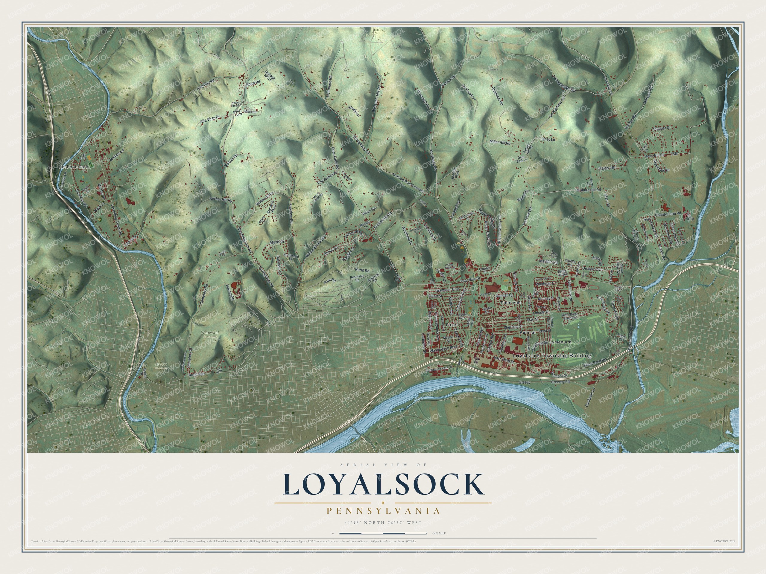
Created by KNOWOL in 2026, this Loyalsock map shows the township's homes and shops in deep red below shaded green hills. The hill shading comes from USGS elevation data. The title panel reads "Aerial View of Loyalsock, Pennsylvania," with the coordinates 41°15' North, 76°57' West.
It fits a den, an office or a family room. It's a thoughtful gift for someone who grew up near Heshbon Park, or who moved away and still thinks of Four Mile Drive as the way home. Open the preview, find Northway Road and follow it to a street you know. See sizes and frames for the Loyalsock map.