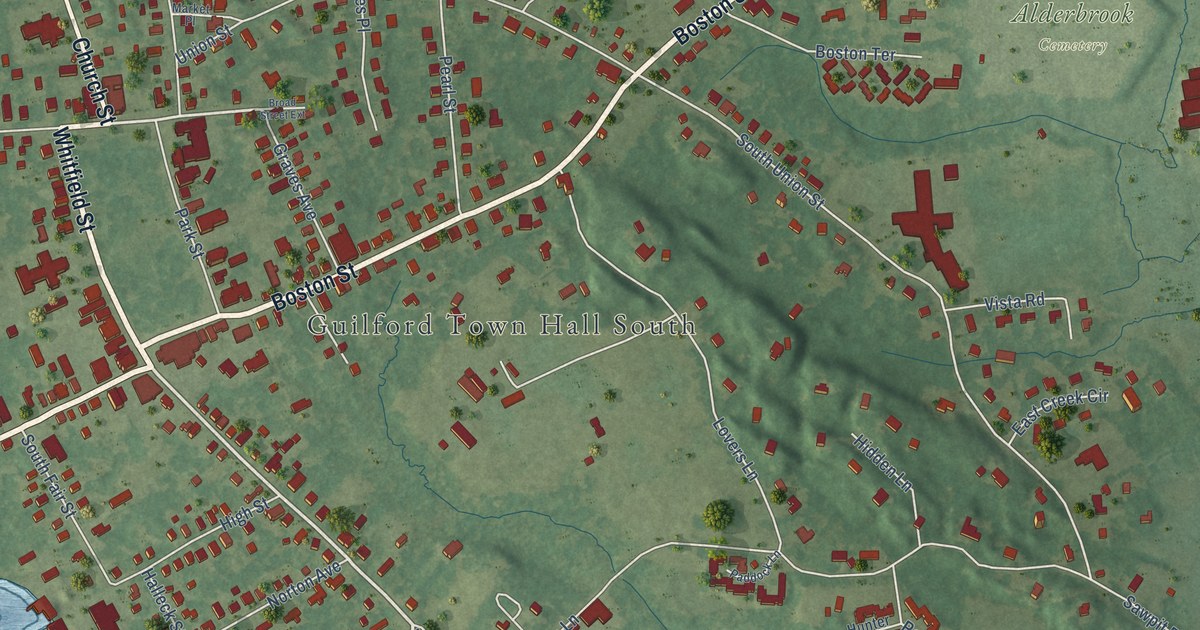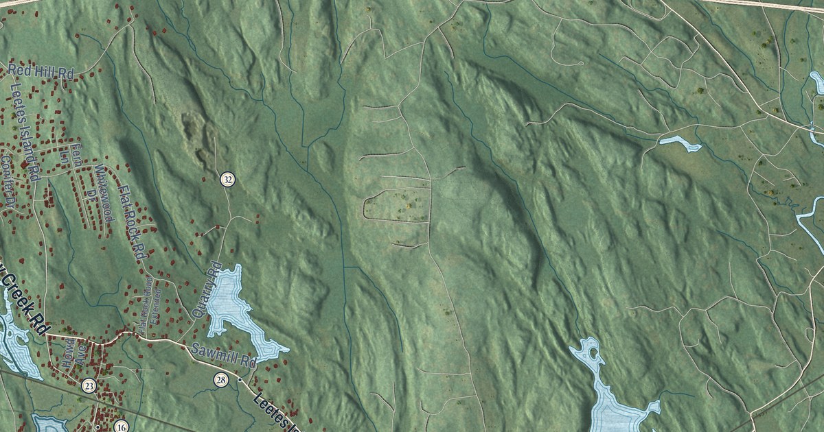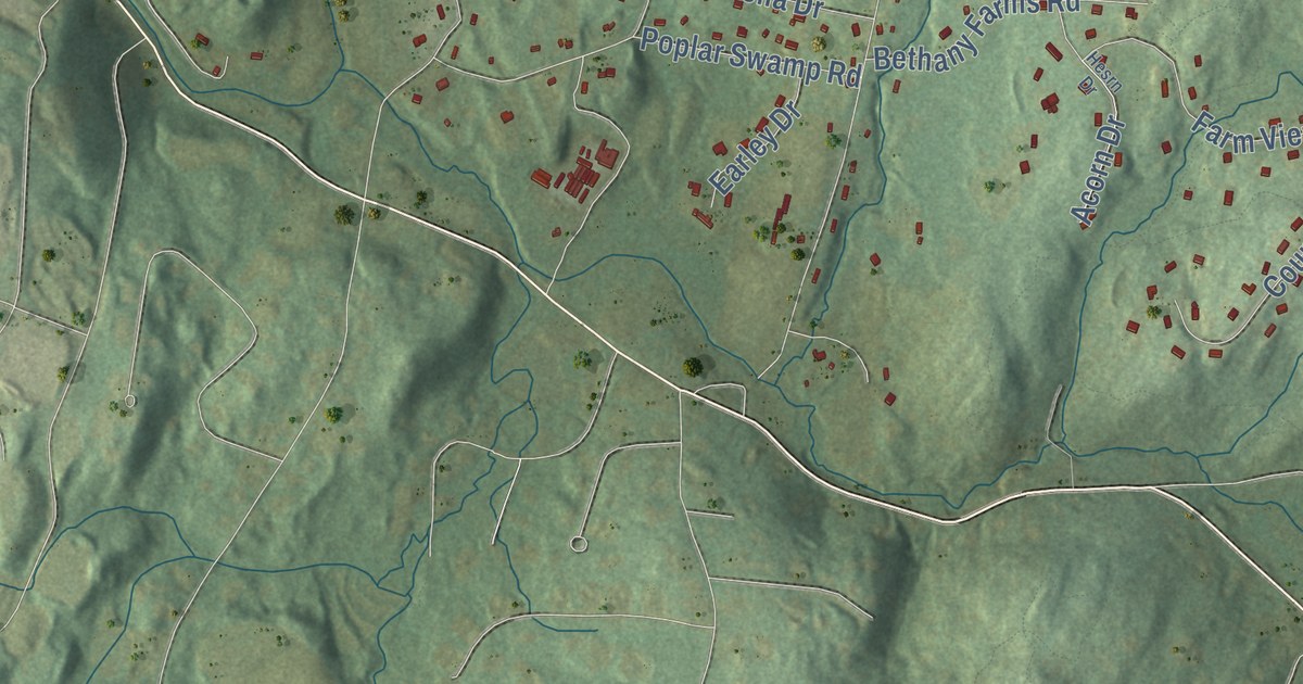
This beautifully detailed map of Bethany, Connecticut was created in 2026 using aerial imagery combined with modern topographical, census, street and landmark data. It’s a one-of-a-kind view of Bethany that combines accurate data with a vintage aesthetic. The map shows every building in its true location, many of the roads carry their names, and the shaded topographic relief shows the shape of the land.
See it on a wall
The Bethany map as an 18 x 24 inch print in a black frame.

Explore an aerial view of Bethany, Connecticut
On the map you’ll find Downtown, Bethany Wood, Davidsons Corner, Beacon Cap, Beacon Hill, Carrington Hill, Lake Bethany, Naugatuck State Forest, and Hein Trails, along with Amity Road, Litchfield Turnpike, Carrington Road, and more. If you look closely you can even find your house accurately drawn in its correct location. Zoom in on the preview to look for yours. Click here to learn more about the history of Bethany.
Take a closer look at the Bethany map
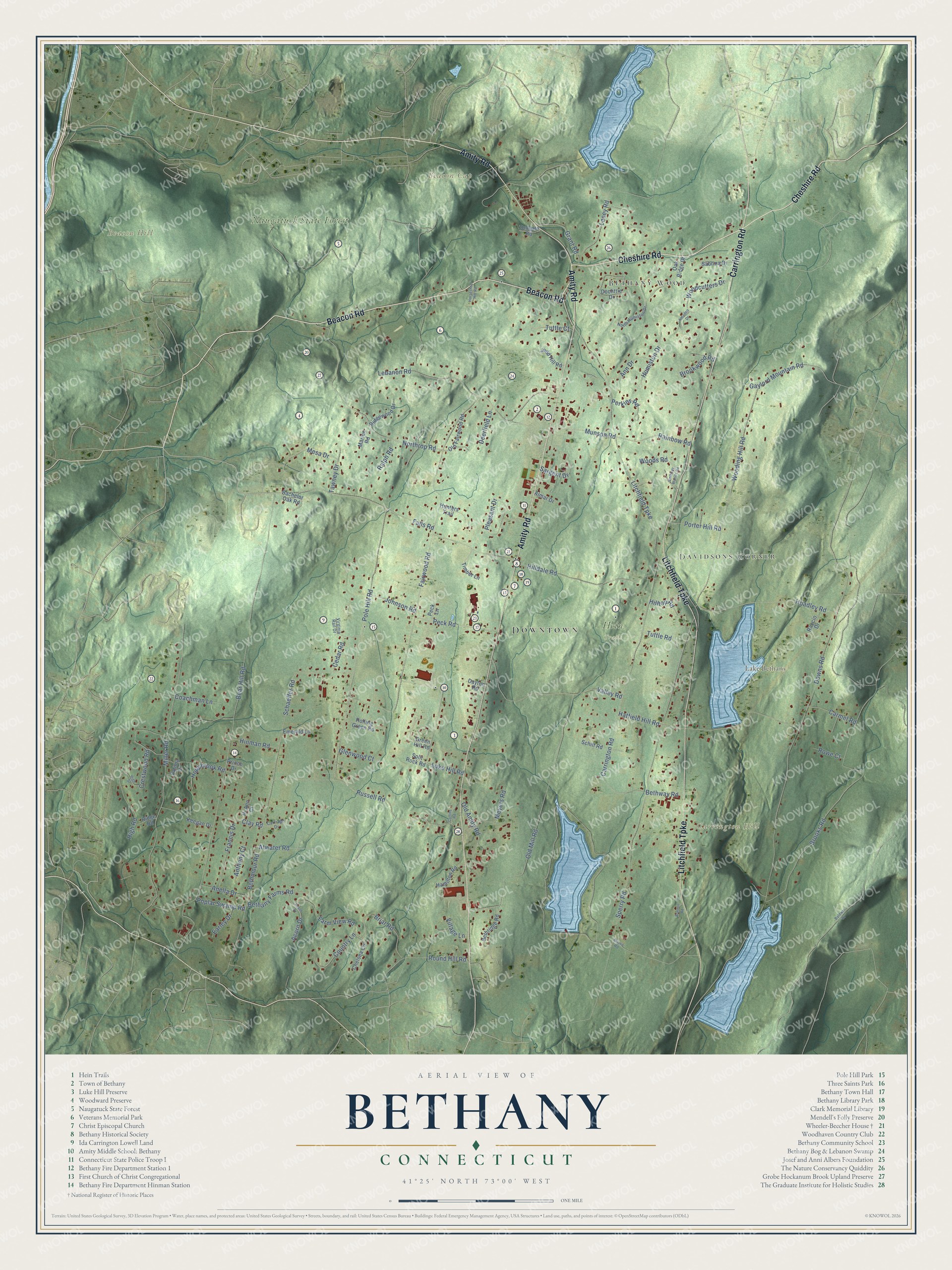
Click to explore a larger preview. The digital watermark does not appear on printed maps.
Names on this map
These names are printed on this map.
Places: Downtown, Bethany Wood, Davidsons Corner, Beacon Cap, Beacon Hill, Carrington Hill, Lake Bethany, Naugatuck State Forest and Hein Trails.
Streets and roads: Amity Road, Litchfield Turnpike, Carrington Road, Beacon Road, Cheshire Road, Northrop Road, Bethmour Road, Bear Hill Road, Downs Road, Sperry Road, Fairwood Road, Brooks Road.
More street names, A to Z
Acorn Drive, Almar Drive, Amadeo Drive, Anella Drive, Ann Drive, Anthony Court, Atwater Road, Bachelor Oak Road, Baldwin Drive, Bethany Farms Road, Bethany Woods Road, Bethridge Road, Bethway Road, Briar Road, Brinton Road, Brookwood Road, Carmel Road, Carriage Drive, Cedar Road, Chelsea Circle, Clay Road, Coachman Lane, Collins Road, Country Lane, Crestwood Road, Dayton Road, Deerfield Lane, Doolittle Drive, Earley Drive, Emerald Lane, Falls Road, Farm View Road, Fatima Drive, Francis Drive, Gaylord Mountain Road, Glenwood Court, Grant Road, Green Hill Road, Hamilton Road, Hatfield Hill Road, Hesrn Drive, Hi Ann Court, High Road, High Street, Hilldale Road, Hilltop Road, Hinman Road, Hoadley Road, Hoppbrook Road, Horseshoe Hill Road, Humiston Drive, Hunters Trail, Johnson Road, Judd Hill Road, Keegan Drive, Lacey Road, Lebanon Road, Luke Hill Road, Marion Road, Mesa Drive, Meyers Road, Miller Road, Morris Road, Munson Road, North Humiston Drive, Oak Ridge Drive, Old Amity Road, Old Fairwood Road, Old Mill Road, Peck Lane, Peck Road, Perkins Road, Pleasant Drive, Pole Hill Road, Poplar Swamp Road, Porter Hill Road, Prince Drive, Raccio Drive, Rainbow Road, Ralph Road, Ridge Road, Ridgewood Drive, Rolling Green Road, Round Hill Road, Rowe Court, Russell Road, Sabrina Drive, Sargent Drive, Schaeffer Road, Schilf Road, Split Rock Road, Tawney Drive, Timber Lane, Tollgate Road, Tuttle Court, Tuttle Road, Valley Road, Village Lane, Virginia Rail Drive, Woodcutters Drive, Wooding Hill Road, Woods Road.
This beautifully detailed map of Bethany makes an attractive addition to your office, library, or den, and it can even be used to teach children the geography and history of the area. It also makes a great gift for someone who left Bethany and still calls it home. When you’re done exploring, click here to get your copy of the Bethany map.