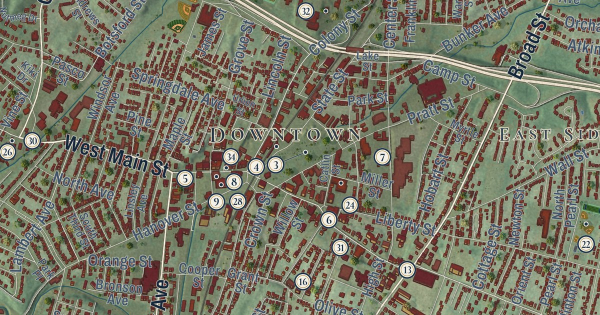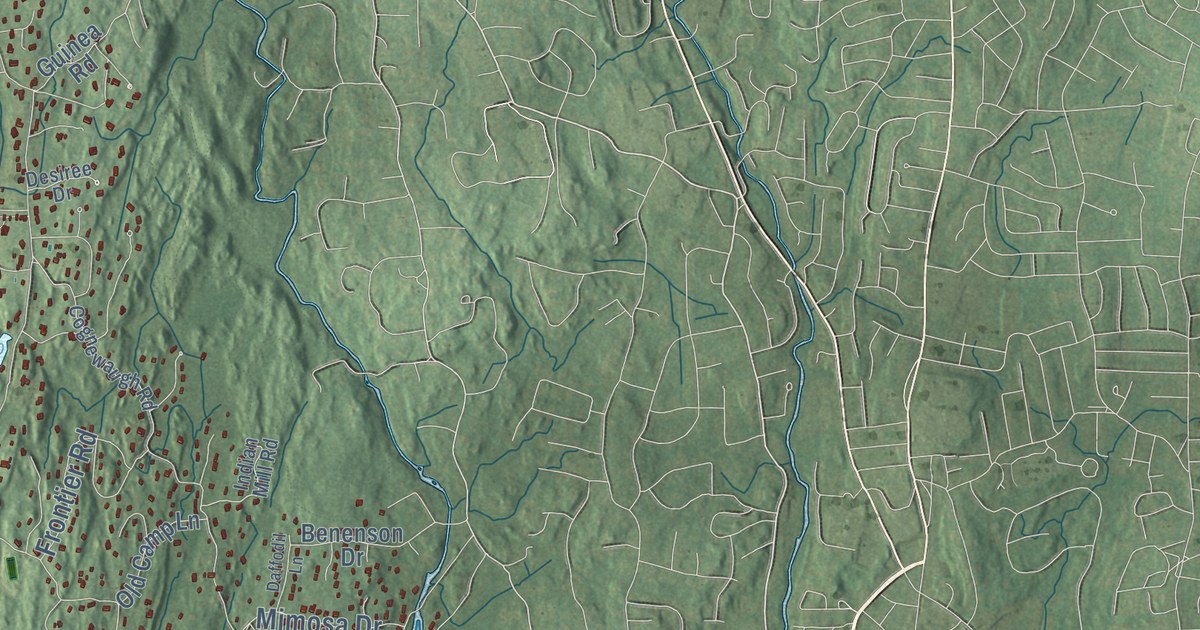
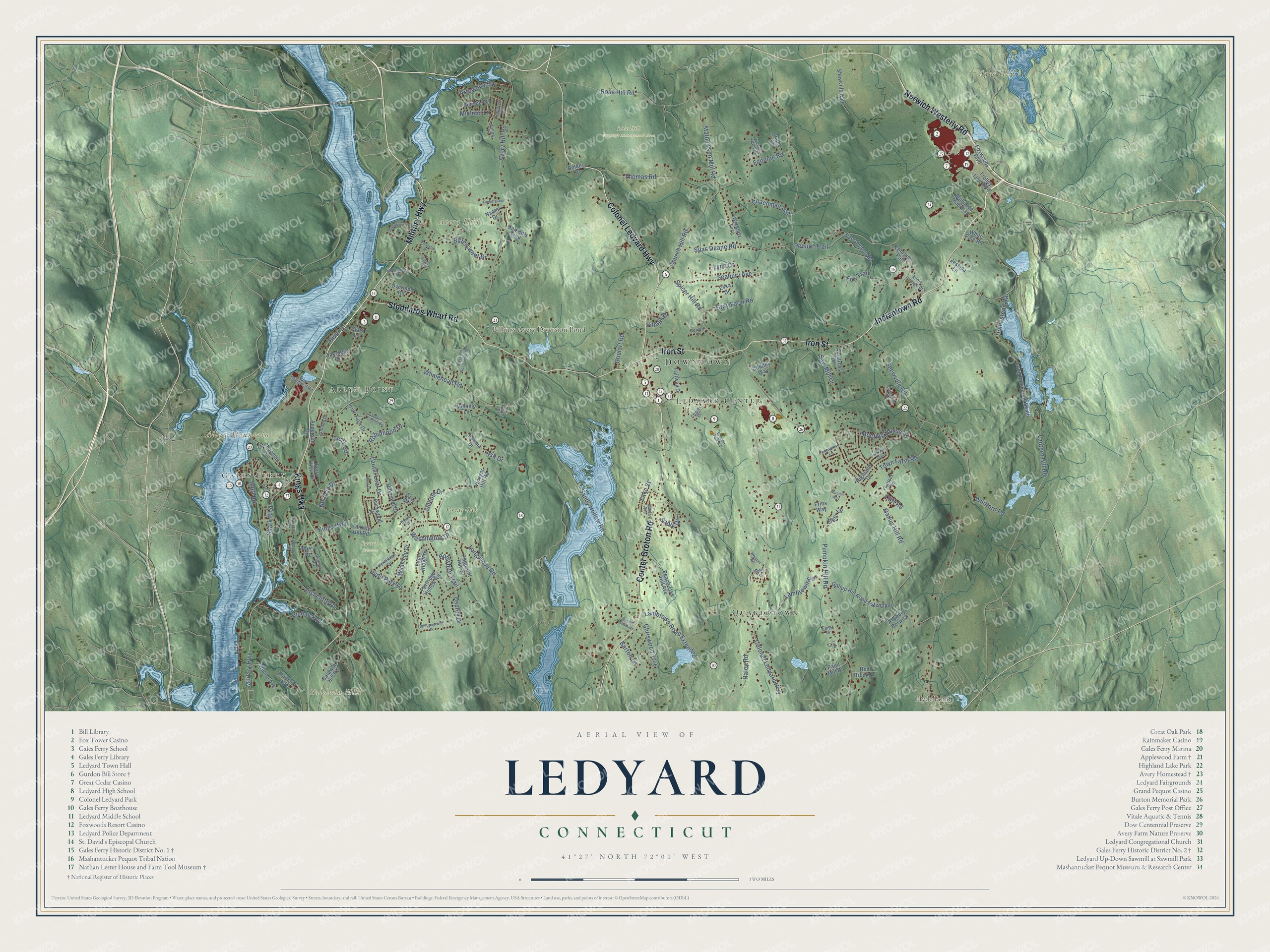
This beautifully detailed map of Ledyard, Connecticut was created in 2026 using aerial imagery combined with modern topographical, census, street and landmark data. It’s a one-of-a-kind view of Ledyard that combines accurate data with a vintage aesthetic. The map shows every building in its true location, many of the roads carry their names, and the shaded topographic relief shows the shape of the land.
See it on a wall
The Ledyard map as an 18 x 24 inch print in a black frame.

Explore an aerial view of Ledyard, Connecticut
On the map you’ll find Downtown, Gales Ferry, Allyn Point, Allyn Mountain, Avery Hill, Ayer Hill, Baldwin Hill, Billings Avery Diversion Pond, Hyde Pond, Barrett Preserve, Great Oak Park, Rose Hill Wildlife Management Area, and more. If you look closely you can even find your house accurately drawn in its correct location. Zoom in on the preview to look for yours. Click here to learn more about the history of Ledyard.
Take a closer look at the Ledyard map
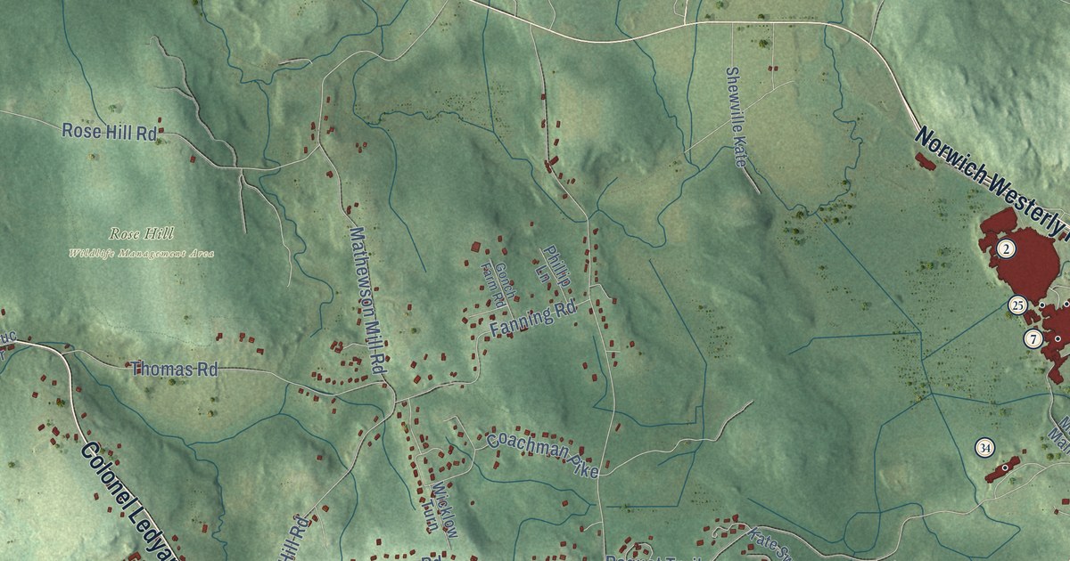
Click to explore a larger preview. The digital watermark does not appear on printed maps.
Names on this map
These names are printed on this map.
Places: Downtown, Gales Ferry, Allyn Point, Allyn Mountain, Avery Hill, Ayer Hill, Baldwin Hill, Billings Avery Diversion Pond, Hyde Pond, Barrett Preserve, Great Oak Park, Rose Hill Wildlife Management Area, Quakertown and Ledyard Center.
Streets and roads: Military Highway, Indiantown Road, Colonel Ledyard Highway, Center Groton Road, Kings Highway, Iron Street, Norwich Westerly Road, Stoddards Wharf Road, Ash Drive, Homestead Road, Shark Boulevard, Lantern Hill Road.
More street names, A to Z
Albatross Drive, Anderson Drive, Annie George Drive, Arrowhead Drive, August Meadows, Autumn Way, Avebury Berwick, Avery Hill Road, Avery Hill Road Extended, Baldwin Hill Road, Baron Court, Barry Drive, Barton Lane, Bittersweet Drive, Blonder Park Road, Bluff Road, Bobwhite Trail, Bolduc Drive, Brewster Drive, Cartridge Trail, Center Drive, Chapman Lane, Chidley Way, Christy Hill Road, Chriswood Trce, Church Hill Road, Clark Lane, Cliff Road, Coachman Pike, Deer Lane, Dow Chemical Road, Eagle Ridge Drive, East Drive, Ephraims Path, Erins Way, Eska Drive, Fairway Drive, Fanning Road, Fargo Drive, Fawn Drive, Ferry View Drive, Flintlock Road, Forest Lane, Fox Trail, Foxwoods Boulevard, Friar Tuck Drive, Gallup Hill Road, Gallup Hill Road Extended, Garden Drive, Gonch Farm Road, Goulart Road, Gray Farm Road, Haley Road, Harvard Terrace, Hermitage Drive, Highland Drive, Hillcrest Avenue, Hyde Park Drive, Inchcliffe Drive, Jessica Lane, Kalmia Drive, Kate Swamp Road, Lakeside Drive, Lake Street, Lambtown Road, Lambtown Road Extended, Laurel Leaf Drive, Lincoln Drive, Long Cove Road, Long Pond Road South, Lynn Drive, Maple Terrace, Marla Avenue, Mathewson Mill Road, Meadow Drive, Meeting House Lane, Melanie Lane, Michael Lane, Monticello Drive, Muhshee Mahchaq, Naomi Drive, Norman Drive, Oak Hills Trail, Oakridge Drive, Oakwood Drive, Osprey Drive, Overlook Road, Paint Mill Drive, Parkwood Drive, Partridge Hollow Road, Peach Tree Hill Avenue, Pennywise Lane, Pequot Trail, Pheasant Run Drive, Phillip Lane, Pinelock Drive, Pumpkin Hill Road, Queen Eleanor Drive, Red Brook Lane, Reuven Drive, Richard Road, River Drive, Robinhood Drive, Rose Hill Road, Sable Drive, Sandy Hollow Road, Saw Mill Drive, Seabury Avenue, Shewville Kate, Shewville Road, Silas Deane Road, Spicer Hill Road, Stonybrook Road, Sunset Avenue, Tanager Lane, Terry Road, Thomas Road, Thresher Avenue, Town Farm Road, Trolley Line Boulevard, Tuckers Run, Village Drive, Vinegar Hill Road, Wahoo Avenue, Washington Drive, West Drive, Whalehead Road, Whippel Road, Whippoorwill Drive, White Pine Road, Whitford Road, Wicklow Turn, Willow Lane, York Court.
This beautifully detailed map of Ledyard makes an attractive addition to your office, library, or den, and it can even be used to teach children the geography and history of the area. It also makes a great gift for anyone with Ledyard roots. When you’re done exploring, click here to get your copy of the Ledyard map.