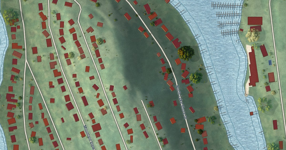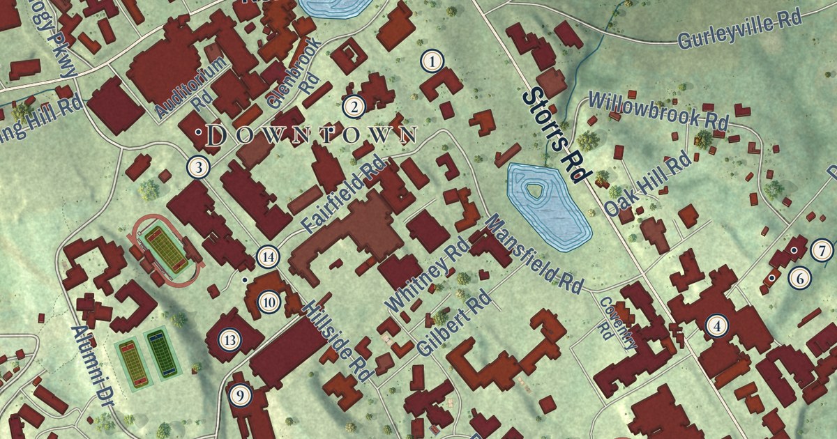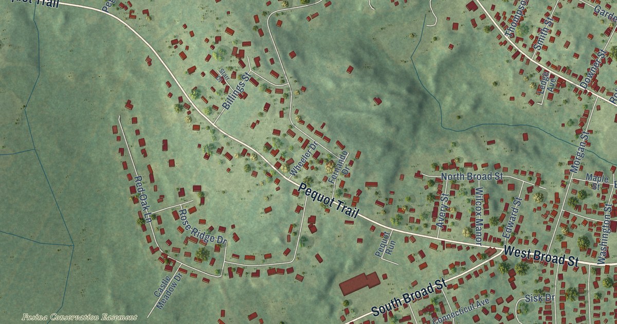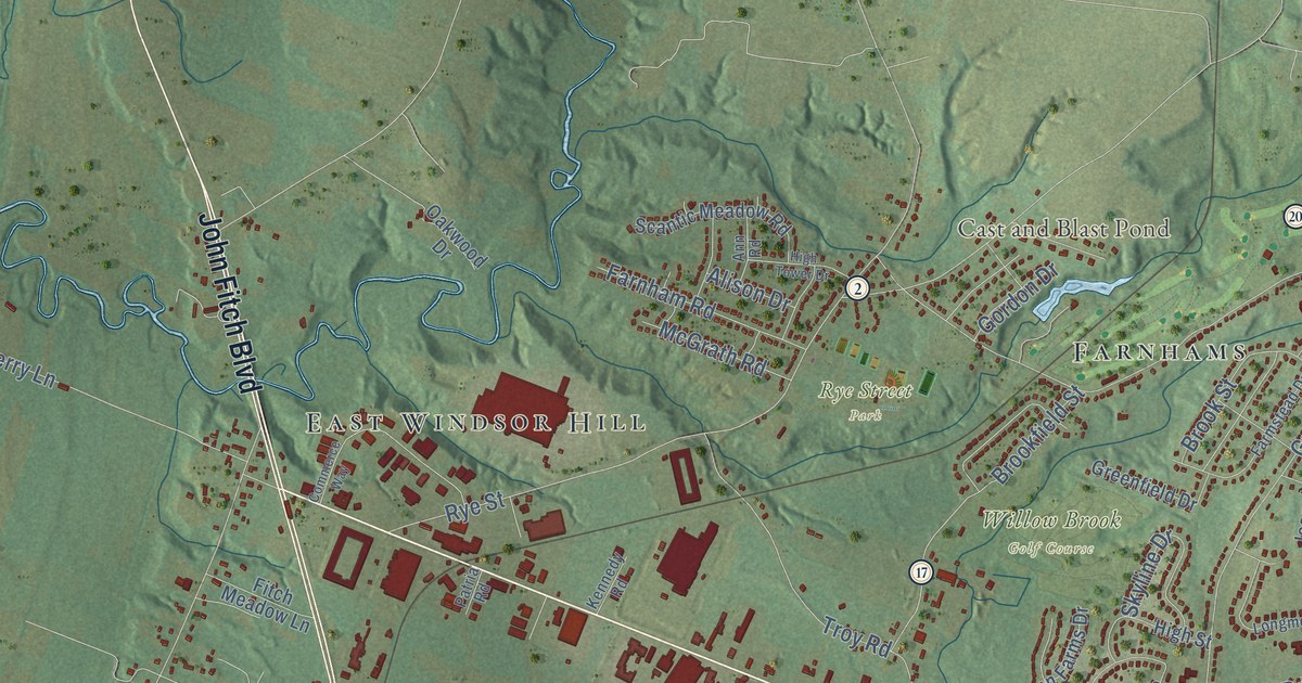
This beautifully detailed map of South Windsor, Connecticut was created in 2026 using aerial imagery combined with modern topographical, census, street and landmark data. It’s a one-of-a-kind view of South Windsor that combines accurate data with a vintage aesthetic. The map shows every building in its true location, many of the roads carry their names, and the shaded topographic relief shows the shape of the land.
See it on a wall
The South Windsor map as an 18 x 24 inch print in a black frame.

Explore an aerial view of South Windsor, Connecticut
On the map you’ll find Downtown, Burnham, Tudor Hill, Brickyard Pond, Cast and Blast Pond, Rye Street Park, Willow Brook Golf Course, Wapping Mews Elderly Housing, East Windsor Hill, Wapping, and Farnhams, along with Ellington Road, and more. If you look closely you can even find your house accurately drawn in its correct location. Zoom in on the preview to look for yours. Click here to learn more about the history of South Windsor.
Take a closer look at the South Windsor map
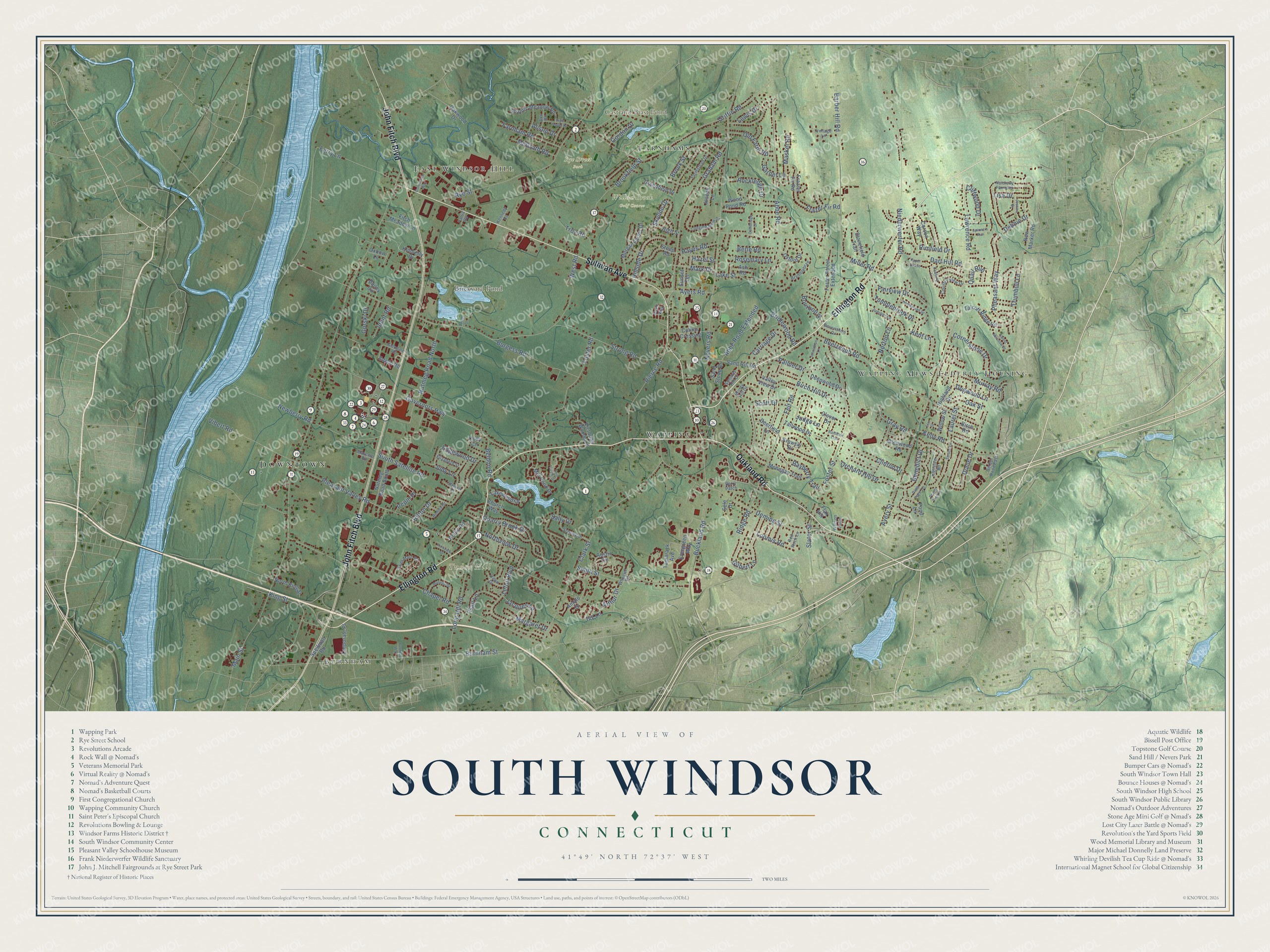
Click to explore a larger preview. The digital watermark does not appear on printed maps.
Names on this map
These names are printed on this map.
Places: Downtown, Burnham, Tudor Hill, Brickyard Pond, Cast and Blast Pond, Rye Street Park, Willow Brook Golf Course, Wapping Mews Elderly Housing, East Windsor Hill, Wapping and Farnhams.
Streets and roads: Ellington Road, Oakland Road, Sullivan Avenue, John Fitch Boulevard, Buckland Road, Main Street, Strong Road, Pleasant Valley Road, Avery Street, Chapel Road, Burnham Street, Clark Street.
More street names, A to Z
Abbe Road, Abbe Road Extended, Alison Drive, Amato Drive, Ann Road, Arthur Drive, Ash Road, Austin Circle, Ayers Road, Bailey Circle, Barber Hill Road, Bayberry Trail, Beelzebub Road, Beldon Road, Benedict Drive, Berle Road, Berry Patch, Birch Hill Drive, Birch Road, Bourbon Street, Bramblebrae, Bridlewood Road, Brookfield Street, Brook Street, Burgess Road, Cadbury Lane, Cambridge Drive, Carriage Drive, Carson Way, Church Way, Cliffwood Drive, Clinton Drive, Clover Drive, Cody Circle, Collins Crossing, Commerce Way, Corneau Way, Cornerstone Drive, Corporate Place, Country View Drive, Dart Hill Road, Dawn Drive, Debbie Drive, Deepwood Drive, Deerfield Lane, Deming Street, Devonshire Drive, Diane Drive, Dogwood Lane, Dzen Way, Edgewood Drive, Edwin Road, Elizabeth Street, Elm Street, Evergreen Way, Fairview Drive, Farmstead Drive, Farnham Road, Felt Road, Ferry Lane, Fitch Meadow Lane, Flax Hill, Foster Road, Foster Street, Foster Street Extended, Frazer Fir Road, Frazier Fir Road, Gail Lane, Garnet Lane, Gerber Road East, Gilbert Lane, Glendale Road, Glenwood Road, Gordon Drive, Gorski Drive, Governors Highway, Graham Road, Gray Road, Greenfield Drive, Griffin Road, Hayes Road, Hazel Street, Highland Drive, High Street, High Tower Drive, Highview Road, Hillside Drive, Hilton Drive, Hollis Road, Homestead Drive, Ident Road, Ivy Lane, Jacques Lane, Jessica Drive, Johnathan Lane, Joseph Lane, Judge Lane, Judy Lane, Juniper Lane, Kelly Road, Kennedy Road, Kent Lane, Kimberly Drive, King Street, Krawski Drive, Lake Street, Lakewood Drive, Laurel Street, Lawrence Road, Lefoll Boulevard, Lewis Drive, Lisa Drive, Long Hill Road, Longmeadow Drive, Loomis Road, Margaret Drive, Mark Drive, Mascolo Road, Maskel Road, McGrath Road, Miller Road, Mill Pond Drive, Mohegan Trail, Morgan Farms Drive, Murielle Drive, Murray Road, Natsisky Farm Road, Nevers Road, Newberry Road, New Marker Road, Niederwerfer Road, North King Street, Northview Drive, Norton Lane, Nutmeg Road North, Nutmeg Road South, Oak Street, Oakwood Drive, Old Farm Road, Orchard Hill Drive, Oxbow Lane, Oxford Drive, Palmer Drive, Paper Chase, Parkview Drive, Patria Road, Peach Tree Lane, Pepin Place, Pheasant Way, Pierce Road, Pine Tree Lane, Pond Lane, Quail Run, Quarry Brook Drive, Rainbow Trail, Red Rock Lane, Ridge Road, Rimfield Drive, Rockledge Drive, Ronda Drive, Rosemary Lane, Rye Street, Saint Marc Circle, Sally Drive, Sand Hill Road, Sand Stone Drive, Scantic Meadow Road, Scott Drive, Sele Drive, Sharon Drive, Skyline Drive, Slater Street, Smith Street, South Satellite Road, Speilman Road, Spinners Run, Spruce Lane, Stanley Drive, Steep Road, Stonefield Trail, Summer Hill Drive, Sunset Terrace, Sweet Meadow Drive, Talcott Ridge Road, Tallwood Drive, Tamarack Avenue, Tomel Drive, Troy Road, Trumbull Lane, Tumblebrook Drive, Twin Circle Drive, Valley View Drive, Vibert Road, Victorian Woods Lane, Vintage Lane, Watson Farm, West Road, Wheeler Road, Willow Street, Windy Hill Drive, Wood Pond Road.
This beautifully detailed map of South Windsor makes an attractive addition to your office, library, or den, and it can even be used to teach children the geography and history of the area. It also makes a great gift for anyone with South Windsor roots. When you’re done exploring, click here to get your copy of the South Windsor map.