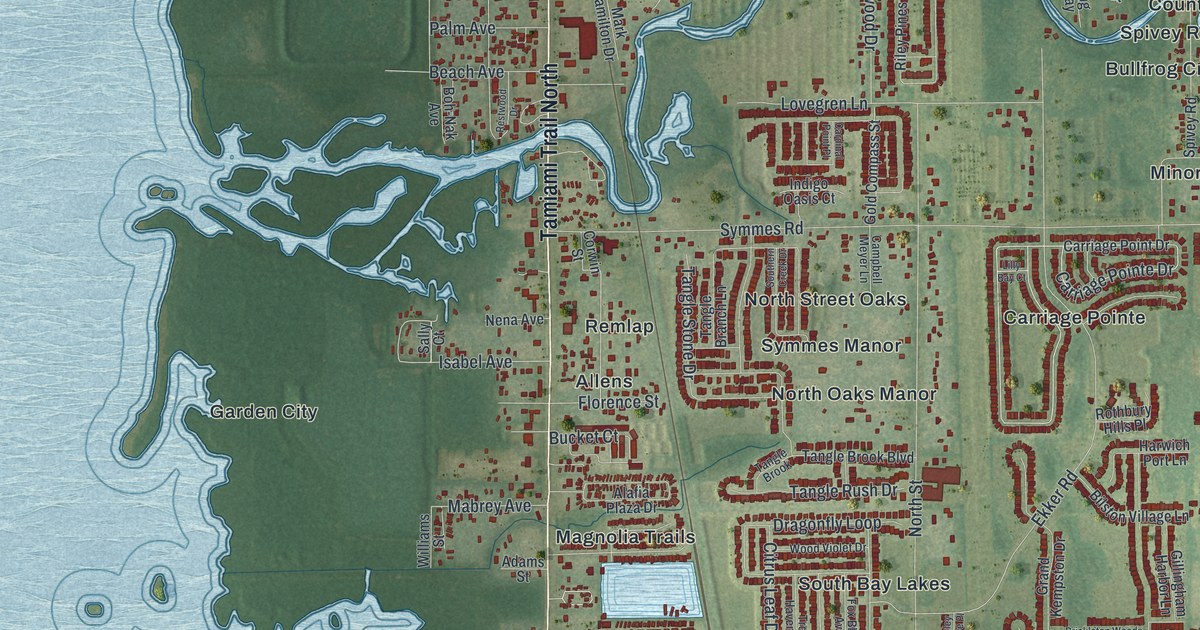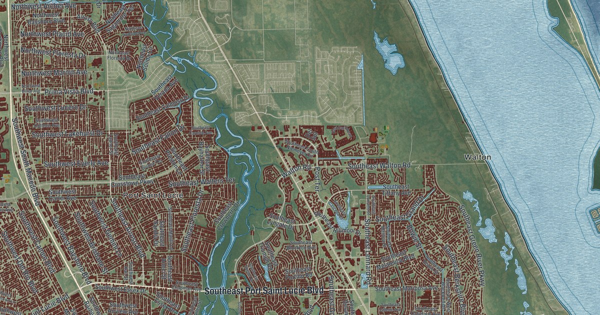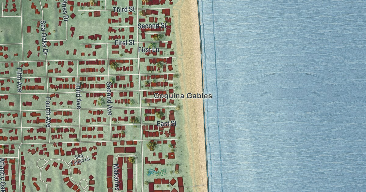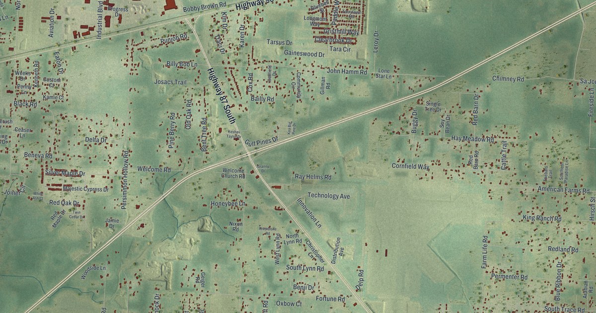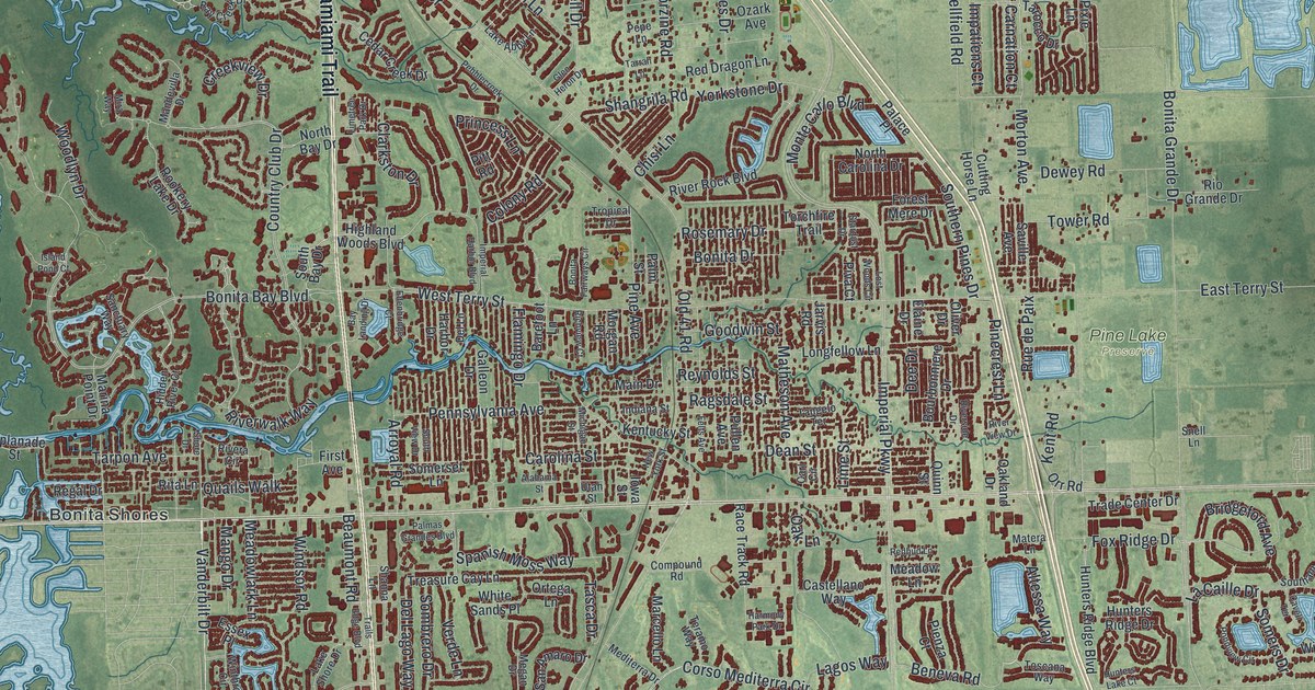
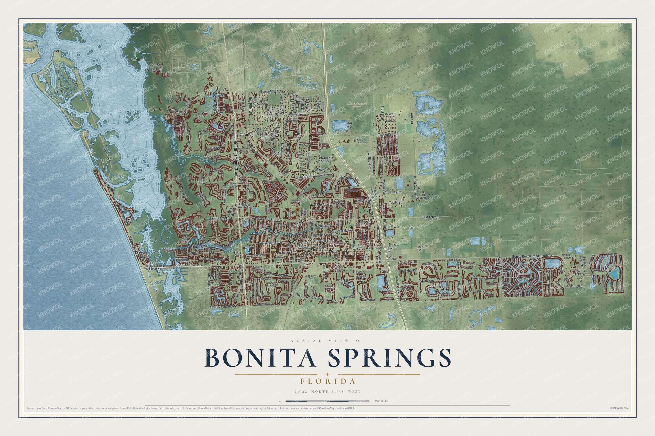
This beautifully detailed map of Bonita Springs, Florida was created in 2026 using aerial imagery combined with modern topographical, census, street and landmark data. It’s a one-of-a-kind view of Bonita Springs that combines accurate data with a vintage aesthetic. The map shows every building in its true location, many of the roads carry their names, and the shaded topographic relief shows the shape of the land.
Explore an aerial view of Bonita Springs, Florida
On the map you’ll find Coconut, Bonita Shores, Hidden Cypress Preserve, Pine Lake Preserve, and Council, along with South Tamiami Trail, Pelicans Nest Drive, Corso Mediterra Circle, Vanderbilt Drive, Goldcrest Drive, Trost Boulevard, Pennyroyal Drive, and more. If you look closely you can even find your house accurately drawn in its correct location. Zoom in on the preview to look for yours.
Did You Know?
In the 1870s, the U.S. Army Corps of Engineers set up a survey camp on what is now the Imperial River. The settlement became known as Survey, and the river as Surveyor’s Creek. Developers later chose new names to draw settlers, and by 1912 they had become Bonita Springs and the Imperial River.
Take a closer look at the Bonita Springs map
Names on this map
These names are printed on this map.
Places: Coconut, Bonita Shores, Hidden Cypress Preserve, Pine Lake Preserve and Council.
Streets and roads: South Tamiami Trail, Pelicans Nest Drive, Corso Mediterra Circle, Vanderbilt Drive, Goldcrest Drive, Trost Boulevard, Pennyroyal Drive, Hickory Boulevard, Del Lago Way, Alhambra Lane, Imperial Parkway, Bonita Grande Drive.
More street names, A to Z
Alabama Street, Altessa Way, Alvara Way, Amarillo Street, Arles Court, Arroyal Road, Arvida Lane, Ascot Bend Court, Barefoot Lane, Bay Creek Drive, Bay Landing Drive, Bay Road, Beaumont Road, Bellino Terrace, Beneva Road, Bernwood Drive, Bernwood Parkway, Blaisdell Drive, Bonita Bay Boulevard, Bonita Beach Road Southeast, Bonita Beach Road Southwest, Bonita Bill Street, Bonita Drive, Bonita Fairways Circle, Bonita National Boulevard, Bourbonniere Drive, Bridgeford Avenue, Bridgetown Court, Burano Drive, Burnt Pine Drive, Busy Bee Drive, Calistoga Drive, Captivia Shell Loop, Carino Terrace, Carl Circle, Carlow Court, Carnation Court, Carolina Street, Casals Lane, Castellano Way, Catskill Drive, Cavan Court, Cavell Terrace, Cavendish Court, Cedar Creek Drive, Cherrywood Court, Chianti Terrace, Chisi Lane, Citrus Park Boulevard, Claire Street, Clarkston Drive, Cockleshell Drive, Cock Robin Lane, Colony Road, Colony Villas Drive, Compound Road, Corzine Road, Country Club Drive, Creekview Drive, Cutting Horse Lane, Danios Drive, Dean Street, Dee Drive, Del Lane, Derry Court, Dewey Road, Dietz Drive, Divot Drive, Dolphin Street, Draine Street, East Terry Street, Edenbridge Court, Elaine Drive, Eleventh Street, Esplanade Street, Essex Place, Estero Boulevard, Felts Avenue, First Avenue, Flamingo Drive, Forester Drive, Forest Mere Drive, Fox Ridge Drive, Galleon Drive, Galway Run Court, Gilroy Street, Girard Terrace, Glen Heron Drive, Golden Eagle Lane, Goodwin Street, Harbor Drive, Harmony Park Drive, Herring Way, Hidden Pines Lane, Hidden River Court, Highland Woods Boulevard, Hunters Lake Court, Hunters Ridge Boulevard, Hunters Ridge Drive, Impatiens Court, Imperial Harbor Boulevard, Indiana Street, Iowa Street, Isabella Drive, Island Pond Court, Jarvis Road, Jef Nik Lane, Jeneva Way, Kent Road, Kentucky Street, Kerry Court, La Caille Drive, Lagos Way, Lake Abby Lane, Lakemont Drive, Lake Shore Drive, Latitude Drive, Lavante Court, Liberty Crossing, Liberty Youth Ranch Way, Lieto Lane, Lime Street, Limetree Park Drive, Lisburn Court, Logan Boulevard, Longfellow Lane, Longford Court, Lost Woods Circle, Luci Drive, Lure Trail, Main Drive, Mandevilla Drive, Mango Drive, Marcello Lane, Marina Point Drive, Matera Lane, Matheson Avenue, Matteotti Vw, Meadow Lane, Meadowlark Lane, Mediterra Drive, Megan Drive, Melaine Lane, Meravi Drive, Michigan Street, Mira Way, Monte Carlo Boulevard, Montecristo Loop, Morgan Road, Moriah Lane, Morton Avenue, Mountain View Drive, Newton Court, New York Street, North Bay Drive, North Carolina Drive, Oakland Drive, Oak Lane, Old 41 Road, Oliver Drive, Orr Road, Ortega Lane, Ott Lane, Ozark Avenue, Palace Place, Palmas Grandes Boulevard, Palm Street, Papillion Drive, Paradise Road, Pebblecreek Drive, Pelican Colony Boulevard, Pennsylvania Avenue, Pepe Lane, Pienza Court, Pine Avenue, Pinecrest Lane, Pinson Drive, Pitt Road, Piva Court, Pixie Lane, Pondview Circle, Princess Lane, Production Circle, Pullen Avenue, Quails Walk, Quinn Street, Race Track Road, Ragsdale Street, Redbud Lane, Red Dragon Lane, Red Robin Drive, Reef Lane, Regal Drive, Reynolds Street, Richview Court, Rio Grande Drive, Rita Lane, Rivera Circle, River Rock Boulevard, Riverside Drive, River View Drive, Riverwalk Way, Rocky Road, Rodas Drive, Roger Dodger Street, Rookery Lake Drive, Rosemary Drive, Rue de Paix, Salinas Way, Sanabria Loop, San Amaro Drive, Sanctuary Way, Sandfly Court, Sanibel Sands Street, San Lucas Lane, Saville Avenue, Seasons Tide Avenue, Seventh Street, Shangrila Road, Shanna Lane, Shore Drive, Sicily Loop, Snell Lane, Sombrero Drive, Somers Drive, Somerset Lane, Sosta Lane, Southampton Drive, South Bay Drive, Southern Pines Drive, South View Drive, Spanish Moss Way, Spring Creek Road, Stardust Drive, Stillwell Parkway, Strike Lane, Sunny Lane, Tahiti Drive, Tangelo Terrace, Tarocco Drive, Tarpon Avenue, Tarrah Lane, Tasca Drive, Teramo Way, Third Street, Tivoli Terrace, Torchfire Trail, Toscana Way, Tower Road, Trade Center Drive, Trails Edge Boulevard, Treasure Cay Lane, Tropic Acres Drive, Tropical Drive, Tuck Drive, Turin Court, Tuscany Court, Twain Drive, Utah Street, Verde Lane, Vermillion Lane, Via del Corso Lane, Villagewalk Circle, Walden Center Avenue, Waterfall Drive, Wellfield Road, West Terry Street, Wharton Drive, White Sands Place, Wicklow Court, Williston Way, Windsor Road, Windward Boulevard, Winthrop Circle, Wood Ibis Avenue, Woodlyn Drive, Woodsage Drive, Woods Edge Parkway, Xenon Way, Yorkstone Drive.
See it on a wall
The Bonita Springs map as a framed print. Swipe for more.


This beautifully detailed map of Bonita Springs makes an attractive addition to your office, library, or den, and it can even be used to teach children the geography and history of the area. It also makes a great gift for someone who left Bonita Springs and still calls it home. When you’re done exploring, click here to get your copy of the Bonita Springs map.