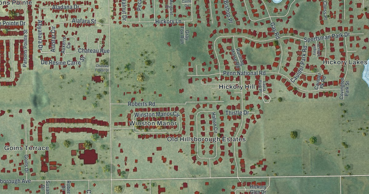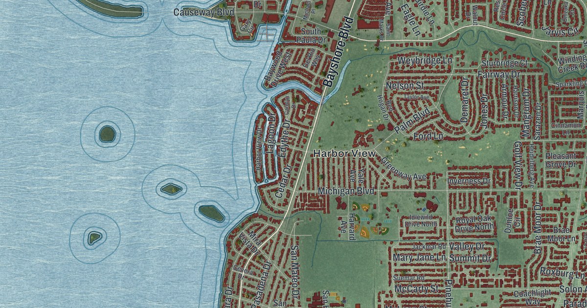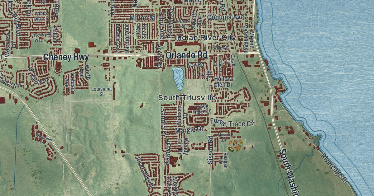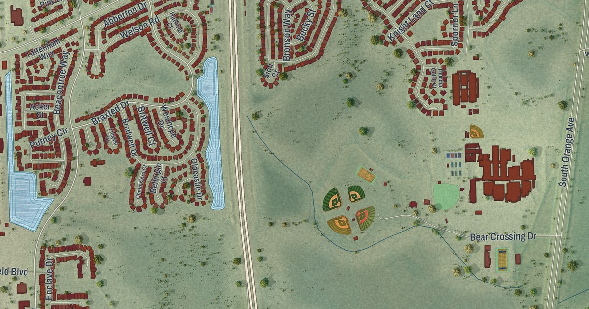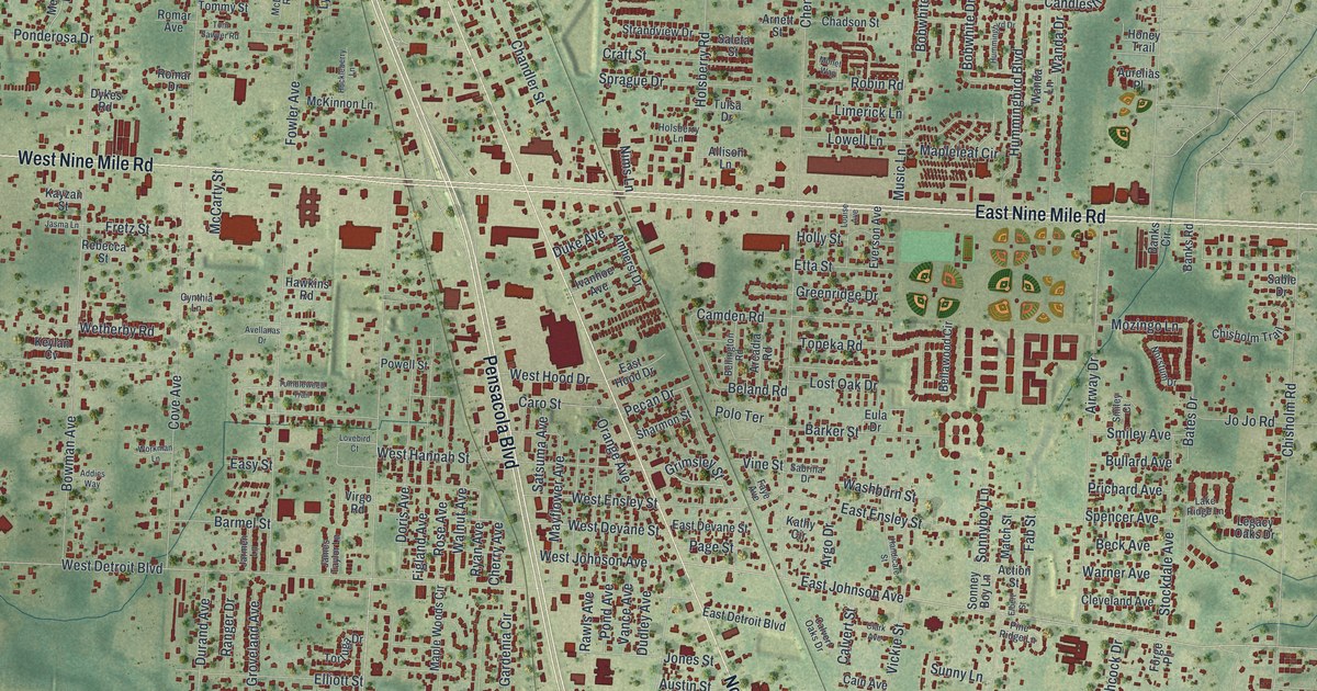
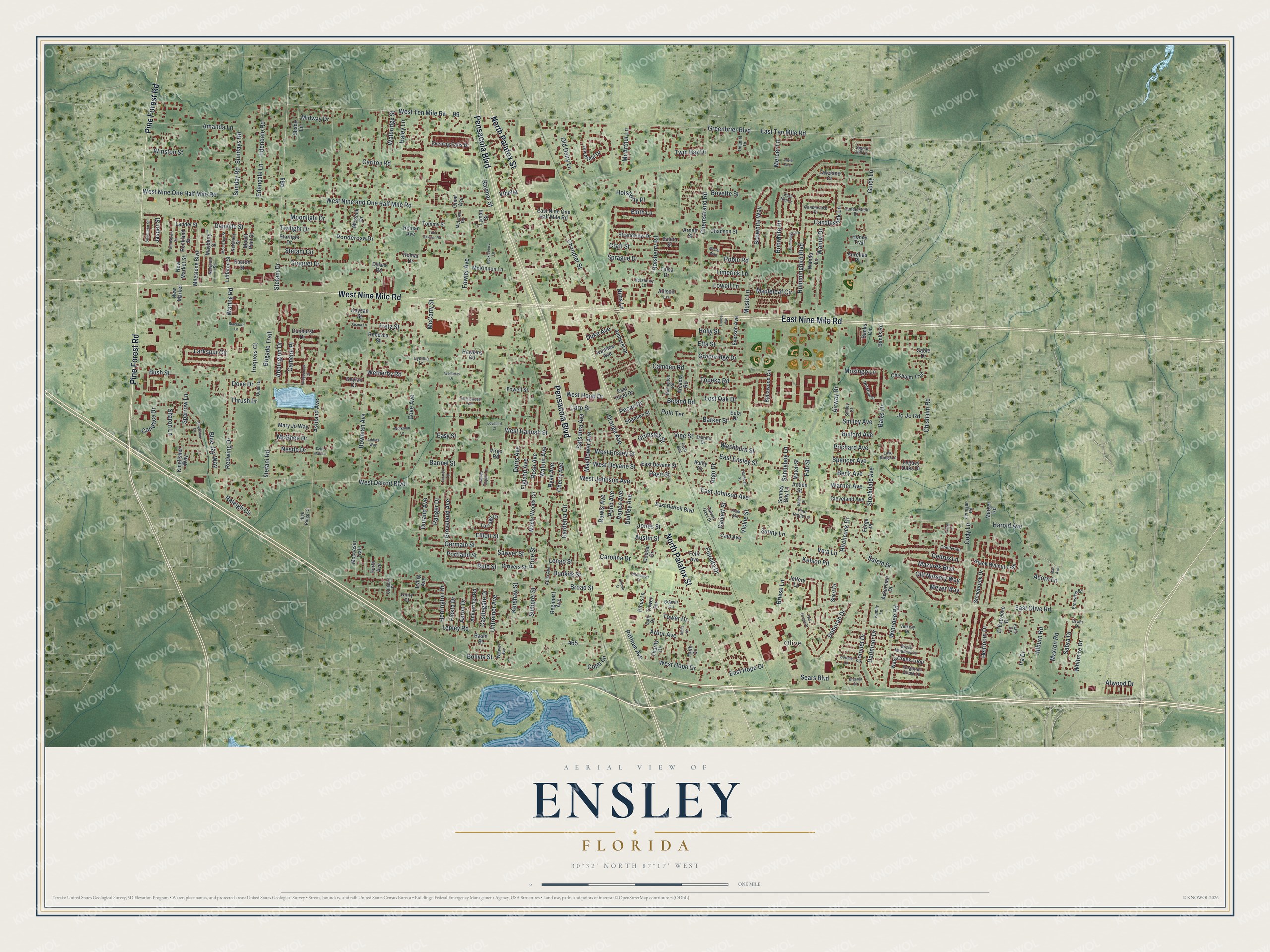
This beautifully detailed map of Ensley, Florida was created in 2026 using aerial imagery combined with modern topographical, census, street and landmark data. It's a modern aerial view of Ensley in Escambia County, Florida, that combines modern data with a vintage aesthetic. The roads feature printed names, and if you look closely you can find your exact house accurately shown in its correct location.
Explore an aerial view of Ensley, Florida
On this map you'll find Olive, East Nine Mile Road, Pensacola Boulevard, North Palafox Street, West Nine Mile Road, Pine Forest Road, East Johnson Avenue, Harold Avenue, West Hope Drive, Coronet Drive, Salem Drive, East Ten Mile Road, and more. Each red shape is a building, so zoom in on the preview and look for yours.
Every town has a first chapter, and Ensley is no exception. Ensley was once known as Fig City because of the figs it produced. The settlement was established about 1912 and was later renamed for Fred B. Ensley. That's from the Florida Place Names.
Ensley is a community in Escambia County. The Census Bureau counted 23,817 people here in 2020.
Take a closer look at the Ensley map
Names on this map
These names are printed on this map.
Places: Olive.
Streets and roads: East Nine Mile Road, Pensacola Boulevard, North Palafox Street, West Nine Mile Road, Pine Forest Road, East Johnson Avenue, Harold Avenue, West Hope Drive, Coronet Drive, Salem Drive, East Ten Mile Road, Pittman Avenue.
More street names, A to Z
Aaron Drive, Abbington Drive, Ackerman Drive, Acorn Lane, Action Street, Addies Way, Airway Drive, Allison Lane, Amanda Lane, Amberidge Road, Amherst Drive, Anzie Avenue, Arbor Avenue, Arcadia Road, Argo Drive, Arnett Street, Ashland Avenue, Atilla Avenue, Atwood Drive, Aurelias Place, Austin Street, Avellanas Drive, Banks Circle, Banks Road, Bardstown Street, Barker Street, Barmel Street, Basin Street, Bates Drive, Beaver Circle, Beck Avenue, Beland Road, Bellawood Circle, Bellington Road, Blackbird Lane, Black Walnut Trail, Blue Jay Way, Bobwhite Drive, Bobwhite Way, Bolivia Street, Bowman Avenue, Boyette Street, Braenar Circle, Briese Lane, Brigade Trail, Broad Street, Brook Meadow Lane, Bullard Avenue, Bush Street, Cain Avenue, Calahan Place, Calvert Oaks Drive, Calvert Street, Camden Road, Camelot Place, Candace Drive, Candlestick Drive, Candlestick Lane, Candlestick Place, Carlton Road, Carolina Drive, Caro Street, Castlegate Drive, Cedrus Lane, Chadson Street, Chandler Street, Charity Drive, Charleston Drive, Chavers Street, Chemstrand Road, Cherry Avenue, Chisholm Road, Chisholm Trail, Clark Avenue, Cleveland Avenue, Cobb Lane, Cody Lane, Conifer Road, Cooper Drive, Coronet Lane, Cove Avenue, Craft Street, Crissy Lane, Croquet Drive, Cynthia Lane, Danville Street, Dartmoor Drive, Deborah Drive, Doris Avenue, Dove Drive, Dovefield Drive, Dudley Avenue, Duke Avenue, Dunhurst Drive, Dunkirk Street, Durand Avenue, Dykes Road, Early Drive, East Detroit Boulevard, East Devane Street, East Ensley Street, East Hood Drive, East Hope Drive, East Nine One Half Mile Road, East Olive Road, Easton Street, Easy Street, Echo Circle, Edendale Lane, Edendale Road, Edith Lane, Elbert Street, El Estrecho Drive, Elliott Street, Ernestine Road, Erwin Drive, Etta Street, Eula Drive, Evening Falls Drive, Everson Avenue, Fab Street, Faith Drive, Family Lane, Faye Avenue, Feliz Avenue, Fiesta Drive, Figland Avenue, Florcita Drive, Forge Place, Forgotten Creek Lane, Fowler Avenue, Fretz Street, Gardenia Circle, Germain Street, Greenbrier Boulevard, Greenridge Drive, Grimsley Street, Groveland Avenue, Guidy Lane, Haley Lane, Handicare Street, Hawkins Road, Heirloom Drive, Herrington Drive, High Ridge Court, Hilburn Road, Hitchcock Drive, Holly Street, Holsberry Lane, Holsberry Place, Holsberry Road, Honey Trail, House Street, Huckleberry Lane, Hummingbird Boulevard, Hummingbird Drive, Ira Drive, Iroquois Court, Irving Avenue, Ivanhoe Avenue, James Taylor Lane, Jarmen Lane, Jasma Lane, Jasper Street, Jeffery Lane, Jernigan Road, Jo Jo Road, Jones Street, Kathy Circle, Katie Mae Lane, Kayzan Street, Kelson Road, Kershaw Street, Keylan Cv, Kingfisher Lane, Kingfisher Way, Lakeland Court, Lake Ridge Lane, Lander Street, Larkspur Circle, Legacy Oaks Drive, Lengo Street, Lepley Road, Limerick Lane, Littleton Street, Lost Oak Drive, Louise Avenue, Lovebird Court, Lowell Lane, Lyman Street, Mae Avenue, Mapleleaf Circle, Maple Woods Circle, Mary Jo Way, Match Street, Maxton Road, Mayberry Street, Mayflower Avenue, Mazurek Boulevard, McArthur Lane, McCarty Street, McGhee Drive, McKinnon Lane, McLuvin Road, Mercer Lane, Merger Road, Messick Drive, Meyer Way, Midway Drive, Milestone Boulevard, Moccasin Trail, Monet Way, Moonlight Drive, Mount Airy Street, Mount Pilot Street, Mozingo Lane, Music Lane, Nalo Creek Loop, Nestle Drive, Newberry Street, New Market, New Market Street, Newport Street, Nims Lane, Norstum Drive, Oak Forest Drive, Odaniel Drive, Old Dairy Lane, Old Nursery Way, Omar Avenue, Orange Avenue, Page Street, Pecan Drive, Perth Avenue, Pine Ridge Lane, Pinus Lane, Polo Terrace, Pond Avenue, Ponderosa Drive, Portland Street, Powell Street, Price Street, Prichard Avenue, Quail Drive, Quail Nest Lane, Raleigh Circle, Ranger Drive, Rawls Avenue, Raymar Street, Rebecca Street, Redwing Drive, Regiment Avenue, Ridgebrook Court, Robin Road, Rockland Street, Romar Avenue, Romar Drive, Rose Avenue, Rule Street, Ryan Avenue, Sable Drive, Sabra Drive, Sabrina Drive, Saleta Street, Satsuma Avenue, Sawyer Street, Sears Boulevard, Shady Lane, Sharmon Street, Sharon Lane, Short Drive, Signal Hill Lane, Smiley Avenue, Smiley Court, Sonney Boy Lane, Sonnyboy Lane, Sparrow Lane, Spencer Avenue, Sprague Drive, Starlight Drive, Stefani Circle, Stefani Drive, Stefani Road, Stella Drive, Stockdale Avenue, Stonebrook Drive, Strandview Drive, Sumpter Street, Sunday Road, Sundays Road, Sunny Lane, Sweetbriar Street, Thrush Drive, Tommy Street, Tom Sawyer Road, Topeka Road, Tortuga Drive, Tower Drive, Tower Terrace, Tulsa Drive, Tumbleweed Trail, Twilight Drive, Twin Bay Drive, Unity Court, Untreiner Avenue, Vance Avenue, Vera Lane, Vickery Drive, Vickie Street, Videlia, Vine Street, Virgo Road, Walbridge Street, Walnut Avenue, Wanda Drive, Wanda Lane, Waring Road, Warner Avenue, Washburn Street, Weaver Avenue, West Detroit Boulevard, West Devane Street, West Ensley Street, West Hannah Street, West Hood Drive, West Johnson Avenue, West Nine and One Half Mile Road, West Nine One Half Mile Road, West Ten Mile Road, Wetherby Road, Whitmire Drive, Winodee Road, Winston Street, Workman Lane.
See it on a wall
The Ensley map as a framed print. Swipe for more.


Created by KNOWOL in 2026. The buildings are small red shapes, the roads carry their printed names, and shaded relief shows the shape of the land. The title panel reads "AERIAL VIEW OF ENSLEY, FLORIDA" with 30°32' NORTH 87°17' WEST.
Hang it in the hallway, the office or the cabin, or give it to someone who left Ensley and still calls it home. Open the preview and look for a street you know. See sizes and frames for the Ensley map.