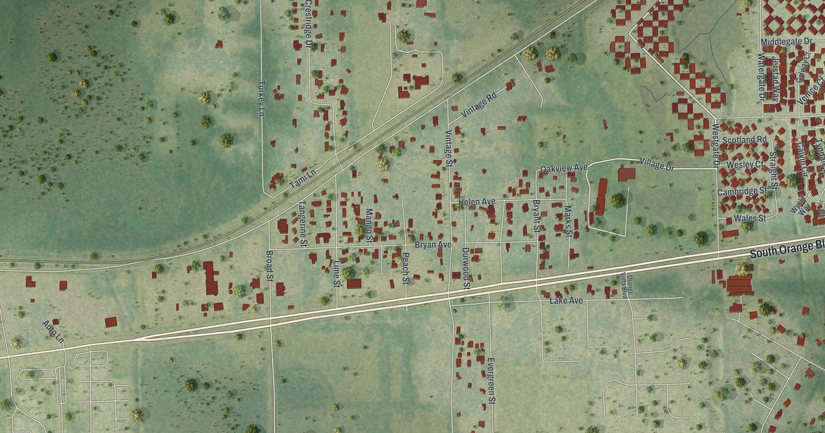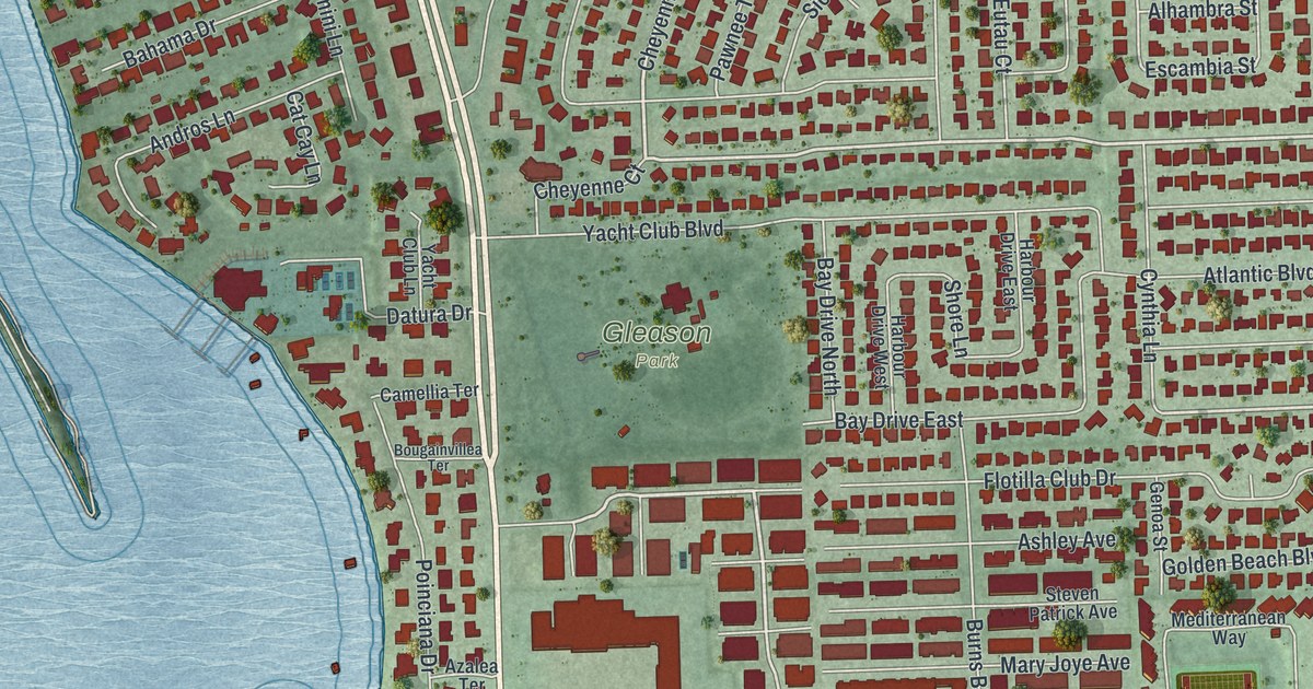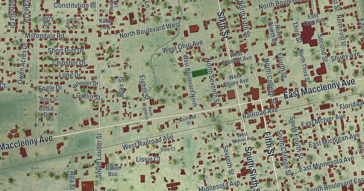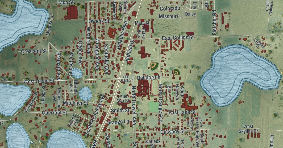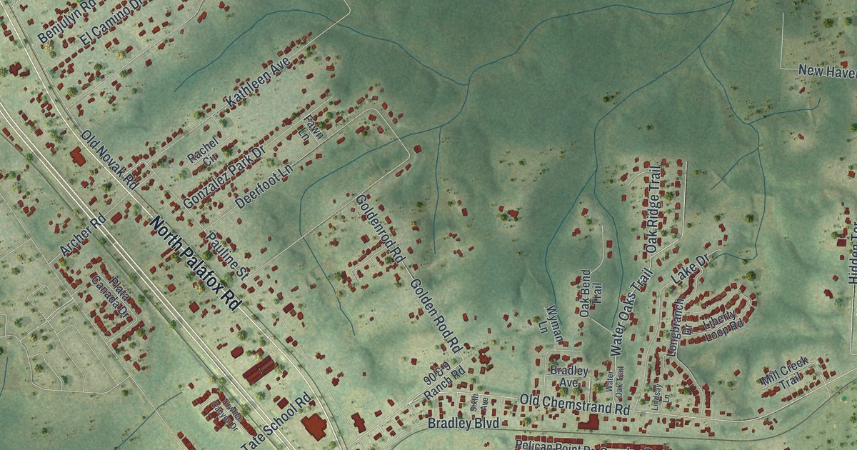
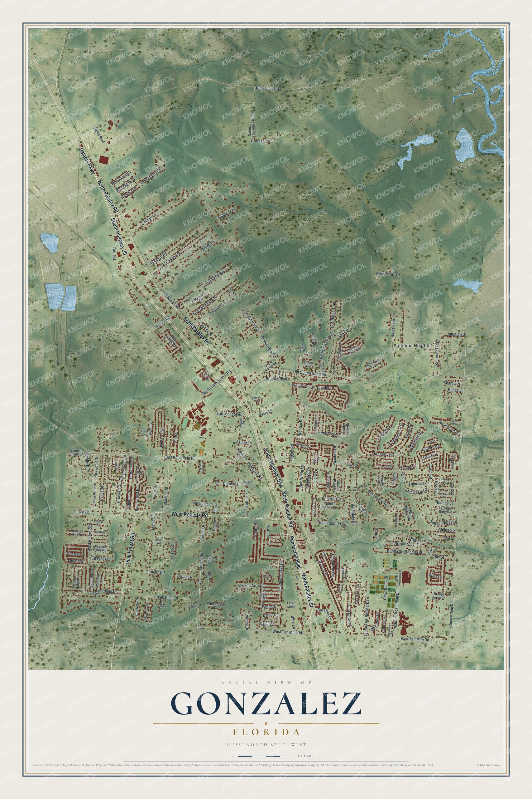
This beautifully detailed map of Gonzalez, Florida was created in 2026 using aerial imagery combined with modern topographical, census, street and landmark data. It's a modern aerial view of Gonzalez in Escambia County, Florida, that combines modern data with a vintage aesthetic. The roads feature printed names, and if you look closely you can find your exact house accurately shown in its correct location.
Explore an aerial view of Gonzalez, Florida
On this map you'll find Satsuma Heights, South Highway 29, Palafox Parkway, West Roberts Road, South Highway 95A, North Palafox Road, Pensacola Boulevard, Pine Forest Road, North Palafox Street, Chemstrand Road, Woodbury Circle, Water Oaks Trail, and more. Each red shape is a building, so zoom in on the preview and look for yours.
Every town has a first chapter, and Gonzalez is no exception. Gen. Andrew Jackson visited Don Manuel Gonzalez at least three times, in 1814, 1818 and 1821, at his estate, Gonzalia. The place was also known as Fifteen Mile House, for its distance from Pensacola. As the story goes, when Jackson was about to capture Pensacola in 1814, he asked Gonzalez to have his son guide the Americans in. Gonzalez refused rather than betray his king and his country. That's from the book Florida Place Names by Allen Morris.
Gonzalez is a community in Escambia County. The Census Bureau counted 14,586 people here in 2020.
Take a closer look at the Gonzalez map
Names on this map
These names are printed on this map.
Places: Satsuma Heights.
Streets and roads: South Highway 29, Palafox Parkway, West Roberts Road, North Palafox Road, Pensacola Boulevard, Pine Forest Road, North Palafox Street, Chemstrand Road, Woodbury Circle, Water Oaks Trail, Condor Drive, Becks Lake Road.
More street names, A to Z
90 & 9 Ranch Road, Adobe Trail, Alysheba Drive, Amy Avenue, Archer Road, Ashford Road, Ashton Brosnaham Drive, Ashton Brosnaham Road, Aspen Lane, Batson Lane, Benjulyn Road, Berrydale Road, Bet Mark Lane, Betmark Road, Big Oak Lane, Bliss Lane, Bob White Lane, Bold Ruler Drive, Bradley Avenue, Bradley Boulevard, Breezy Acres Road, Brentco Road, Broken Arrow Lane, Brookpark Road, Broome Circle, Cabot Street, Calvin Street, Camaree Place, Camellia Drive, Candy Lane, Carla Drive, Childers Street, Chippewa Way, Chris Black Drive, Colt Road, Colwyn Drive, Conference Road, Cool Creek Road, Copper Ridge Circle, Copper Ridge Drive, Countri Lane, Country Place Circle, Crestfield Circle, Cricket Circle, Cricket Ridge Drive, Crockett Drive, Crowl Lane, Deerfoot Lane, Deer Ridge Road, Derry Drive, Devlin Way, Dewberry Lane, Dolphin Drive, Dolphin Road, Dolphin Street, Donegal Drive, Durney Drive, Dye Street, Eagle Drive, Eagle Street, Eagle Terrace, East Kingsfield Road, East Roberts Road, East Ten Mile Road, El Camino Drive, Elder Lane, Equestrian Way, Fawn Lane, Fiddlers Circle, Filly Court, Filly Road, Foxford Street, Frederick Street, Garman Dairy Road, Garman Road, Gateway Lane, Glenmore Drive, Golden Rod Road, Goldenrod Road, Gonzalez Park Drive, Graham Road, Greenberry Drive, Green Hills Road, Hawk Lane, Herschel Street, Hidden Terrace, High Springs Road, Jeter Road, Joel Street, Johnstone Drive, Junction Drive, Kathleen Avenue, Kingslake Drive, Kings Road, Kingstree Drive, Kings Way Drive, Kinsale Drive, Kirkwood Drive, Lake Drive, La Lar Lane, Laura Street, Leigh Loop, Liberty Loop Road, Libra Lane, Lindsay Lane, Longbranch Drive, Lou Street, Majestic Drive, Millbrook Drive, Mill Creek Trail, Millet Circle, Monica Lane, New Haven Drive, Nolan Falkner Court, North Roberts Circle, North Tate School Road, Nowlin Street, Oak Bend Trail, Oak Ridge Trail, Old Chemstrand Road, Old Course Road, Old Novak Road, Orby Street, Packwood Drive, Pauline Street, Peace Terrace, Peaches Lane, Pelican Point Drive, Pierce Road, Pierpoint Avenue, Pinedale Lane, Pinto Circle, Plata Canada Drive, Pompano Road, Pompano Street, Portobella Place, Rachel Circle, Randall Lane, Ray Street, Redford Drive, Reese Lane, Rhea Lane, Rhonda Street, Riddle Road, River Birch Drive, Roberts Circle, Rodney Street, Ronda Street, Rosedown Drive, Rusty Lane, Ryale Road, Samantha Drive, Senegal Drive, Shady Creek Drive, Sharay Drive, Shear Street, Silas Circle, Sixth Avenue, Southern Oaks Drive, Squire Drive, Staff Drive, Stallion Road, Stefani Drive, Stefani Road, Stone Boulevard, Summer Shade Lane, Sunnydale Lane, Sutton Place Drive, Tall Pines Lane, Tara Dawn Circle, Tara Dawn Drive, Tara Dawn Lane, Tate Road, Tate School Road, Teleran Street, Templehill Drive, Templemore Drive, Timber Ridge Drive, Timber Ridge Road, Towhee Canyon Drive, Turnberry Road, Tuttle Lane, Tuttle Road, Twisted Oak Drive, Urban Drive, Valkyry Way, Vineyard Lane, Ware Road, Water Oak Trail, Western Pines Road, West Ten Mile Road, Whipporwill Drive, Wilderness Lane, Windmill Circle, Winners Circle, Wiregrass Place, Woodbury Drive, Woodbury Place, Wyman Lane, Zane Grey Lane, Ziggler Road.
See it on a wall
The Gonzalez map as a framed print. Swipe for more.


Created by KNOWOL in 2026. The buildings are small red shapes, the roads carry their printed names, and shaded relief shows the shape of the land. The title panel reads "AERIAL VIEW OF GONZALEZ, FLORIDA" with 30°35' NORTH 87°17' WEST.
Hang it in the hallway, the office or the cabin, or give it to someone who left Gonzalez and still calls it home. Open the preview and look for a street you know. See sizes and frames for the Gonzalez map.