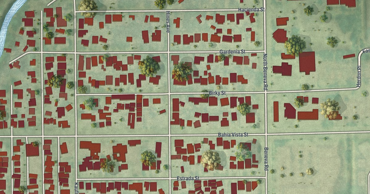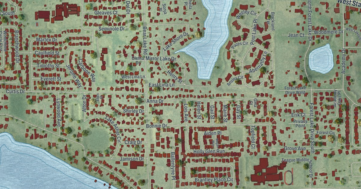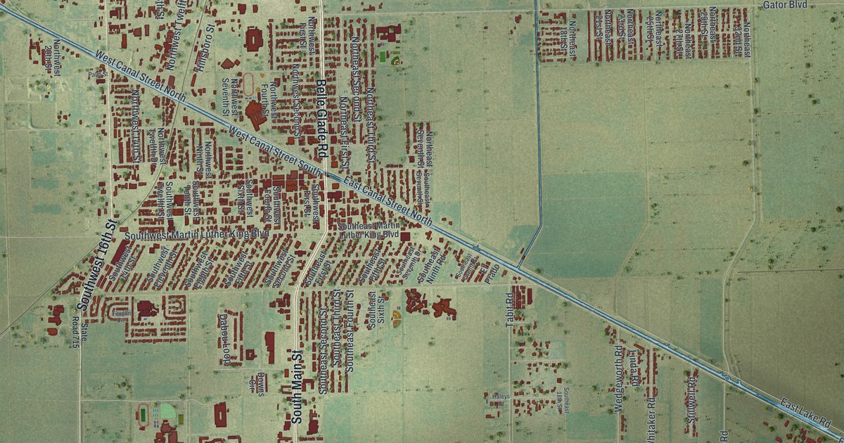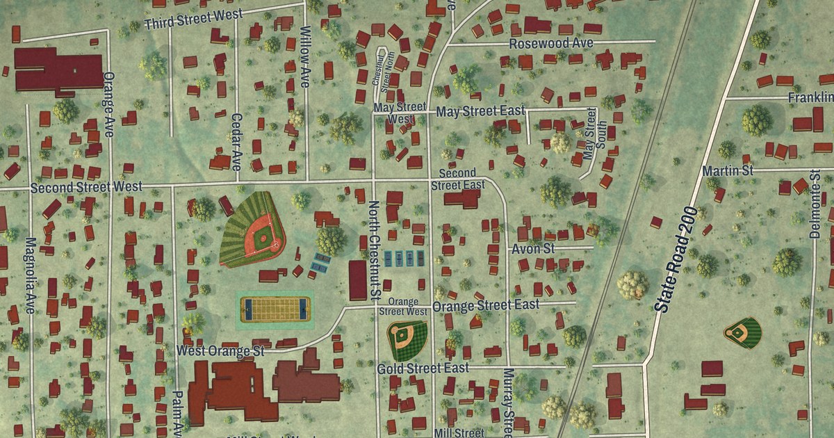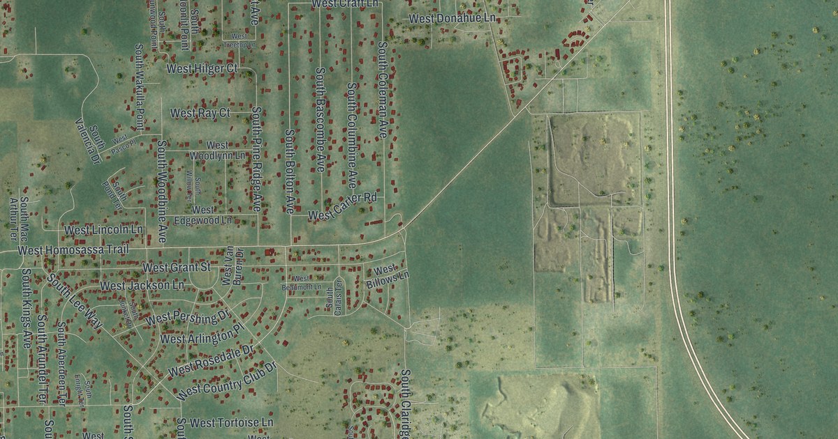
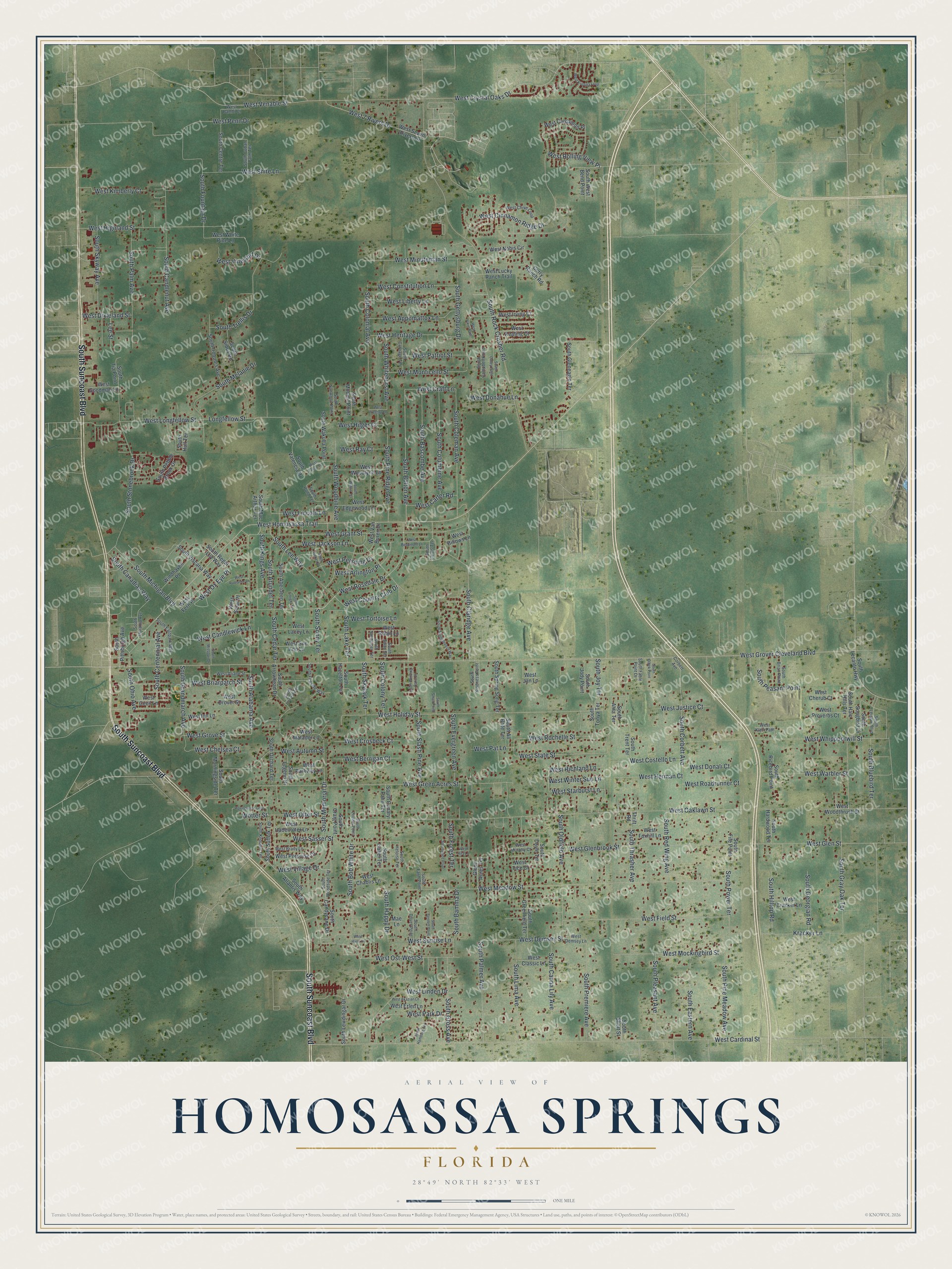
This beautifully detailed map of Homosassa Springs, Florida was created in 2026 using aerial imagery combined with modern topographical, census, street and landmark data. It's a modern aerial view of Homosassa Springs in Citrus County, Florida, that combines modern data with a vintage aesthetic. The roads feature printed names, and if you look closely you can find your exact house accurately shown in its correct location.
Explore an aerial view of Homosassa Springs, Florida
On this map you'll find South Suncoast Boulevard, West Crystal Oaks Drive, West Ox Eye Place, West Grover Cleveland Boulevard, West Rosedale Drive, West Richland Lane, West Venable Street, South Alabama Avenue, South Bolton Avenue, West Country Club Drive, West Homosassa Trail, West Grove Street, and more. Each red shape is a building, so zoom in on the preview and look for yours.
Here is a piece of Homosassa Springs history. In 1924, at the height of the Florida land boom, the Florida West Coast Development Company bought several thousand acres in what is now Homosassa Springs to build a City Beautiful. Known locally as New Homosassa, it was laid out with streets 80 to 100 feet wide and nine-foot sidewalks, with plans for parks, a golf course and 700 home sites. The boom went bust in 1926, and only two commercial buildings and a few Mediterranean Revival homes were built, but a stretch of the wide original sidewalk survived. That's from the Florida Division of Historical Resources.
Homosassa Springs is a community in Citrus County. The Census Bureau counted 14,283 people here in 2020.
Take a closer look at the Homosassa Springs map
Names on this map
These names are printed on this map.
Streets and roads: South Suncoast Boulevard, West Crystal Oaks Drive, West Ox Eye Place, West Grover Cleveland Boulevard, West Rosedale Drive, West Richland Lane, West Venable Street, South Alabama Avenue, South Bolton Avenue, West Country Club Drive, West Homosassa Trail, West Grove Street.
More street names, A to Z
Corbett Avenue, Curry Ranch Road, Glenn Acres Terrace, Kracker Lane, Lee Street, Longfellow Street, Mae Lane, South Aberdeen Terrace, South Alice Point, South Alita Terrace, South All Brite Terrace, South Arrowhead Drive, South Arundel Terrace, South Atlantis Way, South Bamma Drive, South Bascombe Avenue, South Bennett Point, South Bluebird Terrace, South Bob White Drive, South Brian Point, South Calais Terrace, South Campbell Point, South Canadian Way, South Canary Palm Terrace, South Candlenut Avenue, South Candycane Drive, South Canna Lily Avenue, South Carriage Terrace, South Casey Point, South Cedar Terrace, South Centennial Avenue, South Centre Terrace, South Claridge Avenue, South Coleman Avenue, South Colonial Avenue, South Colony Terrace, South Columbine Avenue, South Corbett Avenue, South Craig Point, South Cuban Palm Terrace, South Dover Point, South Doyle Terrace, South Eastern Avenue, South Eastpark Way, South Enright Terrace, South Evergreen Avenue, South Fable Point Drive, South Farm Point, South Fife Point, South Fireside Way, South Forest Terrace, South Fountain Drive, South Georgian Road, South Gettysburg Drive, South Gleneagle Terrace, South Grandmarch Avenue, South Gray Oak Terrace, South Greenfield Terrace, South Gross Avenue, South Halo Hills Terrace, South Hamburg Terrace, South Happy Drive, South Hardwood Terrace, South Hazelton Terrace, South Heloise Terrace, South Hilltop Road, South Hull Terrace, South Indiania Avenue, South Iroquois Avenue, South Isabel Terrace, South Jody Point, South Joy Terrace, South Junket Drive, South Kindness Point, South Kings Avenue, South Knobhill Terrace, South Lake Terrace, South Lecanto Highway, South Lee Way, South Legend Drive, South Leisure Boulevard, South Lewdingar Drive, South Lima Avenue, South Locust Terrace, South Louise Point, South Mac Arthur Terrace, South Melanie Drive, South Memorial Drive, South Michigan Boulevard, South Missouri Drive, South Moonlit Point, South Morningside Terrace, South Ohio Avenue, South Olbek Point, South Oldfield Avenue, South Orchard Terrace, South Palm Avenue, South Palmer Avenue, South Peasant Point, South Pebble Brook Drive, South Pine Meadow Avenue, South Pine Ridge Avenue, South Pittsburgh Avenue, South Pleasant Avenue, South Pond Terrace, South Power Terrace, South Premiere Avenue, South Red Wing Avenue, South Regal Lily Way, South Ricebird Point, South Rock Crusher Road, South Sandpiper Terrace, South Short Street, South Sioux Road, South Skylark Terrace, South Skyway Avenue, South Slash Pine Avenue, South Small Point, South Songbird Drive, South Sonny Terrace, South Springbreeze Way, South Spring Song Terrace, South Stonebrook Drive, South Suffolk Terrace, South Sunwood Point, South Swan Terrace, South Thrasher Avenue, South Tia Point, South Tonya Terrace, South Trellis Drive, South Trent Terrace, South Valencia Drive, South Viscaria Way, South Wakulla Point, South West Bend Point, South Whitehurst Avenue, South Willow Terrace, South Winding Oaks Drive, South Woodbine Avenue, South Woodside Terrace, Thrift Road, West 7 Rivers Drive, West Akazian Lane, West Appomattox Lane, West Ariane Street, West Arlington Place, West Autumn Street, West Bambi Court, West Beaumont Lane, West Berrigan Court, West Billows Lane, West Brady Lane, West Briarpatch Street, West Candlewick Lane, West Cardamon Place, West Cardinal Street, West Carter Road, West Cecil Lane, West Chablis Lane, West Chelsea Court, West Cherub Court, West Chive Loop, West Cinnamon Ridge Drive, West Classic Lane, West Constitution Lane, West Costello Lane, West Cracker Lane, West Craft Lane, West Crosbeck Court, West Demsey Lane, West Demsey Street, West Dixieland Street, West Donahue Lane, West Donali Court, West Drover Street, West Edgewood Lane, West Erlen Lane, West Fern Place, West Field Street, West Foxhill Lane, West Glenbrook Street, West Glen Street, West Goodman Lane, West Grant Street, West Green Acres Street, West Hadenotter Lane, West Hans Court, West Heritage Drive, West Herman Court, West Highland Street, West Hilger Court, West Holiday Street, West Inn Lane, West Irving Court, West Jackson Lane, West Jan Lane, West Justice Court, West Keating Court, West Kimberly Court, West Klett Path, West Kristina Loop, West Lacey Lane, West Liberty Lane, West Lincoln Lane, West Linden Drive, West Longfellow Street, West Lucky Ranch Trail, West Matador Lane, West Meadow Street, West Minuteman Street, West Mockingbird Street, West Monticello Street, West Murphy Court, West Nobis Circle, West Oaklawn Street, West Ost-West Street, West Otter Street, West Park Drive, West Parkway Lane, West Pasco Place, West Pat Lane, West Patriot Street, West Penn Drive, West Pershing Drive, West Porpoise Drive, West Proverbs Court, West Radiance Lane, West Ray Court, West Rita Lane, West Roadrunner Court, West Robin Lane, West Rochelle Street, West Rolling View Place, West Sasser Street, West Seven Rivers Drive, West Shire Lane, West Solar Place, West Starburst Lane, West State Street, West Sue Ann Lane, West Sunrise Lane, West Tice Court, West Tortoise Lane, West Treetop Lane, West Van Buren Drive, West Vikre Path, West Village Drive, West Vineyard Drive, West Warbler Street, West Whippoorwill Street, West White Pine Lane, West Winter Sun Lane, West Woodlynn Lane, West Woodthrush Street, Windhaven Place, Wotter Street, Wpenderson Loop.
See it on a wall
The Homosassa Springs map as a framed print. Swipe for more.


Created by KNOWOL in 2026. The buildings are small red shapes, the roads carry their printed names, and shaded relief shows the shape of the land. The title panel reads "AERIAL VIEW OF HOMOSASSA SPRINGS, FLORIDA" with 28°49' NORTH 82°33' WEST.
It suits a den, a classroom or a front hall, and it makes a gift for anyone with Homosassa Springs roots. Open the preview and find the block you know. See sizes and frames for the Homosassa Springs map.