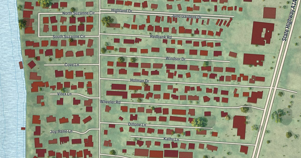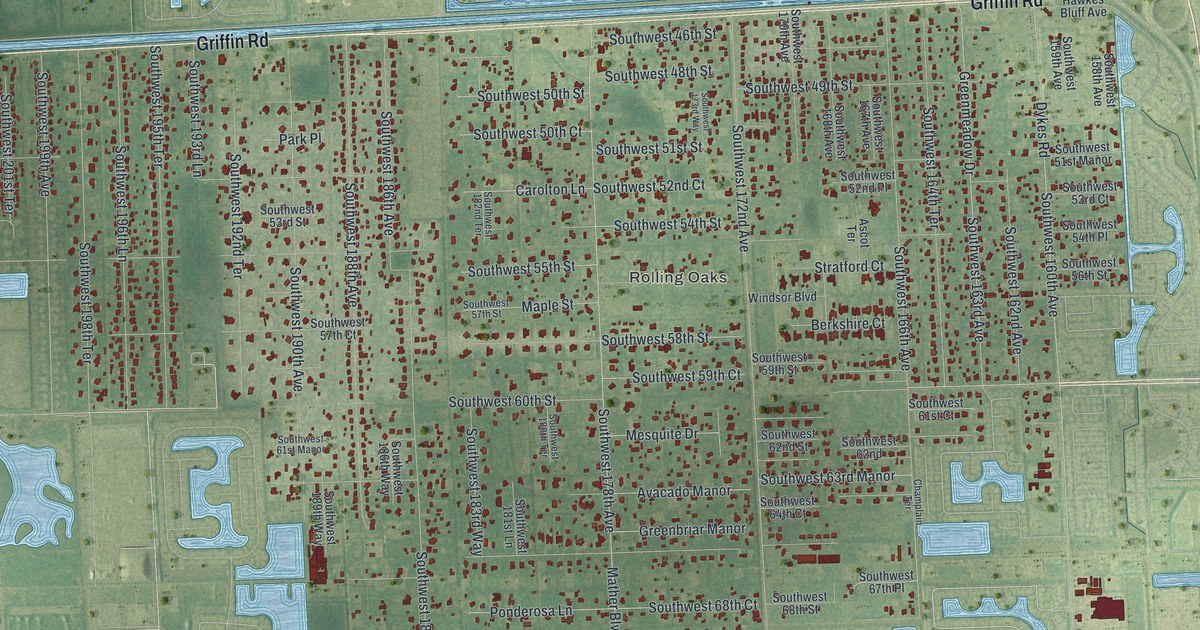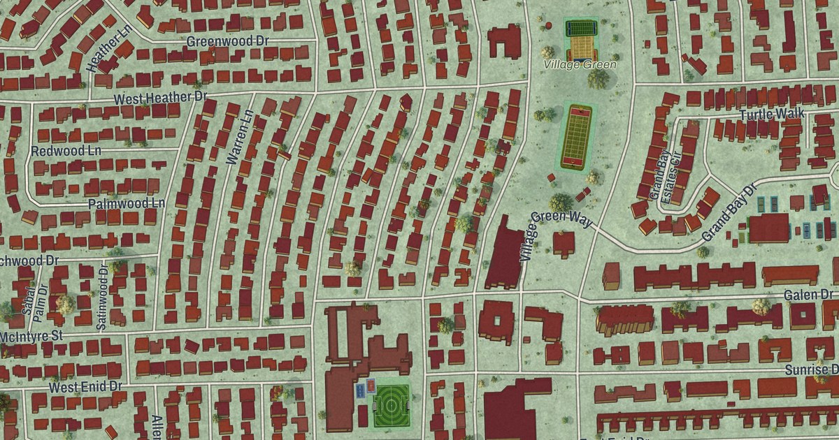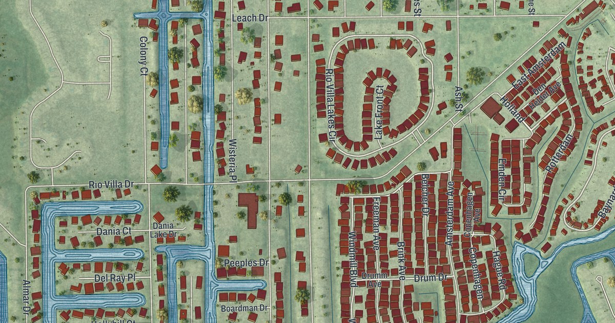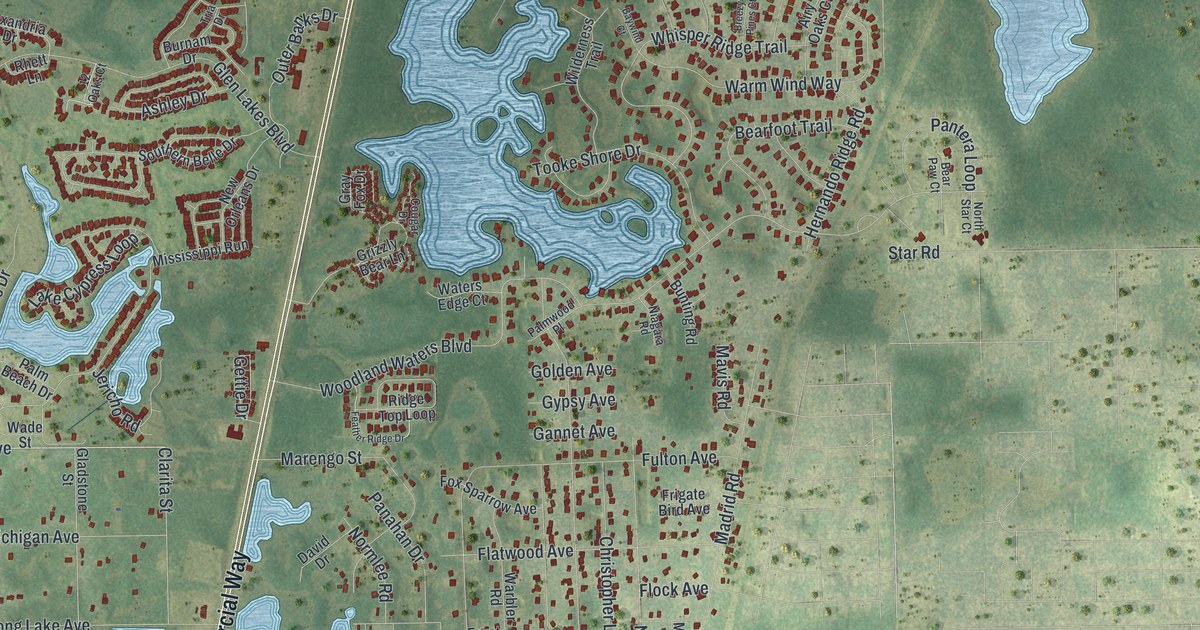
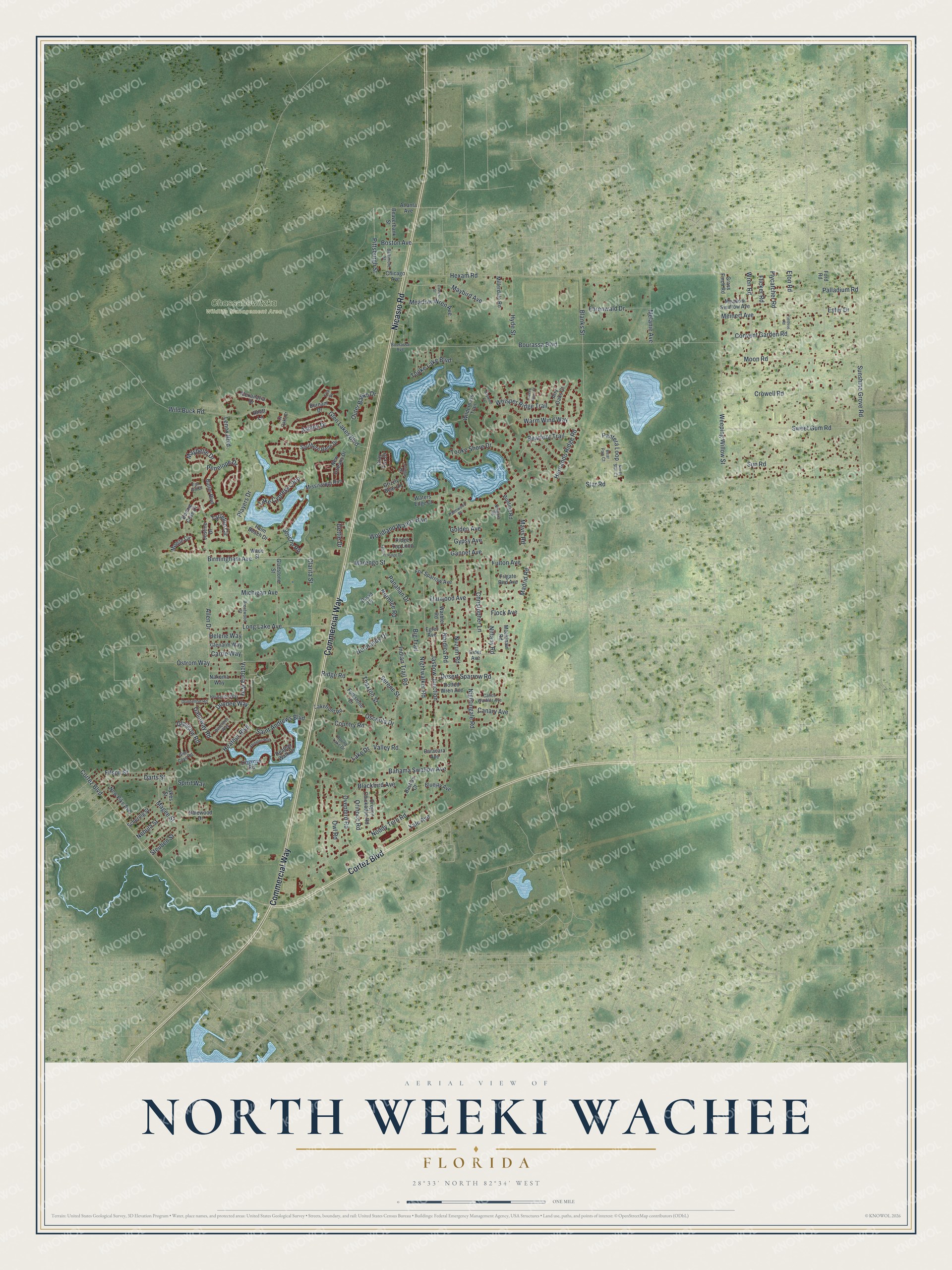
This beautifully detailed map of North Weeki Wachee, Florida was created in 2026 using aerial imagery combined with modern topographical, census, street and landmark data. It's a modern aerial view of North Weeki Wachee in Hernando County, Florida, that combines modern data with a vintage aesthetic. The roads feature printed names, and if you look closely you can find your exact house accurately shown in its correct location.
Explore an aerial view of North Weeki Wachee, Florida
On this map you'll find Chassahowitzka Wildlife Management Area, Commercial Way, Cortez Boulevard, Nicasio Road, Birmingham Avenue, Victoria Way, Pittsburgh Street, Hexam Road, Bourassa Boulevard, Woodland Waters Boulevard, Madrid Road, Star Road, and more. Each red shape is a building, so zoom in on the preview and look for yours.
Here is a piece of North Weeki Wachee history. The name Weeki Wachee comes from an Indian name meaning little spring. Weeki Wachee Springs, the source of the Weeki Wachee River, had a flow of 100,000 gallons a minute, the fifth largest in Florida, and boiled so hard that a boat was difficult to anchor there. Author Rex Beach gathered color for his novel The Mating Call in and around the springs. That's from the Federal Writers Project.
North Weeki Wachee is a community in Hernando County. The Census Bureau counted 9,131 people here in 2020.
Take a closer look at the North Weeki Wachee map
Names on this map
These names are printed on this map.
Places: Chassahowitzka Wildlife Management Area.
Streets and roads: Commercial Way, Cortez Boulevard, Nicasio Road, Birmingham Avenue, Victoria Way, Pittsburgh Street, Hexam Road, Bourassa Boulevard, Woodland Waters Boulevard, Madrid Road, Star Road, Ostrom Way.
More street names, A to Z
12 Oaks Court, Abington Way, Airy Oaks Court, Alexandria Drive, Allen Drive, Ashley Drive, Atlanta Avenue, Bahama Swallow Avenue, Baltimore Street, Bastian Court, Baywind Court, Bearfoot Trail, Bear Paw Court, Beaverbank Street, Big Trail, Blackbird Avenue, Blanks Street, Bluejay Avenue, Bonnie Cove Drive, Boston Avenue, Bourassa Avenue, Breezy Pines Court, Brentwood Street, Bunting Road, Burnam Drive, Butler Boulevard, Calico Warbler Avenue, Canary Avenue, Caracara Avenue, Carnes Street, Carrie Way, Chicago Avenue, Christopher Lane, Clarita Street, Convent Garden Road, Cougar Drive, Country Road, Crowell Road, Dalewood Drive, Darts Street, David Drive, Desert Sparrow Road, Dirlenton Way, Dotted Wren Avenue, Dundee Way, Dunnellon Road, Egret Avenue, Ehrenwald Drive, Eider Avenue, Ester Drive, Eton Road, Fair Hill Drive, Feather Ridge Drive, Fieldvue Road, Filson Street, Flatwood Avenue, Flicker Road, Flock Avenue, Flycatcher Road, Folkstone Drive, Ford Road, Fox Sparrow Avenue, Frigate Bird Avenue, Fulton Avenue, Galloway Road, Gannet Avenue, Gettie Drive, Gladstone Street, Glasgow Road, Glenarm Way, Glen Cove Road, Glen Lakes Boulevard, Golden Avenue, Grass Finch Road, Gray Fox Drive, Grizzly Bear Lane, Gypsy Avenue, Heather Boulevard, Heather Walk Drive, Helene Way, Hernando Ridge Road, Hernando Way, Hyde Street, Indian Trail Road, Jasbow Junction, Jericho Road, Justine Drive, Lake Cypress Loop, Lake Drive, Lakefront Road, Lenox Boulevard, Lingrove Road, Long Lake Avenue, Lykes Street, Mackinaw Road, Magee Street, Marengo Street, Mavis Road, Maybelle Drive, Maybird Avenue, Meadow Swallow Avenue, Meadow Wren Avenue, Meinert Avenue, Melanie Avenue, Michigan Avenue, Millerdale Road, Mississippi Run, Mobile Circle, Moon Road, Nakoma Way, Nebula Street, New Orleans Drive, New Pike Avenue, Niagara Road, Nightingale Road, Nightwalker Road, Nittany Road, Noddy Tern Road, Nordica Road, Normandy Drive, Normlee Road, North Star Court, Nuzum Road, Oregon Chickadee Road, Orinoco Road, Osceola Drive, Outer Banks Drive, Ovenbird Road, Owl Road, Palladium Road, Palm Beach Drive, Palmwood Place, Panahan Drive, Pantera Loop, Penelope Drive, Players Drive, Rhett Lane, Ridge Road, Ridge Top Loop, Round Lake Drive, Saint Andrews Boulevard, Schering Street, Serene Street, Southern Belle Drive, Spirit Way, Steuben Street, Sun Road, Sunshine Grove Road, Sweet Gum Road, Tarleton Circle, Thaxton Street, Tooke Lake Boulevard, Tooke Shore Drive, Tria Drive, Valley Road, Wade Street, Warbler Road, Warm Wind Way, Waters Edge Court, Weeping Willow Street, Whisper Ridge Trail, Wild Buck Road, Wilderness Trail, Wren Road, Yale Avenue.
See it on a wall
The North Weeki Wachee map as a framed print. Swipe for more.


Created by KNOWOL in 2026. The buildings are small red shapes, the roads carry their printed names, and shaded relief shows the shape of the land. The title panel reads "AERIAL VIEW OF NORTH WEEKI WACHEE, FLORIDA" with 28°33' NORTH 82°34' WEST.
It suits a den, a classroom or a front hall, and it makes a gift for anyone with North Weeki Wachee roots. Open the preview and find the block you know. See sizes and frames for the North Weeki Wachee map.