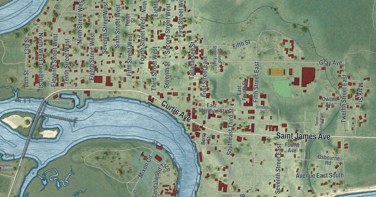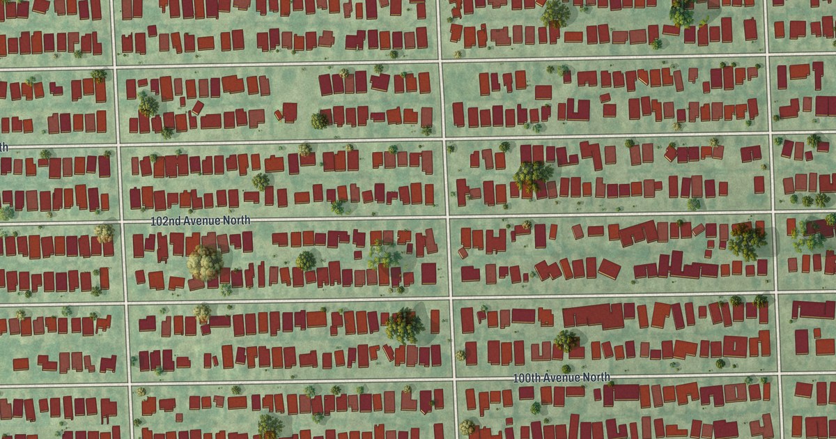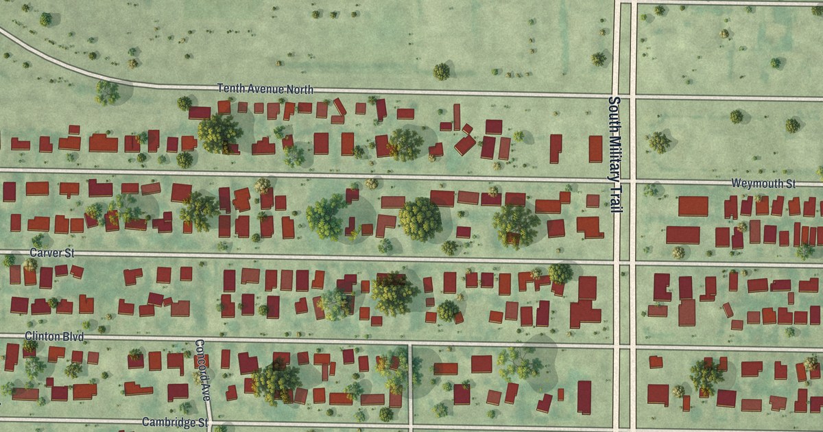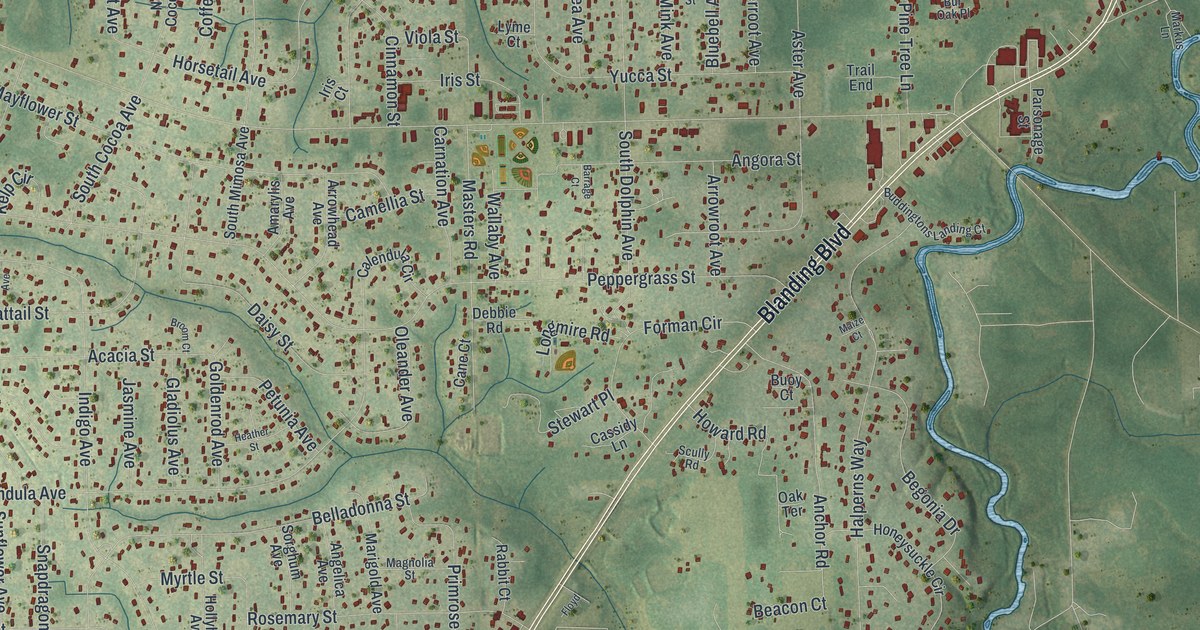
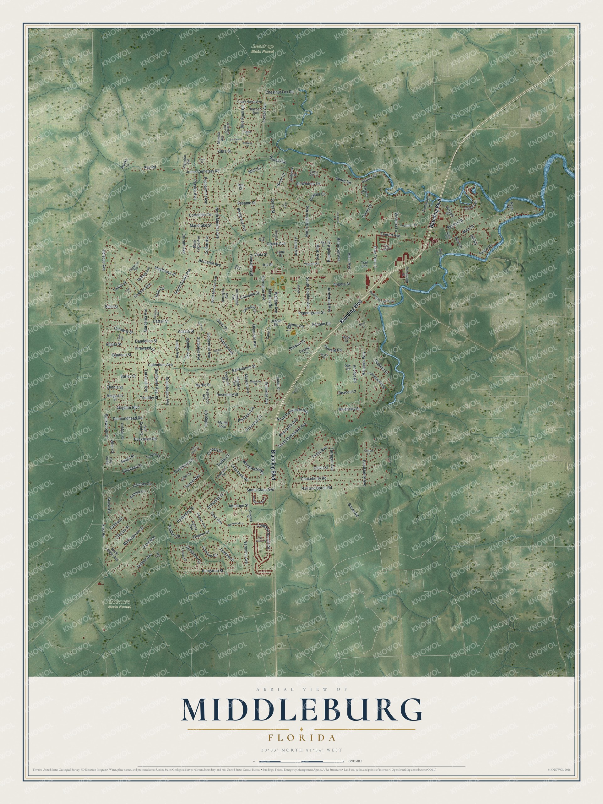
This beautifully detailed map of Middleburg, Florida was created in 2026 using aerial imagery combined with modern topographical, census, street and landmark data. It’s a one-of-a-kind view of Middleburg that combines accurate data with a vintage aesthetic. The map shows every building in its true location, many of the roads carry their names, and the shaded topographic relief shows the shape of the land.
Explore an aerial view of Middleburg, Florida
On the map you’ll find Belmore State Forest and Jennings State Forest, along with Blanding Boulevard, Santa Clara Avenue, Deer Avenue, Hall and Boree Road, Juniper Avenue, Beacon Court, Primrose Circle, Wintergreen Street, North Mimosa Avenue, Currant Avenue, and more. If you look closely you can even find your house accurately drawn in its correct location. Zoom in on the preview to look for yours.
Did You Know?
Middleburg grew up in the early 1800s as a transportation center linking the St. Johns River with the interior. First settled in the 1820s as Clark's Ferry, a crossing on Black Creek, it took the name Middleburg in the 1840s and became the first Clay County seat in 1858. The 4th Massachusetts Cavalry burned much of the town in 1864, but prosperity returned in the 1870s as river traffic and the citrus industry grew. That's from the Florida Division of Historical Resources.
Take a closer look at the Middleburg map
Names on this map
These names are printed on this map.
Places: Belmore State Forest and Jennings State Forest.
Streets and roads: Blanding Boulevard, Santa Clara Avenue, Deer Avenue, Hall and Boree Road, Juniper Avenue, Beacon Court, Primrose Circle, Wintergreen Street, North Mimosa Avenue, Currant Avenue, Section Street, Peppergrass Street.
More street names, A to Z
Acacia Street, Alfalfa Street, Alligator Boulevard, Alpaca Avenue, Amarylis Avenue, Anchor Road, Angelica Avenue, Angora Street, Antelope Street, Armadillo Street, Arrowhead Avenue, Arrowroot Avenue, Aster Avenue, Azalea Avenue, Backwoods Drive, Bamboo Street, Banks Road, Barkwood Lane, Barley Street, Barrage Court, Basil Street, Beaver Avenue, Begonia Drive, Belladonna Street, Bison Court, Bitterroot Avenue, Blackberry Avenue, Bluebell Avenue, Blueberry Bay Court, Blueberry Street, Bluegrass Avenue, Blue Knoll Road, Boree Road, Broom Court, Buckhead Road, Buddingtons Landing Court, Bull Creek Road, Bullrush Court, Buoy Court, Bur Oak Place, Butler Avenue, Calendula Avenue, Calendula Circle, Camel Circle, Camellia Street, Campbell Street, Cane Court, Caraway Street, Carnation Avenue, Cassidy Lane, Cattail Street, Chestnut Fox Road, Chickpea Street, Chicory Circle, Chicory Street, Chipmunk Road, Chokeberry Road, Cinnamon Street, Clover Avenue, Clove Street, Coffee Avenue, Compound Lane, Coriander Terrace, Cornell Road, Cosmos Avenue, Cotton Gin Court, Cotton Lane, Cougar Court, Cranberry Circle, Crazy Horse Avenue, Daffodil Avenue, Daisy Street, Dale Court, Dandelion Street, Debbie Road, Diamondhead Road, Dogwood Avenue, Dolphin Circle, East Fennel Court, East Road, Eli Whitney Drive, Enchanted Lane, Everett Avenue, Fennel Avenue, Fireweed Street, Fisher Circle, Floyd, Forest Drive, Forman Circle, Foxtail Avenue, Gardenia Avenue, Geranium Avenue, Ginhouse Drive, Gladiolus Avenue, Gobbler Road, Goldenrod Avenue, Gopher Circle, Gopher Street, Guava Court, Halperns Way, Harvard Street, Heather Street, Hedgehog Street, Hemp Court, Hibiscus Avenue, Hidden Oaks Drive, Hill Road, Hollyhock Avenue, Honeysuckle Circle, Horsetail Avenue, Howard Road, Indigo Avenue, Indigo Circle, Iris Court, Iris Street, Ivy Court, Jasmine Avenue, Javeline Circle, Javeline Street, Joan Avenue, Johns Cemetery Road, Kalmia Circle, Kalmia Street, Kangaroo Circle, Kangaroo Street, Kay Road, Kelp Circle, Larkspur Avenue, Laurel Drive, Laurel Street, Leopard Circle, Licorice Court, Lilac Court, Longleaf Ranch Circle, Longmire Road, Lyme Court, Magnolia Street, Main Street, Maize Court, Maluke Lane, Mandrake Street, Marguerite Street, Marigold Avenue, Markus Lane, Masters Road, Mayflower Street, Mimosa Avenue, Mink Avenue, Mint Circle, Myrtle Loop, Myrtle Street, North Cocoa Avenue, North Dolphin Avenue, North Juniper Avenue, North Periwinkle Avenue, North Street, Oak Terrace, Oleander Avenue, Orchid Avenue, Panda Avenue, Parsley Avenue, Parsonage Street, Peppermint Avenue, Petunia Avenue, Pika Street, Pine Tree Lane, Plankton Avenue, Plantain Avenue, Poinsettia Avenue, Primrose Avenue, Rabbit Court, Racoon Run, Redwing Court, Rose Court, Rosemary Street, Rye Court, Sable Avenue, Scenic Drive, Scully Road, Sedge Street, Sesame Street, Smallwood Place, Snapdragon Avenue, Sorghum Avenue, Sorrel Street, South Cocoa Avenue, South Dolphin Avenue, South Mimosa Avenue, South Periwinkle Avenue, Stewart Place, Sunflower Avenue, Tacoma Drive, Tall Pines Lane, Tansy Avenue, Tarragon Avenue, Timothy Street, Trail End, Truffle Court, Tumbleweed Road, Veronica Avenue, Viola Street, Wallaby Avenue, Wharf Street, Whin Court, Wisteria Lane, Witch Hazel Road, Yucca Street, Yvonne Terrace, Zibra Street, Zunnia Street.
See it on a wall
The Middleburg map as a framed print. Swipe for more.


This beautifully detailed map of Middleburg makes an attractive addition to your office, library, or den, and it can even be used to teach children the geography and history of the area. It also makes a great gift for anyone with Middleburg roots. When you’re done exploring, click here to get your copy of the Middleburg map.