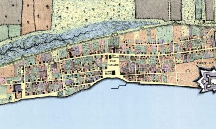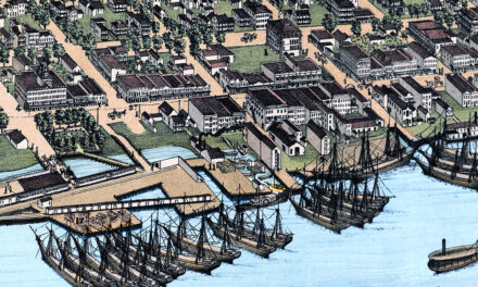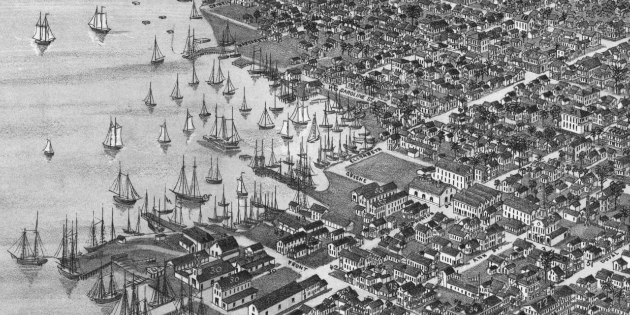
This historic map of Key West, Florida was created in 1884 by J.J. Stoner, a prominent 19th century map maker. The map shows a bird’s eye view of the city as it used to be, including street names and old landmarks.
Landmarks on the map include Fort Taylor, U.S. Naval Depot, Marine Hospital, Masonic Hall, Odd Fellows Hall, International Telegraph Office, McKillip Boots and Shoes, Greaux Watches, Stillman’s Saloon, Sweeny Mineral Water & Beer, Greg’s Cigar Factory, Wellacott’s Ice Cream Parlor, and more.
This historic map of Key West was restored by KNOWOL. Reproductions of the restored map are available here.
Bird’s Eye View of Key West, Florida in 1884
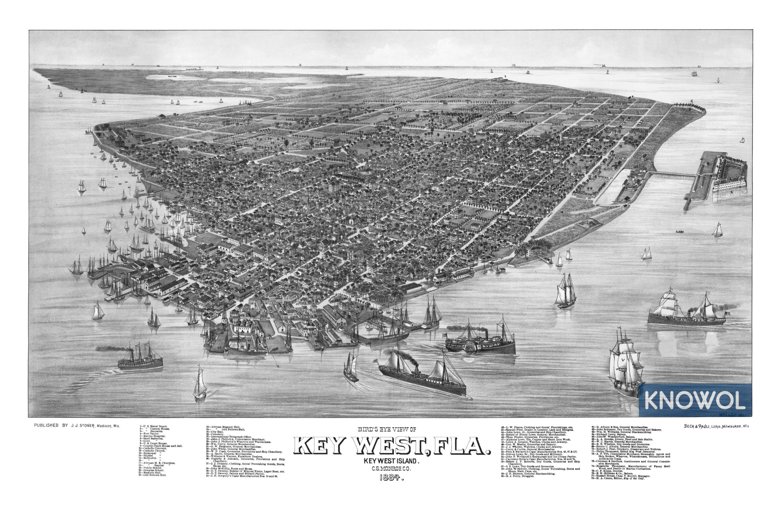
This old map of Key West makes an attractive addition to your office, library, or den and can even be used to teach children the geography and history of the area. When you’re done exploring, click here to get your copy.