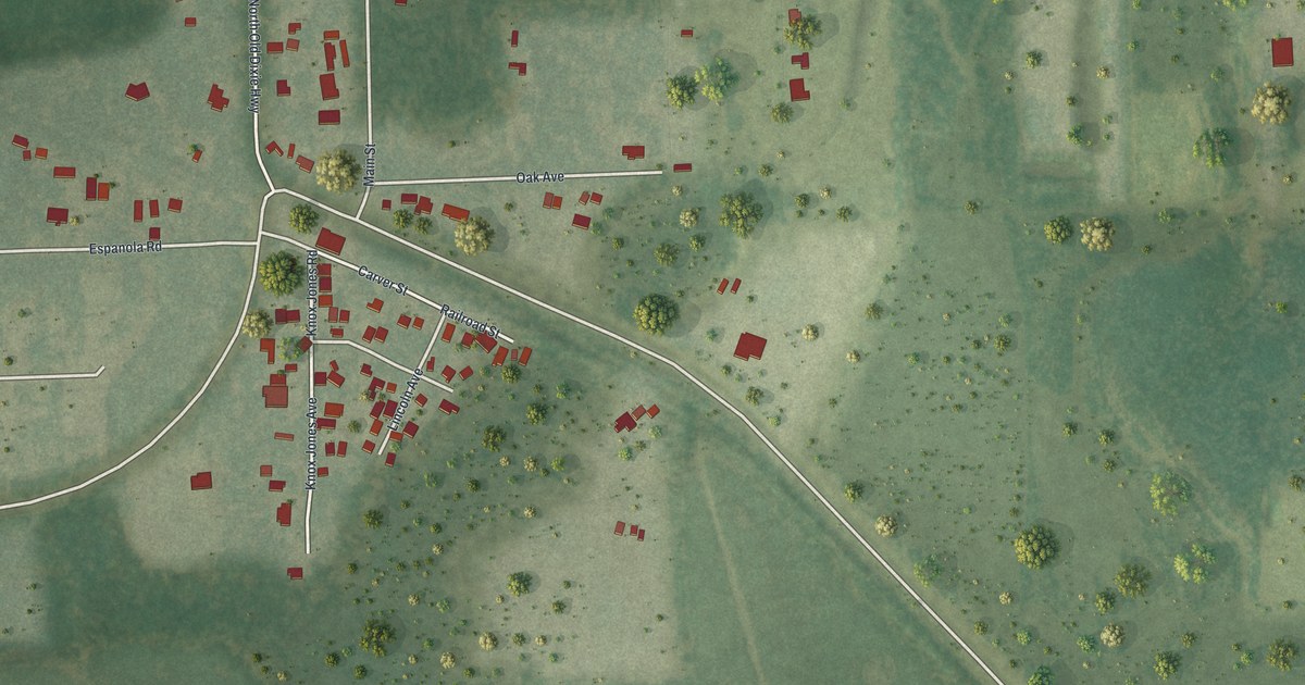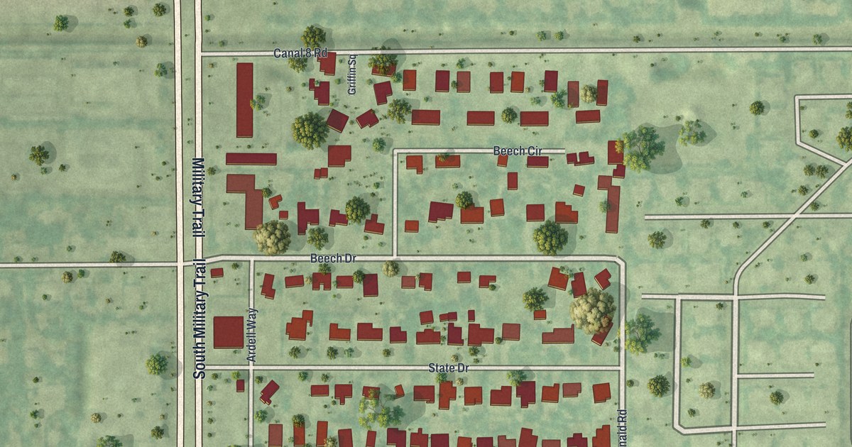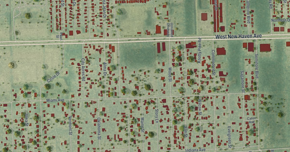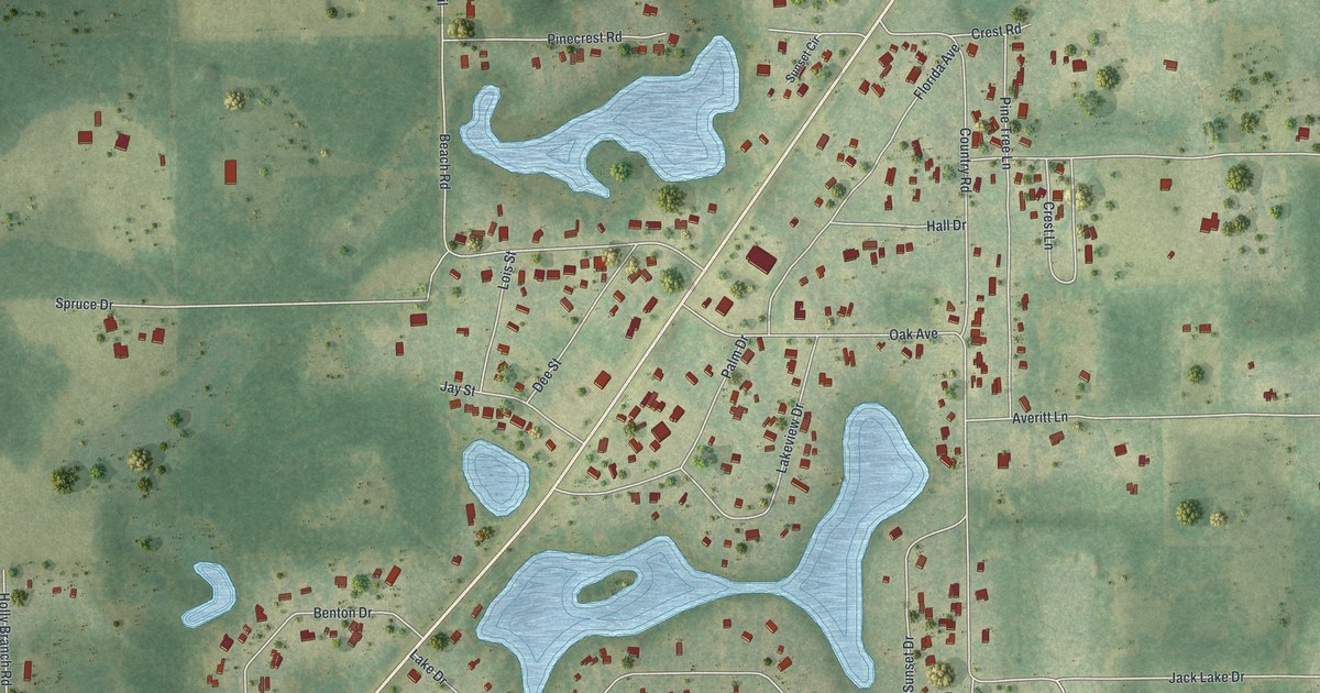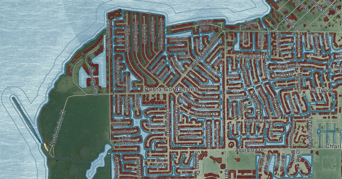
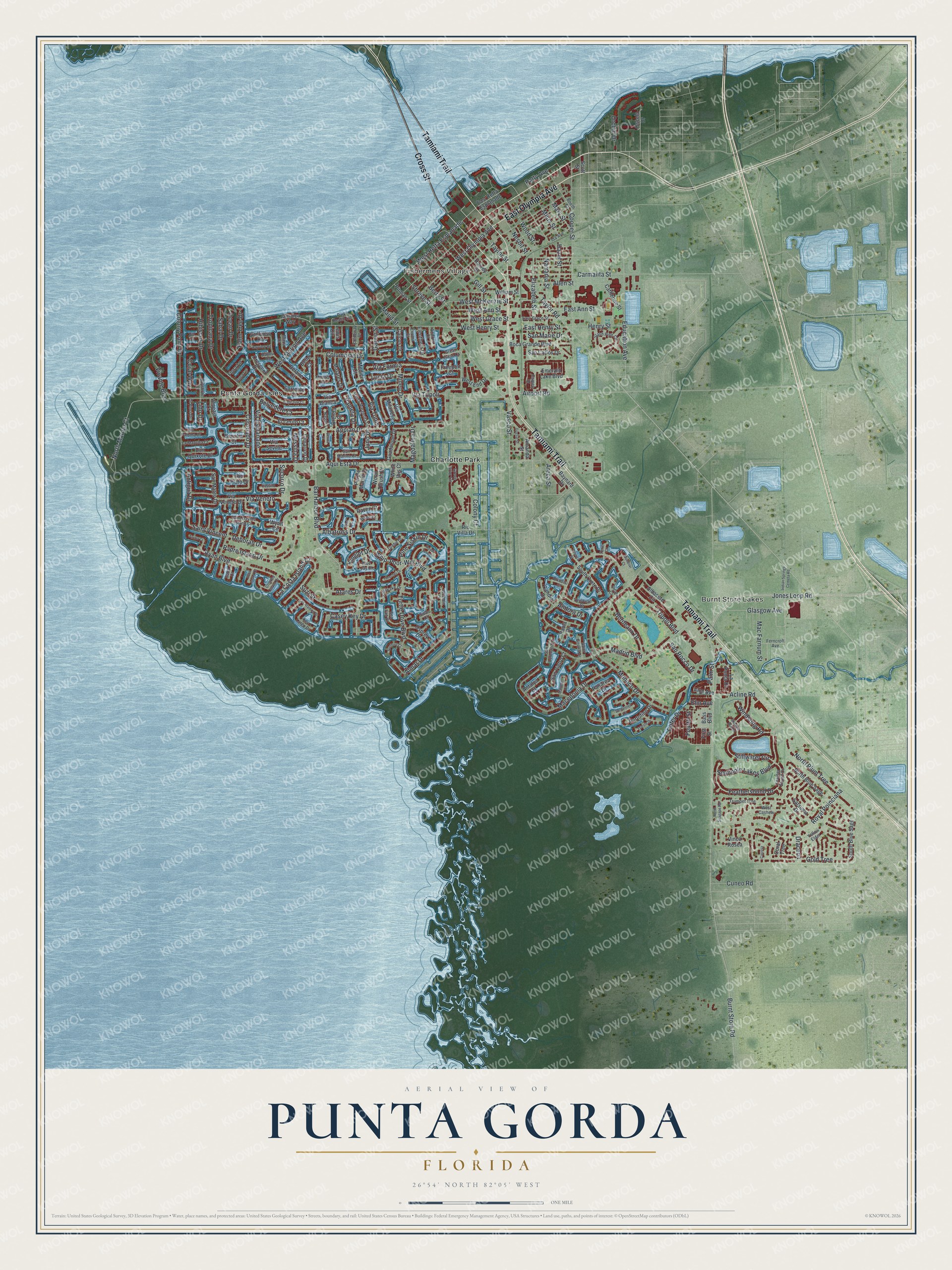
This beautifully detailed map of Punta Gorda, Florida was created in 2026 using aerial imagery combined with modern topographical, census, street and landmark data. It’s a one-of-a-kind view of Punta Gorda that combines accurate data with a vintage aesthetic. The map shows every building in its true location, many of the roads carry their names, and the shaded topographic relief shows the shape of the land.
Explore an aerial view of Punta Gorda, Florida
On the map you’ll find Burnt Store Lakes, Fishermens Village, Charlotte Park, Punta Gorda Isles, and West Retta Esplanade, along with Cross Street, East Olympia Avenue, Tamiami Trail, Burnt Store Road, Bal Harbor Boulevard, Outer Drive, West Marion Avenue, and more. If you look closely you can even find your house accurately drawn in its correct location. Zoom in on the preview to look for yours.
Did You Know?
Isaac Trabue bought land along Charlotte Harbor and had a town platted in 1885 under his own name. The railroad arrived in 1886. In December 1887, 34 unhappy townspeople met at Hector’s Billiard Parlor. They voted to incorporate and renamed the town Punta Gorda, Spanish for fat point.
Take a closer look at the Punta Gorda map
Names on this map
These names are printed on this map.
Places: Burnt Store Lakes, Fishermens Village, Charlotte Park and Punta Gorda Isles.
Streets and roads: Cross Street, East Olympia Avenue, Tamiami Trail, Burnt Store Road, Bal Harbor Boulevard, West Retta Esplanade, Outer Drive, West Marion Avenue, Gold Tree, Stillwater Circle, Saint Vincent, Juno Drive.
More street names, A to Z
Acline Road, Airport Road, Albacete Circle, Albatross Drive, Allen Street, Almar Drive, Aloe Avenue, Amanda Street, Andora Drive, Andros Court, Antalya Court, Antigua Drive, Appian Drive, Aqui Esta Drive, Areca Street, Aruba Court, Atares Drive, Aves Island Court, Bass Boulevard, Baynard Drive, Bayou Road, Bayshore Court, Bayview Road, Belaire Court, Belle Court, Belvedere Court, Berry Street, Blue Jay Court, Boca Grande Boulevard, Booth Street, Bordeaux Drive, Brazilia Court, Brenda Court, Brindisi Court, Caicos Drive, Cameo Drive, Candia Drive, Capri Isle Court, Carissa, Carmalita Street, Casey Key Drive, Cassino Court, Catherine Street, Cimarron Drive, Coldeway Drive, Colony Court, Colony Point Drive, Columbian Drive, Cooper Street, Coral Tree, Coral Way, Coronado Drive, Crescent Drive, Crooked Island Drive, Cuneo Road, Deborah Drive, Dileuca Street, Di Vinci Drive, Don Quixote Drive, Dracena, East Ann Street, East Grace Street, East Henry Street, East Retta Esplanade, Education Avenue, El Cerito Court, Eleuthera Drive, Elizabeth Street, Elm Avenue, Emerald Lake Boulevard, Exuma Court, Feathersound Drive, Feather Sound Drive, Ferncroft Avenue, First Street, Flora Lane, Fourth Street, Freeport Court, Garvin Street, Genoa Court, Gill Street, Glasgow Avenue, Great Isaac Court, Grebe Drive, Green Brier Circle, Guadalupe Drive, Gulfview Road, Gussie Street, Harvey Street, Hazel Street, Henry Street, Hibiscus Drive, Ida Avenue, Indian Springs Cemeta Road, Jamaica Way, Jones Loop Road, Key Largo Drive, Kinglet Drive, Kittiwake Drive, La Costa Island Court, La Mancha Court, La Punta Drive, Lewis Circle, Licata Court, Lido Drive, Los Alamos Drive, Lucia Drive, Macedonia Drive, Mac Farnum Street, Madrid Boulevard, Magdalina Drive, Maltese Court, Maria Court, Mary Street, Matares Drive, Maud Street, Medici Court, Messina Drive, Milus Street, Mineo Drive, Monaco Drive, Mondovi Court, Montia Court, Napoli Lane, Narranja Street, Nesbit Street, North Blue Sage, North Marion Court, North Plum Tree, North Seagape Road, Ocean Drive, Orchid Drive, Oscela Drive, Osprey Drive, Owl Court, Padre Island Drive, Palm Street, Palm Tree Drive, Pamela Drive, Panarea Drive, Paola Drive, Park Beach Circle, Patty Avenue, Pine Siskin Drive, Pitman Street, Portofino Drive, Purple Martin Drive, Raven Court, Rio Court, Rio Plato Drive, Rio Villa Drive, Rosa Lane, Royal Poinciana, Royal Tern Drive, Ryan Boulevard, Saba Court, Sabal Drive, Saint Davids Island Court, Saint Girons Drive, San Carlos Drive, San Lorenzo Drive, San Marie Drive, San Marino Court, San Mateo Drive, San Pietro Court, San Rocco Drive, Santa Margerita Lane, Santander Court, Satsuma Drive, Scott Street, Sea Fan Drive, Seminole Lakes Boulevard, Shadow Run Court, Shreve Street, Slash Pine Circle, Socorro Drive, Sorrento Court, South Blue Sage, South Crete Drive, Spoonbill Court, Surfbird Court, Suzi Street, Swan Court, Taylor Road, Taylor Street, Terin Court, Thrasher Drive, Toulouse Drive, Trieste Drive, Tripoli Boulevard, Tropicana Drive, Trumpet Tree, Turtle Dove Boulevard, Vasco Street, Venezia Court, Via Bianca, Via Esplanade, Via Formia, Via Milanese, Via Paloma Drive, Via Seville, Via Tripoli, Via Tunis, Via Veneto, Via Veneto Drive, Vinca Rosea, Vivante Boulevard, West Ann Street, West Cashew, West End Drive, West Grace Street, West Henry Street, West McKenzie Street, West Olympia Avenue, Whip-Poor-Will Boulevard, White Ibis Court, William Street, Windsong Road, Wood Street, Wood Thrush Drive, Wren Court, Wyatt Circle, Yellow Elder.
See it on a wall
The Punta Gorda map as a framed print. Swipe for more.


This beautifully detailed map of Punta Gorda makes an attractive addition to your office, library, or den, and it can even be used to teach children the geography and history of the area. It also makes a great gift for anyone who grew up in Punta Gorda or moved away. When you’re done exploring, click here to get your copy of the Punta Gorda map.