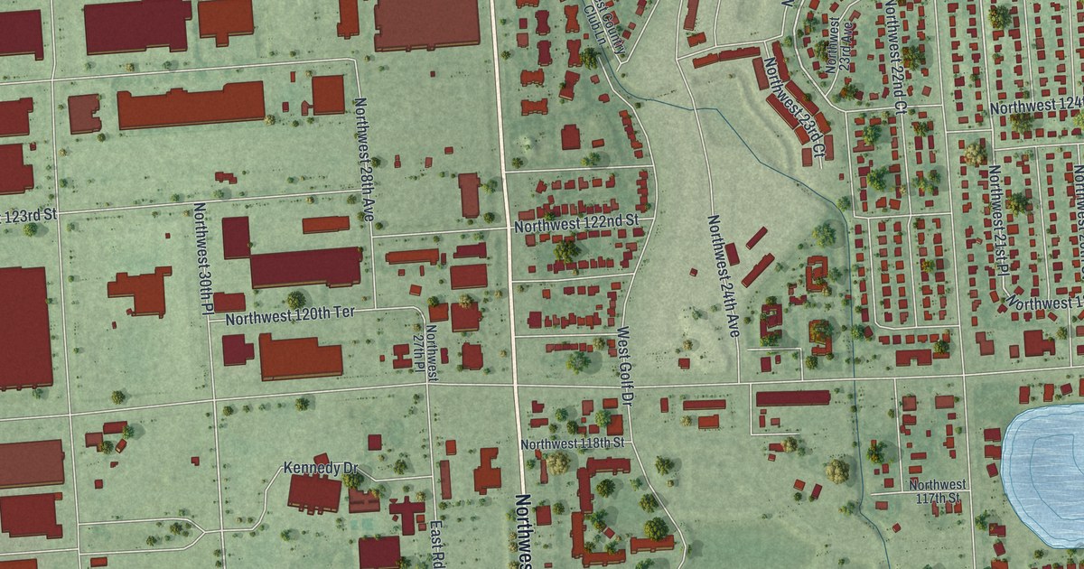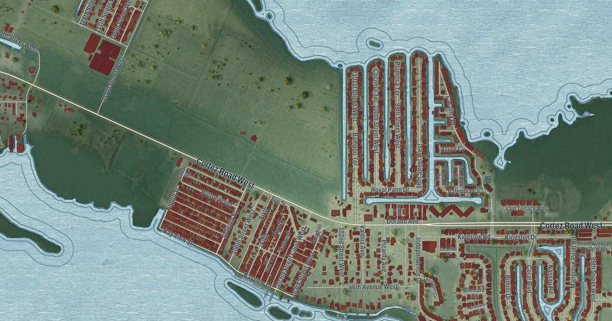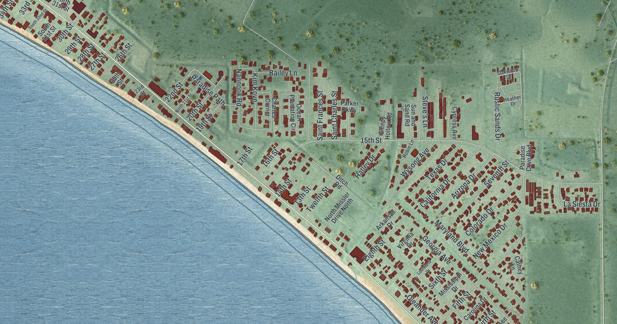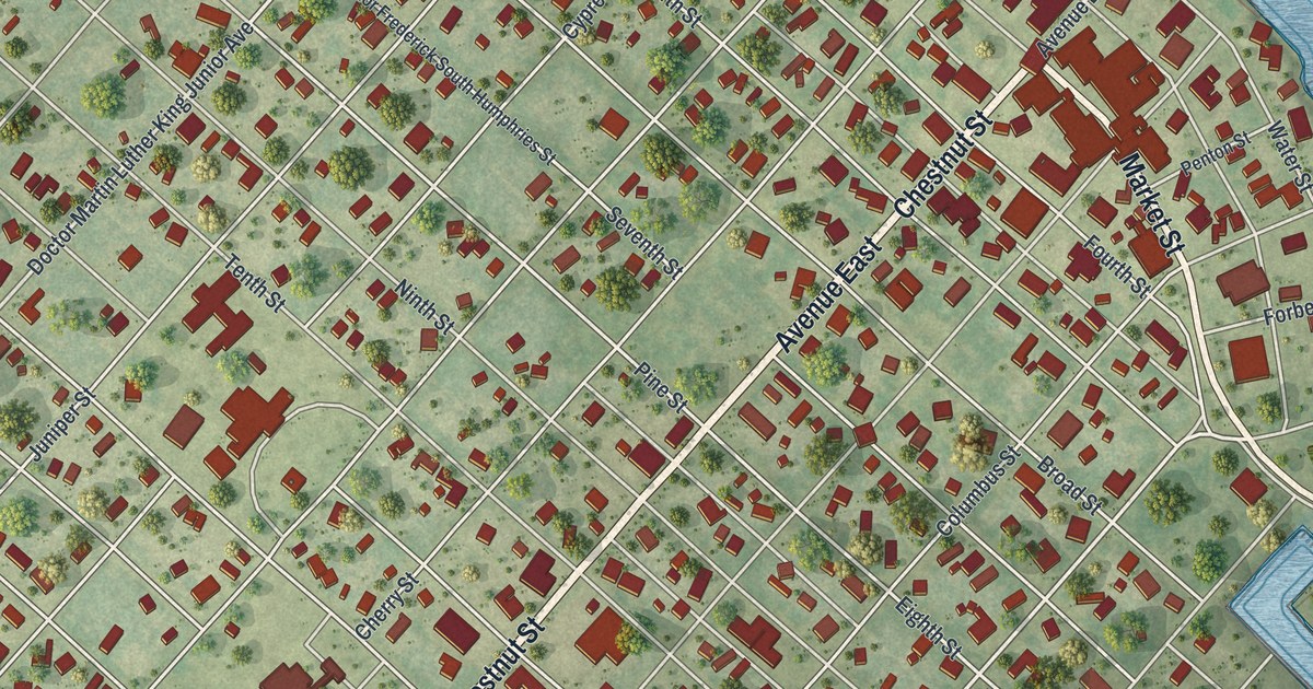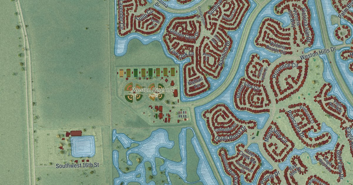
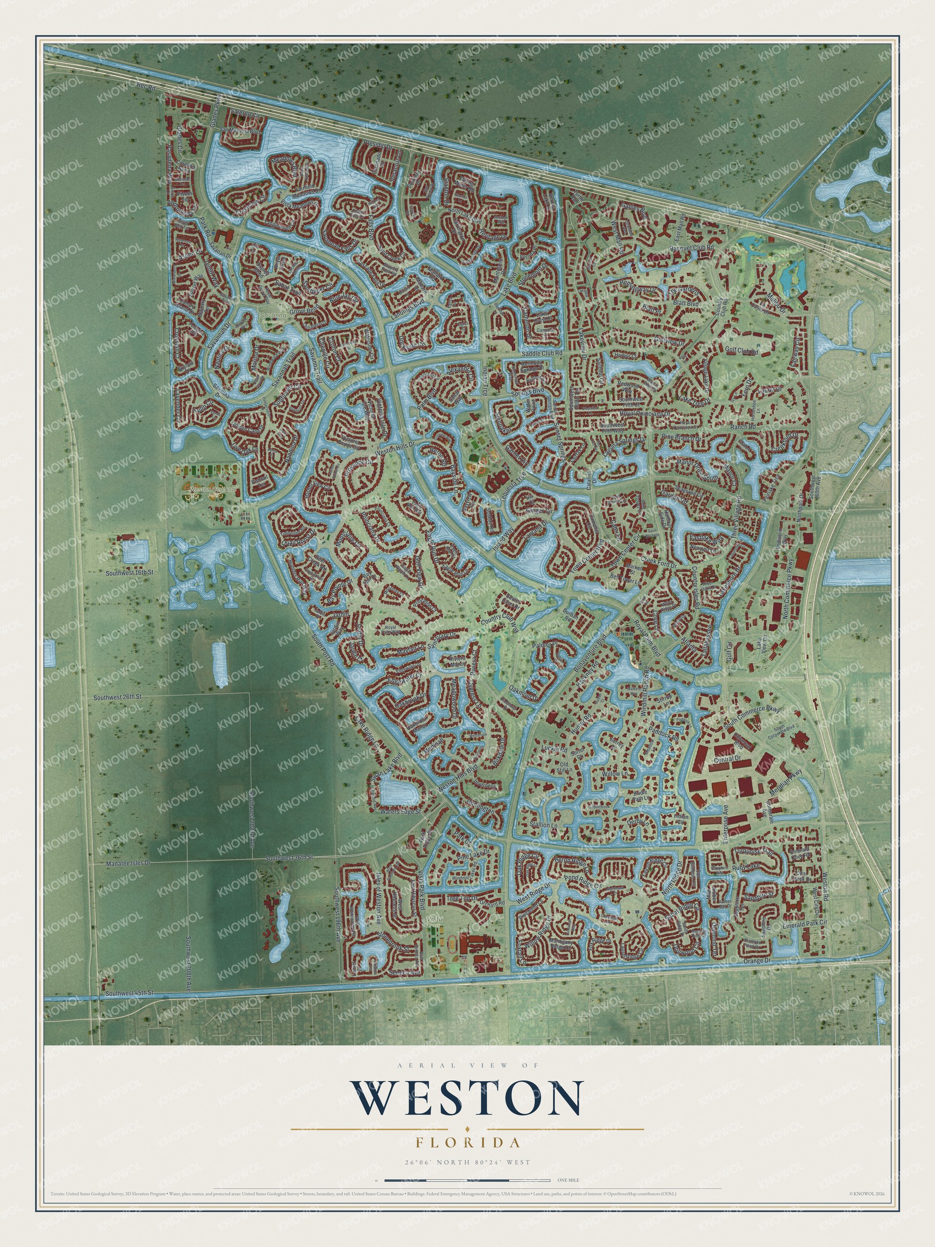
This beautifully detailed map of Weston, Florida was created in 2026 using aerial imagery combined with modern topographical, census, street and landmark data. It’s a one-of-a-kind view of Weston that combines accurate data with a vintage aesthetic. The map shows every building in its true location, many of the roads carry their names, and the shaded topographic relief shows the shape of the land.
Explore an aerial view of Weston, Florida
On the map you’ll find Vista Park and Weston Regional Park, along with Lake Boulevard, Waters Edge Street, Commerce Parkway, Racquet Club Road, Golfview Drive, and more. If you look closely you can even find your house accurately drawn in its correct location. Zoom in on the preview to look for yours.
Did You Know?
In the 1950s industrialist Arthur Vining Davis took control of about 15,000 acres here. His company, Arvida, later planned a community on the land called Indian Trace. It was renamed Weston in the early 1980s, and the first homes were finished in 1984. In 1996 about 90 percent of voters chose to make Weston a city.
Take a closer look at the Weston map
Names on this map
These names are printed on this map.
Places: Savanna Commons, Vista Park, Weston Regional Park and Ruby Lake.
Streets and roads: Lake Boulevard, Waters Edge Street, South Commerce Parkway, Racquet Club Road, Golfview Drive, Saddle Club Road, Lakeview Drive, Fairway Circle, Lake Ridge Lane, Meridian Parkway, Central Drive, Seneca Avenue.
More street names, A to Z
Alexandra Circle, Amber Bay Drive, Amber Way, Andromeda Lane, Aspen Lane, Aster Way, Atlanta, Bay Isle Drive, Bay Pointe Drive, Bayridge Lane, Bayside Lane, Bayview Circle, Bedford Avenue, Bell Tower Lane, Bermuda Springs Drive, Birkdale Drive, Blatt Boulevard, Blatt Place, Blue Jay Circle, Bonaventure Boulevard, Bridle Path Lane, Cambridge Drive, Camellia Circle, Cameron Court, Cameron Drive, Canary Island Drive, Capri Lane, Carrington Drive, Cascade Falls Drive, Catalina Drive, Cedar Falls Drive, Center Court Drive, Chenille Circle, Chinaberry Drive, Cinnamon Way, Coconut Circle, Conservation Drive, Cordoba Bend, Coronado Road, Corporate Avenue, Country Club Road, Country Club Way, Country Isles Road, Cove Lane, Creek Ford Drive, Creekford Drive, Crescent Way, Crestview Circle, Crestview Lane, Crossbill Court, Crossbill Lane, Croton Court, Cypress Lane, Danielle Court, Deer Creek Road, Derby Lane, Diamond Head Drive, Diamond Terrace, Dockside Circle, Dogwood Circle, Durban Road, Eagle Run Circle, Eagle Run Drive, Eagle Run Lane, Eagle Run Way, Eagle Watch Lane, East Hibiscus Street, Eastlake Way, East Mall Road, East Seneca Avenue, Edgewater Court, Edgewater Drive, Egret Court, Egret Lane, Elderberry Drive, Emerald Cove Road, Emerald Park Circle, Enterprise Avenue, Fairfax Lane, Fairfield Meadows Drive, Fairlake Trce, Falcon Ridge Circle, Falling Water Road, Falls Boulevard, Fern Drive, Fishtail Terrace, Fox Ridge Drive, Foxtail Lane, Gables Boulevard, Garden Road, Garnet Circle, Ginger Circle, Glades Circle, Glades Parkway, Golden Cane Drive, Golf Club Road, Golf View Drive, Granada Avenue, Greenbrier Court, Grove Bend, Gulf Circle, Hacienda Terrace, Hackney Road, Hampton Court, Harbor Court, Harbor Pointe Circle, Harbor View Circle, Harbour Side Drive, Hawthorn Terrace, Hemingway Drive, Heritage Drive, Heritage Way, Heron Ridge Lane, Heron Road, Hickory Way, Hidden Valley Way, Horseshoe Lane, Hunter Court, Hunter Road, Hunters Run Way, Huntington, Ibis Lane, Indian Circle, Indian Trce, Inverness, Iris Court, Island Circle, Island Way, Isles of Weston Avenue, Islewood Avenue, Ivy Lane, Jardin, Jardin Court, Jardin Drive, Jardin Place, Jardin Way, Kelly Lane, La Costa Drive, Laguna Springs Drive, Lake Crest Court, Lakeshore Circle, Lakeshore Drive, Lake Tree Drive, Lakeview, Lake View Circle, Landings Boulevard, Lantana Drive, Laurel Drive, Laurel Place, Laurel Ridge Circle, Lavender Circle, Leeward Way, Live Oak Lane, Luckie Road, Magnolia Ridge Drive, Mahogany Ridge Drive, Majesty Terrace, Malibu Drive, Mallard Drive, Mallard Lane, Mallard Road, Manatee Isles Drive, Manor Court, Manor Drive South, Marina Drive, Market Street, Mayfair Lane, Meadow Lane, Meadowood Drive, Meadows Boulevard, Medinah, Montclaire Circle, Montclaire Drive, Monterey Court, Montpeliar, Nandina Drive, Nautica Drive, Nelson Court, Newport Lane, Nighthawk Drive, North Commerce Parkway, North Lake Boulevard, Northpark Drive, North Ridge Drive, Oakbrook Drive, Oakbrook Manor, Oakmont Drive, Oak Ridge Circle, Oak Ridge Lane, Old Still Lane, Opal Creek Drive, Orange Drive, Orchard Road, Orchid Bend, Osprey Bend, Paddock Lane, Paddock Road, Palm Boulevard, Palmer Place, Park Court, Park Ridge Street, Park Road, Pasadena Way, Pediatrix Way, Penta Court, Peregrine Way, Pine Branch Drive, Pinehurst Drive, Pine Lake Drive, Pinewood Lane, Pisces Terrace, Poinciana Court, Poinciana Drive, Pond Ridge Circle, Presidio Drive, Princeton Court, Provence Circle, Quail Roost Drive, Rainbow Avenue, Ranch Road, Rec Road, Redwood Way, Regal Cove Road, River Oaks Drive, Riviera Court, Riviera Manor, Royal Grove, Royal Grove Way, Royal Palm Boulevard, Royal Palm Way, Royal Poinciana Court, Royal Poinciana Drive, Sabal Ridge Circle, Sabal Trail, Sabal Way, Saddlebrook Lane, Sailboat Circle, Saint Gabrielle Lane, Saint Michelle, Saint Tropez Circle, Salerno Circle, Sanctuary Drive, Sand Creek Circle, Sandpiper Circle, Sandy Ridge Drive, San Luis Rey, San Messina Boulevard, San Remo Drive, San Simeon Circle, Sapphire Drive, Sapphire Isle, Sapphire Street, Sapphire Terrace, Savanah Trail, Savanan Drive, Savanna Drive, Savannah Drive, Savannah Falls Drive, Savannah Trail, Savanna Trail, Seabay Road, Seagrape Circle, Silver Bell Terrace, Sirius Lane, Skylark Drive, Slippery Rock Road, Somerset Way, Sorrel Court, Sorrento Drive, South Corporate Boulevard, South Post Road, Southwest 16th Street, Southwest 26th Street, Southwest 36th Street, Southwest 45th Street, Southwest 160th Avenue, Southwest 169th Terrace, Southwest 196th Avenue, Southwest 202nd Avenue, Southwest 208th Avenue, Southwest Fifth Court, Southwest Fifth Way, Spinnaker, Springs Boulevard, Stallion Lane, Stanton Drive, Stanton Lane, Stirrup Lane, Stonebrook Street, Stonemont Drive, Sunflower Circle, Sunset Springs, Sunset Springs Boulevard, Sunset Way, Surrey Lane, Swan Lake Boulevard, Sycamore Terrace, Talavera Road, Tallahassee, Tanglewood Circle, Tequesta Trce, The Gardens, Three Village Road, Timberline Road, Town Center Boulevard, Town Center Circle, Trailmore Lane, Tree Top Drive, Tulip Circle, Turquoise Trail, Turtle Run, Universal Boulevard, Vanda Terrace, Veracruz Lane, Verona Lake Drive, Verona Place, Victoria Isle Drive, Victoria Isle Way, Victoria Pointe Circle, Village Lake Drive, Vista Meadows Drive, Vista Park Boulevard, Walkers Way, Water Point, Water Ridge Drive, Waters Edge Drive, Waterside Circle, Wentworth, Westbrook, West City Drive, West Gardenia Avenue, West Hibiscus Street, West Mall Road, Weston Hills Boulevard, Weston Hills Drive, Weston Road, West Ridge Drive, West Whitewater Avenue, Willow Lane, Willow Ridge Drive, Windmill Lakes Road, Windmill Ranch Road, Windward Way, Winterberry Lane, Zenith Way.
See it on a wall
The Weston map as a framed print. Swipe for more.


This beautifully detailed map of Weston makes an attractive addition to your office, library, or den, and it can even be used to teach children the geography and history of the area. It also makes a great gift for anyone with Weston roots. When you’re done exploring, click here to get your copy of the Weston map.