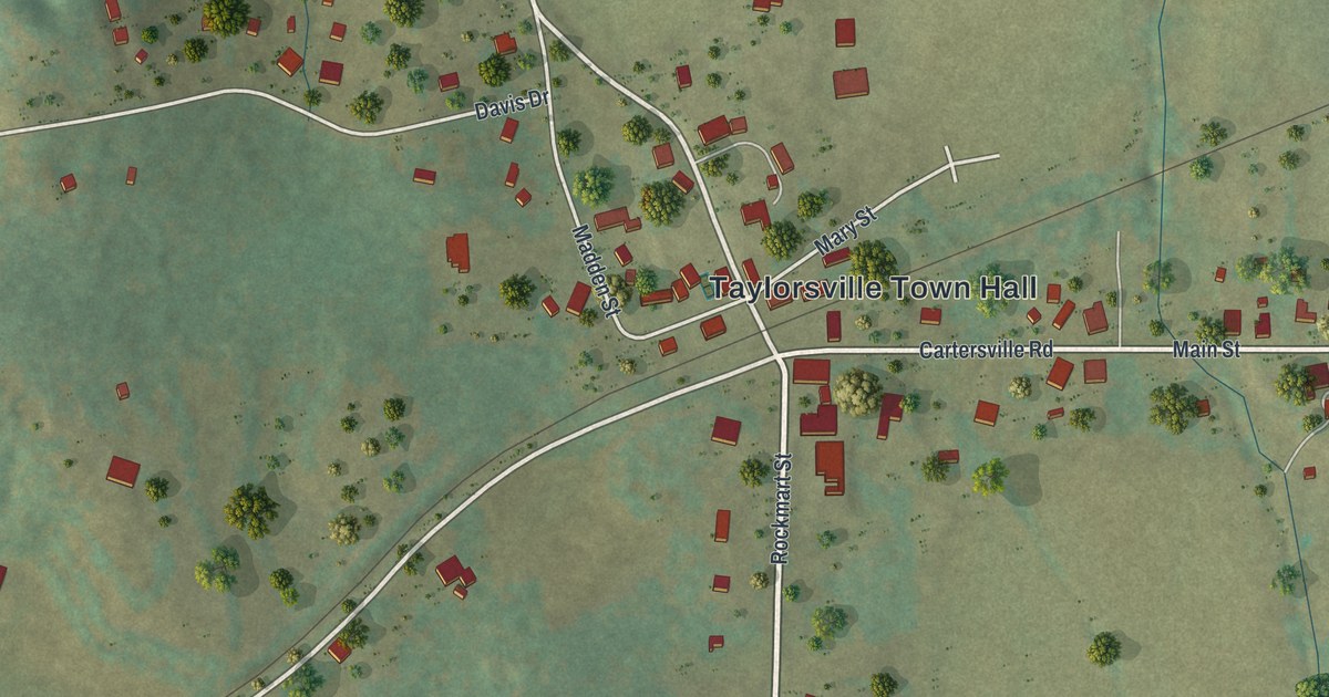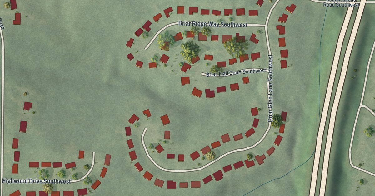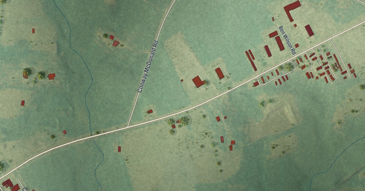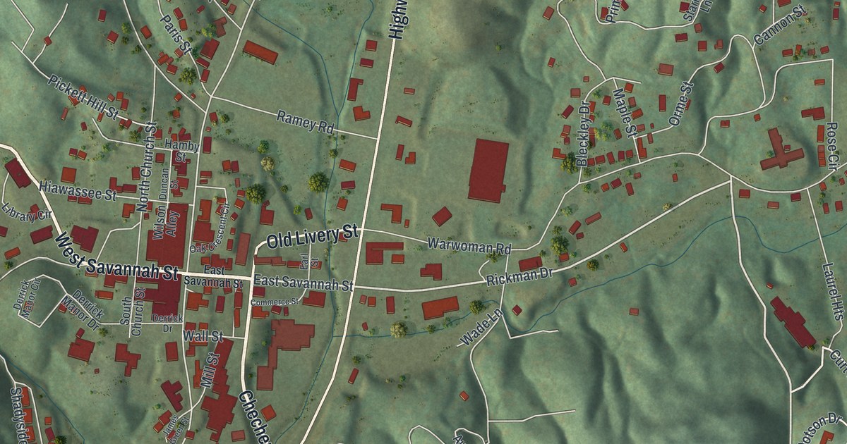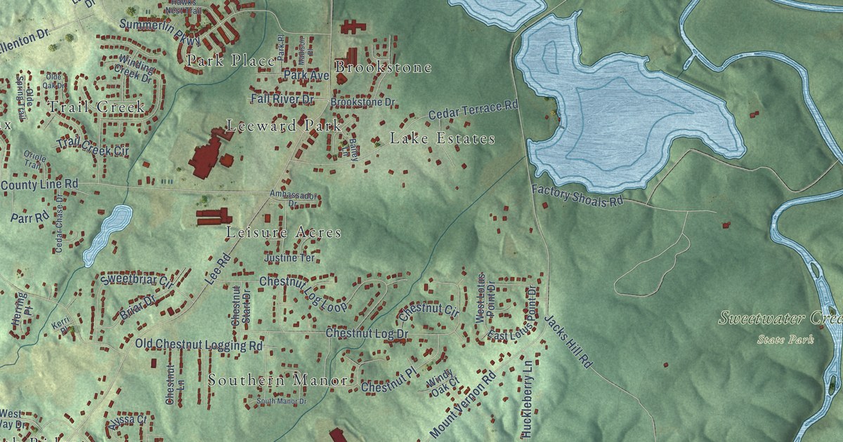
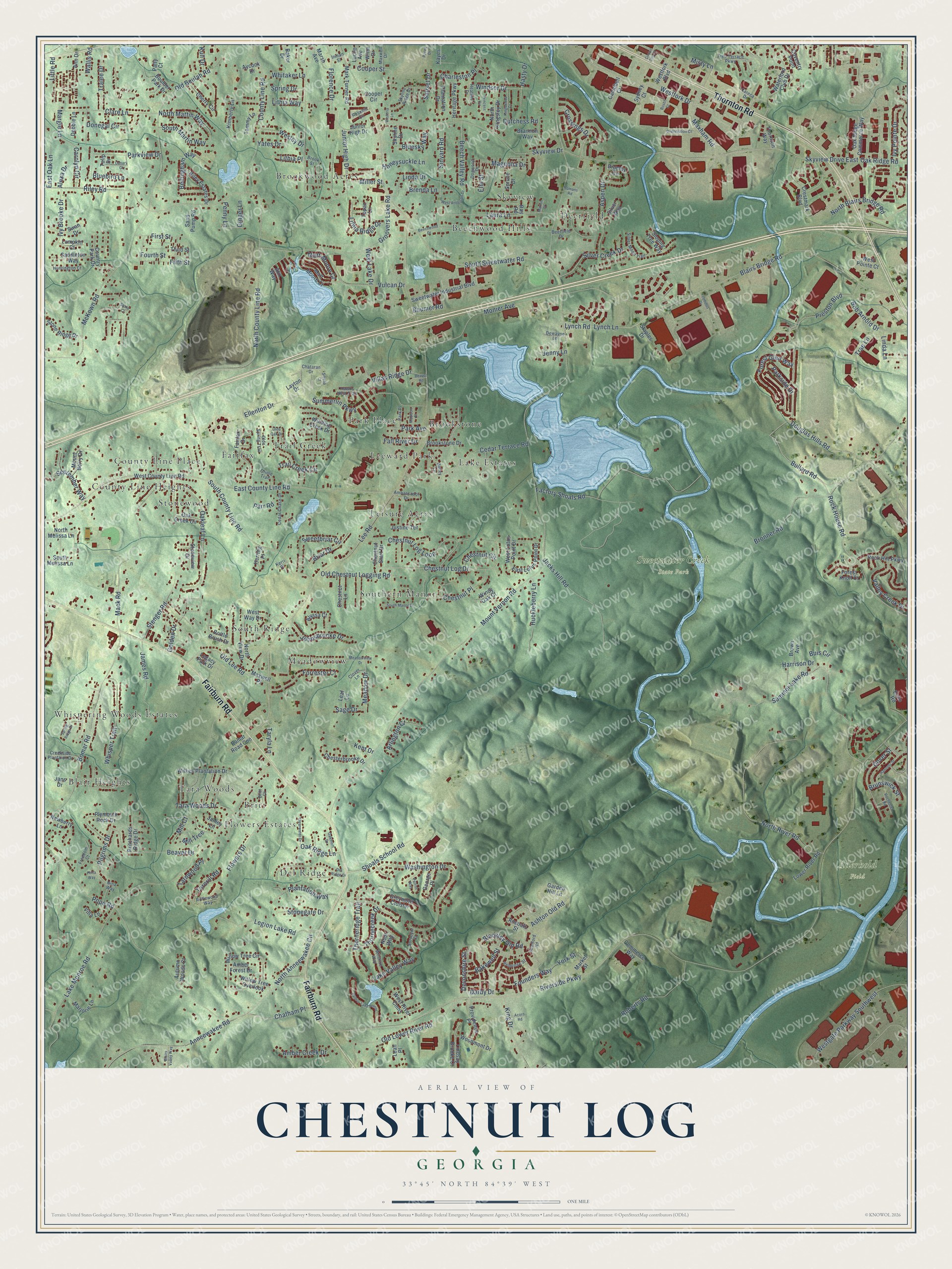
This beautifully detailed map of Chestnut Log, Georgia was created in 2026 using aerial imagery combined with modern topographical, census, street and landmark data. It’s a one-of-a-kind view of Chestnut Log that combines accurate data with a vintage aesthetic. The map shows every building in its true location, many of the roads carry their names, and the shaded topographic relief shows the shape of the land.
Explore an aerial view of Chestnut Log, Georgia
On the map you’ll find Aderhold Field, Sweetwater Creek State Park, Blair Heights, County Line Place, Deerfield, Brookwood Acres, Leeward Park, Meadowview, Del Ridge, Southern Manor, Beechwood Hills, Whispering Woods Estates, and more. If you look closely you can even find your house accurately drawn in its correct location. Zoom in on the preview to look for yours.
Take a closer look at the Chestnut Log map
Names on this map
These names are printed on this map.
Places: Aderhold Field, Sweetwater Creek State Park, Blair Heights, County Line Place, Deerfield, Brookwood Acres, Leeward Park, Meadowview, Del Ridge, Southern Manor, Beechwood Hills, Whispering Woods Estates, Trail Creek, Brookstone, Tara Woods, Leisure Acres, Fairfax, County Line Heights, South Ridge, Flowers Estates, Park Place, Lake Estates, Skyview, Stonewood and Britt.
Streets and roads: Thornton Road, Fairburn Road, North County Line Road, Skyview Drive East, Lynch Lane, North Martin Way, Hasty Drive, Mount Vernon Road, Riverside Parkway, Lee Road, Factory Shoals Road, Blairs Bridge Road.
More street names, A to Z
Acorn Road, Alexa Drive, Alix Way, Alyssa Court, Ambassador Drive, Amber Creek Drive, Amber Forest Drive, Ancoats Street, Ann Drive, Anneewakee Road, Arlington Court, Ashton Old Road, Aspen Drive, Autumn Woods Court, Aycock Drive, Bailey Lane, Baker Drive, Bakewell Street, Baumer Road, Beaver Drive, Beaver Road, Beech Valley Road, Beechwood Drive, Bellingham Way, Blackley Old Road, Blairs Valley Way, Bluebird Lane, Bluesky Way, Bob Arnold Drive, Bomar Road, Bomar Road Con, Bosch Court, Bottle Brush Drive, Boulder Park Drive, Brannon Way, Brenda Lane, Briar Drive, Britt Court, Bronner Road, Brookstone Drive, Brook Street, Brown Avenue, Brumby Circle, Brunswick Street, Buis Circle, Bullard Road, Campbell Court, Canary Court, Careca Drive, Carolyn Circle, Cedar Chase Drive, Cedar Terrace Road, Charleston Place, Chataran Drive, Chatham Place, Cherry Circle, Chesterbrooke Drive, Chestnut Circle, Chestnut Lane, Chestnut Log Drive, Chestnut Log Loop, Chestnut Place, Chestnut Start Drive, Circuit City Court, Clare Lane, Clearwater Drive, Clover Lane, Commerce Way, Cooper Circle, Cooper Street, Country Park Drive, County Line Road, Coventry Point, Creekside Plantaion Drive, Crestmark Boulevard, Crossings Drive, Darby Drive, Debbie Lane, Deerfield Drive, Del Ridge Drive, Devonshire Street, Dewayne Lane, Distribution Court, Dogwood Drive, Donegal Circle, Douglas Hills Road, Dover Street, Dutchess Road, East County Line Road, East Lotus Point Drive, East Oak Lane, Echo Road, Ellenton Drive, Elm Street, Fairfax Drive, Fall River Drive, Fifth Street, First Street, Florence Drive, Flowers Drive, Forest Glen Way, Forest Knoll Court, Forrester Court, Founders Way, Fourth Street, Freedom Court, Garden Hill Lane, George Place, Ginger Lane, Golden Drive, Greymont Cloister, Groovers Lake Road, Hanover Street, Harrison Drive, Hawks Nest Trail, Heather Drive, Heritage Parkway, Herring Place, Honeysuckle Lane, Huckleberry Lane, Huntington Court, Inman Street, Ivy Brooke Drive, Ivy Pointe Drive, Jacks Hill Road, James Road, Jamey Lane, Jans Drive, Jenny Lane, Johnsbrooke Drive, Junior High Drive, Justine Terrace, Kayes Drive, Kent Drive, Kerri Place, Kimberly Lane, King Drive, Kingswood Court, Kull Drive, Lake Monroe Road, Lake Valley Way, Laura Lane, Layton Drive, Leaf Lane, Leah Place, Legacy Park Drive, Legion Lake Road, Linda Drive, Linda Lane, Lindsay Brooke Court, Lithia Place, Lithia Ridge Drive, Lithia Way, Little Road, Lower River Road, Lucile Avenue, Lumpkin Court, Lynch Road, Mack Road, Madison Place, Magnolia Drive, Margie Lane, Marion Court, Marjorie Lane, Market Street, Mark Turner Road, Marsh Avenue, Matt-Moore Court, Matt Moore Court, Maxham Road, Maxwell Drive, Maxwell Place, McKown Road, Meadow Drive, Meadowview Drive, Mill Court, Miller Street, Mill Trce, Misty Lane, Monier Avenue, Mount Berry Drive, Newberry Lane, Nina Way, Noor Way, North Anneewakee Circle, North Blairs Bridge Road, North Kingsley Drive, North Melissa Lane, North River Road, North View Drive, Oak Creek Circle, Oakleaf Lane, Oakmont Drive, Oak Ridge Commerce Way, Oak Ridge Lane, Oak Ridge Road, Old Beulah Road, Old Chestnut Logging Road, Olde Oak Drive, Olde Spring Trail, Old Lee Road, Old Lower River Road, Oriole Trail, Paces Drive, Palmer Lake Pointe, Park Avenue, Parkside Drive, Parkview Drive, Parr Road, Patriot Way, Patty Court, Penny Lane, Pilgrims Drive, Pinta Way, Plantation Drive, Plantation Way, Plymouth Rock Drive, Pope Road, Preston Boulevard, Primrose Street, Princess Circle, Pritchards Ridge Drive, Providence Place, Ray Road, Rifflewood Way, Riley Estates Drive, Riley Road, Roberts Road, Rochester Road, Rock Hill Parkway, Rock House Road, Romans Road, Rosehill Circle, Saddleton Way, Sage Drive, Sand Pump Road, September Way, Shoals School Road, Sibella Court, Silver Creek Drive, Silver Moon Trail, Silver Way, Sinyard Road, Skyline Drive, Skyline Ridge Drive, Skyview Drive, Sloping Tree Way, South County Line Road, South Manor Drive, South Martin Way, South Melissa Lane, South Sweetwater Road, Spring Drive, Spring Ridge Drive, Spruce Drive, Staples Drive, Stenger Road, Stone Court, Stonegate Drive, Stone Ridge Drive, Stoneview Drive, Stretford Road, Summer Lake Road, Summerlin Parkway, Sunset Drive, Surveyor Court, Swan Drive, Sweetbriar Circle, Sweetwater Industrial Boulevard, Sydney Court, Tammy Lane, Tara Woods Drive, Tarnrill Road, Tarnwood Place, Taryla Lane, Terminus Drive, Third Street, Thornecreek Drive, Thorneridge Trail, Thornton Way, Topaz Lane, Trae Lane, Trail Creek Circle, Tralee Drive, Tree Terrace Parkway, Tulip Drive, Valley Creek Drive, Villa Lane, Villas Ridge Drive, Vulcan Drive, Wallis Road, Washington Drive, Waterford Club Drive, Wesley Drive, West Anderson Drive, West County Line Road, Westfork Boulevard, Westfork Drive, Westgate Parkway Southwest, West Lake Drive, West Lotus Point Drive, West Pointe Court, West River Cmns, West Way Drive, Whisper Trail, Whitaker Lane, Wilkes Plantation Drive, Willow Tree Circle, Willow Tree Overlook, Wilshire Way, Winding Creek Drive, Windsor Drive, Windy Oak Court, Winn Drive, Wisteria Lane, Woodmont Drive, Yates Drive, York Street.
See it on a wall
The Chestnut Log map as a framed print. Swipe for more.


This beautifully detailed map of Chestnut Log makes an attractive addition to your office, library, or den, and it can even be used to teach children the geography and history of the area. It also makes a great gift for anyone who grew up in Chestnut Log or moved away. When you’re done exploring, click here to get your copy of the Chestnut Log map.