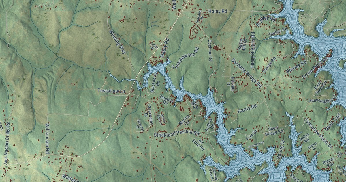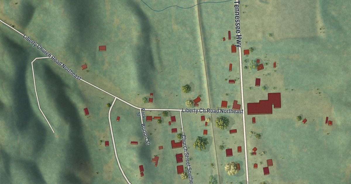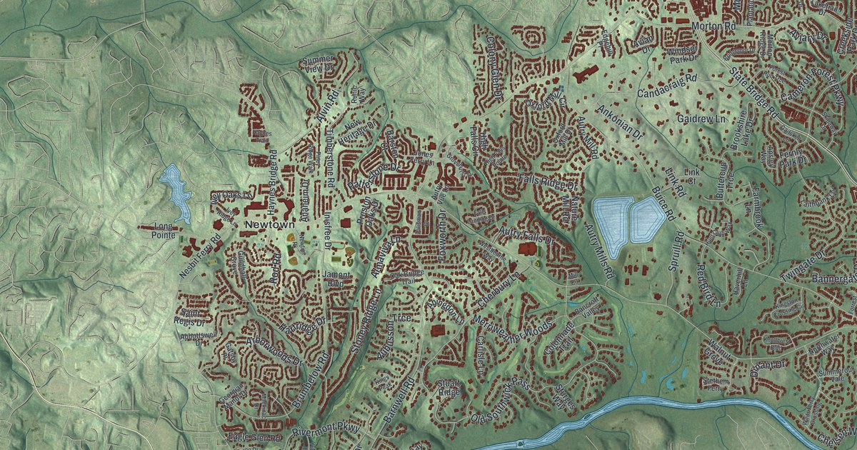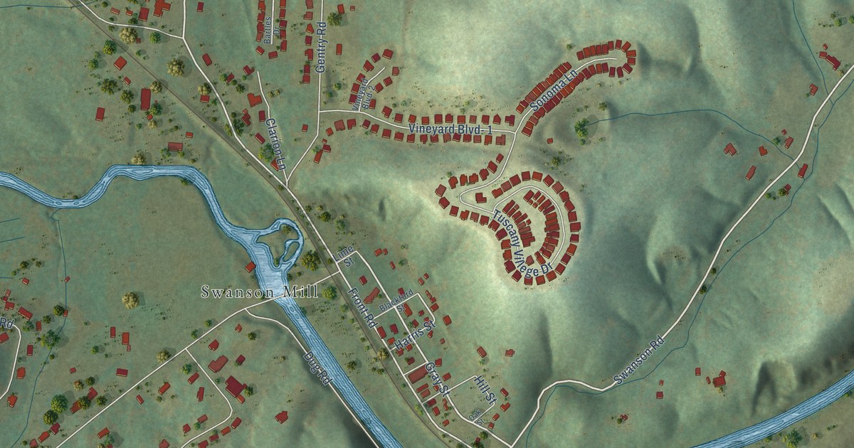
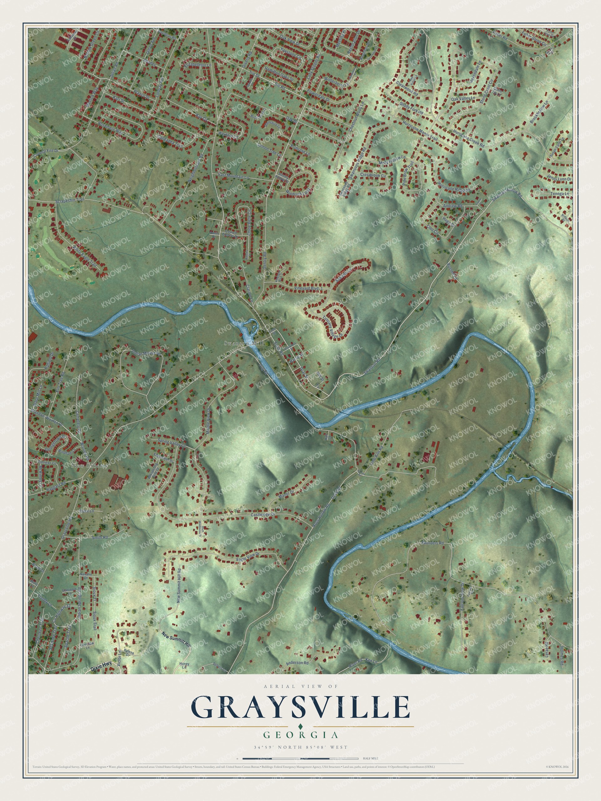
This beautifully detailed map of Graysville, Georgia was created in 2026 using aerial imagery combined with modern topographical, census, street and landmark data. It’s a one-of-a-kind view of Graysville that combines accurate data with a vintage aesthetic. The map shows every building in its true location, many of the roads carry their names, and the shaded topographic relief shows the shape of the land.
Explore an aerial view of Graysville, Georgia
On the map you’ll find New Liberty, Swanson Mill, and Sioux Tl, along with Dixie Highway, Swanson Road, Gentry Road, Gray Street, Swanson Hollow Road, Front Road, Norfolk Green Circle, Brandon-Wooten Drive, Iris Road, and more. If you look closely you can even find your house accurately drawn in its correct location. Zoom in on the preview to look for yours.
Did You Know?
From Internet Archive: "Moving his command from Chattanooga, Sept. 7, 1863, the Confederate commander formed his line of battle, chiefly along the road from La Fayette to Lee and Gordon's mills, the right lying between Graysville and Ringg’old, upon the Western & Atlantic railroad."
Graysville is a community in Catoosa County.
Take a closer look at the Graysville map
Names on this map
These names are printed on this map.
Places: New Liberty and Swanson Mill.
Streets and roads: Dixie Highway, Swanson Road, Gentry Road, Gray Street, Swanson Hollow Road, Front Road, Norfolk Green Circle, Sioux Tl, Brandon-Wooten Drive, Iris Road, Hill Street, Hurricane Creek Road.
More street names, A to Z
Amlin Drive, Anderson Road, Andrew Road, Apache Trail, Arbor Mill Lane, Bartles Drive, Blackford Street, Brookhollow Lane, Callaway Court, Camile Court, Caneadea Trail, Carrigan Circle, Castleview Drive, Cemetery Road, Cherokee Trail, Chestnut Wood Lane, Chloe Belle Circle, Choctaw Lane, Clarion Lane, Clearwood Road, Cleo Circle, Council Embers Drive, Council Fire Drive, County Highway 32, Crestbrook Circle, Davidson Road, Dove Road, Dug Road, Duke Lane, Eagle View Drive, East Mountain Lane, Edgewater Drive, Elizabethton Lane, Elm Tree Road, Falcons View Drive, Falcons Vw, Flowerdale Drive, Freddy Lane, Fuller Glen Circle, Fuller Glenn Circle, Fuller Road, Georgetown Drive, Givens Road, Glenshire Lane, Graysville Road, Haggard Road, Hall Lane, Hames Road, Hamilton Oaks Drive, Harris Street, Hatfield Drive, Havendale Lane, Holmes Road, Honey Lane, Hugo Drive, Hurricane Manor Trail, Hurricane Ridge Road, Indian Mound Road, Indian Springs Road, Iris Drive, James Avenue, Jenny Lynn Drive, Julian Road, Karr Street, Kay Circle, Ken Lane, Keystone Circle, Kylene Drive, Lady Slipper Road, Lemon Tree Lane, Lerae Road, Lime Kiln Road, Lime Street, Lindsay Avenue, Manor Drive, McKinley Lane, Meeting Place, Middle View Drive, Misty Hollow Lane, Molly Lane, Mystic Brook Court, Navaho Drive, Neighborhood Road, New Summit Hill Road, New Summitt Hill, Oak Drive, Oak Street, Oak Valley Lane, Oak View Drive, Observation Lane, Pine Brow Trail, Plaxco Drive, Primrose Lane, Red Robin Lane, Restoration Drive, Reunion Drive, Rhodes, River Road, Rosemere Way, Ross Hollow Road, Russell Lane, Saunders Road, Scrapeshin Trail, Sellers Lane, Seminole Lane, Shady Fork Road, Shawnee Trail, Sioux Trail, Smith Road, Sonoma Lane, South Middleview Drive, Spindle Court, Spring Valley Lane, Stone Crest Circle, Stone Tip Lane, Stormy Hollow Drive, Susan Carol Lane, Swansons Ridge Road, Tennga Lane, Tuscany Villege Drive, Unicorn Trail, Victor Lane, Vineyard Blvd- 1, Vineyard Blvd-2, Wexford Lane, Whispering Pine Drive, White Eagle Trail, Windham Lane, Windrush Loop, Windsor Drive, Winterberry Lane, Winterberry Road, Woods Drive, Wooten Road, Worlick Way.
See it on a wall
The Graysville map as a framed print. Swipe for more.


This beautifully detailed map of Graysville makes an attractive addition to your office, library, or den, and it can even be used to teach children the geography and history of the area. It also makes a great gift for someone who left Graysville and still calls it home. When you’re done exploring, click here to get your copy of the Graysville map.