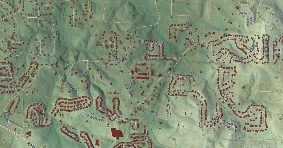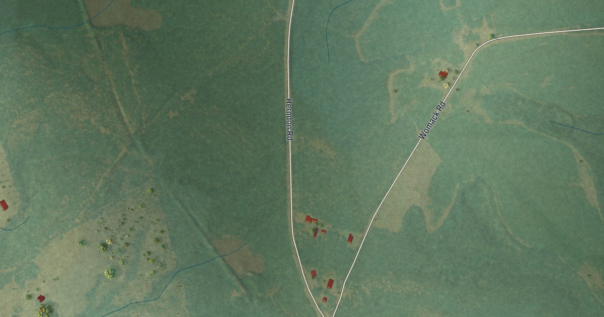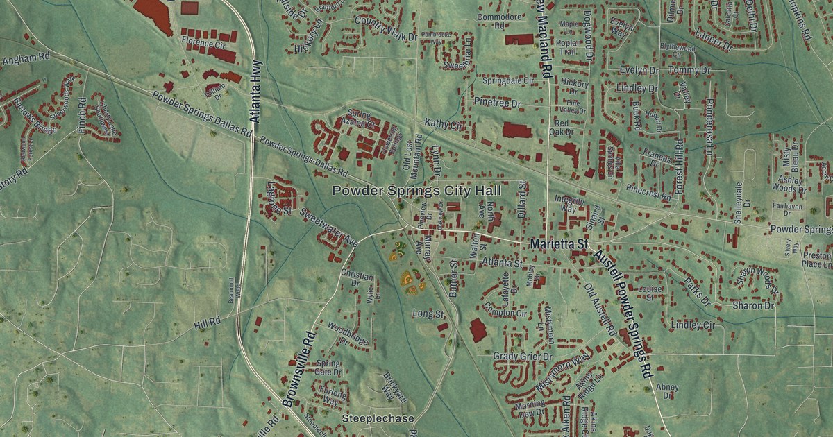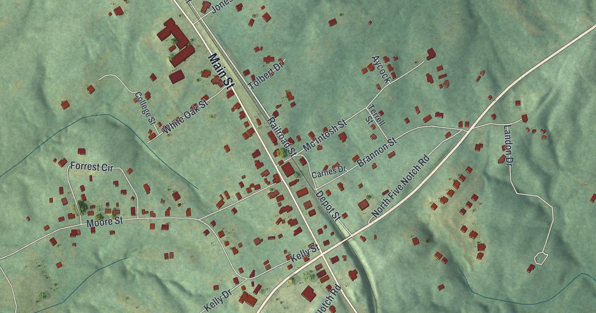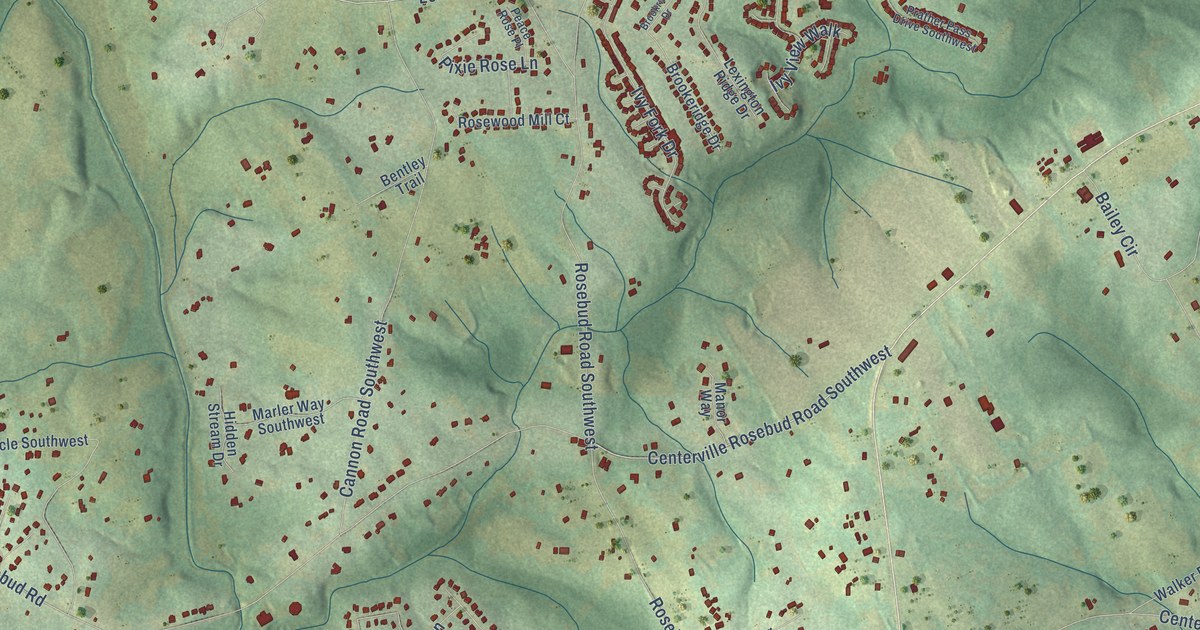
This beautifully detailed map of Rosebud, Georgia was created in 2026 using aerial imagery combined with modern topographical, census, street and landmark data. It’s a one-of-a-kind view of Rosebud that combines accurate data with a vintage aesthetic. The map shows every building in its true location, many of the roads carry their names, and the shaded topographic relief shows the shape of the land.
Explore an aerial view of Rosebud, Georgia
On the map you’ll find Lenora and McElroys Mill, along with Loganville Highway, Temple Johnson Road, Skyland Drive Southwest, Red Rose Lane, Centerville Rosebud Road Southwest, Hidden Forest Drive Southwest, Brushy Fork Road, Lenora Church Road, Old Loganville Road Southwest, Rosebud Road Southwest, and more. If you look closely you can even find your house accurately drawn in its correct location. Zoom in on the preview to look for yours.
Take a closer look at the Rosebud map
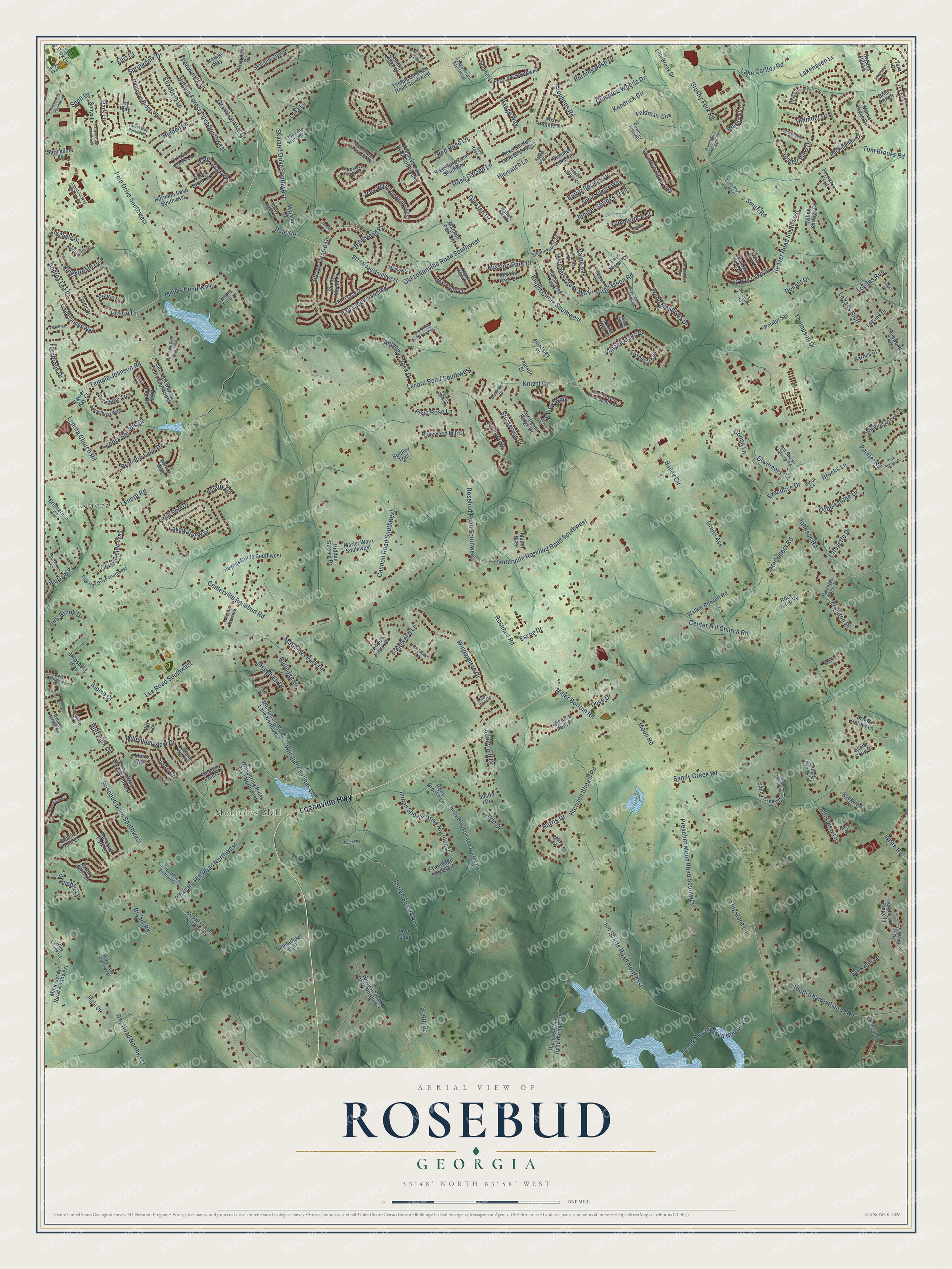
Names on this map
These names are printed on this map.
Places: Lenora and McElroys Mill.
Streets and roads: Loganville Highway, Temple Johnson Road, Skyland Drive Southwest, Red Rose Lane, Centerville Rosebud Road Southwest, Hidden Forest Drive Southwest, Brushy Fork Road, Lenora Church Road, Old Loganville Road Southwest, Rosebud Road Southwest, Pate Road, Centerville Rosebud Road.
More street names, A to Z
Abbie Kilgore Way, Alaina Avenue, Alpine Court, Andrea Lee Court, Anthony Creek Drive, Aviator Circle, Bailey Circle, Barnes Court, Barrington Manor Drive, Beau Point Court, Beaut Court, Beaver Pond Court, Beaver Road Southwest, Beaverton Circle, Bentley Trail, Black Fox Drive, Black Shoals Road Northeast, Booth Road, Brandon Lake Drive, Braswell Lane, Brenteresa Court, Briar Run Court, Brighton Place, Brookeridge Drive, Brook Hollow Lane, Brook Lane, Brookridge Drive, Brooks Lane, Brushy Fork Road Southwest, Brushymill Court, Bryant Road, Burning Bush Drive, Butler Springs Drive, Camouflage Trail, Cannon Road Southwest, Carriage Downs Court Southwest, Center Hill Church Road, Centurian Way Vw, Chafin Point Court, Cherrywood Drive, Cobblestone Drive, Compton Woods Drive, Countryside Way, Creekmore Lane, Creekwood Trail, Crested View Drive, Crimson Creek Lane, Day Road Northwest, Donald Drive, Donna Lane, Dove Court Southwest, Dove Drive, Duval Point Way Southwest, East Park Drive, Edenbrooke Circle, Elizabeth Lane, Ellis Court, Elm Trace Drive, Era Trce, Escoe Drive, Ewing Farm Drive, Executive Drive, Fall Creek Landing, Fawn Ledge, Fawnledge Northeast, Feldman Chs, Fernbrook Drive, Fieldwood Lane, Flagstone Lane, Foxberry Run, Fox Run, Fredricksberg Drive, Glen Ian Drive, Glen Summit Lane, Governors Circle, Grand Central Drive, Granite Falls Lane, Green Avenue, Greenridge Drive, Grove Lake Street, Hampton Ridge Way, Hapsburg Way, Haralson Mill Road Northeast, Harms Way, Harris Drive, Harrison Shoals Road, Haynes Circle Southwest, Haynes Creek Drive Northeast, Haypatch Lane, Henderson Ridge Lane, Hidden Creek Drive, Hidden Lane, Hidden Stream Drive, Hillmont Drive, Hogans Mill Lane, Holly Brooke Lane, Holly Brooke Lane Northeast, Holly Manor Drive, Huff Park Court, Hurndon Road Southwest, Indian Shoals Drive Northeast, Indian Shoals Road, Industrial Way Southwest, Ingle Court, Inns Brook Drive, Irvin Drive, Ivy Fork Drive, Ivy View Walk, Ivy Way, Janel Lane, Jensen Court, Jim Scaffe Road Northeast, Johnson Road, Joseph Eli Drive, Julianna Drive, Juniper Springs Trail, Justin Drive, Kendrick Circle, Kenilworth Court, Kingstream Drive, Knight Circle, Knight Circle Southwest, Lafayette Drive, Lake Carlton Road, Lakehaven Lane, Lake Port Drive, Lakeside Court, Lakewater Way, Laurel Way Southwest, Lee Road Southwest, Lenora Road, Lenora Road Southwest, Lenora Springs Drive, Lexington Ridge Drive, Lilly Brook Drive, Logan Ridge Circle, Logans Bluff, Logans Drive, Logans Run, Logans Terrace, Longfield Drive, Lyda Lane, Lyda Lane Southwest, Maes Overlook, Manor Ridge Drive, Manor Way, Marham Park Circle, Marler Way Southwest, Matthews Park Drive, McCuller Road, McCullers Road, Meadow Point Drive, Metro Way, Michaels Creek Way, Mill Court, Millenium View Drive, Miller Bottom Road, Millers Pond Lane, Millers Pond Way, Mink Livsey Road, Mink Livsey Road Northwest, Minnow Court, Mission Park Court, Mission Park Drive, Moon Road, Newbury Place Drive, Notting Glen Lane, Oak Field Drive, Oakwilde Court, Old Sharon Church Road, Park Hill Circle Southwest, Park Lane, Parkside Way Southwest, Pate Brook Road, Pate Creek Vw, Pate Drive Southwest, Pate Ridge Drive Southwest, Pate Road Southwest, Peace Rose Place, Pearson Street, Pebblestone Drive, Periwinkle Drive, Perrinton Trail, Pixie Rose Lane, Pleasant Hill Road Northwest, Pointer Road, Pointer Spr, Polly Place, Prairie Drive, Prairie Lane, Prather Pass Drive Southwest, Prather Son Drive, Preacher Moon Road Southwest, Preserve Park Drive Southwest, Preserve Run Trail, Preserve Wood Lane Southwest, Range Road Southwest, Range Way, Red Rose Court, Red Rose Lane Southwest, Richards Drive Southwest, Rockberry Court, Rock Court, Rockdale Circle, Rockingham Drive, Rock Patch Road, Rock Springs Court, Rockview Lane, Rockview Terrace, Rosebud Drive Northwest, Rosebud Drive Southwest, Rosebud Park Drive, Rosebud Road, Rose Garden Lane, Rose Garden Lane Southwest, Rosegate Drive, Rose Pointe Drive, Rosetta Lane Northwest, Rosewood Mill Court, Ruby Lane Northwest, Rutledge Drive, Sandy Cove Drive, Sandy Creek Circle, Sandy Creek Court, Sandy Creek Road, Savannah Ridge Trail, Sawyer Parkway, Score Court, Shady Maple Lane, Shady Oaks Drive, Shepherds Lane, Silvery Way, Skyland Drive, Skyland Glen Drive, Smith Road, Smith Road Southwest, Snell Drive, Sonya Lane, South Sharon Church Road, Springdale Drive, Springdale Road, Starlite Way, Stephens Pond Vw Southwest, Stephens Road, Sugar Creek Circle, Summer Lake Terrace, Summer Leigh Court, Summer Place, Summit Glen Drive, Summit Heights Drive, Summit Place Drive, Sunny Hill Drive, Sweetbriar Trce, Sweetbriar Walk, Tara Court, Temple Johnson Road Southwest, Thompson Drive, Tom Brooks Road, Tradd Court, Traddsprings Way, Tumblerock Court, Twin Manor Drive, Victoria Park Drive, Village Centre Drive, Vintage Oaks Drive, Violet Way Court, Virgil Moon Crossing, Virgil Moon Road, Walker Bennett Road, Walters Park Drive, Waverly Downs Drive, Webb Meadows Drive, Whispering Pines Lane, Whispering Pines Lane Northwest, Whispering Pines Trail Northwest, White Road, Willow Springs Drive, Windermere Drive, Winding Grove Lane, Windlake Drive Southwest, Winnstead Place, Woodsley Place, Wynship Lane, Xavier Ray Court, Zoey Lee Drive.
See it on a wall
The Rosebud map as a framed print. Swipe for more.


This beautifully detailed map of Rosebud makes an attractive addition to your office, library, or den, and it can even be used to teach children the geography and history of the area. It also makes a great gift for anyone with Rosebud roots. When you’re done exploring, click here to get your copy of the Rosebud map.