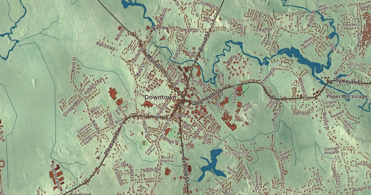
Bridgewater people know their town by its neighborhoods, Stanley, Scotland, Paper Mill Village and South Bridgewater, and by “the Nip,” Lake Nippenicket out on the western edge. This map prints Pleasant Street, Plymouth Street, Pond Street, Broad Street, Main Street and Bedford Street, with Lake Nippenicket, Carver Pond, Blood Pond, Osceola Island and Spragues Hill. Click here to purchase a print of this map for your wall.
Bridgewater is in Plymouth County, about 25 miles south of Boston.
KNOWOL made this map in 2026 from public survey data and gave it the look of an old atlas. United States Geological Survey elevation data gives the land its shading, and the Census Bureau gives the roads and the town line. Bridgewater covers 28.2 square miles between West Bridgewater, East Bridgewater, Halifax, Middleborough and Raynham, about five miles south of Brockton. It became a city government in 2010 but kept “the town of” in its name, and it had 28,633 people at the 2020 census.
A township from Duxbury
Between 1946 and 1951, archaeologists digging the Titicut site on the Taunton River in Bridgewater turned up thousands of artifacts going back to the Early Archaic period. In 1645 the land was bought from the Native people as part of Duxbury by 54 proprietors, most of whom never moved here. The Town of Bridgewater’s recorded history, in the Secretary of the Commonwealth’s list, dates European settlement to 1650. Bridgewater was set up as a township of Plymouth Colony on June 3, 1656, the year the state’s list gives for its incorporation as a town, and it was placed in Plymouth County when the counties were formed in 1685. The town remains part of Plymouth County today.
The old township was much larger than today’s town. It grew by annexation from 1662 to 1798, and North Bridgewater, set off from it in 1821, is now the city of Brockton. The bounds of the town proper were fixed in 1846.
The first normal school
Horace Mann founded the Bridgewater Normal School, and it opened on September 9, 1840, in the basement of the old town hall, with 21 women, seven men and a single instructor, the principal Nicholas Tillinghast. It was one of the first normal schools in the nation, and the oldest permanently located public college in Massachusetts. In 1845 the state agreed to build it a home, the first building ever put up in America to prepare teachers, and at its dedication in 1846 Mann called it the first normal schoolhouse “in this hemisphere.” The school has had many names since, and became Bridgewater State University in 2010. It’s called the “home of teacher education in America” and is the largest of the state’s nine state universities.
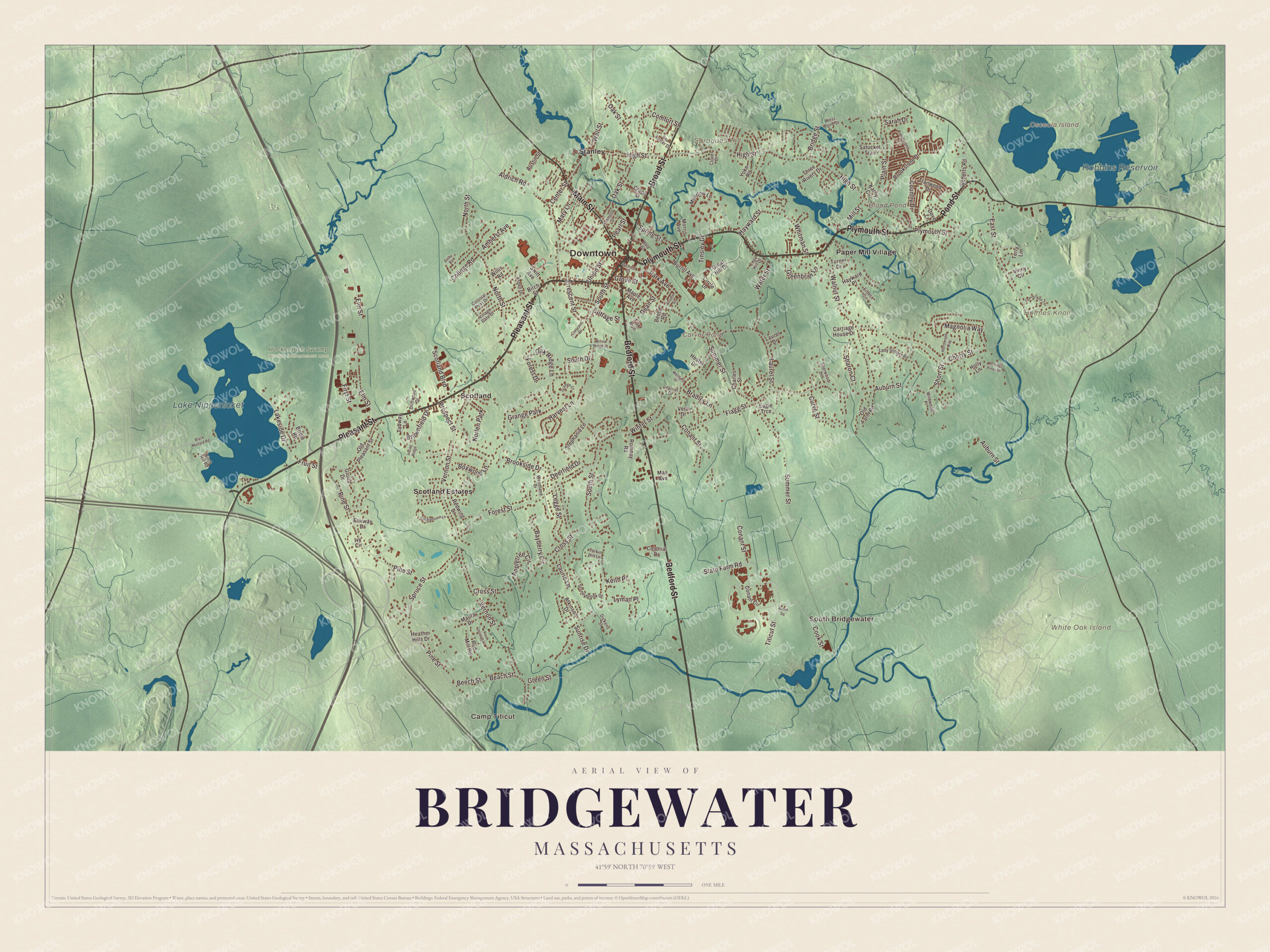
Click to explore a larger preview. The digital watermark does not appear on printed maps.
Names on this map
These names are printed on this map.
Places: Downtown, Camp Titicut, South Bridgewater, Holmes Knoll, Osceola Island, Spragues Hill, White Oak Island, Blood Pond, Carver Pond, Lake Nippenicket, Robbins Reservoir, Hockomock Swamp Wildlife Management Area, Paper Mill Village, Scotland, Scotland Estates, Stanley, Grange Park and Norlen Park.
Streets and roads: Pleasant Street, Plymouth Street, Pond Street, Broad Street, Main Street, Bedford Street, High Street, East Street, Flagg Street, Elm Street, South Street, Summer Street.
More street names, A to Z
Alden Square, Aldrich Road, Amherst Avenue, Appletree Circle, Aspen Drive, Atkinson Drive, Auburn Street, Austin Street, Bayberry Circle, Beach Street, Beebe Road, Beech Street, Birch Hill Road, Birch Street, Black Mallard Road, Bourne Street, Boxwood Lane, Bradley Lane, Bridge Street, Bridle Road, Brookside Drive, Brookstone Drive, Brownfield Drive, Burrill Avenue, Carriage House Drive, Center Street, Charles Street, Cherry Street, Circle Drive, Clover Drive, Cobblestone Lane, Colby Road, College Road, Colonial Drive, Colonial Post Drive, Comfort Street, Conant Circle, Conant Street, Cook Street, Cottage Street, Country Drive, Crapo Street, Crescent Drive, Crescent Street, Cross Street, Curve Street, Dean Street, Deerfield Drive, Dickens Street, Dove Lane, Driftwood Drive, Eagle Trce, Edge Hill Drive, Erbeck Circle, Fairway Drive, Fieldstone Circle, First Street, Forest Drive, Forest Street, Fox Run, Fruit Street, Gloria Drive, Grange Court, Great Hill Drive, Greenbrier Lane, Green Street, Grove Street, Hale Street, Hammond Street, Harriet Drive, Hartswood Way, Harvest Lane, Hayward Place, Hayward Street, Heather Hills Drive, Hester Drive, Holly Lane, Indian Ridge, Ivy Circle, Kathy Circle, Keith Place, Lady Slipper Road, Lakeside Drive, Laurel Drive, Laurel Street, Laurie Lane, Legge Street, Lyman Place, Mae Avenue, Magnolia Way, Maple Avenue, Mary Lane, Maura Drive, Meadow Lane, Mill Street, Morris Avenue, North Street, Oak Ridge Lane, Oak Street, Old Farm Road, Old Pleasant Street, Park Avenue, Paul Joseph Lane, Pearl Street, Pine Street, Plain Street, Prospect Street, Red Mill Road, Redwing Drive, Roberts Road, Rolling Pines Drive, Romney Road, Sarah Drive, Satucket Trail, School Street, Scotland Boulevard, Sea Tower Drive, Sharon Court, Sherwood Lane, Short Street, South Drive, Spring Street, Spruce Street, State Farm Road, Stephanie Lane, Stoneybrook Drive, Sunrise Drive, Swift Avenue, Tabway Lane, Tarkin Hill Lane, Terry Lane, Three Rivers Drive, Tinsley Drive, Titicut Street, Tommi Ann Terrace, Trailwood Drive, Turner Drive, Union Street, Vera Drive, Vernon Street, Village Gate Drive, Vinny Circle, Wall Street, Walnut Street, Water Street, Wellfield Drive, West Pond Street, Whitman Street, Wildwood Place, Willis Road, Willow Ridge Drive, Winter Street, Woodland Drive, Yoke Road.
See it on a wall
The Bridgewater map as a framed print. Swipe for more.


Iron on the Town River
The Bridgewater Iron Works on High Street, on the banks of the Town River, goes back to 1694, when David Perkins was allowed to dam the river; he had a blacksmith shop there by 1707. In 1785 the brothers Isaac and Nathan Lazell built a slitting mill on the site, the second in the country to go up after the Revolution, and the works later made cannon in the War of 1812 and iron pots for the whaling trade. By 1860 the Bridgewater Iron Company was one of the largest in the country, forging heavy parts for the Navy’s ironclads, the USS Monitor and the USS New Ironsides among them, and it employed about 600 men by 1868. In 1899 the Stanley Works of New Britain, Connecticut, bought the plant, and the neighborhood around it has been called Stanley ever since. The last foundry closed in 1988, and the 12-acre site, given to the town in 1994, is now Iron Works Park, with a small bridge over the river and the remnants of several buildings.
Around the map
Start in South Bridgewater, then follow Pleasant Street, Plymouth Street, Pond Street, Broad Street, Main Street and Bedford Street across town, and look outward toward Paper Mill Village, Scotland and Stanley. The Taunton River begins in Bridgewater where the Town and Matfield rivers meet, and runs 37 miles to Mount Hope Bay; it’s the longest coastal river in New England without dams. Lake Nippenicket, the largest of the town’s ponds, drains to the Town River, and a good part of it lies in the Hockomock Swamp Wildlife Management Area. The Hockomock is considered the largest freshwater swamp in the state. Osceola Island, Blood Pond, Carver Pond, Lake Nippenicket and Spragues Hill are all printed on the map, along with Paper Mill Village.
Bridgewater’s map makes a fine addition to an office, library or den, and it can help teach children the geography and history of the town where America first built a school for teachers. It’s made for people who call Bridgewater home, from Scotland to Stanley, and it shows the town as it looks today. Zoom in on the preview above to explore the details, then click here to get your copy of the Bridgewater, Massachusetts map.

Sources
- Bridgewater, Massachusetts, Wikipedia
- Hockomock Swamp, Wikipedia
- Brockton, Massachusetts, Wikipedia
- Bridgewater State University, Wikipedia
- Bridgewater Iron Works, Wikipedia
- Taunton River, Wikipedia
- Lake Nippenicket, Wikipedia
- City and Town Incorporation and Settlement Dates, Secretary of the Commonwealth of Massachusetts (archived copy)