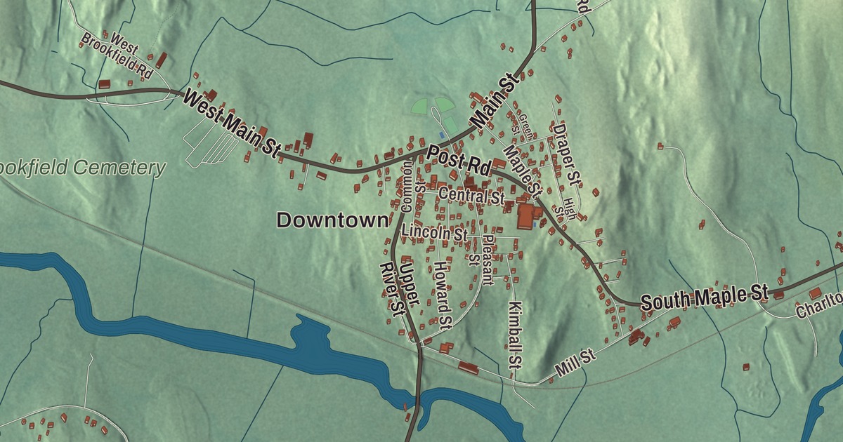
Ask anyone from Brookfield for directions and you’ll hear about West Main Street, which is Route 9 through the center, and the big ponds down on the East Brookfield line. This map prints West Main Street, Main Street, Fiskdale Road, North Brookfield Road, Post Road and South Maple Street, with Quaboag Pond, Quacumquasit Pond, Baker Pond, Cranberry Pond and three hills. Click here to purchase a print of this map for your wall.
Brookfield is in Worcester County, 18 miles west of Worcester.
KNOWOL made this map in 2026 from public survey data and gave it the look of an old atlas. The relief comes from United States Geological Survey elevation data, and the streets and the town line come from the Census Bureau. Brookfield covers 16.6 square miles along the Quaboag River, whose banks are swampy and partly kept as wildlife management areas. The land is mostly flat, with a few small hills in the southern half of town, and 3,439 people lived here at the 2020 census.
Quaboag Plantation
Men from Ipswich settled here as part of the Quaboag Plantation lands, and the town’s own page dates the first European settlement to 1660. The Town of Brookfield’s recorded history, in the Secretary of the Commonwealth’s list, gives 1664 instead. It was one of the most isolated settlements in the colony, and after King Philip’s War reached it in August 1675 it lay empty for twelve years. Brookfield was incorporated as a town in 1718, and it remains part of Worcester County today.
Brookfield was once much bigger. Three towns have been carved from its lands: North Brookfield in 1812, West Brookfield in 1848 and East Brookfield in 1920. The neighbors to the northwest, north and east were all once part of it, and Sturbridge, a short stretch of Brimfield and Warren round out the town line.
Knox’s cannon and Washington’s horses
In the winter of 1776 General Henry Knox came through town hauling cannon from Fort Ticonderoga to end the Siege of Boston, and a marker along Route 9 remembers his route. Massachusetts and New York began placing the plaques of the Henry Knox Trail in 1926, the march’s 150th anniversary. In 1789 George Washington, the first president, toured five New England states, and across from the old Brookfield Inn on West Main Street a memorial names this part of the road the George Washington Memorial Highway.
He didn’t stay the night. His party would have stopped here, the town page says, except that the innkeeper, Mrs. Bannister, was in bed with a terrible headache. Woken up, she took him for a college president and sent him on to Spencer. When she learned who it was, she’s supposed to have said: “Bless me! One look at that good man would have cured my aching head.” That tour became the basis for all the “George Washington slept here” claims, but in Brookfield he only watered his horses.
Two Brookfield children who made their names
Mary Jane Hawes was born here in 1825, one of nine children in a family of modest means. She was teaching school at 13 and published her first story at 15. As Mary Jane Holmes she went on to write 39 novels about domestic life in small towns and the countryside, and her books sold some 2 million copies in her lifetime, second only to Harriet Beecher Stowe’s, her page says. Arthur Louis Day, born in Brookfield in 1869, became a geophysicist and volcanologist who ran the Geophysical Laboratory of the Carnegie Institution for Science from 1907 until he retired in 1936, and he served as vice president of the National Academy of Sciences.
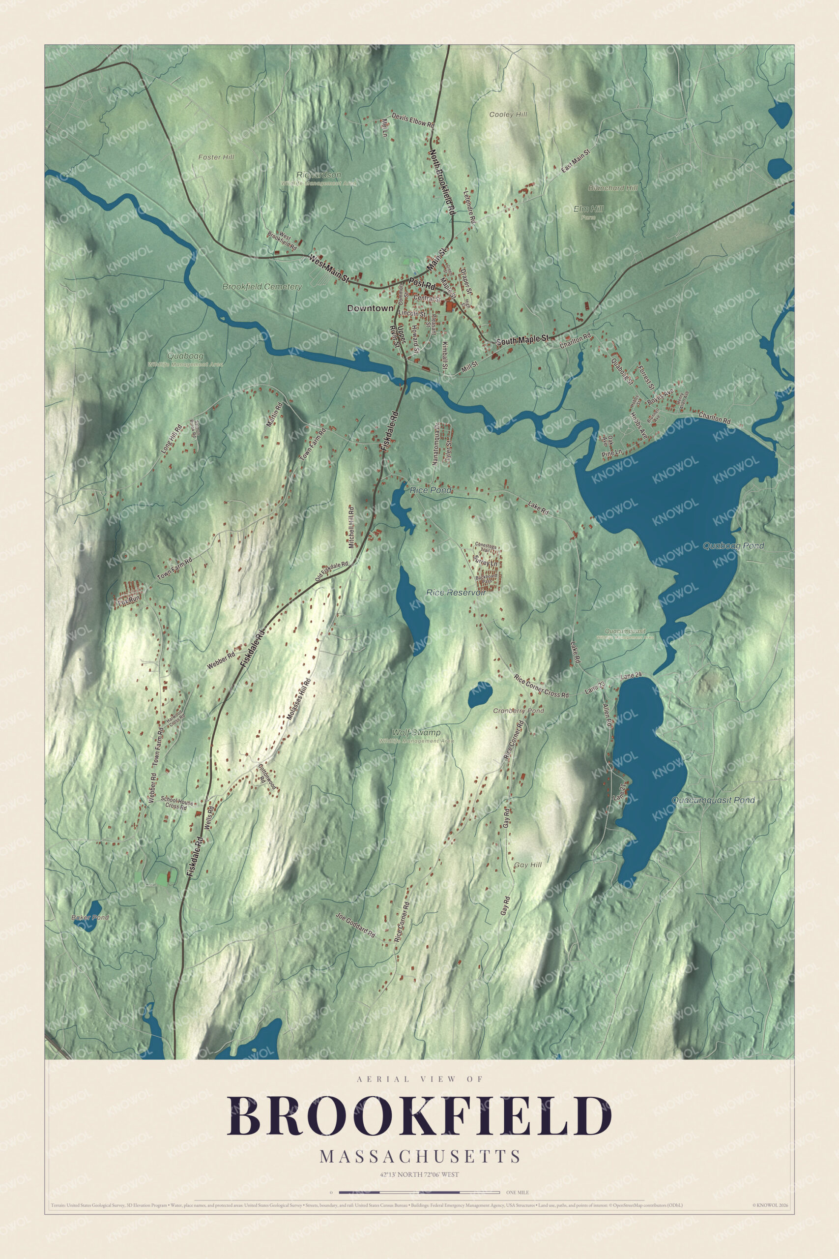
Click to explore a larger preview. The digital watermark does not appear on printed maps.
Names on this map
These names are printed on this map.
Places: Downtown, Blanchard Hill, Cooley Hill, Foster Hill, Gay Hill, Baker Pond, Cranberry Pond, Quaboag Pond, Quacumquasit Pond, Rice Reservoir, Rice Pond, Brookfield Cemetery, Elm Hill Farm, Quaboag Wildlife Management Area, Quacumquasit Wildlife Management Area, Richardson Wildlife Management Area and Wolf Swamp Wildlife Management Area.
Streets and roads: Fiskdale Road, West Main Street, North Brookfield Road, Main Street, Post Road, South Maple Street, Central Street, Lincoln Street, East Main Street, Molasses Hill Road, Hobbs Avenue, Tyler Street.
More street names, A to Z
Allen Road, Boyes Avenue, Brunnell Avenue, Buckboard Pass, Charlton Road, Common Street, Conestoga Trail, Cottonwood Road, Devils Elbow Road, Draper Street, Forrest Street, Fox Run, Gay Road, Green Street, Harwood Cross Road, Henry Allen Avenue, High Street, Hobbs Street, Howard Street, Joe Goddard Road, Kimball Street, Lake Road, Lane 21, Lane 23, Lane 24, Letendre Road, Long Hill Road, Maple Street, Martin Road, Mel Lane, Mill Street, Mitchell Hill Road, Nanatomqua Drive, Oak Avenue, Old Fiskdale Road, Pine Lane, Pleasant Street, Quaboag Street, Rice Corner Cross Road, Rice Corner Road, Salmon Brook Road, School House Cross Road, Surrey Lane, Town Farm Road, Upper River Street, Webber Road, Wells Road, West Brookfield Road.
See it on a wall
The Brookfield map as a framed print. Swipe for more.


Around the map
Start in the center, where Route 9 and Route 148 meet, then follow West Main Street, Main Street, Fiskdale Road, North Brookfield Road, Post Road and South Maple Street across town. The old Boston and Albany Railroad still runs through Brookfield, now owned by CSX, and Amtrak’s Lake Shore Limited uses the line between Worcester and Springfield without stopping here. The public library got its start in the 1860s.
Along the East Brookfield border lie two big ponds, Quaboag Pond to the north and Quacumquasit Pond to the south, the second reaching into Sturbridge. Quacumquasit drains into Quaboag Pond, which was once called Podunk Pond, and the Quaboag River starts there and runs west for 25.7 miles to Three Rivers, where it helps form the Chicopee River. The river takes its name from the pond, an Indian name meaning “red-water” place or pond. Baker Pond, Cranberry Pond, Quaboag Pond, Quacumquasit Pond, Blanchard Hill, Cooley Hill and Foster Hill are all printed on the map.
Brookfield’s map makes a handsome addition to an office, library or den, and it can help teach children the geography and history of the town that gave three other Brookfields their start. It’s made for people who call Brookfield home, and it shows the town as it looks today. Zoom in on the preview above to explore the details, then click here to get your copy of the Brookfield, Massachusetts map.

Sources