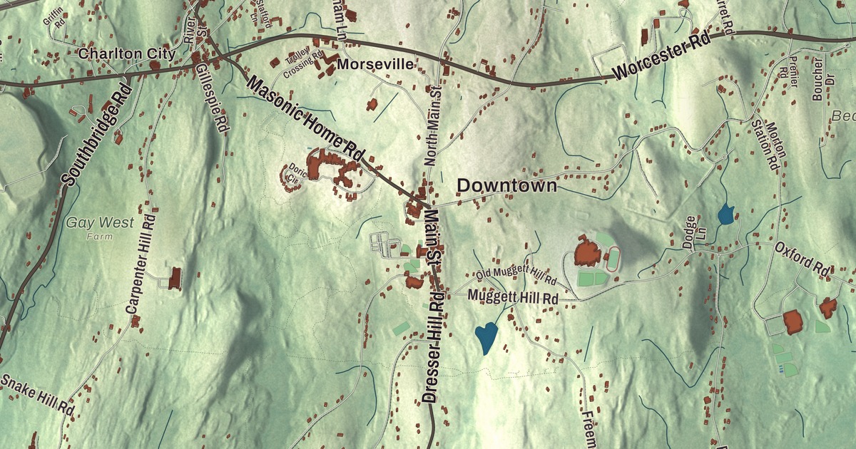
Charlton is a big town with several villages, among them Charlton City, Charlton Depot and Northside, and its main roads are named for the neighbors they lead to. This map prints Worcester Road, Southbridge Road, Sturbridge Road, Main Street, City Depot Road and Masonic Home Road, with Glen Echo Lake, Ashworth Pond, Baker Pond, the South Charlton Reservoir, Austin Hill, Barnes Hill and Beacon Hill. Click here to purchase a print of this map for your wall.
Charlton is in Worcester County, first settled as part of Oxford.
KNOWOL made this map in 2026 from public survey data and gave it the look of an old atlas. The relief comes from United States Geological Survey elevation data, and the roads and the town line come from the Census Bureau. Charlton covers 43.8 square miles, nearly all of it land, and had 13,315 people at the 2020 census.
From district to town
The Town of Charlton’s recorded history, in the Secretary of the Commonwealth’s list, dates European settlement to 1735, when the land was part of Oxford. One of the first settlers was Jonathan Wheelock, whose house from that year still stands in Northside Village; he ran a tannery and a distillery on a nearby brook. Charlton was set off from Oxford as a district on January 10, 1755, and named for Sir Francis Charlton. Charlton was incorporated as a town in 1775, on August 23, under a law that turned all districts into towns to help the Revolutionary cause, and it remains part of Worcester County today.
Farming stayed the main work through the 1800s, and by the turn of the twentieth century woolen mills were going up along some of the town’s brooks. John Spurr, who was at the Boston Tea Party and the Battle of Bunker Hill and saw Burgoyne’s surrender at Saratoga, later became a major general in the state militia; his 1798 house on Main Street is on the National Register.
The Rider Tavern
On the old stage road between Worcester and Hartford, Northside Village grew up around Wheelock’s tannery and later the coaches. Eli Wheelock began building a grand inn there in 1797, using materials gathered within six miles of the village, and after his death that year his partner Leonard Morey finished it in 1799. Brothers Isaiah and William Rider bought most of it in 1801, and as the Rider Tavern it became a major stop for stagecoach travelers, the Marquis de Lafayette among them. In the 19th century it had the only roof garden in New England outside Boston, its page says. The Charlton Historical Society owns it now and opens it for tours in summer.
The man who brought ether to surgery
William Thomas Green Morton was born in Charlton in 1819 and grew up in the Waters-Morton House in Northside Village. He became a dentist, and on October 16, 1846, at Massachusetts General Hospital, in a now-famous demonstration, the surgeon John Collins Warren removed a tumor from a patient’s neck without pain after the patient breathed ether. Morton was the first to publicly demonstrate inhaled ether as a surgical anesthetic, and news of it spread around the world; the operating room is preserved as the Ether Dome. He’s credited with winning the medical world’s acceptance of surgical anesthesia.
Another famous name rests here. John “Grizzly” Adams, the frontiersman famous for his grizzly bears, is buried at the Bay Path Cemetery in Charlton, under a tombstone believed to have been commissioned by P. T. Barnum.
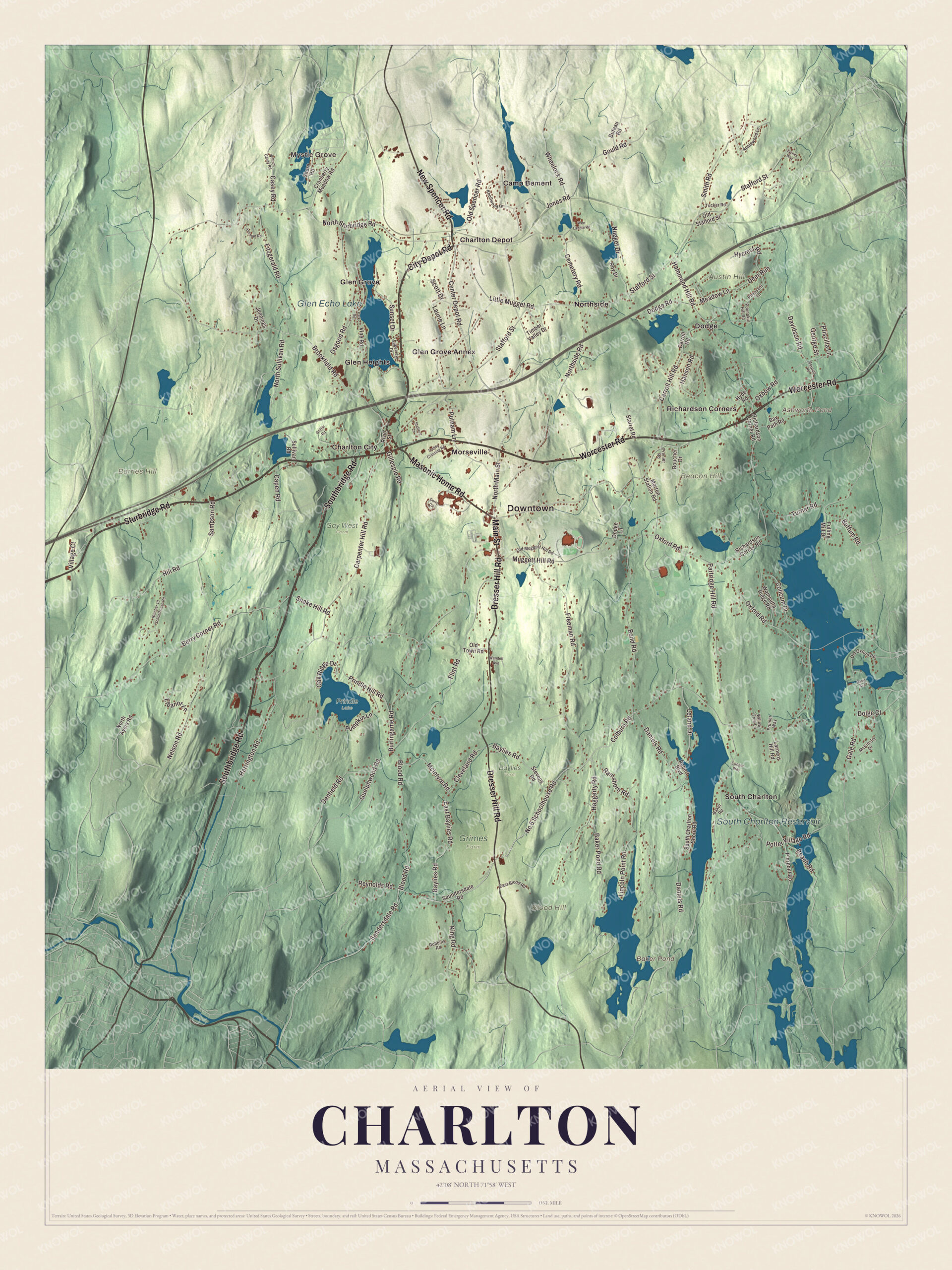
Click to explore a larger preview. The digital watermark does not appear on printed maps.
Names on this map
These names are printed on this map.
Places: Downtown, Mystic Grove, Austin Hill, Barnes Hill, Beacon Hill, Blood Hill, Ashworth Pond, Baker Pond, South Charlton Reservoir, Glen Echo Lake, Baylies Farm, Gay West Farm, Grimes Farm, Prindle Lake, Camp Bement, Charlton City, Charlton Depot, Dodge, Glen Grove, Glen Grove Annex, Glen Heights, Morseville, Northside, Richardson Corners and South Charlton.
Streets and roads: Worcester Road, Southbridge Road, Sturbridge Road, City Depot Road, Main Street, Masonic Home Road, New Spencer Road, Dresser Hill Road, Center Depot Road, Sandersdale Road, North Main Street, No 6 Schoolhouse Road.
More street names, A to Z
Applewood Lane, Baker Pond Road, Baker Road, Baylies Road, Bay Path Road, Baypath Road, Beach Road, Berry Corner Road, Blood Road, Bond Road, Boucher Drive, Brookfield Road, Buffum Road, Burlingame Road, Buteau Road, Capen Road, Carpenter Hill Road, Carroll Hill Road, Carroll Road, Casey Road, Cemetery Road, Cleveland Road, Colburn Road, Colicum Drive, Cooper Way, Cranberry Meadow Road, Daniels Road, Davidson Road, Davis Avenue, Deer Run, Denfield Road, Dodge Lane, Dodge Road, Dolge Court, Doric Circle, East Baylies Road, East Blood Road, Eleanor Lane, Fitzgerald Road, Flint Road, Freeman Road, Fulling Mill Drive, Gale Road, George Street, Gillespie Road, Gould Road, Griffin Road, Guelphwood Road, Haggerty Road, Hammond Hill Road, Hanson Road, Harrington Road, Hill Road, Hycrest Road, Hyde Road, Jaynes Way, Jennings Drive, Jones Road, King Road, Knollwood Drive, Lakeview Drive, Larnerd Hill Road, Laurie Lane, Leland Drive, Lincoln Point Road, Little Mugget Road, McIntyre Road, McKinstry Drive, Meadow Lane, Morton Station Road, Muggett Hill Road, Nelson Road, North Ayers Road, Northside Road, North Sturbridge Road, North Sullivan Road, Nugget Drive, Number 10 Schoolhouse Road, Oak Ridge Drive, Old Muggett Hill Road, Old Oxford Road, Old Spencer Road, Old Stafford Street, Old Town Road, Osgood Road, Oxbow Road, Oxford Road, Park Road, Partridge Hill Road, Pheasant Lane, Pierpont Road, Ponnakin Hill Road, Potter Village Road, Prenier Road, Prindle Hill Road, Priscilla Lane, Prunier Way, Pumpkin Lane, Putnam Lane, Ramshorn Road, Reynolds Road, Richardson Corner Road, River Street, Robbins Road, Robert Boulevard, Roy Drive, Sampson Road, Saundersdale Road, Scott Drive, Shore Road, Smith Road, Snake Hill Road, South Charlton Shore Road, Stafford Lane, Stafford Street, Starret Road, Stevens Road, Sullivan Road, Sunset Drive, Timber Valley Drive, Trolley Crossing Road, Tucker Road, Turner Road, Village Court, Vine Road, Wamsutta Ridge Road, Wee Laddie Road, Wendell Avenue, Wheelock Road, William Casey Road, Willow Tree Lane, Yeoman Road.
Around the map
Start at Mystic Grove, then follow Worcester Road, Southbridge Road, Sturbridge Road, City Depot Road, Main Street and Masonic Home Road across town, and look outward toward Charlton City, Charlton Depot, Dodge, Glen Grove and Glen Grove Annex. The Charlton Center Historic District runs along Main Street from Mugget Hill Road to Masonic Home Road, with the Shingle style Overlook Hotel, the first architect-designed building in the center, and the 1905 Colonial Revival town hall, where memorials honor the town’s veterans. Buffumville Lake, a 200-acre Army Corps of Engineers flood control lake, is open for hiking, boating and fishing, with the 92-mile Midstate Trail at its north end, and Capen Hill Nature Sanctuary keeps 86 acres of free trails and a visitor center with rescued animals. Ashworth Pond, Baker Pond, the South Charlton Reservoir, Glen Echo Lake, Austin Hill, Barnes Hill and Beacon Hill are all printed on the map.
Charlton’s map makes a fine addition to an office, library or den, and it can help teach children the geography and history of the town where William Morton grew up. It’s made for people who call Charlton home, from Charlton City to Northside, and it shows the town as it looks today. Zoom in on the preview above to explore the details, then click here to get your copy of the Charlton, Massachusetts map.

We made a map for every town and city in Massachusetts. Explore the complete Massachusetts map collection and find your town.
Sources
- Charlton, Massachusetts, Wikipedia
- Northside Village Historic District, Wikipedia
- John Spurr House, Wikipedia
- Rider Tavern, Wikipedia
- William T. G. Morton, Wikipedia
- John “Grizzly” Adams, Wikipedia
- Charlton Center Historic District, Wikipedia
- Buffumville Lake, Wikipedia
- Capen Hill Nature Sanctuary, Wikipedia
- City and Town Incorporation and Settlement Dates, Secretary of the Commonwealth of Massachusetts (archived copy)