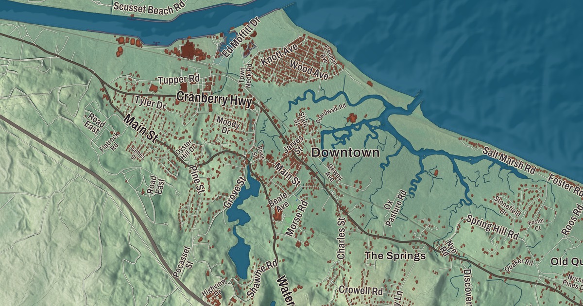
Sandwich’s town motto, Post tot Naufracia Portus, means “after so many shipwrecks, a haven,” and this map of Cape Cod’s oldest town prints Main Street, Water Street, Cranberry Highway, Forestdale Road, Barlow Road and Scusset Beach Road, with East Sandwich, Forestdale and the long reach of Mashpee and Wakeby ponds. Click here to purchase a print of this map for your wall.
Sandwich is in Barnstable County.
KNOWOL made this map in 2026 from public survey data, styled after an old atlas. United States Geological Survey elevation data shapes the hills and kettle ponds, and the roads and the town line come from the Census Bureau. Sandwich covers 44.2 square miles, with Cape Cod Bay to the north, Barnstable to the east, Mashpee and Falmouth to the south and Bourne to the west, about 57 miles south-southeast of Boston. The Cape Cod Canal enters the bay here. The town had 20,259 people at the 2020 census.
The oldest town on the Cape
Before the English came, this was the land of the Wampanoag, who helped the Pilgrims of Plymouth Colony in the 1620s, and the Mashpee Wampanoag Tribe still lives on Cape Cod. The town page says a group of settlers from Saugus founded Sandwich in 1637 with Plymouth Colony’s permission, naming it for the seaport of Sandwich in Kent, England. The Town of Sandwich’s recorded history, in the Secretary of the Commonwealth’s list, dates European settlement to 1630. Sandwich was incorporated as a town in 1639, and it shares the title of oldest town on Cape Cod with Yarmouth. Its western part broke away to become the town of Bourne in 1884.
Sandwich was the site of an early Quaker settlement, and today it hosts the oldest continuous Quaker meeting in the country. The Hoxie House, a saltbox where the Reverend John Smith lived around 1675, is likely the oldest house still standing in the area. Smith, the town’s pastor from 1673 to 1689, urged tolerance of the Quakers. His family kept the house until 1856; a retired whaling captain, Abraham Hoxie, owned it next, and the town restored it in 1959 and runs it as a museum.
Glass and the canal
Farming, fishing and trade carried the town at first. In 1825 Deming Jarves started a glass factory in Sandwich, which had a shallow harbor, a likely canal route and timber to feed the furnaces. His Boston and Sandwich Glass Company made glass in town from 1826 to 1888. It was one of the first factories to make pressed glass, and it perfected the process; it worked mostly in lead glass and was known for its color, and Jarves won several patents for his molds and pressing methods. The Sandwich Glass Museum holds many of the company’s pieces. Work on the Cape Cod Canal through town began in 1909, and the canal opened in 1914.
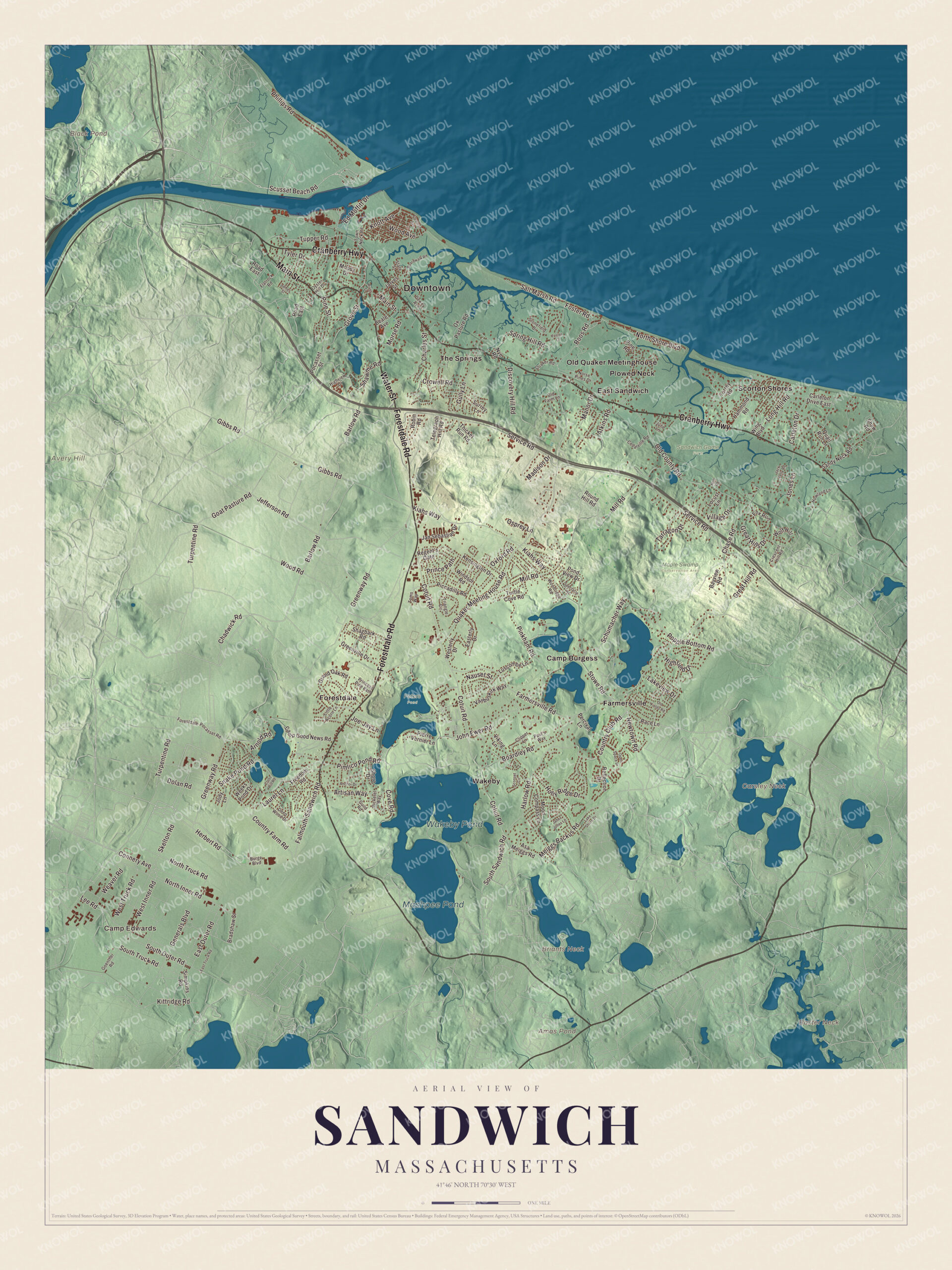
Click to explore a larger preview. The digital watermark does not appear on printed maps.
Names on this map
These names are printed on this map.
Places: Downtown, Camp Edwards, Avery Hill, Baxter Neck, Briants Neck, Carsley Neck, Amos Pond, Black Pond, Mashpee Pond, Wakeby Pond, Maple Swamp Conservation Area, Peters Pond, Sandwich Game Farm, Camp Burgess, East Sandwich, Farmersville, Forestdale, Old Quaker Meetinghouse, Plowed Neck, Scorton Shores, The Springs and Wakeby.
Streets and roads: Cranberry Highway, Forestdale Road, Main Street, Water Street, Scusset Beach Road, Barlow Road, Farmersville Road, Chadwick Road, Country Club Road, North Inner Road, Jefferson Road, Tupper Road.
More street names, A to Z
Anchor Drive, Arnold Road, Artisan Way, Asa Meiggs Road, Atkins Road, Bayview Road, Beale Avenue, Boardley Road, Boardwalk Road, Bradshaw Street, Burge Boulevard, Camp Good News Road, Carleton Drive, Carleton Drive East, Cedarville Road, Charles Street, Chase Road, Clipper Lane, Connery Avenue, Cotuit Road, Country Farm Road, Cove Road, Crescent Hill Road, Cross Hill Road, Crowell Road, Deep Wood Drive, Dewey Avenue, Discovery Hill Road, Dolan Road, Easterly Drive, East Outer Road, East Truck Road, Ed Moffitt Drive, Falmouth-Sandwich Road, Flatrock Road, Forestdale-Pocasset Road, Foster Court, Foster Road, Fox Run, Freedom Road, Freeman Avenue, Generals Boulevard, Gibbs Road, Goat Pasture Road, Goenther Road, Grand Oak Road, Great Hill Road, Great Hills Drive, Greenville Drive, Greenway Road, Grove Street, Guild Road, Gully Lane, Hammond Road, Harlow Road, Herbert Road, Highfield Drive, Highview Drive, Holly Ridge Drive, Holt Road, Howland Lane, Jabez Jones Lane, Jack Kelly Road, James Street, Jan Sebastian Drive, Jarves Street, Jody Lane, Joe-Jay Lane, John Ewer Road, Jones Lane, June Lane, Kensington Drive, Kiahs Way, Kittridge Road, Knott Avenue, Lake Shore Drive, Lakeview Drive, Laurel Lane, Lee Road, Little Acorn Lane, Locust Lane, Long Hill Road, Luscombe Lane, Madison Drive, Manor Drive, Meiggs Backus Road, Mill Road, Moody Drive, Moon Compass Lane, Morse Road, Nauset Street, Newtown Road, Norse Pines Drive, North Shore Boulevard, North Truck Road, Nye Road, Old County Road, Old Farm Lane, Old Fields Road, Open Space Drive, Osprey Lane, Oxford Road, Ox Pasture Road, Oyster Hill Drive, Paul's Way, Percival Lane, Phillips Road, Piccadilly Road, Pickerel Way, Pierre Vernier Lane, Pimlico Pond Road, Pine Road, Pine Street, Pinkham Road, Pocasset Street, Pond View Drive, Popple Bottom Road, Prince Path, Princess Pine Path, Quail Run Lane, Quaker Meeting House Road, Quaker Road, Race Lane, Reflection Drive, Regent's Gate, River Street, Road East, Robin Road, Roos Road, Round Hill Road, Salt Marsh Road, Sandy Neck Road, Schumacher Way, Sconset Circle, Service Road, Shagbark Road, Shawme Road, Shaw Road, Shore Drive, Simpkins Road, Skelton Road, Snake Pond Road, South Outer Road, South Sandwich Road, South Truck Road, Spectacle Road, Spring Hill Road, State Street, Stonefield Drive, Stowe Road, Surrey Lane, Tarragon Drive, Telegraph Hill Road, Thicket Run Road, Toms Way, Torrey Road, Town Neck Road, Triangle Circle, Turpentine Road, Turtle Cove Road, Tyler Drive, Vanbuskirk Way, Viking Lane, Village Drive, Weaver Road, Weeks Pond Drive, Westerly Drive, West Inner Road, West Truck Road, Windsor Road, Wing Boulevard, Wolf Hill, Wood Avenue, Woodridge Road, Wood Road.
See it on a wall
The Sandwich map as a framed print. Swipe for more.


Around the map
Start with East Sandwich. Follow Cranberry Highway, Forestdale Road, Main Street, Water Street, Scusset Beach Road and Barlow Road across town. Then look outward toward Farmersville, Forestdale, Old Quaker Meetinghouse, Plowed Neck and Scorton Shores. Amos Pond, Black Pond, Mashpee Pond, Wakeby Pond, Avery Hill, Baxter Neck, Briants Neck and Scusset Beach are all printed on the map. Mashpee Pond and Wakeby Pond, which lie in both Sandwich and Mashpee, are kettle holes fed by groundwater; together they cover 729 acres and form the largest freshwater pond on Cape Cod. Scusset Beach State Reservation sits on the mainland side of the canal, unlike most of Sandwich, at the canal’s east end, with half a mile of beach, a 3,000-foot stone jetty and a trail up Sagamore Hill, once a Native American meeting ground. The Sandwich boardwalk, first built in 1875 by Gustavus Howland, runs 1,350 feet across the marsh to the Town Beach; after Hurricane Bob nearly wrecked it in 1991, it was rebuilt with money from 1,700 engraved planks. The town also has the Heritage Museums and Gardens, the Dexter Grist Mill and a museum for Thornton Burgess, the conservationist who wrote the Old Mother West Wind stories.
The Sandwich map makes a fine addition to an office, library or den, and it can help teach children the geography and history of Cape Cod’s oldest town. It’s made for people who call Sandwich home, from East Sandwich to Forestdale, and it shows the town as it looks today. Zoom in on the preview above to explore the details, then click here to get your copy of the Sandwich, Massachusetts map.

Sources