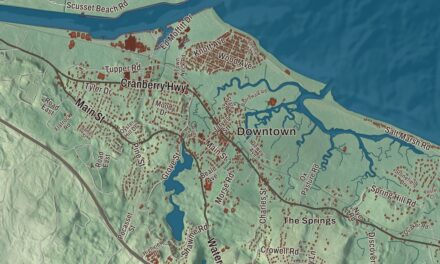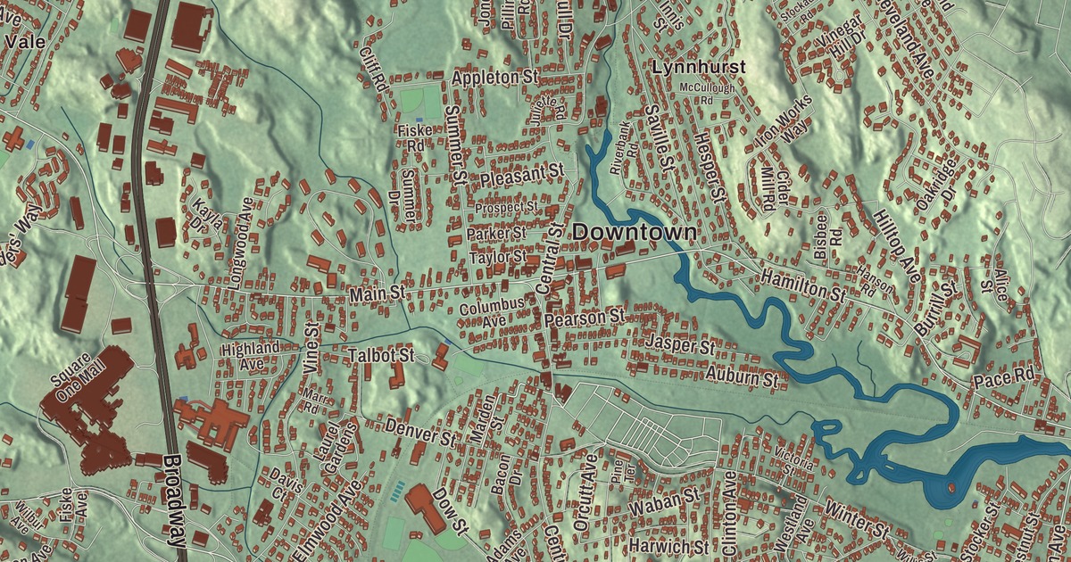
Saugus is known as the site of the first integrated iron works in North America, on the banks of the Saugus River, and this map of the town prints the Newburyport Turnpike, Broadway, Bennett Highway, Walnut Street, Water Street and the Salem Turnpike, with Breakheart Reservation to the north and Rumney Marsh to the south. Click here to purchase a print of this map for your wall.
Saugus is in Essex County.
KNOWOL made this map in 2026 from public survey data and gave it the dress of an old atlas. United States Geological Survey elevation data shapes the hills and the marsh, and the roads and the town line come from the Census Bureau. Saugus covers 11.8 square miles just inland from Massachusetts Bay, with Lynnfield to the north, Lynn to the east, Revere to the south and Melrose and Wakefield to the west, about 9 miles northeast of Boston. The town had 28,619 people at the 2020 census.
Hammersmith
When the English arrived in the 1620s, the Naumkeag, also called the Pawtucket, held the land from what’s now Boston to the Merrimack River under their leader Montowampate. The English took the name Saugus from the Pawtucket word for “outlet” and used it for the river and the country around it, which they renamed Lynn in 1637. The Town of Saugus’ recorded history, in the Secretary of the Commonwealth’s list, dates European settlement to 1630.
In 1646 the iron works on the Saugus River, then called Hammersmith, went into operation. Its manager, Richard Leader, picked a spot on the Saugus River, which carried shallow boats and could be dammed for power, with forests for charcoal and bog ore in the nearby ponds and swamps. The works made more than a ton of iron a day, but it never paid, and it closed around 1670. Its remains lay hidden under brush until the archaeologist Roland W. Robbins began digging there in 1948. A reconstruction opened as a museum in 1954, and in 1968 it became the Saugus Iron Works National Historic Site, with a blast furnace, forge and rolling mill run by seven large waterwheels, a wharf and a restored 17th-century house. On a rocky cliff near the works, tradition says, Major Samuel Appleton made a speech in 1687 against the rule of Governor Sir Edmund Andros, and the spot is known as Appleton’s Pulpit.
A town of its own
Saugus was officially incorporated as a town on February 17, 1815, and held its first town meeting that March in the parish church; it had 784 people then, and farming was its main work. Earlier, in 1804, Frederic Tudor had cut ice from a pond on his family’s farm here and shipped it to Martinique, the start of the nineteenth-century ice trade. New industries came with the Industrial Revolution: shoes and woolens in Saugus Center, tobacco in Cliftondale and East Saugus. After the Civil War, Cliftondale became a major tobacco producer, and the snuff factory in East Saugus was the largest producer of snuff in the country. On May 30, 1912, an airfield in Saugus saw the first airmail delivery in New England.
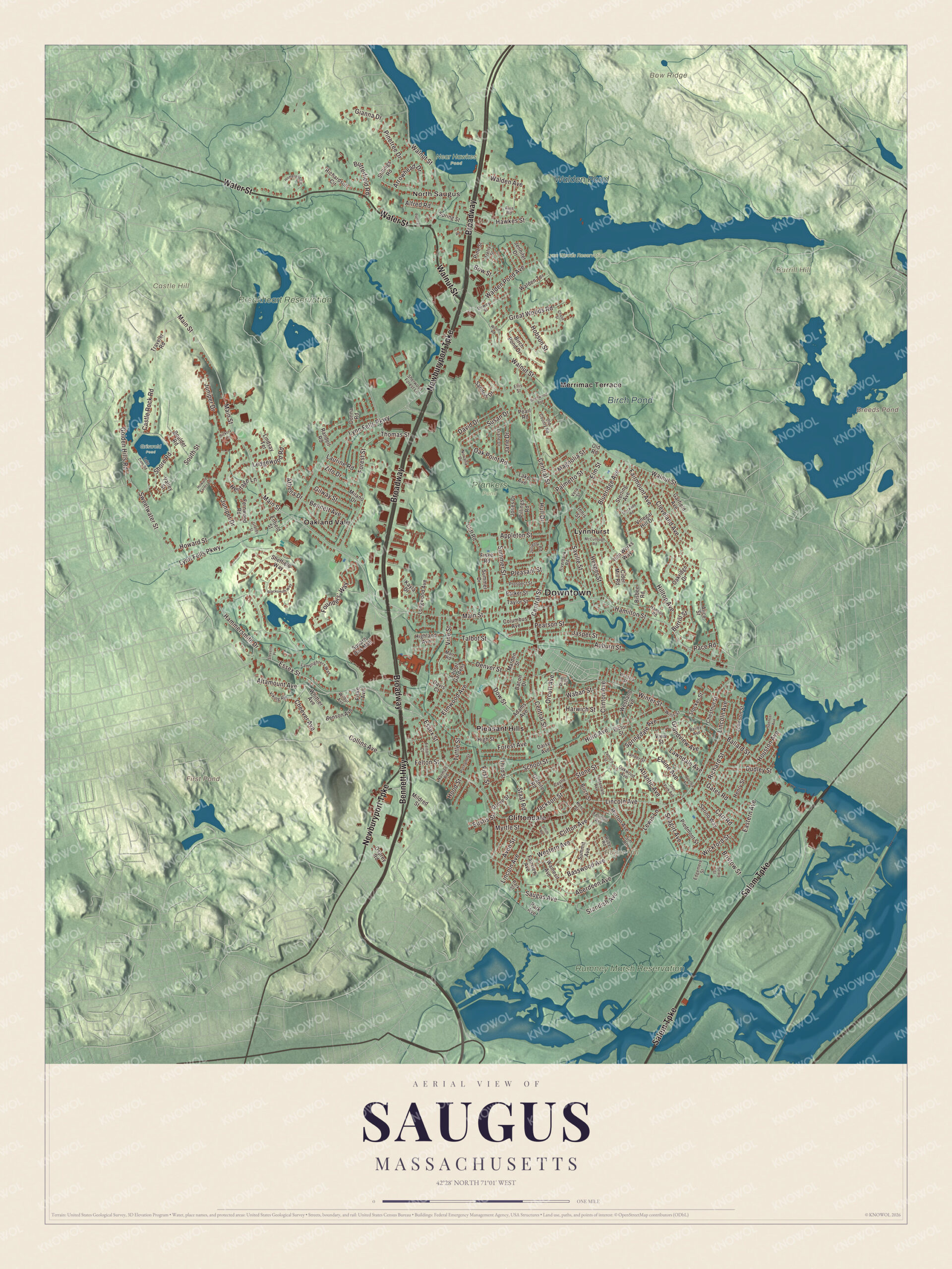
Click to explore a larger preview. The digital watermark does not appear on printed maps.
Names on this map
These names are printed on this map.
Places: Downtown, North Saugus, Baker Hill, Bow Ridge, Burrill Hill, Castle Hill, Breeds Pond, First Pond, Walden Pond, Birch Pond, Breakheart Reservation, Griswold Pond, Lynn Woods Reservation, Near Hawkes Pond, Prankers Pond, Rumney Marsh Reservation, Cliftondale, Lynnhurst, Merrimac Terrace, Oakland Vale and Pleasant Hills.
Streets and roads: Newburyport Turnpike, Broadway, Water Street, Bennett Highway, Walnut Street, Salem Turnpike, Essex Street, Lincoln Avenue, Hamilton Street, Main Street, Orcutt Avenue, Sweetwater Street.
More street names, A to Z
Aberdeen Avenue, Adams Avenue, Alfred Road, Alice Street, Altamount Avenue, Appleton Street, Arrowhead Drive, Athena Drive, Atlantic Avenue, Auburn Street, Avis Road, Avon Street, Bacon Drive, Bailey Avenue, Ballard Street, Basswood Avenue, Belair Street, Bennett Avenue, Benson Avenue, Birch Pond Drive, Birch Street, Birchwood Avenue, Bisbee Road, Blacksmith Way, Blueridge Avenue, Boulder Road, Bow Street, Bristow Street, Burrill Street, Butterfield Road, Carr Road, Castle Rock Road, Castle Street, Central Street, Chase Street, Cheever Avenue, Chestnut Street, Cider Mill Road, Cleveland Avenue, Cliff Road, Clifton Avenue, Clinton Avenue, Collins Avenue, Columbus Avenue, Daisy Avenue, David Drive, Davis Court, Denver Street, Dewey Street, Diane Drive, Donna Road, Dow Street, Dudley Street, Eastern Avenue, Edgemere Street, Elaine Avenue, Ellis Street, Elm Street, Elmwood Avenue, Enfield Street, Eustis Street, Fairmount Avenue, Fairview Avenue, Felmont Avenue, Felton Court, Felton Street, Fernwood Road, First Street, Fiske Avenue, Fiske Road, Forest Avenue, Forest Street, Founders' Way, Garfield Avenue, Gates Road, Gianna Drive, Gilway Street, Glen Park Avenue, Golden Hills Road, Granby Street, Grandview Avenue, Granite Road, Great Woods Road, Grove Street, Hammersmith Drive, Hanson Road, Harwich Street, Hawkes Street, Henry Street, Heritage Lane, Hesper Street, Hickory Lane, Highland Avenue, High Street, Hilltop Avenue, Hobson Street, Homeland Circle, Hood Street, Houston Avenue, Howard Farms Lane, Howard Street, Hull Drive, Hurd Avenue, Ila Road, Innis Street, Intervale Avenue, Iron Works Way, Jackson Street, Jane Drive, Jasper Street, Jennifer Drive, Johnson Street, Jones Drive, Juliette Road, Juniper Drive, Kayla Drive, Kent Street, Lake Avenue, Lake Dam Road, Lamplighters Way, Lander Street, Laurel Gardens, Laurine Road, Lawndale Avenue, Ledgewood Road, Lewis Lane, Lindsay Terrace, Longwood Avenue, Lynn Fells Parkway, Magnolia Street, Marden Street, Marr Road, McCullough Road, Milano Drive, Mildred Street, Morton Avenue, Myrtle Street, Nirvana Drive, Norman Road, Oak Point Road, Oakridge Drive, Oakwood Avenue, Old County Road, Old Road, Osprey Road, Overlea Avenue, Pace Road, Palmetto Street, Park Avenue, Parker Street, Park Street, Patel Drive, Pearl Road, Pearson Street, Piedmont Street, Pillings Road, Pine Street, Pine Terrace, Pinetree Drive, Pleasant Street, Prospect Street, Putnam Street, Randell Road, Richardson Circle, Richard Street, Riverbank Road, Ruby Road, Sanders Drive, Saugus Avenue, Saville Street, School Street, Seagirt Avenue, Serino Way, Sheffield Way, Sherwood Forest Lane, Shore Road, Sim Road, Smith Road, South Street, Spencer Avenue, Springdale Avenue, Spring Street, Square One Mall, Staaf Road, Standish Avenue, Sterling Avenue, Stevens Place, Stillings Road, Stockade Road, Stocker Street, Stone Street, Summer Drive, Summer Street, Summit Avenue, Susan Drive, Talbot Street, Taylor Street, Third Street, Thomas Street, Traveler Road, Trefry Street, Tuttle Street, Valley Street, Vera Street, Victoria Street, Victor Street, View Street, Viking Road, Vinegar Hill Drive, Vine Street, Waban Street, Walden Avenue, Walden Pond Avenue, Walden Terrace, Wamesit Avenue, Western Avenue, Westland Avenue, Whittier Avenue, Wickford Street, Wilbur Avenue, Willis Street, Winter Street, Wood Road, Zamora Street, Zito Drive.
Around the map
Start with North Saugus. Follow the Newburyport Turnpike, Broadway, Water Street, Bennett Highway, Walnut Street and the Salem Turnpike across town. Then look outward toward Cliftondale, Lynnhurst, Merrimac Terrace, Oakland Vale and Pleasant Hills. Breeds Pond, Walden Pond, Birch Pond, Breakheart Reservation, Rumney Marsh Reservation, Baker Hill, Bow Ridge, Burrill Hill and First Pond are all printed on the map. About four miles of the Newburyport Turnpike, now U.S. Route 1, were built through Saugus in 1805. People at first called it a mistake, since it climbed over hills and crossed swamps, but the automobile brought it traffic, and from the 1950s businesses moved out to the road. The Salem Turnpike carries Route 107 through the Rumney Marsh, a state reservation of salt marsh along the Saugus and Pines rivers that reaches into both Saugus and Revere. Breakheart Reservation covers 652 acres of hardwood forest and two lakes in Saugus and Wakefield. It began as Breakheart Hill Forest, a private hunting retreat in North Saugus; the Metropolitan District Commission bought it in 1934, the Civilian Conservation Corps built its roads and trails, and it opened to the public in 1936. Breeds Pond and Walden Pond are part of Lynn Woods Reservation, a city forest in neighboring Lynn, and a small piece of that park lies in Saugus. Saugus is also home to the oldest barber shop in the United States, George’s Barber Shop in Cliftondale Square, a family business opened in 1898.
The Saugus map makes a fine addition to an office, library or den, and it can help teach children the geography and history of the town of the first integrated iron works in North America. It’s made for people who call Saugus home, from North Saugus to Cliftondale, and it shows the town as it looks today. Zoom in on the preview above to explore the details, then click here to get your copy of the Saugus, Massachusetts map.

We made a map for every town and city in Massachusetts. Explore the complete Massachusetts map collection and find your town.
Sources
- Saugus, Massachusetts, Wikipedia
- Saugus Iron Works National Historic Site, Wikipedia
- Appleton’s Pulpit, Wikipedia
- Breakheart Reservation, Wikipedia
- Rumney Marsh Reservation, Wikipedia
- Lynn Woods Reservation, Wikipedia
- City and Town Incorporation and Settlement Dates, Secretary of the Commonwealth of Massachusetts (archived copy)