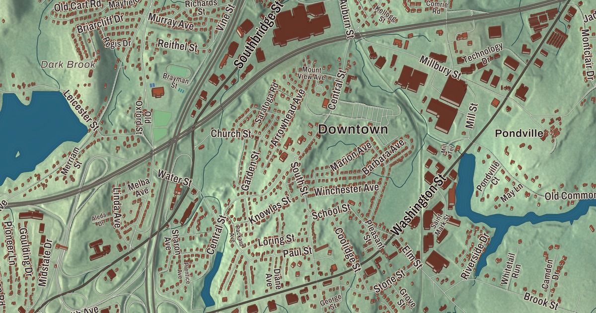
Grow up in Auburn and you’ll hear about it early: the rocket that went up from a farm on Pakachoag Hill in March 1926. This map prints Southbridge Street, Washington Street, Walsh Avenue, School Street, Auburn Street and Elm Street, along with Auburn Pond, Henshaw Pond, the Stoneville Reservoir, Dark Brook, Crowl Hill, Deadhorse Hill and Denny Hill. Click here to purchase a print of this map for your wall.
Auburn is in Worcester County, and most of it was once the South Parish of Worcester.
Made by KNOWOL in 2026, this map takes public survey data and gives it the look of an old atlas. United States Geological Survey elevation data supplies the shaded hills, and the Census Bureau supplies the roads and the town line. Auburn had 16,889 people at the 2020 census.
From Ward to Auburn
Before it became a town, the rest of its land lay inside Leicester and Millbury. The Town of Auburn’s recorded history dates European settlement to 1714, in the Secretary of the Commonwealth’s list. On April 10, 1778, parts of Worcester, Sutton, Leicester and Oxford were incorporated as the Town of Ward, named for Artemas Ward, a general of the American Revolution who was born in Shrewsbury. The name lasted until 1837, when the Post Office complained it was too close to the name of the town of Ware, and Ward became Auburn. The town remains part of Worcester County today.
Three people born here in the Ward years made their names elsewhere. Elias Carter, born in 1781 in Ward, the son of a builder, became an architect of the white steepled churches of central Massachusetts; his first church, at Brimfield, was finished in 1805, and many of his buildings are on the National Register of Historic Places. Zedekiah Belknap, born in Ward the same year, became a traveling portrait painter in Vermont, New Hampshire and Massachusetts, and nearly two hundred of his portraits survive, some in the Smithsonian American Art Museum. Jacob Whitman Bailey, born in Auburn in 1811, taught chemistry, mineralogy and geology at West Point, improved the microscope, and was president of the American Association for the Advancement of Science in 1857; his page calls him the pioneer of microscopic research in America.
The rocket on Pakachoag Hill
On March 16, 1926, Robert H. Goddard launched the first liquid-fueled rocket from Pakachoag Hill. The town page puts the launch on his aunt Effe Ward’s farm, and the launch site’s page calls it the Asa Ward Farm. The 10-foot rocket, fueled with gasoline and liquid oxygen, climbed 41 feet, flew for two and a half seconds and came down 184 feet from its launching frame. His last launch in Auburn, on July 17, 1929, carried a barometer, a thermometer and a camera that fired when the parachute opened, and all three were recovered. The spot is now inside the Pakachoag Golf Course at 20 Upland Street. An obelisk stands on the ninth fairway, a second marker sits just off Upland Street, and the Goddard Rocket Launching Site was declared a National Historic Landmark in 1966. Back in the center, Goddard Memorial Park, next to the fire department headquarters, displays a model of his rocket and a Polaris missile, and a second replica stands at Auburn High School.
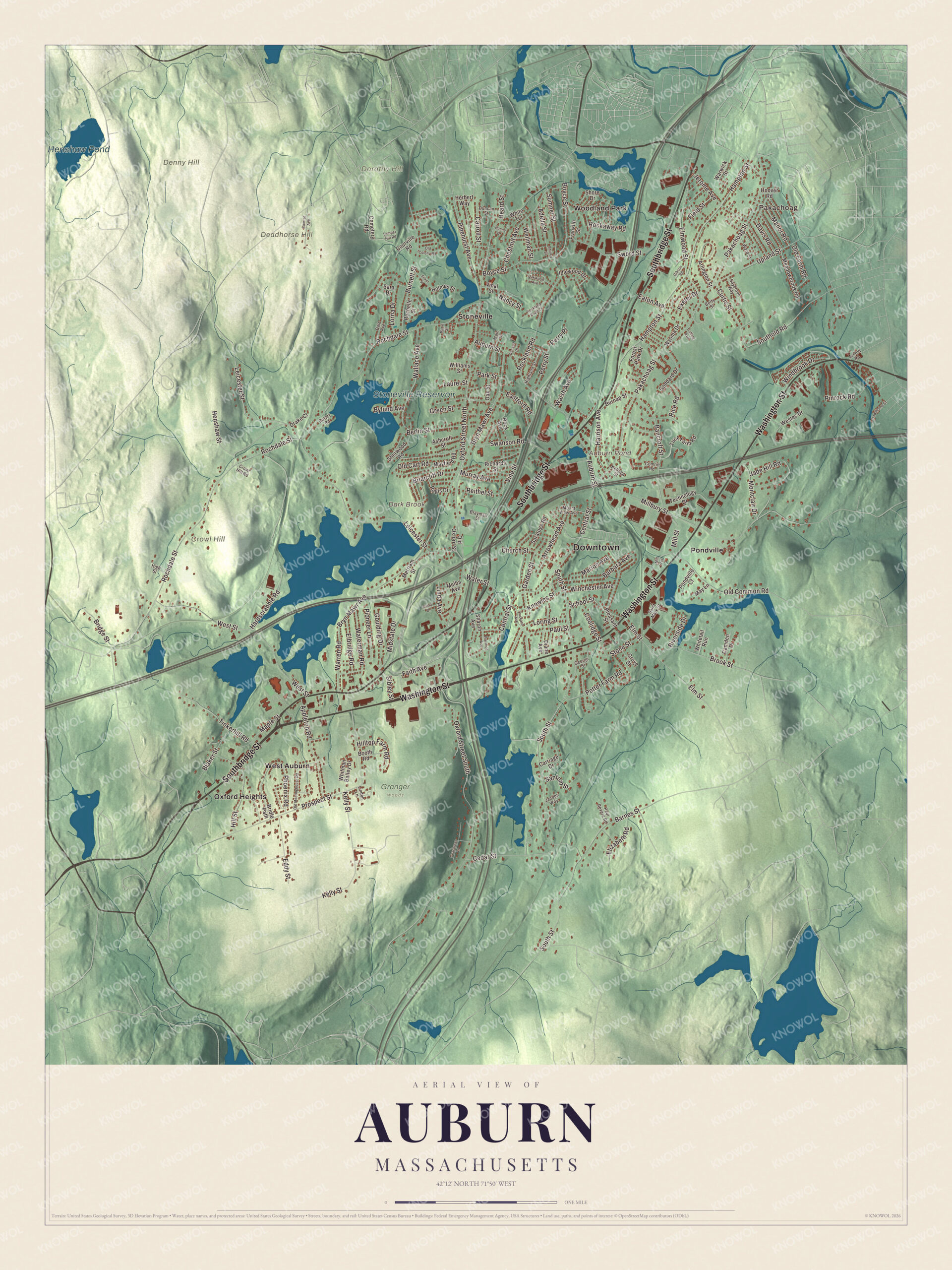
Click to explore a larger preview. The digital watermark does not appear on printed maps.
Names on this map
These names are printed on this map.
Places: Downtown, Pakachoag, Crowl Hill, Deadhorse Hill, Denny Hill, Dorothy Hill, Auburn Pond, Dark Brook, Stoneville Reservoir, Henshaw Pond, Granger Woods, Oxford Heights, Pondville, Stoneville, West Auburn and Woodland Park.
Streets and roads: Southbridge Street, Washington Street, Oxford Street North, Walsh Avenue, School Street, Auburn Street, Elm Street, Adella Street, Rochdale Street, South Street, Pakachoag Street, Leicester Street.
More street names, A to Z
Aleda Drive, Appleton Road, Arlington Street, Arnold Road, Arrowhead Avenue, Ashcroft Street, Bancroft Street, Barbara Avenue, Barnes Street, Berlin Street, Betty Street, Blaker Street, Booth Road, Boyce Street, Brayman Street, Briarcliff Drive, Bridge Street, Bridle Path, Brook Street, Bryn Mawr Avenue, Burnap Street, Burnett Street, Bylund Avenue, Camden Drive, Carriage Drive, Carroll Street, Cedar Street, Cemetery Road, Central Street, Chestnut Avenue, Church Street, Coachman Lane, Comrie Road, Coolidge Street, Courville Road, Crowl Hill Road, Curtis Street, Cutting Avenue, Dale Avenue, Davis Road, Diane Avenue, Drake Court, Duncan Street, Eastford Road, Eaton Avenue, Eddy Street, Elbridge Road, Elizabeth Road, Elmwood Street, Exeter Drive, Faith Avenue, Field Street, Forest Park Drive, Franklin Street, Garden Street, George Street, Gibson Road, Goddard Drive, Goulding Drive, Green Street, Grove Street, Hampton Street, Hanna Drive, Hardscrabble Road, Harrison Avenue, Hawthorne Street, Heard Street, Henshaw Street, Herbert Way, Highland Street, High Street, Hill Street, Hilltop Farm Road, Holmes Street, Hoover Road, Idlewood Drive, Jacobs Way, Jade Hill Road, Jerome Avenue, Kellogg Street, Kelly Street, Knowles Street, Lamper Hill Road, Laurel Street, Linda Avenue, Linden Lane, Loring Street, Lorna Drive, Main Street, Manor Road, Maple Street, Marie Street, Marion Avenue, Mayfield Road, May Lane, Meadowbrook Road, Melba Avenue, Merriam Street, Midstate Drive, Millbury Street, Mill Street, Mill Terrace, Montclair Drive, Mount View Avenue, Murray Avenue, Nancy Street, Oak Street, Oakwood Avenue, Old Cart Road, Old Colony Road, Old Common Road, Old Farm Road, Old Meetinghouse Road, Old Oxford Street, Oxford Street South, Packard Avenue, Park Street, Paul Revere Road, Paul Street, Perry Place, Perry Street, Phoenix Road, Pinehurst Avenue, Pinrock Road, Pioneer Lane, Pleasant Street, Pondville Court, Potter Farm Road, Prentice Avenue, Prospect Street, Regis Drive, Reithel Street, Renaud Drive, Rice Road, Richards Street, Riverside Drive, Rochelle Street, Rock Avenue, Rockaway Road, Rockland Road, Rockland Road Court, Rotary Road, Saint Mark Street, Santom Street, Sara Drive, Saratoga Road, Saybrook Way, Sharon Avenue, Sherwood Road, Shirley Street, Shore Drive, Sibley Street, Silver Street, Southold Road, Stone Street, Sumner Street, Sunrise Avenue, Swanson Road, Sword Street, Technology Drive, Tinkerhill Road, Tuck Farm Road, Upland Street, Vinal Street, Vine Street, Wallace Avenue, Ward Street, Warren Road, Warwick Street, Waterman Road, Water Street, Wellman Street, Westec Drive, West Street, Whitetail Run, White Terrace, Whitman Bailey Drive, Williams Street, Winchester Avenue, Windbrook Drive, Wyoma Drive.
Getting around the map
Start at Pakachoag, then follow Southbridge Street, Washington Street, Walsh Avenue, School Street, Auburn Street and Elm Street across town. Look outward toward Oxford Heights, Pondville, Stoneville, West Auburn and Woodland Park. Auburn Pond, the Stoneville Reservoir, Henshaw Pond, Crowl Hill, Deadhorse Hill, Denny Hill and Dark Brook are all printed on the map. The town page lists the Auburn Mall among its points of interest, along with the Worcester Flood Diversion Channel, a chain of dams, reservoirs and channels in Auburn and Millbury that the Army Corps of Engineers built under the Flood Control Act of 1944 to protect Worcester from floods. In winter part of it turns into the Auburn Ice Channel, a local spot for ice climbing.
Hang this Auburn map in an office, library or den, and use it to teach children the geography and history of the town where Goddard’s rocket first flew. It’s made for people who call Auburn home, from Pakachoag to West Auburn, and it shows the town as it looks today. Zoom in on the preview above to explore the details, then click here to get your copy of the Auburn, Massachusetts map.

We made a map for every town and city in Massachusetts. Explore the complete Massachusetts map collection and find your town.
Sources
- Auburn, Massachusetts, Wikipedia
- Goddard Rocket Launching Site, Wikipedia
- Robert H. Goddard, Wikipedia
- Artemas Ward, Wikipedia
- Elias Carter, Wikipedia
- Zedekiah Belknap, Wikipedia
- Jacob Whitman Bailey, Wikipedia
- Worcester Flood Diversion Channel, Wikipedia
- City and Town Incorporation and Settlement Dates, Secretary of the Commonwealth of Massachusetts (archived copy)