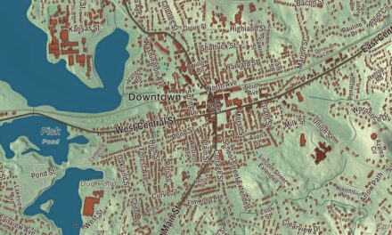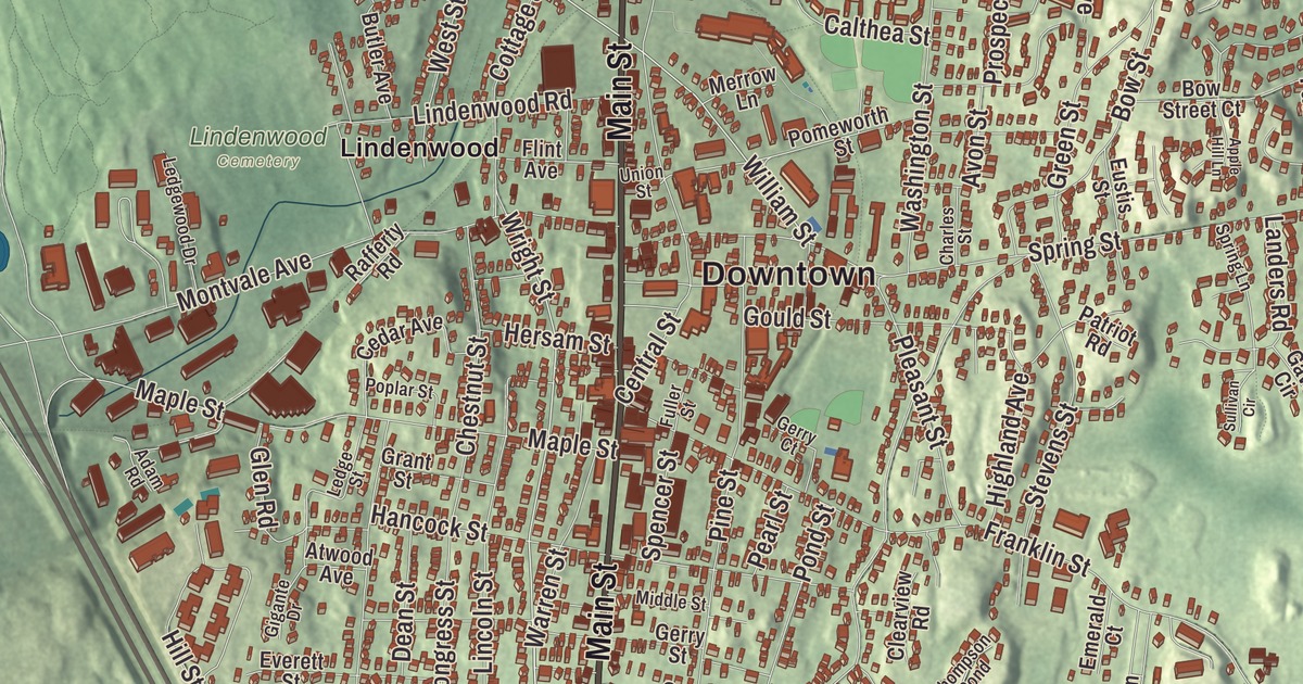
If you grew up in Stoneham, you’ll find Main Street, Spot Pond, Bear Hill, Farm Hill and Haywardville on this map, along with William Street, Warren Street and Woodland Road. Click here to purchase a print of this map for your wall.
Stoneham is in Middlesex County.
KNOWOL made this map in 2026 from public survey data and laid it out with the bearing of an old atlas. The hills rise from United States Geological Survey elevation data, and the roads and the town line come from the Census Bureau. Stoneham covers 6.7 square miles nine miles north of downtown Boston, bordered by Woburn, Winchester, Medford, Malden, Melrose, Wakefield and Reading, and 0.6 square miles of it are water. The town had 23,244 people at the 2020 census.
Cheese Rock and Charlestown End
Stoneham lies on the traditional land of the Massachusett and Pawtucket peoples. The first written mention of it comes from February 7, 1632, when Governor John Winthrop and his party came upon a pond they named Spot Pond and ate lunch on a height they called Cheese Rock, known today as Bear Hill. Colonists first settled here in 1634, when it was part of Charlestown. The Town of Stoneham’s recorded history, in the Secretary of the Commonwealth’s list, dates European settlement to 1645. By 1678 there were six families, all in the northeast part of town. By 1725 the area called “Charlestown End” had 65 taxpaying men, who lived miles from Charlestown’s church and school, and Captain Benjamin Geary and 53 neighbors asked to be set apart. Charlestown said no at first, but on December 17, 1725, the General Court made Stoneham its own township, as long as it built a church and hired a minister and a schoolmaster within two years. Stoneham was incorporated as a town in 1725.
The first meetinghouse and the burying ground both date from 1726. The Old Burying Ground, on Pleasant and William streets, is the only part of that first town center still standing, with about 450 stones and fragments carved with urns, willows and cherubs, dated from 1728 to 1924. The church was organized in 1729, and that same year the town voted £9 to build a school. Stoneham stayed small through colonial times, then grew into a major shoemaking center in the 1800s.
Central Square
Main Street began as the Andover-Medford Turnpike, now Route 28, and the business center grew along it. John Hill’s Italianate shoe factory of 1858 at 426 Main Street was the town’s first major industrial building, and it still stands across from the public library of 1904. The triangle where Main Street meets Center Street became the town’s commercial hub, framed by three Second Empire buildings put up between 1868 and 1890, the Dow Block, the Oddfellows Building and the Chase Block. Next to the square, the brick fire station of 1916 has a four-story hose drying tower in the style of the Italian Renaissance. Every day at 9 a.m. and 9 p.m., the Nine O’Clock Horn sounds from the station. It once signaled firefighters and warned of emergencies, and today it’s kept mostly as a tradition.
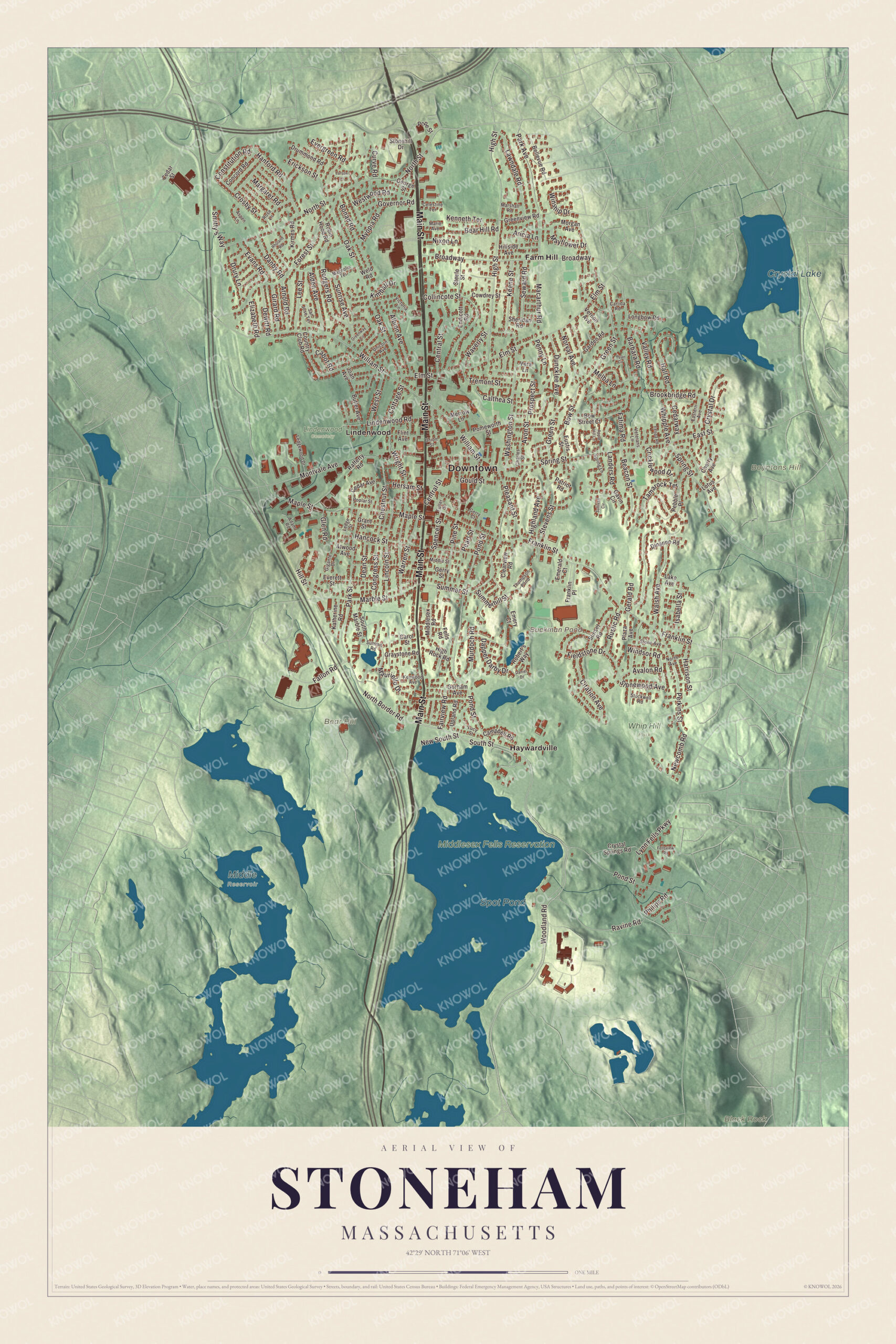
Click to explore a larger preview. The digital watermark does not appear on printed maps.
Names on this map
These names are printed on this map.
Places: Downtown, Bear Hill, Black Rock, Boyntons Hill, Buckman Pond, Spot Pond, Crystal Lake, Lindenwood Cemetery, Middle Reservoir, Middlesex Fells Reservation, Whip Hill Park, Farm Hill, Haywardville and Lindenwood.
Streets and roads: Main Street, Woodland Road, South Street, Warren Street, William Street, Wright Street, Prospect Street, Constitution Road, Stonewood Avenue, Waverly Street, Pond Street, Franklin Street.
More street names, A to Z
Adam Road, Albion Avenue, Alden Avenue, Apple Hill Lane, Aricia Lane, Arnold Road, Aspen Lane, Atwood Avenue, Avalon Road, Avon Street, Barbara Road, Beacon Street, Bear Hill Road, Bellevue Road, Bonad Road, Bow Street, Bow Street Court, Broadway, Brookbridge Road, Butler Avenue, Cabot Road, Calthea Street, Campbell Road, Carlida Road, Carol Street, Cedar Avenue, Cedar Street, Cedarway, Celestine Terrace, Central Street, Charles Street, Cherry Avenue, Chestnut Street, Citation Avenue, Clearview Road, Collincote Street, Concord Road, Congress Street, Cottage Street, Country Club Road, Cowdrey Street, Cricklewood Drive, Crosby Street, Crystal Drive, Crystal Springs Road, Curve Road, Danby Road, Daniel Drive, Dapper Darby Drive, Dean Street, Dewitt Road, Dinanno Road, Drummond Road, Drury Lane, Duncklee Avenue, Eastern Avenue, East Street, Elizabeth Road, Elm Street, Emerald Court, Emery Court, Endicott Road, Erickson Street, Eustis Street, Evans Road, Everett Street, Evergreen Road, Fairview Road, Fallon Road, Fatima Road, Fells Road, Fellsview Road, Felspa Road, Fieldstone Drive, Flint Avenue, Forest Street, Franklin Place, Fuller Street, Garden Road, Gavin Circle, George Street, Gerald Road, Gerry Court, Gerry Street, Gigante Drive, Girard Road, Glen Road, Gorham Avenue, Gould Street, Governor Road, Grant Street, Graystone Road, Green Street, Greenview Road, Greenway Circle, Hall Road, Hancock Street, Hanford Road, Harrison Street, Hersam Street, Highland Avenue, High Rock Road, High Street, Hillside Avenue, Hill Street, Isabella Street, Joan Avenue, Katherine Road, Keene Street, Kenneth Terrace, Kenwood Avenue, Kimball Drive, Kirmes Road, Lake Avenue, Landers Road, Larson Lane, Lawndale Road, Ledge Street, Ledgewood Drive, Lee Street, Lincoln Street, Lindenwood Road, Longbow Road, Lotus Avenue, Lucy Street, Lynn Fells Parkway, Macarthur Road, Magnolia Terrace, Maple Street, Marble Street, Margaret Road, Marie Avenue, Marshall Road, Mauriello Drive, Mayflower Drive, Melba Lane, Merrow Lane, Middlesex Road, Middle Street, Montvale Avenue, Morgan Avenue, Murdoch Road, Myopia Road, Newcomb Road, New South Street, Nixon Lane, North Avenue, North Border Road, North Street, Norval Avenue, Oak Street, Park Avenue, Park Street, Patriot Road, Pearl Street, Pebble Place, Penny Lane, Perkins Street, Philips Road, Pine Street, Plaza Avenue, Pleasant Street, Pomeworth Street, Pope Street, Poplar Street, Rafferty Road, Ravine Road, Rhuland Road, Robert's Way, Robin Hood Road, Rodgers Road, Rose Lane, Rustic Road, Ryan Circle, San Jose Terrace, Seward Road, Sheridan Road, Smitty's Way, South Marble Street, Spencer Street, Spring Lane, Spring Street, Steele Street, Stevens Street, Stockwell Road, Stone Avenue, Stonehill Drive, Sullivan Circle, Summerhill Street, Summer Street, Summit Road, Sunrise Avenue, Sunset Road, Tamarock Terrace, Thompson Pond, Tremont Street, Unicorn Avenue, Union Street, Upland Road, Valley Road, Vera Lane, Vernon Avenue, Veterans Lane, Victoria Lane, Walsh Avenue, Washington Street, Weld Road, West Street, Westwood Road, Whipple Avenue, Windsor Road, Winship Drive.
See it on a wall
The Stoneham map as a framed print. Swipe for more.


Around the map
Start with Farm Hill. Follow Main Street, Woodland Road, South Street, Warren Street, William Street and Wright Street across town. Then look outward toward Haywardville and Lindenwood. Buckman Pond, Spot Pond, Crystal Lake, Bear Hill, Black Rock and Boyntons Hill are all printed on the map. Spot Pond lies almost entirely in Stoneham, inside the Middlesex Fells Reservation, and its Great Island once hosted wrestling matches and prizefights. Mills worked along Spot Pond Brook from the 1600s to the 1800s, and the Hayward Rubber Works there gave the area the name Haywardville; a trail through the Spot Pond Archeological District passes the remains. The Stone Zoo, founded in 1905 as the Middlesex Fells Zoo, covers about 26 acres in town and was renamed in 1969 for its late director, Walter D. Stone. Stoneham is also the birthplace of Nancy Kerrigan, who won Olympic figure skating medals in 1992 and 1994.
The Stoneham map makes a welcome addition to an office, library or den, and it can help teach children the geography and history of a town at the edge of the Fells. It’s made for people who call Stoneham home, from Farm Hill to Lindenwood, and it shows the town as it looks today. Zoom in on the preview above to explore the details, then click here to get your copy of the Stoneham, Massachusetts map.

Sources
- Stoneham, Massachusetts, Wikipedia
- Old Burying Ground (Stoneham, Massachusetts), Wikipedia
- Central Square Historic District (Stoneham, Massachusetts), Wikipedia
- Stoneham Firestation, Wikipedia
- Spot Pond, Wikipedia
- Spot Pond Archeological District, Wikipedia
- Stone Zoo, Wikipedia
- Nancy Kerrigan, Wikipedia
- City and Town Incorporation and Settlement Dates, Secretary of the Commonwealth of Massachusetts (archived copy)