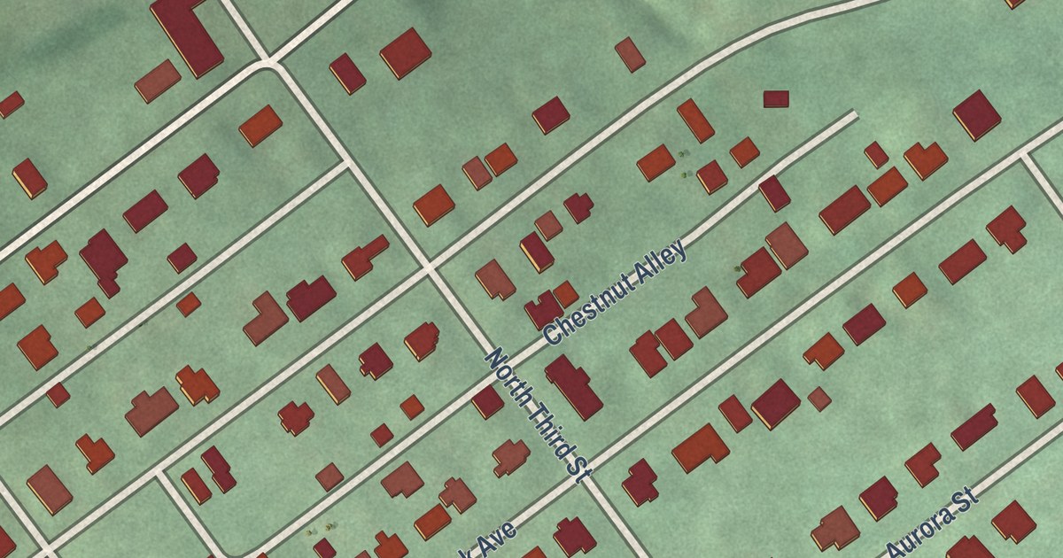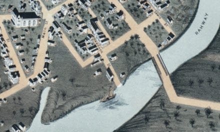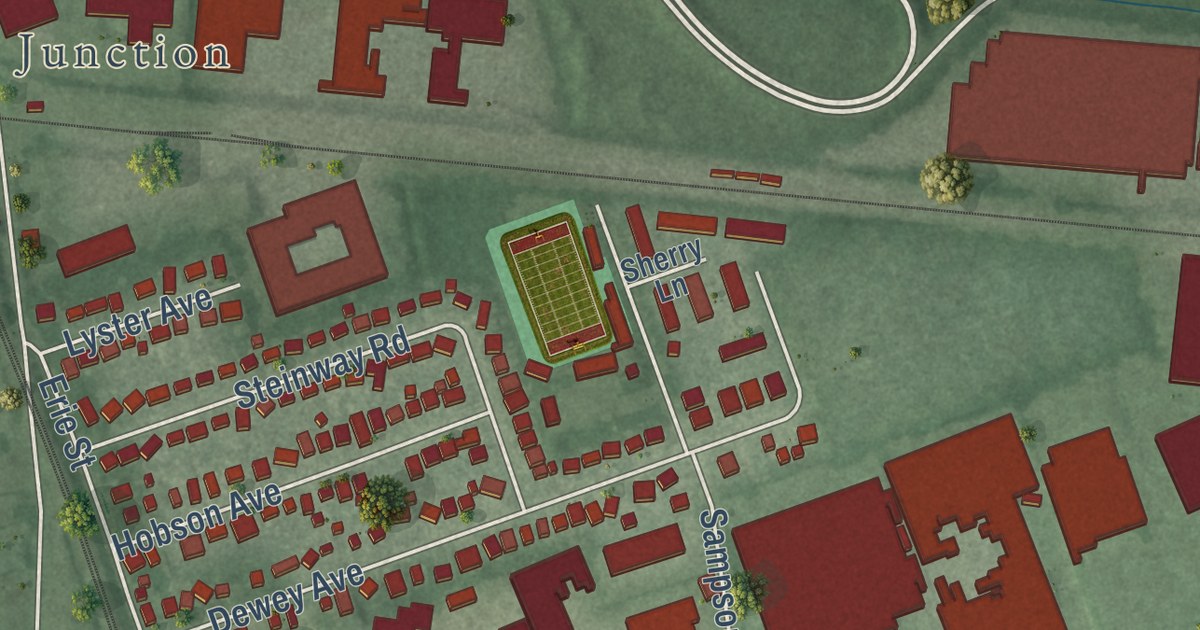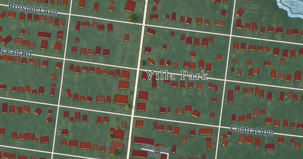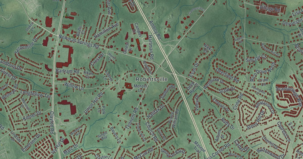
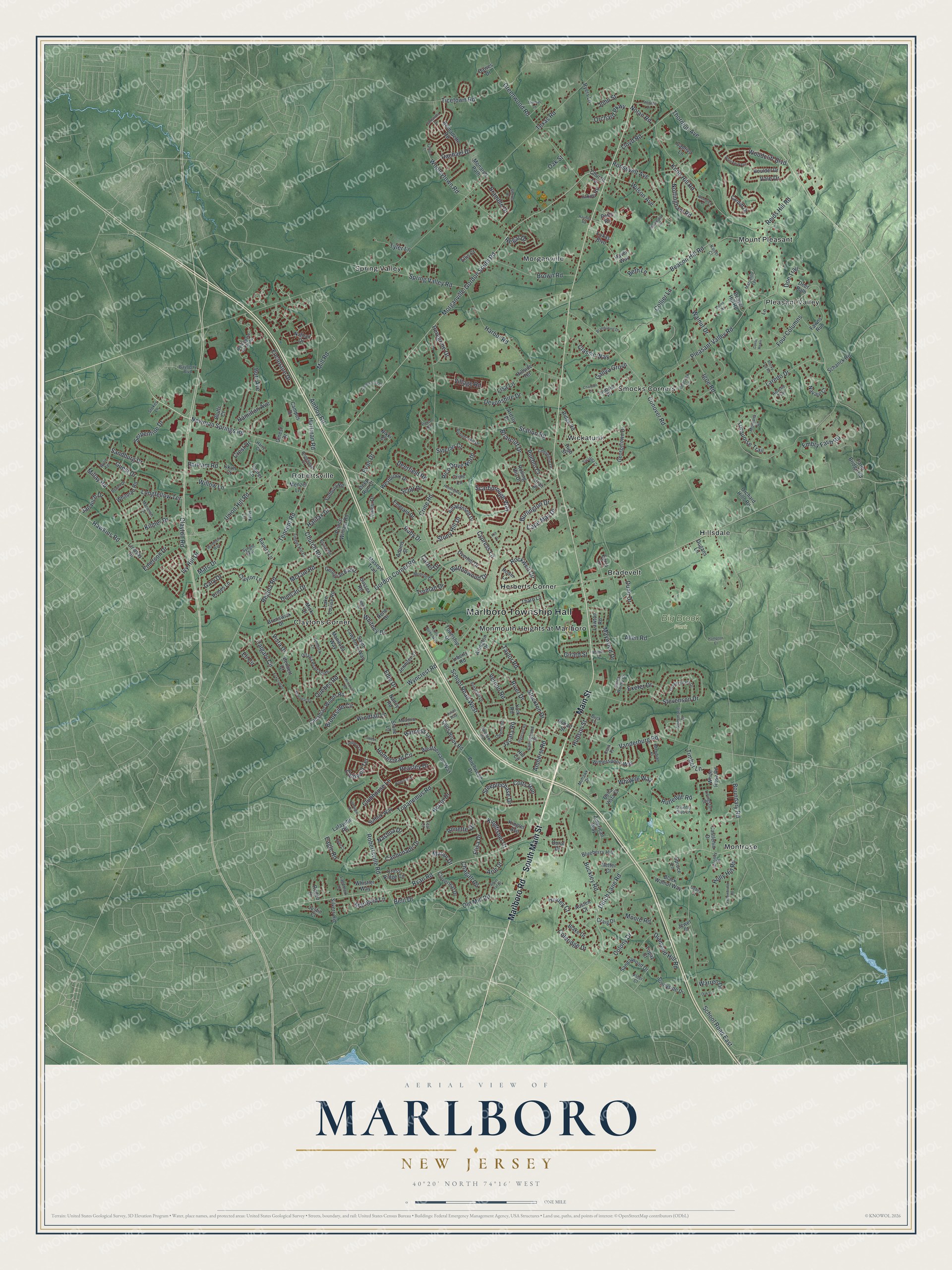
This beautifully detailed map of Marlboro, New Jersey was created in 2026 using aerial imagery combined with modern topographical, census, street and landmark data. It’s a one-of-a-kind view of Marlboro that combines accurate data with a vintage aesthetic. The map shows every building in its true location, many of the roads carry their names, and the shaded topographic relief shows the shape of the land.
Explore an aerial view of Marlboro, New Jersey
On the map you’ll find Marlboro Township Hall, Bradevelt, Claytons Corner, Herberts Corner, Hillsdale, Monmouth Heights at Marlboro, and Big Brook Park, along with Main Street, Marlboro Road, Ryan Road, School Road, and more. If you look closely you can even find your house accurately drawn in its correct location. Zoom in on the preview to look for yours.
Take a closer look at the Marlboro map
Names on this map
These names are printed on this map.
Places: Marlboro Township Hall, Big Brook Park, Bradevelt, Claytons Corner, Herberts Corner, Hillsdale, Monmouth Heights at Marlboro, Montrose, Morganville, Mount Pleasant, Pleasant Valley, Robertsville, Smocks Corners, Spring Valley and Wickatunk.
Streets and roads: South Main Street, Marlboro Road, Main Street, Ryan Road, School Road West, Spring Valley Road, Newman Springs Road, Tennent Road, Pleasant Valley Road, Morganville-Gordon South Road, Texas Road, School Road East.
More street names, A to Z
Abbey Lane, Adams Street, Albermarle Drive, Alberta Drive, Alder Court, Allen Road, Amagansett Drive, Amboy Road, American Way, Amherst Road, Angelique Court, Annette Drive, Apache Trail, Ardsly Place, Arie Drive, Arlington Drive, Austen Court, Autumn Hill Drive, Bartram Road, Bauers Lane, Bayberry Boulevard, Beacon Hill Road, Beaver Hill Road, Belil Drive, Bella Vista Court, Benet Drive, Bennett Court, Bernadette Road, Beth Lane, Birchwood Drive, Black Walnut Way, Blake Drive, Blueberry Hill, Bluffs Court, Boulder Drive, Boulevard de Jardin, Boundary Road, Bramble Drive, Brandywine Drive, Briarcliff Drive, Brookside Circle, Brown Road, Bruce Road, Brunswick Drive, Buck Lane, Buckley Road, Burlington Drive, Burr Avenue, Buttonwood Drive, Caldwell Terrace, Calgary Circle, Campus Drive, Canadian Woods Road, Cannonade Drive, Cape May Drive, Captiva Lane, Cardiff Drive, Carter Drive, Castlehill Drive, Chagall Road, Chardon Court, Cheyenne Drive, Church Lane, Church Road, Clark Place, Classic Way, Clayton Lane, Clayton Road, Cloverleaf Drive, Clubhouse Lane, Coleridge Drive, Collier Lane, Collingwood Road, Colony Drive, Colts Brook Road, Colts Run, Commercial Court, Conover Road, Corso Reale, Country Club Lane, Craig Drive, Crest Drive, Crine Lane, Crine Road, Cross Ridge Circle, Cypress Lane, Dawes Drive, Debra Court, Deep Run Court, Deerfield Road, Deer Path, Devonshire Drive, Diamond Hill Road, Doe Trail, Doral Drive, Doree Road, Dugans Lane, Duncan Drive, Dunn Drive, Dutch Lane Road, Eagle Road, Edie Drive, Egret Lane, Eli Circle, Elisa Drive, Ellis Court, Embry Farm Road, Emerald Drive, Emerson Drive, Enclosure Drive, Evan Drive, Exeter Drive, Falson Lane, Farm Bridge Road, Fawns Run, Four Columns, Foxcroft Drive, Freneau Drive, Gallya Grove, Gary Drive, Georgetown Drive, Georgian Bay Drive, Ginesi Drive, Girard Street, Gordon Corner Road, Graversham Drive, Greenwood Road, Guest Drive, Halifax Drive, Hamilton Avenue, Hampton Court, Hansom Lane, Harbor Road, Harness Lane, Harnley Road, Harrington Terrace, Harry Court, Hartman Road, Haven Way, Hawkins Road, Hemingway Court, Hemlock Lane, Heron Drive, High Street, Hill Circle, Hillside Terrace, Hobart Street, Holly Hill Road, Homestead Circle, Hudson Street, Huxley Court, Igoe Road, Imbrie Place, Ingersoll Road, Ivy Hill Drive, Jacata Road, Jakob Road, James Worthy Court, Janwich Drive, Jennifer Court, Jewel Court, John Street, Julian Way, Justin Court, Kaiser Court, Kilmer Drive, Kilt Court, Kingfisher Court, Kinglet Avenue, Knob Hill Road, Lafayette Road, Lake Louise Road, Lakeview Drive, Landmark Lane, Lane, Laredo Drive, Laurel Lane, Lawton Road, Liberty Road, Lindsay Drive, Lisa Lane, Livingston Court, Lloyd Road, Longfellow Terrace, Lotta Burke Way, Lukas Boulevard, Macleish Drive, Manitoba Way, Manor Drive, Marc Drive, Marigold Lane, Marseille Terrace, Masepe Trail, Maywood Drive, McCue Road, Meadow Lane, Memorial Road, Menzel Lane, Meridian Place, Micki Drive, Millay Road, Mill Road, Mohawk Drive, Monarch Path, Monroe Drive, Montana Drive, Montreal Square, Moore Road, Nancy Road, Nashua Drive, Nathan Drive, Navajo Court, Netter Court, Newton Street, Nikki Court, Nolan Road, Nottingham Road, Oak Lane, Oak Street, Okun Court, Old Mill Road, Oran Place, Orchard Hills Road, Orchard Parkway, Ottawa Road South, Overhill Drive, Owens Road, Park Lane, Peacock Lane, Peasley Drive, Peregrine Drive, Pierson Road, Potts Road, Prescott Drive, Prides Lane, Prince William Road, Pueblo Court, Quail Court, Quebec Road, Rachael Drive, Regal Drive, Regina Road, Reids Hill Road, Rene Drive, Rico Drive North, Ridge Road, River Drive, Robertsville Road, Rockwell Circle, Rocky Top Road, Rodeo Drive, Rodin Lane, Rolling Hill Drive, Roosevelt Avenue, Ruby Drive, Rutledge Road, Ryers Lane, Saint Lawrence Way, Samantha Drive, Sandalwood Drive, Sandburg Drive, Saratoga Court, Scarborough Way, Schanck Road, Scott Drive, Serenity Place, Serpentine Drive, Silver Leaf Drive, Silvers Road, Sinclair Court, Sorrel Drive, Spencer Circle, Spruce Lane, Station Road, Steeplechase Drive, Stevenson Drive, Stockton Drive, Stokes Lane, Stone Lane, Stony Hill Drive, Sudbury Road, Suffolk Way, Sunnyside Drive, Sussex Road, Sweet Court, Syngle Way, Taylor Road, Teal Court, Tharp Lane, Thomas Lane, Thornton Avenue, Ticetown Road, Timber Hill Drive, Timber Lane, Topanemus Road, Topaz Court, Township Drive, Truman Drive, Turquoise Trail, Tyler Lane, Union Hill Road, Vale Drive, Valesi Drive, Vanderburg Road, Vernon Road, Village Road, Vista Drive, Walnut Drive, Warren Drive, Waterford Avenue, Weathervane Way, Wembley Place, Westbrook Drive, Whipple Way, Whistler Way, White Rose Road, Whitman Road, Whitney Drive, Willow Lane, Wilson Avenue, Windfall Lane, Windham Way, Witherspoon Way, Woodcliff Boulevard, Wooleytown Road, Wylie Terrace, Wyncrest Road, Yellowbrook Road, York Road.
See it on a wall
The Marlboro map as an 18 x 24 inch print in a black frame.

This beautifully detailed map of Marlboro makes an attractive addition to your office, library, or den, and it can even be used to teach children the geography and history of the area. It also makes a great gift for anyone with Marlboro roots. When you’re done exploring, click here to get your copy of the Marlboro map.