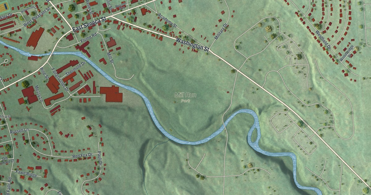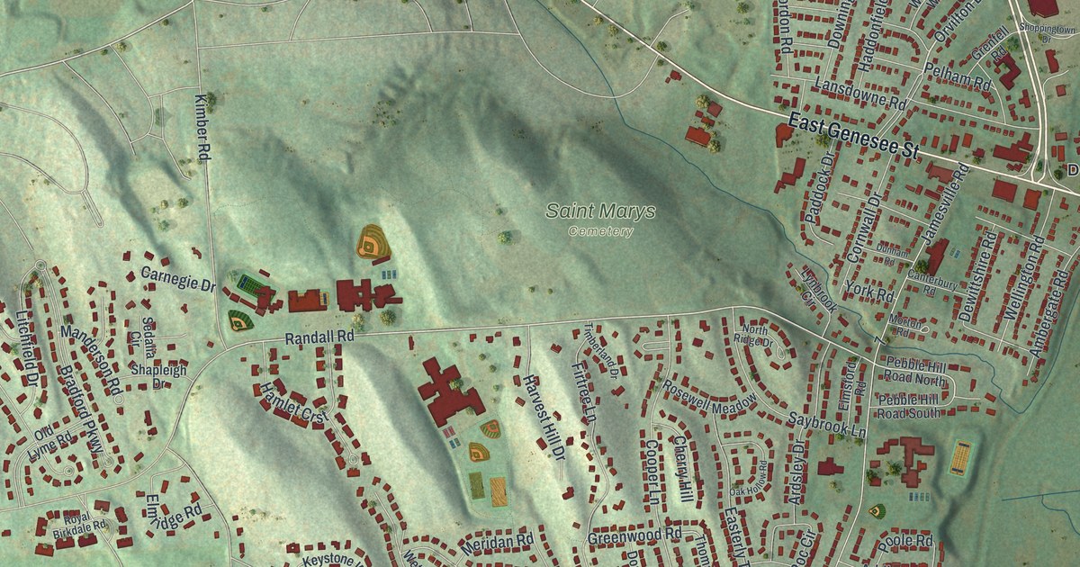
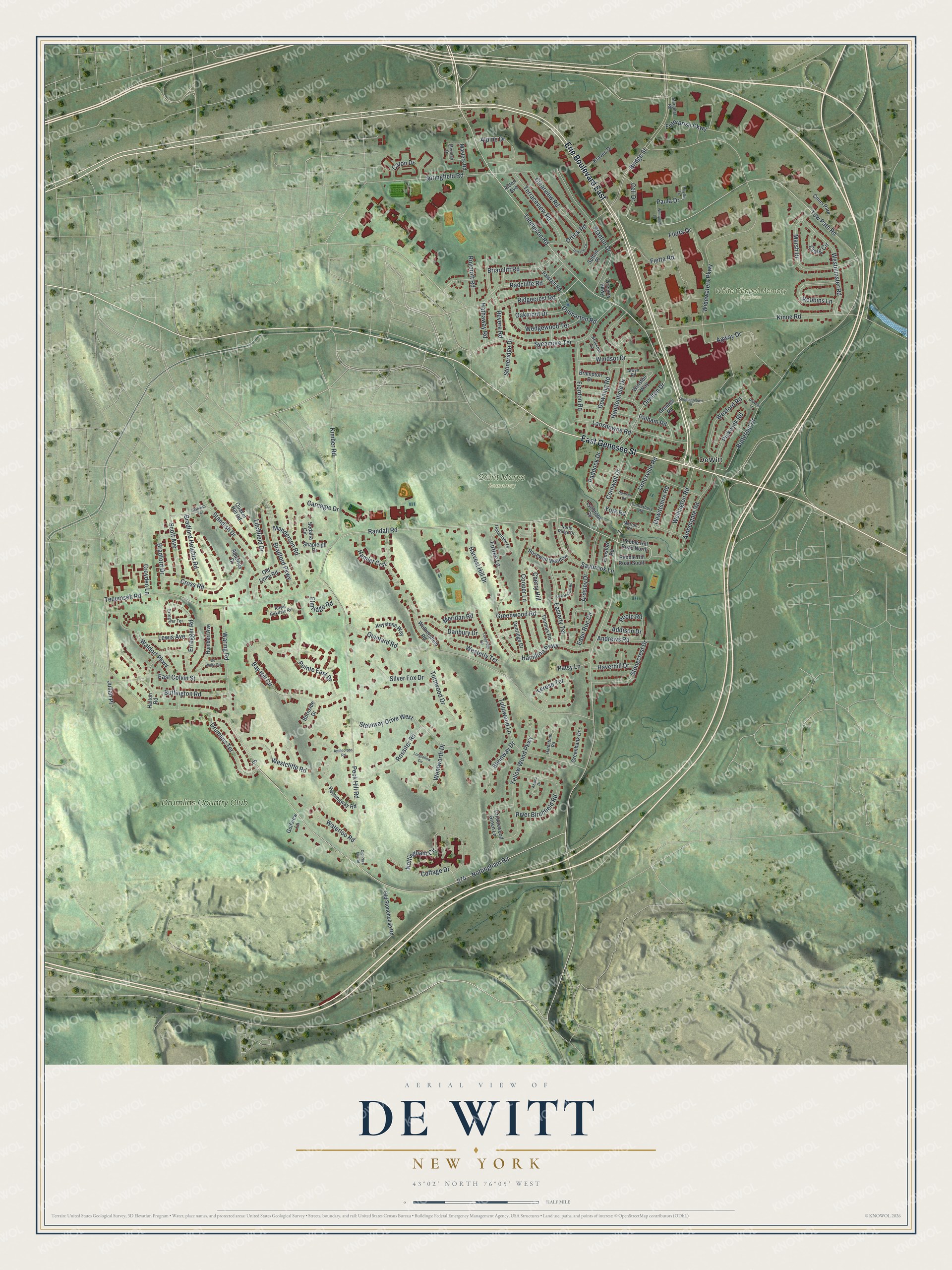
This beautifully detailed map of De Witt, New York was created in 2026 using aerial imagery combined with modern topographical, census, street and landmark data. It's a modern aerial view of De Witt in Onondaga County, New York, that combines modern data with a vintage aesthetic. The roads feature printed names, and if you look closely you can find your exact house accurately shown in its correct location.
Explore an aerial view of De Witt, New York
On this map you'll find Saint Marys Cemetery, White Chapel Memory Gardens, DeWitt, Drumlins Country Club, Erie Boulevard East, East Genesee Street, Thompson Road, Orvilton Drive, Tow Path Road, Randall Road, Greenwood Road, Bridge Street, and more. Each red shape is a building, so zoom in on the preview and look for yours.
Here is a piece of De Witt history. DeWitt began as Youngsville. John Young, a Revolutionary soldier, settled there about 1790, and his six sons and three daughters grew up and settled around him; he kept the first tavern and built the first frame house. A post office named Orville opened in 1814, and in 1835 the name was changed to De Witt. For a time it was also called Hull's Landing, and Hull's grist mill, reached by boats on the canal, became a great shipping point. That's from the Onondaga historian William Beauchamp.
De Witt is a community in Onondaga County. The Census Bureau counted 11,247 people here in 2020.
Take a closer look at the De Witt map
Names on this map
These names are printed on this map.
Places: Saint Marys Cemetery, White Chapel Memory Gardens, DeWitt, Drumlins Country Club and Cmns Park.
Streets and roads: Erie Boulevard East, East Genesee Street, Thompson Road, Orvilton Drive, Tow Path Road, Randall Road, Greenwood Road, Bridge Street, Paula Drive, Nottingham Road, Jamesville Road, Peck Hill Road.
More street names, A to Z
Addison Drive, Agway Drive, Alden Avenue, Alpine Drive, Alwyn Road, Ambergate Road, Andrews Road, Applecross Road, Aquarius Drive, Ardsley Drive, Azalea Drive, Bay Hill Circle, Bradford Drive, Bradford Heights Road, Bradford Parkway, Brampton Drive, Briarcliff Road, Brockton Lane, Buffington Road, Burnside Drive, Butternut Drive, Canterbury Road, Carnegie Drive, Caton Drive, Celi Drive, Cherry Hill, Clearview Road, Cooper Lane, Cornwall Drive, Cottage Drive, Craig Circle, Cricklewood Green Lane, Cross Road, Croyden Lane, Danbury Drive, Dewittshire Road, De Wolfe Road, Donridge Drive, Downing Road, Drovers Lane, Drumlins Terrace, Dunbarton Road, Dunham Road, East Colvin Street, Easterly Terrace, Eden Roc Circle, Elmridge Road, Elmsford Road, Enterprise Parkway, Erregger Road, Erregger Terrace, Falstaff Road, Fietta Drive, Fietta Road, Fiordon Road, Firtree Lane, Golfview Lane, Greenbank Drive, Gregory Parkway, Grenfell Road, Haddonfield Drive, Halton Road, Hamilton Parkway, Hamlet Crst, Hardstone Road, Harvest Hill Drive, Hathaway Road, Haverhill Drive, Hemingway Road, Humbert Avenue, Julian Place, Keystone Way, Kimber Road, Kinne Road, Kravec Drive, Lansdowne Road, Lewis Avenue, Litchfield Drive, Longfellow Circle, Longridge Road, Lynbrook Circle, Manderson Road, Marginal Road, Marsh Drive, Masters Road, Meridan Road, Merman Drive, Morton Road, North Ridge Drive, Nottingham Circle, Oak Hollow Road, Oakmont Drive, Old Lyme Road, Old Peck Hill Road, Old Stonehouse Road, Orrick Road, Paddock Drive, Patsy Lane, Pebble Hill Road North, Pebble Hill Road South, Pelham Road, Phyllis Lane, Pickwick Road, Pointe East Drive, Poole Road, Quaker Hill Road, Quintard Road, Radcliffe Road, Revere Road, Ridgecrest Road, River Birchfield Road, Robbins Lane, Rosewell Meadow, Rossiter Road, Royal Birkdale Road, Roycroft Road, Saybrook Lane, Scott Avenue, Sedalia Circle, Shapleigh Drive, Shoppingtown Drive, Silver Fox Drive, Springfield Road, Standish Drive, Standish Terrace, Stanton Drive, Steinway Drive, Steinway Drive West, Stonecrest Drive, Stoneridge Drive, Sutton Place, Sycamore Terrace, Tecumseh Road, Terese Terrace, Terrace Circle, Terraceview Road, Thomas Road, Timberland Drive, Tulipwood Lane, Turnwood Drive, Waldorf Parkway, Waring Road, Waterloo Road, Wedgewood Terrace, Wellington Road, Wentworth Drive, Westcliffe Road, Westerly Terrace, Westminster Road, Wethersfield Road, Wexford Road, Whirlybird Lane, Widewaters Parkway, Windsor Drive, Winston Way, Yellow Wood Parkway, York Road.
See it on a wall
The De Witt map as a framed print. Swipe for more.


Created by KNOWOL in 2026. The buildings are small red shapes, the roads carry their printed names, and shaded relief shows the shape of the land. The title panel reads "AERIAL VIEW OF DE WITT, NEW YORK" with 43°02' NORTH 76°05' WEST.
It suits a den, a classroom or a front hall, and it makes a gift for anyone with De Witt roots. Open the preview and find the block you know. See sizes and frames for the De Witt map.