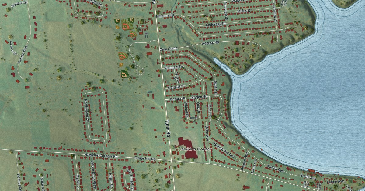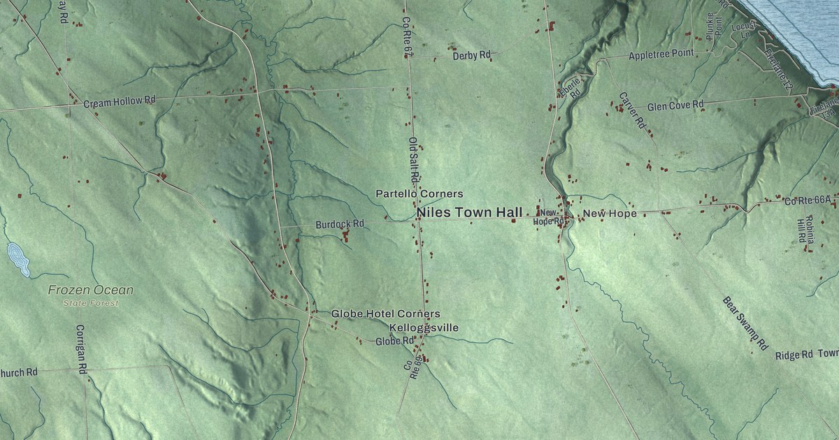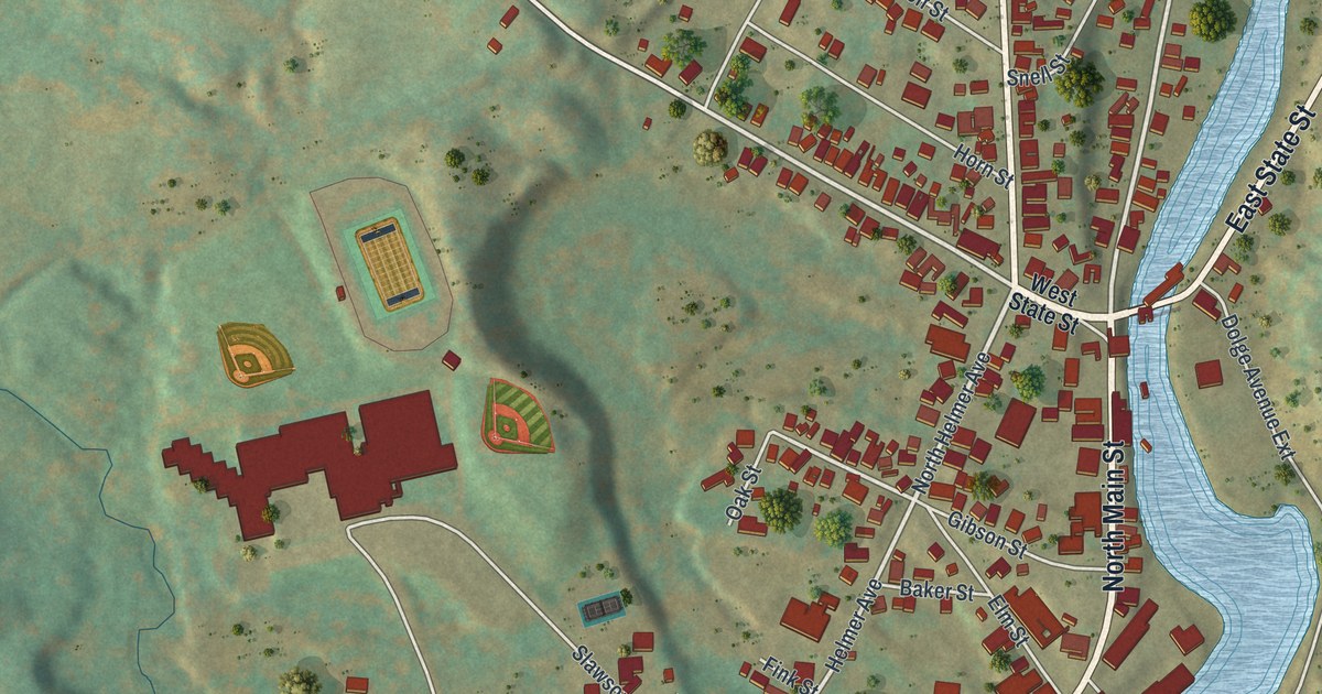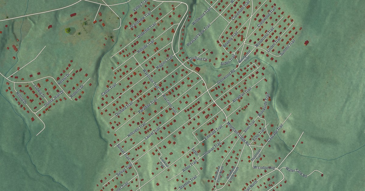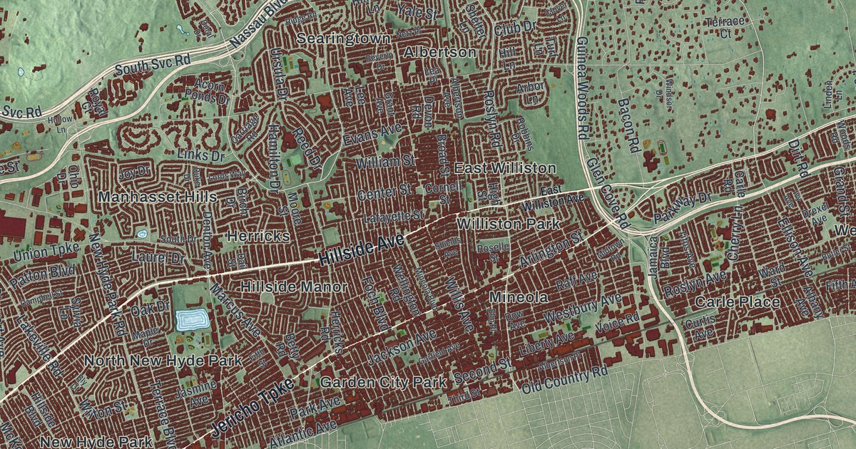
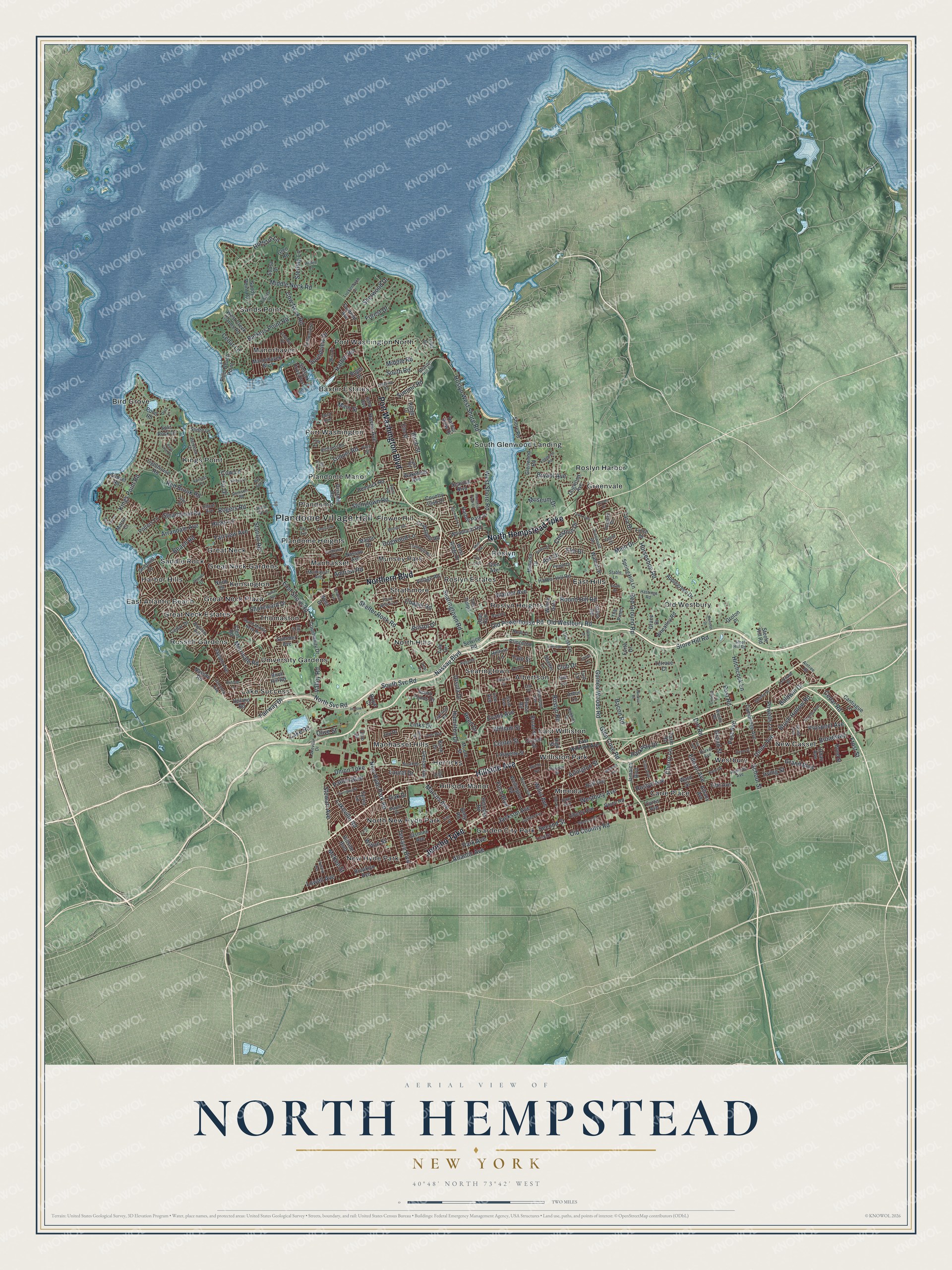
This beautifully detailed map of North Hempstead, New York was created in 2026 using aerial imagery combined with modern topographical, census, street and landmark data. It’s a one-of-a-kind view of North Hempstead that combines accurate data with a vintage aesthetic. The map shows every building in its true location, many of the roads carry their names, and the shaded topographic relief shows the shape of the land.
Explore an aerial view of North Hempstead, New York
On the map you’ll find Plandome Village Hall, Albertson, Bird Grove, Carle Place, East Atlantic Beach, and East Hills, along with Jericho Turnpike, Northern Boulevard, Hillside Avenue, Hempstead Turnpike, and more. If you look closely you can even find your house accurately drawn in its correct location. Zoom in on the preview to look for yours.
Did You Know?
During the Revolution, the old town of Hempstead was divided. Its southern half was mostly loyal to the Crown. The northern half, settled by Yankees, backed the revolution. After the war, in 1784, the north split off as North Hempstead, named for its place north of Hempstead.
Take a closer look at the North Hempstead map
Names on this map
These names are printed on this map.
Places: Plandome Village Hall, Albertson, Baxter Estates, Bird Grove, Carle Place, East Atlantic Beach, East Hills, East Williston, Flower Hill, Garden City Park, Great Neck, Great Neck Estates, Great Neck Gardens, Great Neck Plaza, Greenvale, Harbor Hills, Herricks, Hillside Manor, Kensington, Kings Point, Lake Success, Manhasset, Manhasset Hills, Manorhaven, Mineola, Munsey Park, New Cassel, New Hyde Park, North Hills, North New Hyde Park, Old Westbury, Plandome, Plandome Heights, Plandome Manor, Port Washington, Port Washington North, Roslyn, Roslyn Estates, Roslyn Harbor, Roslyn Heights, Russell Gardens, Saddle Rock, Sands Point, Searingtown, South Glenwood Landing, Strathmore, Thomaston, University Gardens, Westbury and Williston Park.
Streets and roads: Jericho Turnpike, Northern Boulevard, Hillside Avenue, North Hempstead Turnpike, Port Washington Boulevard, Old Westbury Road, Roslyn Road, Shelter Rock Road, Nassau Boulevard, Forest Drive, Museum Drive, South Svc Road.
More street names, A to Z
Acorn Ponds Drive, Aintree Road, Albany Avenue, Albertson Avenue, Albertson Place, Allen Drive, Andrew Road, Applegreen Drive, Arbor Lane, Arbor Road, Arden Lane, Arlington Street, Arrandale Avenue, Ash Drive, Ashwood Road, Atlantic Avenue, Bacon Road, Baldwin Drive, Barkers Point Road, Bayview Avenue, Beach Road, Beacon Hill Road, Betty Road, Beverly Drive, Birchdale Lane, Birch Drive, Birch Hill Road, Birch Street, Blue Sea Lane, Bly Court, Bond Street, Boulder Road, Bristol Drive, Broad Street, Broadway, Brooklyn Avenue, Brush Hollow Road, Bryant Avenue, Butler Street, Cambridge Avenue, Campbell Street, Cantiague Lane, Capi Lane, Carle Road, Carriage Lane, Carriage Road, Cedar Drive, Cedar Lane, Cedar Road, Center Street, Central Drive, Chapel Road, Cherry Lane, Chestnut Drive, Clapham Avenue, Clent Road, Clover Drive, Clover Lane, Club Drive, Community Drive, Concord Avenue, Cornell Street, Country Club Drive, Cow Lane, Cow Neck Road, Crabapple Road, Curtis Avenue, Dail Street, Deer Run, Denton Avenue, Devon Road, Dirt Road, Dock Lane, Dogwood Avenue, Dogwood Lane, Doral Drive, Dover Street, Dow Avenue, Drexel Avenue, Driftwood Drive, Duke Drive, East Shore Road, East Williston Avenue, Ellard Avenue, Ellison Avenue, Elm Drive, Elm Place, Elm Street, Engineers Road, Evans Avenue, Fairfield Avenue, Fairfield Road, Fairview Avenue, Fairway Drive, Fifth Avenue, Fifth Street, Finch Drive, Fir Drive, Foch Boulevard, Forte Drive, Fourth Avenue, Frost Street, Garfield Avenue, Gay Drive, Glen Avenue, Glen Cove Road, Glen Road, Glenwood Road, Grace Avenue, Grace Drive, Grand Avenue, Grand Boulevard, Grand Street, Grant Avenue, Gristmill Lane, Gristmill Road, Groton Place, Guinea Woods Road, Gulls Cv, Hamilton Drive, Harbor Hill Road, Harbor Park Drive, Harbor Road, Harbor View Drive, Hastings Road, Haven Avenue, Helen Drive, Hemlock Drive, Hemlock Road, Herricks Road, Hicks Lane, High Street, Hill Lane, Hillside Boulevard, Hillturn Lane, Hitchcock Lane, Hoffstot Lane, Holland Avenue, Hollow Lane, Horseshoe Road, Industrial Park Drive, Irma Avenue, Irving Street, Ivy Avenue, Jackson Avenue, Jamaica Boulevard, Jasmine Avenue, Jayson Avenue, Joy Drive, Kings Point Road, Lafayette Street, Lake Road, Lakeville Drive, Lakeville Road, Laurel Drive, Lea Place, Lee Avenue, Leonard Drive, Liberty Avenue, Lighthouse Road, Linden Lane, Links Drive, Locust Lane, Longview Road, Lords Way, Lowell Avenue, Luckenbach Lane, Luquer Road, Lynn Road, Main Drive, Main Street, Manhasset Avenue, Manorhaven Boulevard, Mansion Drive, Maple Drive, Maple Street, Marcus Avenue, Martin Court, Mason Drive, McKee Street, Merrivale Road, Middle Neck Road, Middle Road, Midtown Road, Mimosa Drive, Mineola Boulevard, Miro Place, Moore Street, Mott Avenue, Nassau Avenue, Nassau Road, Netz Place, New Hyde Park Road, North Court, North Drive, North Svc Road, Oak Drive, Ohio Drive, Old Country Road, Old Powerhouse Road, Olive Street, Park Avenue, Parkway Drive, Patton Boulevard, Payne Whitney Lane, Peach Drive, Peacock Drive, Pine Street, Pine Tree Drive, Pinewood Road, Plum Beach Point, Pond Road, Poplar Drive, Post Avenue, Post Road, Potters Lane, Powells Lane, Princeton Street, Prospect Avenue, Queen Street, Raff Avenue, Railroad Avenue, Red Brook Road, Red Ground Road, Reed Drive, Remsen Road, Reni Road, Richards Road, Ridge Drive, Ridge Road, Robbins Drive, Robbins Lane, Roger Drive, Rogers Road, Roselle Street, Roslyn Avenue, Roslyn West Shore Road, Round Hill Road, Royal Court, Sands Point Road, School Street, Searingtown Road, Seaview Boulevard, Second Street, Service Road, Shelter Bay Drive, Shelter Lane, Sherwood Drive, Shields Avenue, Shore Drive, Shore Road, Shoreward Drive, Sinclair Drive, Sintsink Drive East, Soundview Drive, Sousa Drive, South Drive, South Middle Neck Road, South Road, South Street, Split Rock Drive, Spring Hill Lane, Stable Lane, Station Road, Steamboat Road, Steele Hill Road, Steel Hill Road, Sterling Lane, Steven Lane, Stewart Avenue, Stonytown Road, Store Hill Road, Summer Avenue, Summit Road, Sunset Road, Sylvia Lane, Tara Drive, Terrace Boulevard, Terrace Court, The Loch, The Pines, The Terrace, The Tulips, Third Avenue, Third Street, Tibbits Lane, Titus Avenue, Todd Drive, Town Path, Trumbull Road, Turf Lane, Union Avenue, Union Turnpike, Upland Road, Urban Avenue, Ursula Drive, Valley Road, Vanad Drive, Vanderbilt Avenue, Village Road, Voice Road, Wakefield Avenue, Walnut Drive, Ward Street, Warner Avenue, Wellington Road, Westbury Avenue, West Creek Farms Road, West Drive, West Ridge Drive, West Shore Road, Wheatley Road, William Street, Willis Avenue, Willow Gate, Wilton Street, Windsor Drive, Woodland Road, Woods Drive, Woods Road, Yale Drive, Yale Street.
See it on a wall
The North Hempstead map as a framed print. Swipe for more.


This beautifully detailed map of North Hempstead makes an attractive addition to your office, library, or den, and it can even be used to teach children the geography and history of the area. It also makes a great gift for someone who left North Hempstead and still calls it home. When you’re done exploring, click here to get your copy of the North Hempstead map.