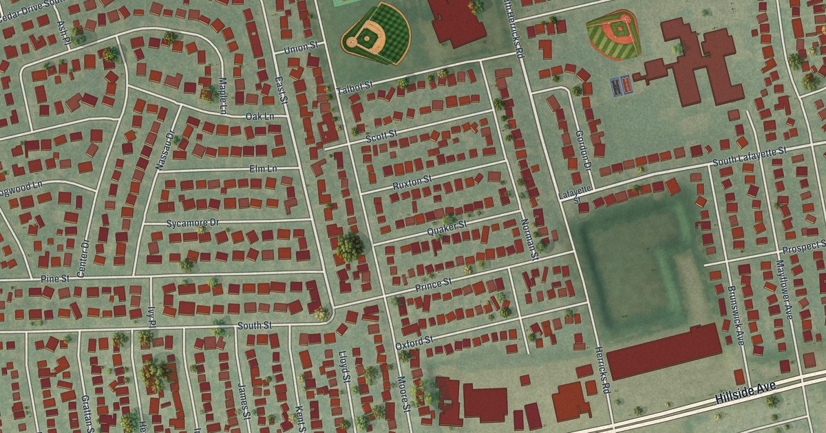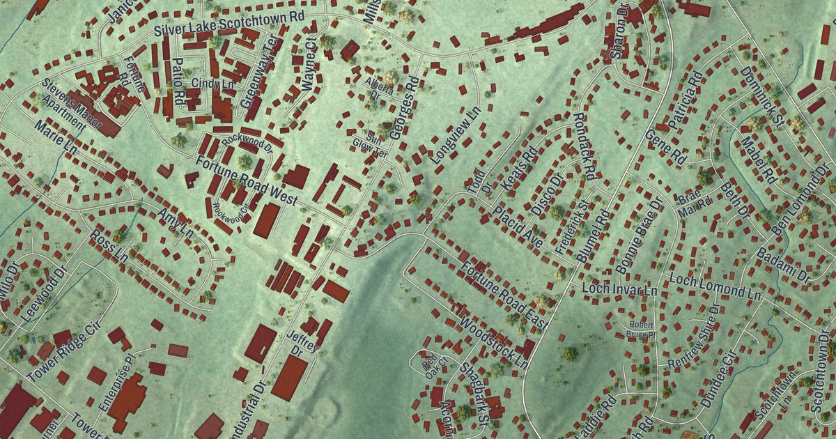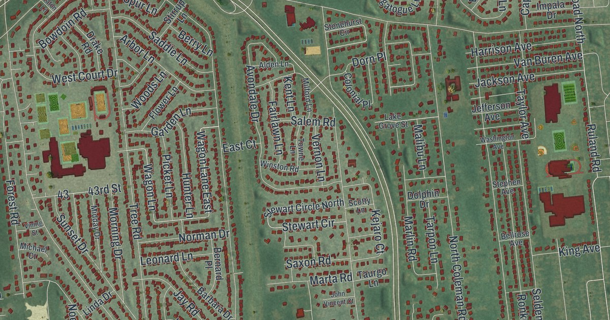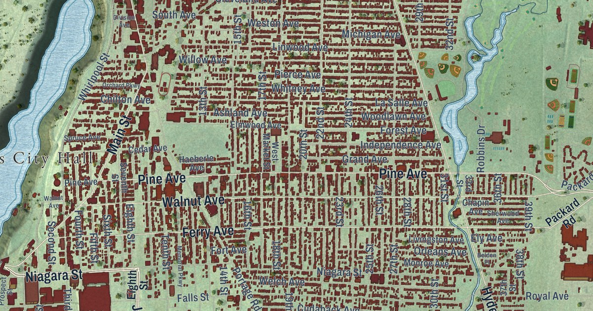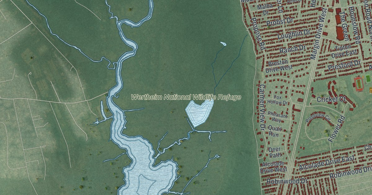
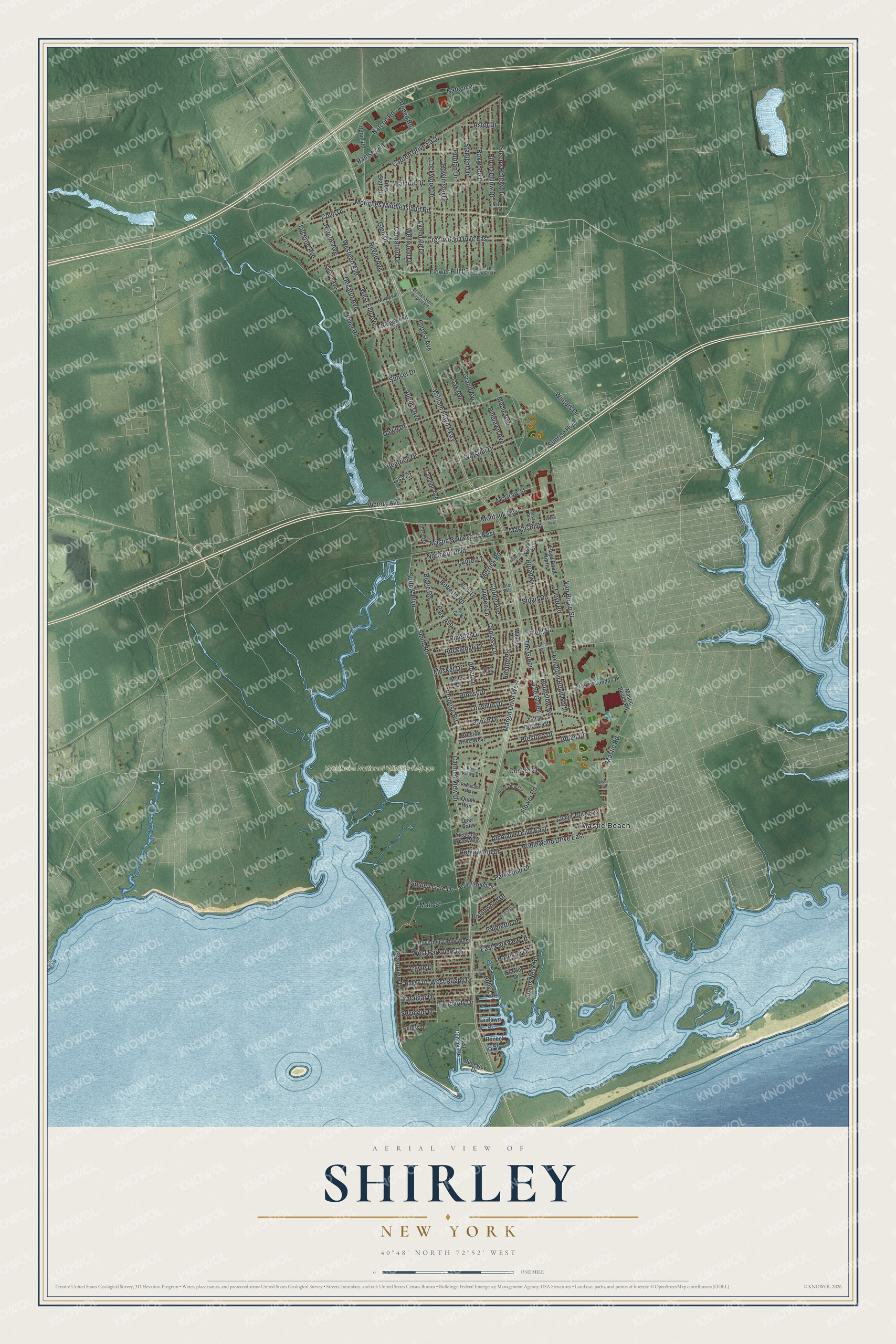
This beautifully detailed map of Shirley, New York was created in 2026 using aerial imagery combined with modern topographical, census, street and landmark data. It’s a one-of-a-kind view of Shirley that combines accurate data with a vintage aesthetic. The map shows every building in its true location, many of the roads carry their names, and the shaded topographic relief shows the shape of the land.
Explore an aerial view of Shirley, New York
On the map you’ll find Mastic Beach and Wertheim National Wildlife Refuge, along with Moriches Middle Island Road, William Floyd Parkway, Grand Avenue, Winters Drive, Parkview Drive, and more. If you look closely you can even find your house accurately drawn in its correct location. Zoom in on the preview to look for yours.
Did You Know?
Shirley was once called Tangiers, after William Tangier Smith. In the 1940s developer Walter T. Shirley set out to make the Mastic Bay area affordable. His company built 4,000 houses with four rooms each, priced from 4,700 dollars. The hamlet carries his name.
Take a closer look at the Shirley map
Names on this map
These names are printed on this map.
Places: Wertheim National Wildlife Refuge and Mastic Beach.
Streets and roads: Moriches Middle Island Road, William Floyd Parkway, Broadway, Grand Avenue, Winters Drive, West Parkview Drive, Smith Road, Revilo Avenue, Auborn Avenue, River Road, West End Avenue, Westend Avenue.
More street names, A to Z
Abby Lane, Alcolade Drive East, Alcolade Drive West, Alder Lane, Appel Drive, Argyle Drive, Astor Drive, Avondale Drive, Baybright Drive West, Beatrice Drive, Birch Hollow Drive, Boxwood Drive, Breston Drive West, Brookhaven Airport Road, Brushwood Drive, Candido Avenue, Carlton Drive East, Carmen View Drive, Carnation Drive, Chanel Drive East, Colin Drive, Commack Road, Corbin Avenue, Crestwood Drive East, Cricket Court, Cypress Lane, Dawn Drive, Decatur Avenue, Deer Path, Dorsett Place, Duneview Drive, East Concourse, East Parkview Drive, Essex Circle, Fairlawn Court, Fleet Road, Flower Hill Drive, Flower Hill Drive East, Flower Road, Floyd Road, Floyd Road North, Forrest Avenue, Fox Hollow Drive, Francis Landau Place, Free State Drive, Glen Drive, Golden Gate Drive, Grandview Drive, Happy Acres Drive, Harrison Drive, Havenwood Drive, Helene Avenue, Heston Road, Holly Lane, Hounslow Road, Johns Neck Road, Laurel Lane, Lawrence Road, Lexington Road North, Linden Lane, Lisa Court, Lockwood Drive, Lombardy Drive, Loughlin Drive, Lucerne Avenue, Main Street, Malba Drive, Manor Drive, Maple Avenue, Margin Drive West, Mastic Beach Road, Mastic Boulevard, Mastic Boulevard West, Mastic Road, McGraw Street, Merrick Road, Montauk Highway, Musket Drive, Natcon Drive, Natcon Road, Northern Boulevard, Norwood Drive, Oak Avenue, Ostend Circle, Palmetto Drive, Park Avenue, Park Circle, Parkwood Drive, Patton Avenue, Peters Drive, Pheasant Way, Pinelawn Avenue, Pinetop Drive, Pondview Circle, Presford Drive, Probst Drive, Propose Road, Puritan Drive, Quail Run, Ramsey Road, Ranch Drive, Ridge Road, Ridgewood Drive, Roberts Road, Robinwood Drive, Robinwood Drive East, Rockledge Drive, Roneck Court, Roned Road, Rowlinson Drive, Rugby Drive, Seymour Drive, Silver Road, Sleepy Hollow Drive, Stanley Drive, Starlight Drive, Stuart Road, Suffolk Boulevard, Sunrise Highway, Sunset Drive, The Green, Tipton Drive East, Trafalgar Drive, Tudor Road, Upton Road, Van Buren Street, Versa Place, Victory Avenue, Vita Drive, Waldorf Drive, Wellwood Drive, West Rugby Drive, Windus Drive, Winston Drive, Wood Avenue.
See it on a wall
The Shirley map as a framed print. Swipe for more.


This beautifully detailed map of Shirley makes an attractive addition to your office, library, or den, and it can even be used to teach children the geography and history of the area. It also makes a great gift for someone who left Shirley and still calls it home. When you’re done exploring, click here to get your copy of the Shirley map.