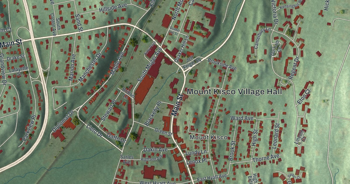
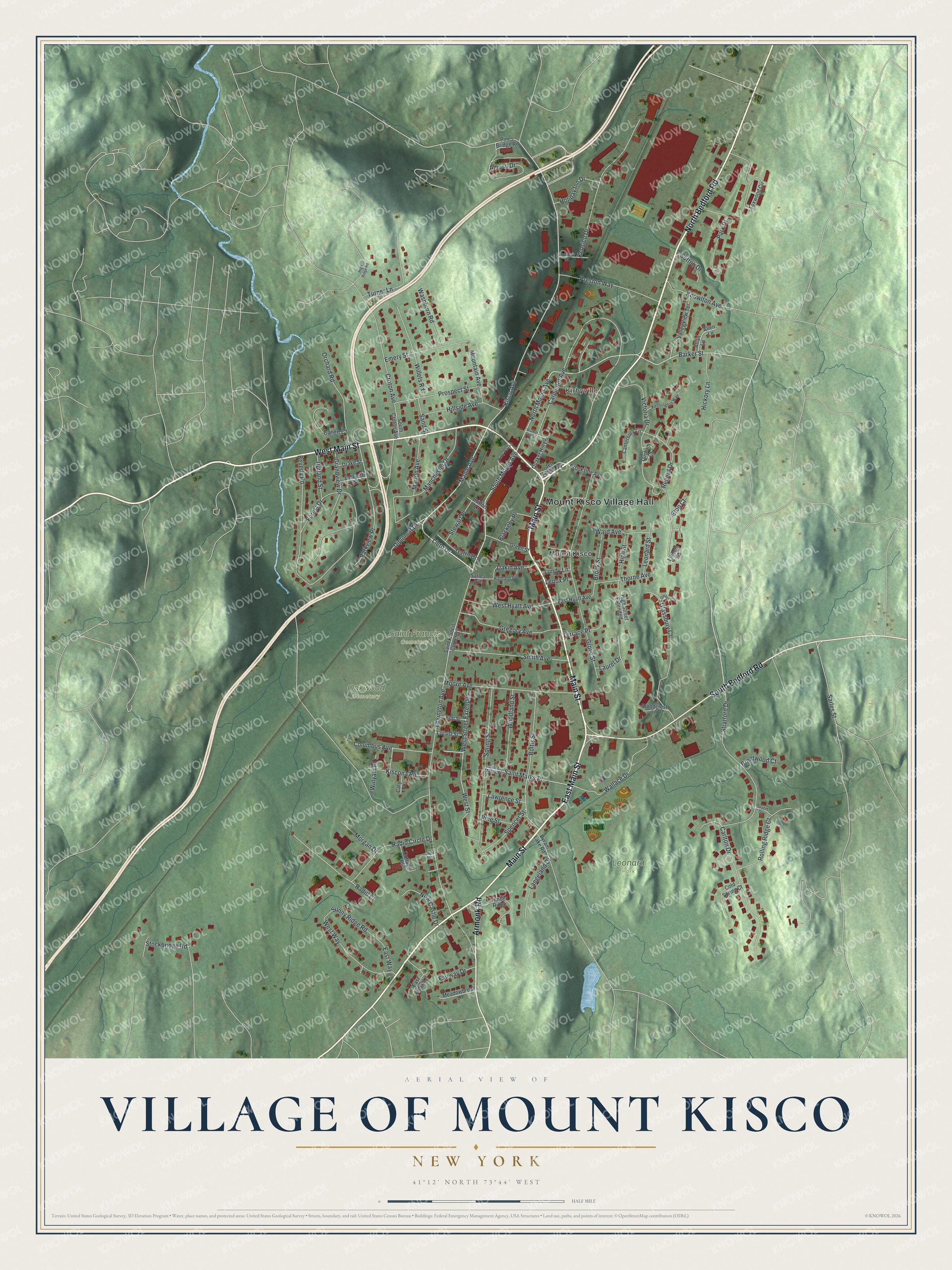
This beautifully detailed map of the Village of Mount Kisco, New York was created in 2026 using aerial imagery combined with modern topographical, census, street and landmark data. It’s a one-of-a-kind view of the Village of Mount Kisco that combines accurate data with a vintage aesthetic. The map shows every building in its true location, many of the roads carry their names, and the shaded topographic relief shows the shape of the land.
Explore an aerial view of the Village of Mount Kisco, New York
On the map you’ll find Mount Kisco Village Hall, Kirbyville, Leonard Park, Oakwood Cemetery, and Saint Francis Cemetery, along with Bedford Road, Main Street, Armonk Road, Maple Avenue, and more. If you look closely you can even find your house accurately drawn in its correct location. Zoom in on the preview to look for yours.
Did You Know?
The name of this place first showed up in colonial records as Cisqua. It named a meadow and a river in a land deed dated September 6, 1700. After 1850 the local postmaster spelled it Mount Kisko. The present spelling came in 1875, when the village incorporated.
Take a closer look at the Village of Mount Kisco map
Names on this map
These names are printed on this map.
Places: Mount Kisco Village Hall, Kirbyville, Leonard Park, Oakwood Cemetery, Saint Francis Cemetery and Mount Kisco.
Streets and roads: North Bedford Road, West Main Street, Main Street, East Main Street, South Bedford Road, Armonk Road, Maple Avenue, Lieto Drive, South Moger Avenue, North Moger Avenue, Barker Street, Diplomat Drive.
More street names, A to Z
Allan Lane, Allen Lane, Amuso Drive, Austin Drive, Beverly Road, Blackeby Place, Boltis Street, Brentwood Court, Britton Lane, Brookside Avenue, Brook Street, Byram Lake Road, Canterbury Lane, Caren Court, Carlton Drive, Carpenter Avenue, Cary Place, Cold Spring Court, Columbus Avenue, Cottage Place, Croton Avenue, Dakin Avenue, Drake Street, Durham Court, East Hyatt Avenue, East Ridge Lane, East Way, Elm Street, Emery Street, Eton Court, Fairway Drive, Forest Drive, Foxwood Circle, Gatto Drive, Gerber Court, Glassbury Court, Grandview Drive, Green Street, Gregory Avenue, Grove Street, Hickory Lane, Highland Avenue, High Ridge Road, High Street, High Street Extended, Hillside Avenue, Holiday Inn Drive, Hubbels Drive, Jeff Feigel Square, Kensico Drive, Kensington Way, Kirby Plaza, Kisco Avenue, Kiscona Road, Knowlton Avenue, Lafayette Street, Langeland Drive, Laurel Drive, Lawrence Street, Lenox Place, Leonard Street, Lexington Avenue, Lincoln Court, Lindy Street, Locust Street, Lundy Lane, Manchester Drive, Marion Avenue, Meadowbrook Lane, Moore Avenue, Morgan Drive, Mountain Avenue, New Castle Drive, Orchard Road, Park Drive, Parkview Place, Pines Bridge Road, Pine Street, Preston Way, Prospect Street, Quaker Hill Lane, Quaker Hill Street, Radio Circle Drive, Radio Court, Regent Drive, Rolling Ridge Court, Rutland Street, Saint Marks Place, Sand Street, Sarles Avenue, Sarles Street, Smith Avenue, South Croton Avenue, Spencer Street, Spring Street, Stewart Place, Stockbridge Road, Stratford Drive, Sunny Ridge Road, Sutton Drive, Terrace Place, Thorne Avenue, Timber Ridge, Turner Lane, Valley View Terrace, Victoria Drive, Wallace Drive, Ward Avenue, Washburn Road, West Hyatt Avenue, West Street, West Street Extended, West Way, Willets Road, Winyam Place, Woodcrest Lane, Woodland Street.
See it on a wall
The Mount Kisco map as a framed print. Swipe for more.


This beautifully detailed map of the Village of Mount Kisco makes an attractive addition to your office, library, or den, and it can even be used to teach children the geography and history of the area. It also makes a great gift for anyone who grew up in the Village of Mount Kisco or moved away. When you’re done exploring, click here to get your copy of the Village of Mount Kisco map.