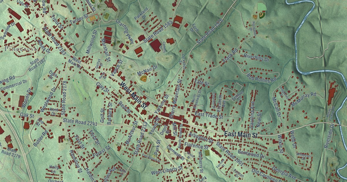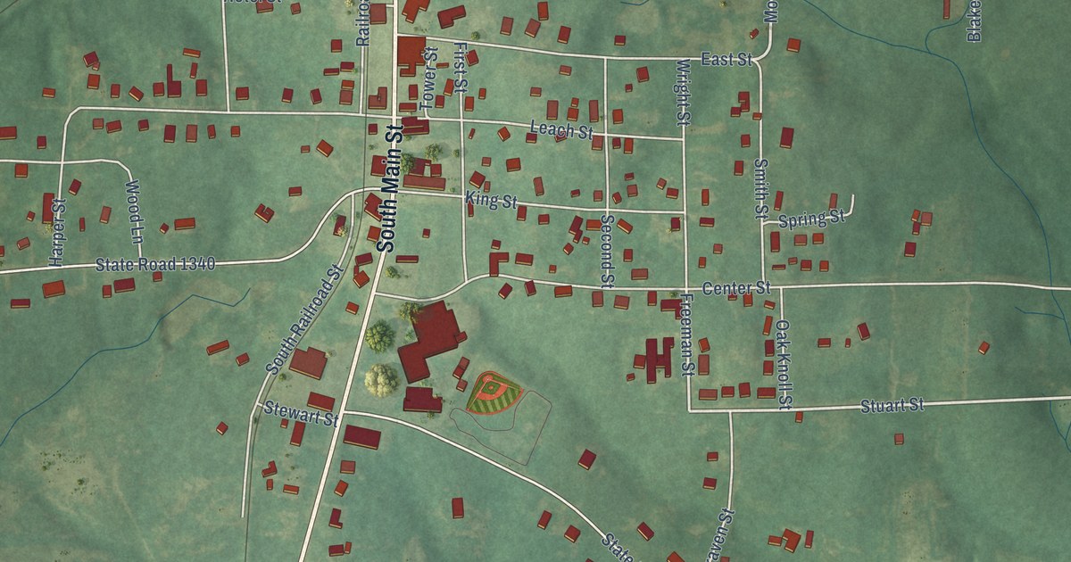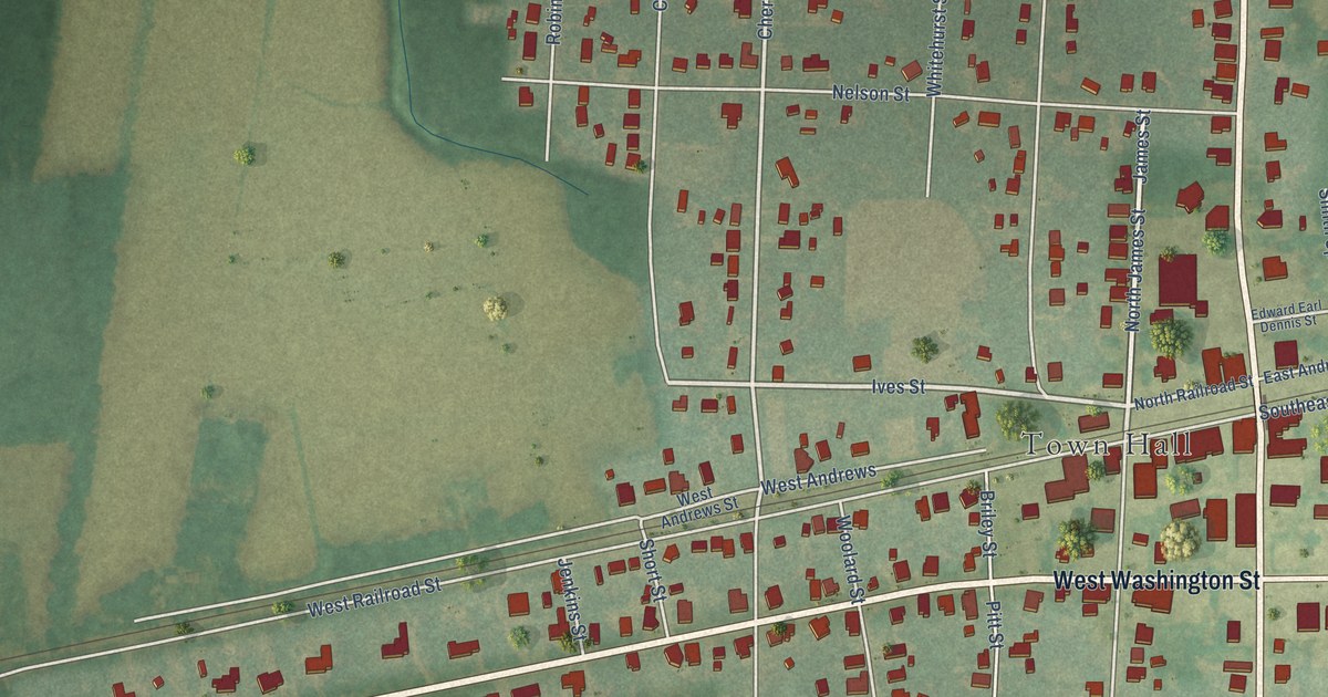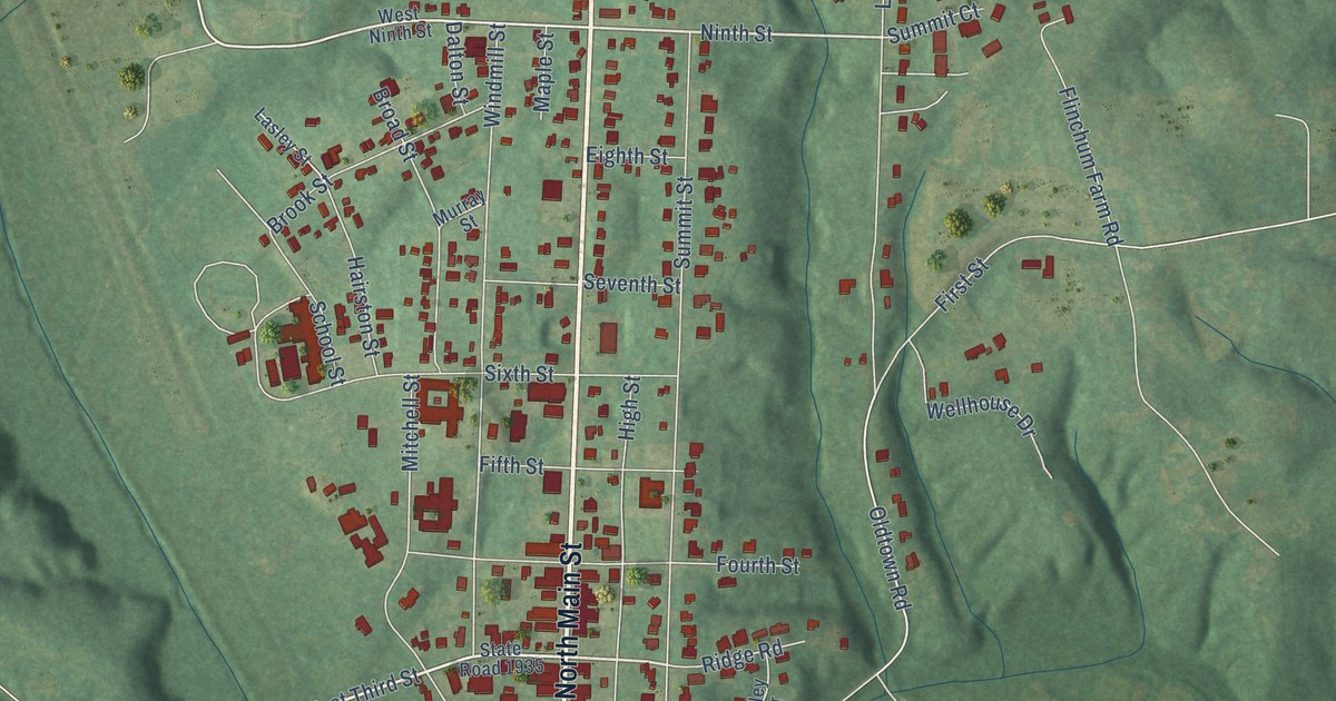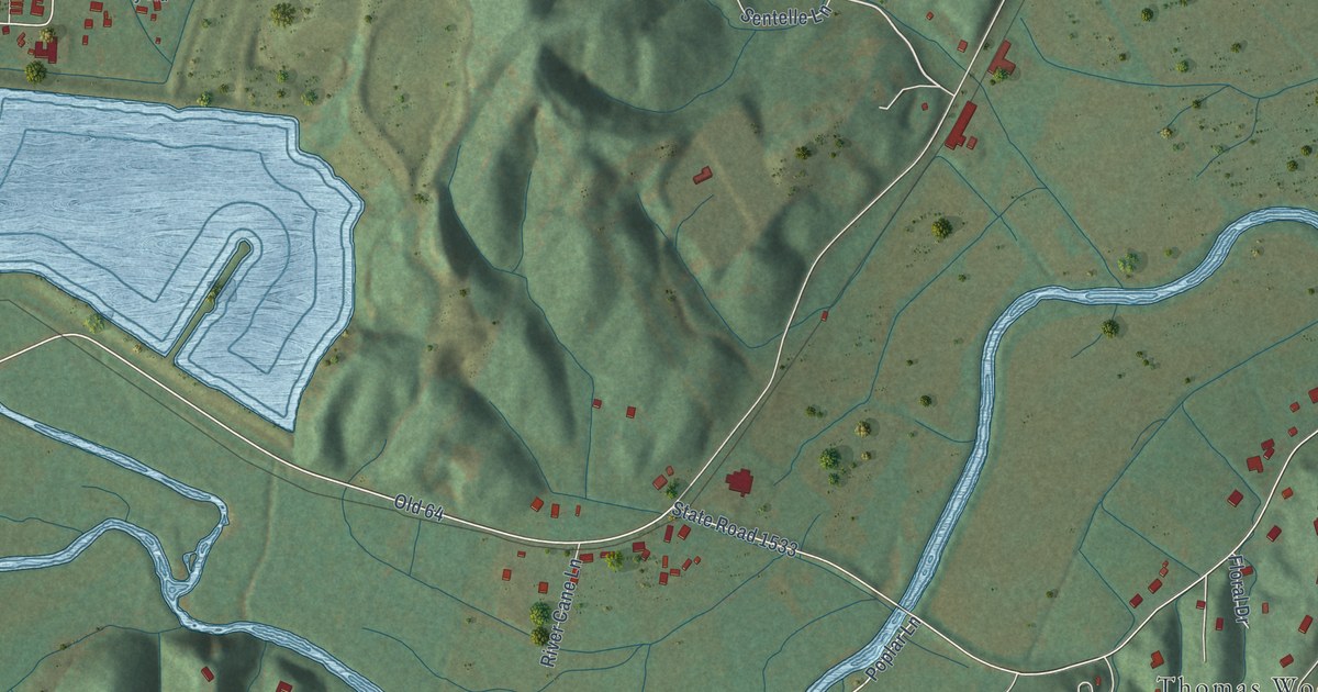
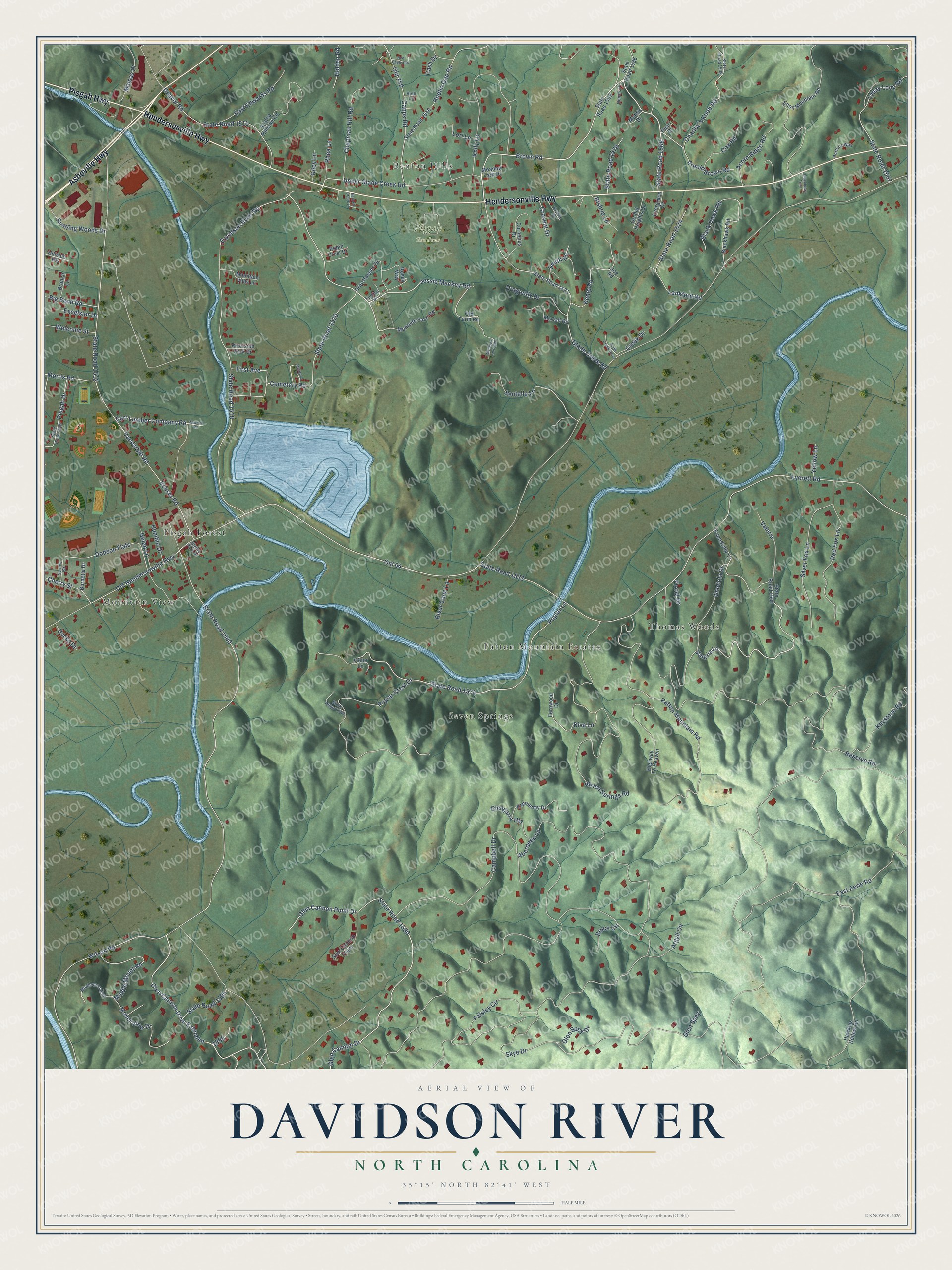
This beautifully detailed map of Davidson River, North Carolina was created in 2026 using aerial imagery combined with modern topographical, census, street and landmark data. It’s a one-of-a-kind view of Davidson River that combines accurate data with a vintage aesthetic. The map shows every building in its true location, many of the roads carry their names, and the shaded topographic relief shows the shape of the land.
Explore an aerial view of Davidson River, North Carolina
On the map you’ll find Pisgah Gardens, Thomas Woods, Seven Springs, Mountain View, Patton Mountain Estates, Pisgah Forest, and Benton Hills, along with Hendersonville Highway, Asheville Highway, Pisgah Highway, Brown Road, Cemetery Road, and more. If you look closely you can even find your house accurately drawn in its correct location. Zoom in on the preview to look for yours.
Did You Know?
From Internet Archive: "Since that time local tax districts have been established, in the order named, at Selica, Penrose, Round Top; Beauty Hill, Cedar Mountain, Rosman, Davidson River, Calvert, Gloucester (whole township), Blantyre and Old Toxaway."
Davidson River is a community in Transylvania County.
Take a closer look at the Davidson River map
Names on this map
These names are printed on this map.
Places: Pisgah Gardens, Thomas Woods, Seven Springs, Mountain View, Patton Mountain Estates, Pisgah Forest and Benton Hills.
Streets and roads: Hendersonville Highway, Asheville Highway, Pisgah Highway, Brown Road, Cemetery Road, Jessie Mackey Road, State Road 1568, Glen Cannon Drive Extended, State Road 1580, Upper Glade Creek Road, Glen Cannon Point Drive, Sentelle Lane.
More street names, A to Z
Aberdeen Lane, Acorn Ridge Road, Argyll Circle, Arnold Brown Road, Azalea Hillside Circle, Big Bend Road, Bishop Lane, Blackberry Trail, Black Hawk Road, Blackhawk Road, Blythe Park Drive, Branch Lane, Bruce Circle, Burnette Drive, Campbell Drive, Capps Road, Carr Lumber Company Road, Cash Drive, Chapman Hill Road, Charley's Knob Road, Cherry Street, Cornelius Drive, Cox Road, Creek Drive, Cresent Drive, Davidson River Road, Deavor Road, Diva Lane, Dodson Flats, Dragonfly Drive, Ducks Drive, East Aerie Road, East Edwards Road, Ecusta Road, Enon Mountain Road, Everett Road, Evergreen Cv, Excelsior Drive, Fernwood Drive, First Avenue, Floral Drive, Friendship Lane, Fulcher Drive, Glade Creek Acres, Glade Creek Road, Gladiola Drive, Glen Cannon Drive, Glen Cannon Point, Glengarry Heights, Glen Spey, Glen Spey Drive, Grey Havens Drive, Hawkins Hollow Road, Helen Lane, Highway To Heaven, Hillside Heights, Holden Road, Hudlin Gap Road, Humble Drive, Joe Road, Kelly Lane, Kemp Road, Keystone Road, Kildrummy Drive, Lankford Road, Lori Lane, Lyday Loop Road, Makenna Drive, Mamas Place, Mathis Drive, McCall Road, Meadow Lark Drive, Middle Mount Road, Middlemount Road, Monteith Farm Road, Morris Road, Mountain Laurel Road, Mountain View Lane, Mount View Drive, Nena's Place, Old 64, Old 280, Old Farm Road, Old Hendersonville Highway, Orchid Heights Drive, Paisley Circle, Parkers Creek Lane, Patton Mountain Road, Pearl Drive, Pisgah Drive, Poplar Crest Drive, Poplar Lane, Portia's Way, Red Cagle Hill, Red Fox Lane, Reserve Road, Rhea Lane, Riley Lane, River Cane Lane, Riverside Park Drive, Robin Crest Drive, Rosey Way, Rustling Woods Drive, Ruth Lane, Sawmill Road, Seven Springs Road, Short Ridge Trail, Silver Fox Lane, Skye Drive, Smith Road, Spruce Street, State Road 1507, State Road 1508, State Road 1509, State Road 1510, State Road 1511, State Road 1512, State Road 1518, State Road 1520, State Road 1521, State Road 1524, State Road 1533, State Road 1540, State Road 1569, State Road 1574, State Road 1579, State Road 1586, State Road 1595, State Road 1601, Surrette Drive, Valeria, Valeria Lane, Vanderbilt Road, Vietor Lane, Welcome Street, Wilson Road, Yellow Lane.
See it on a wall
The Davidson River map as a framed print. Swipe for more.


This beautifully detailed map of Davidson River makes an attractive addition to your office, library, or den, and it can even be used to teach children the geography and history of the area. It also makes a great gift for anyone with Davidson River roots. When you’re done exploring, click here to get your copy of the Davidson River map.