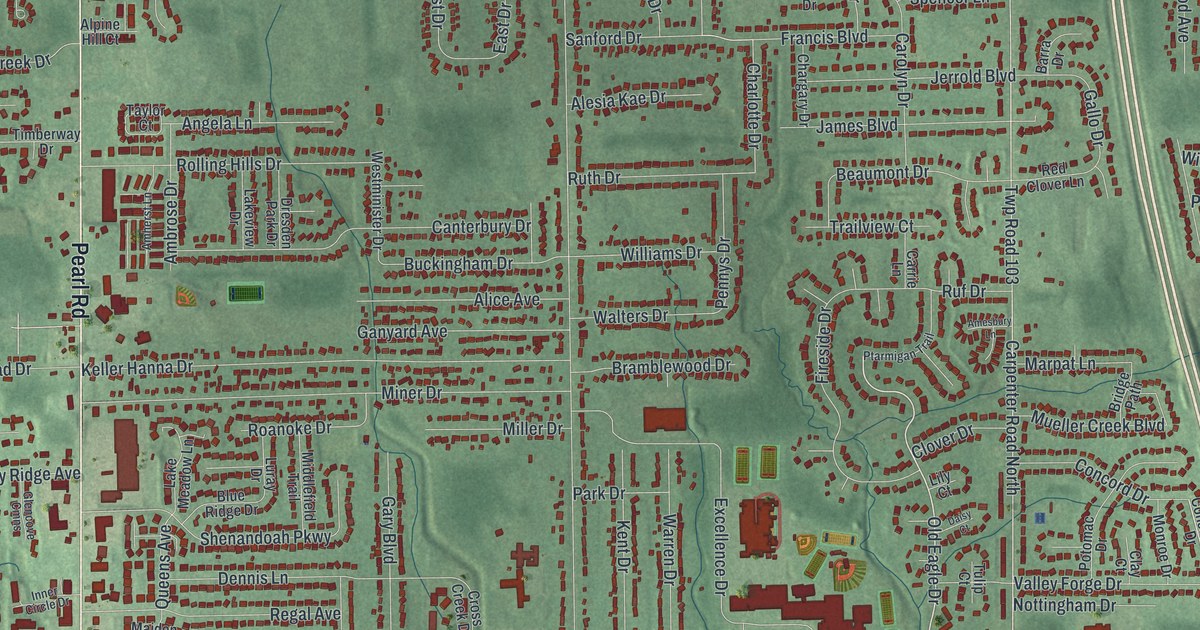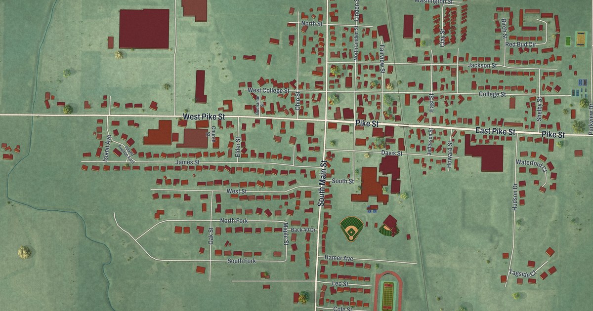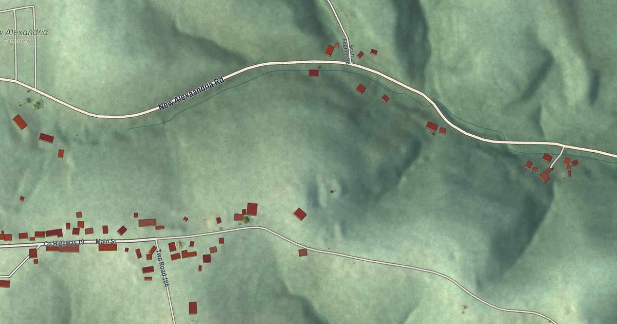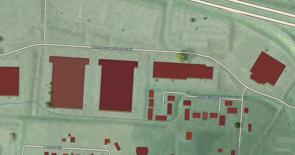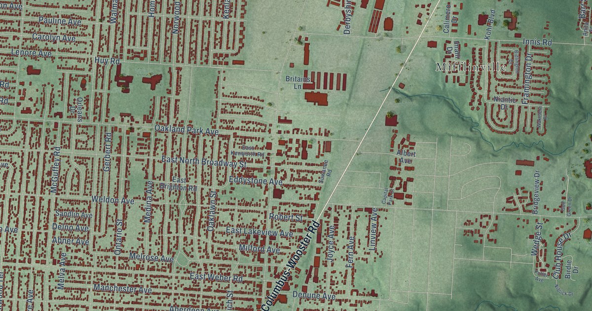
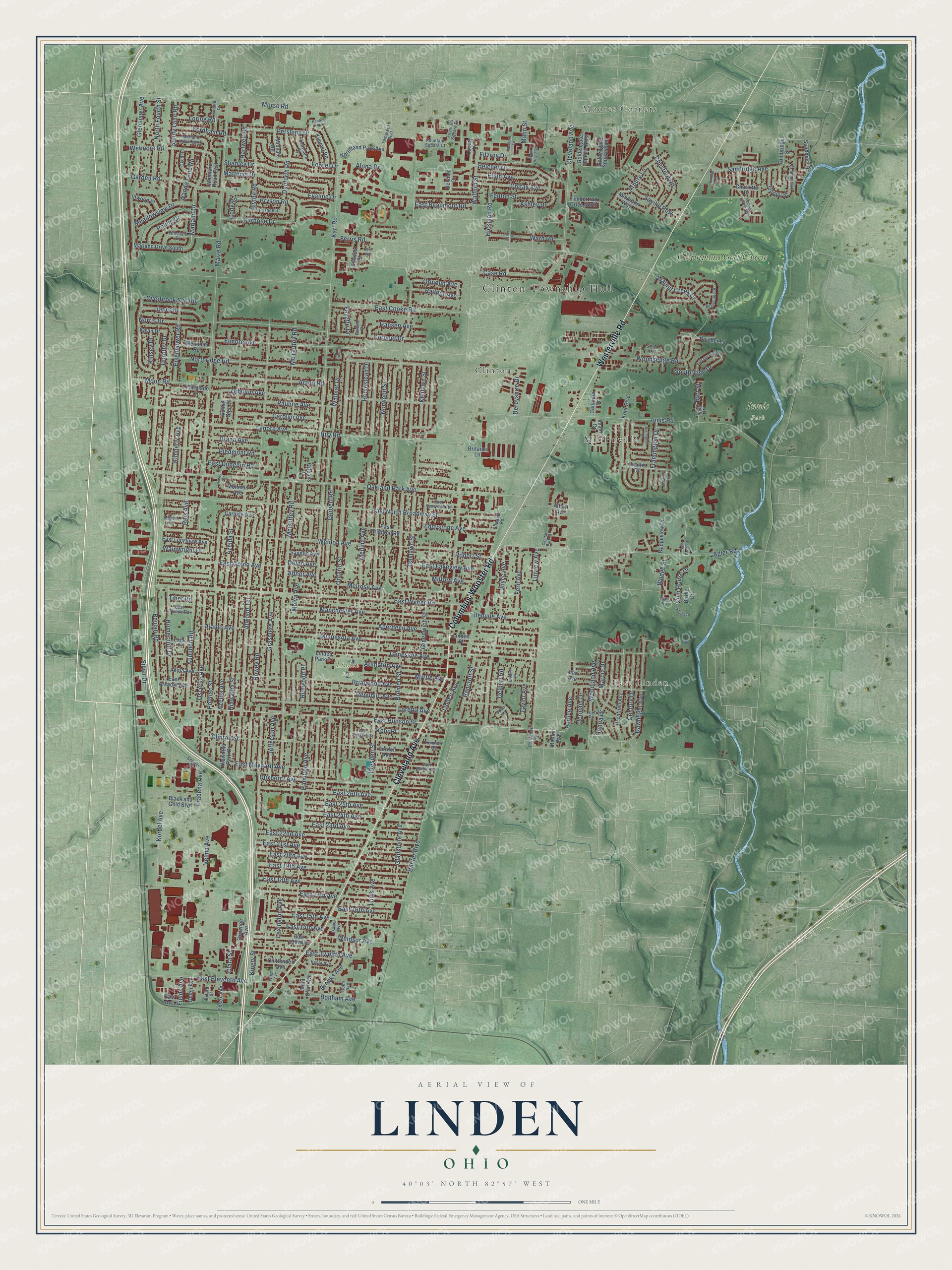
This beautifully detailed map of Linden, Ohio was created in 2026 using aerial imagery combined with modern topographical, census, street and landmark data. It’s a one-of-a-kind view of Linden that combines accurate data with a vintage aesthetic. The map shows every building in its true location, many of the roads carry their names, and the shaded topographic relief shows the shape of the land.
Explore an aerial view of Linden, Ohio
On the map you’ll find Clinton Township Hall, Moores Corners, East Linden, Innis Park, Linden Park, Mifflinville, Clinton, and Champions Golf Course, along with Cleveland Avenue, Columbus-Wooster Road, Westerville Road, Ontario Street, and more. If you look closely you can even find your house accurately drawn in its correct location. Zoom in on the preview to look for yours.
Did You Know?
President John Adams granted the Linden land to George Stevenson for his service in the War of Independence. Linden Heights Village was founded there in 1908. Its leaders wanted to join Columbus, but the borders did not touch. The village expanded south, hoping Columbus would grow north. Leaders voted for annexation in 1921.
Linden is a place in Franklin County.
Take a closer look at the Linden map
Names on this map
These names are printed on this map.
Places: Clinton Township Hall, Moores Corners, East Linden, Innis Park, Linden Park, Mifflinville, Clinton and Champions Golf Course.
Streets and roads: Cleveland Avenue, Columbus-Wooster Road, Westerville Road, Ontario Street, Atwood Terrace, East Hudson Street, Howey Road, Beulah Road, East 22nd Avenue, Marland Drive, Wainwright Drive, Pauline Avenue.
More street names, A to Z
Aberdeen Avenue, Abner Avenue, Acton Road, Agler Road, Akola Avenue, Alamo Avenue, Albert Avenue, Alona Drive, Anita Street, Arbury Lane, Arlington Avenue, Ashley Drive, Audubon Road, Azelda Avenue, Azelda Street, Bancroft Street, Barr Street, Beacontree Drive, Belcher Court, Belcher Drive, Bidlington Drive, Billiter Boulevard, Birdie Drive, Black and Gold Boulevard, Blenheim Road, Blythe Road, Bonham Avenue, Boulder Lane, Bremen Street, Brentnell Avenue, Bretton Place, Briarwood Avenue, Bridgeview Drive, Brighton Road, Britains Lane, Brooks Avenue, Bryson Road, Burnell Circle West, Calimero Drive, Capital Park Court, Carbone Drive, Carlisle Avenue, Carolyn Avenue, Case Road, Century Drive, Charlotte Drive, Chesford Road, Chittenden Avenue, Clara Street, Clinton Street, Club House Drive, Cody Road, Colfax Avenue, Commodore Street, Cordell Avenue, Coronet Drive, Danforth Road, Dawnlight Avenue, Delbert Road, Delno Avenue, Densmore Road, Denune Avenue, Derbyshire Drive, Dolle Avenue, Dorothy Drive, Dow Avenue, Dresden Street, Dunbridge Street, Duxberry Avenue, Earl Avenue, East 13th Avenue, East 14th Avenue, East 15th Avenue, East 16th Avenue, East 17th Avenue, East 18th Avenue, East 19th Avenue, East 20th Avenue, East 21st Avenue, East 23rd Avenue, East 24th Avenue, East 25th Avenue, East 26th Avenue, East Arcadia Avenue, East Beaumont Road, East Blake Avenue, East Brighton Road, East Como Avenue, East Cooke Road, East Dunedin Road, East Eleventh Avenue, East Kenworth Road, East Lakeview Avenue, East Longview Avenue, East Maynard Avenue, East North Broadway Street, East Tompkins Street, East Tulane Road, East Twelfth Avenue, East Weber Road, Eddystone Avenue, Eden Avenue, Edgar Place, Eisenhower Road, Elmore Avenue, Elmore Court, Emslie Drive, Essex Avenue, Estates Place, Evaline Drive, Fairglade Lane, Fayette Drive, Fenton Street, Fern Avenue, Ferris Road, Fields Avenue, Fitzroy Drive, Fordham Road, Fountain Square Court, Fountain Square Drive, Fowler Drive, Fradena Avenue, Framington Drive, Frisbee Drive, Ganson Drive, Garden Road, Genessee Avenue, Gerbert Road, Gladstone Avenue, Glenmawr Avenue, Goldengate Square East, Goldengate Square West, Golf Green Drive, Grasmere Avenue, Greenwich Street, Hamilton Avenue, Hanna Drive, Hansen Avenue, Hartwell Road, Hiawatha Park Drive, Hiawatha Street, Hickman Road, Hillsdale Drive, Homecroft Drive, Homestead Drive, Huy Road, Imani Drive, Innis Road, Inwood Place, Isabel Avenue, Janet Drive, Jefferson Avenue, Jermain Drive, Joan Place, Joel Place, Jonquil Street, Joyce Avenue, Karl Road, Keffer Road, Kenfield Road, Kenlawn Street, Kenmore Road, Kevin Drive, Kimberly Avenue, Kimmel Road, Kingry Street, Kinsey Drive, Kohr Boulevard, Kohr Place, Korbel Avenue, Lenore Avenue, Lexington Avenue, Linden Avenue, Linden Park Drive, Linden Place, Linview Avenue, Loretta Avenue, Loring Road, Louis Avenue, Luxury Lane, Maize Road, Malin Drive East, Malin Street, Manchester Avenue, Marcia Drive, Marland Drive North, Marland Drive South, Matthias Drive, McGuffey Road, Mc Guffey Road, Meadowview Drive, Medina Avenue, Melrose Avenue, Melva Avenue, Midvale Road, Milford Avenue, Milverton Way, Minnesota Avenue, Mohican Avenue, Moon Road, Morse Road, Myrtle Avenue, Niantic Drive, Niblick Drive, Norris Drive, North Fourth Street, Northland Park Avenue, Northridge Road, Norwood Street, Oakland Park Avenue, Oaklawn Street, Ohlen Avenue, Okell Road, Orleans Drive, Ormond Avenue, Osceola Avenue, Osceola Drive, Overbrook Svc Road, Oxford Street, Parkwood Avenue, Perdue Avenue, Pershing Drive, Piedmont Road, Poling Drive, Pontiac Street, Putter Avenue, Radnor Avenue, Rankin Avenue, Reis Avenue, Renwood Place, Republic Avenue, Robert Street, Saint Clair Avenue, Sale Road, Sandlin Avenue, Sandridge Avenue, Sandy Lane Road, Saville Row, Service Road, Shanley Drive, Shawnee Avenue, Silver Drive, Southridge Drive, Staci Lane, Summit Drive, Sundance Drive, Sunny Glen Place, Suwanee Road, Tamarack Boulevard, Taylor Avenue, Tibet Road, Timbertrail Drive North, Urana Avenue, Vantage Point Drive, Velma Avenue, Vesta Avenue, Wakefern Place, Walford Lane, Walford Street, Walmar Drive, Walnut Creek Drive, Wanda Lane Road, Ward Road, Wedge Street, Weldon Avenue, Wetmore Road, Wetmore Road East, Windsor Avenue, Woodland Avenue, Woodsedge Road, Wright Avenue, Zebulon Avenue.
See it on a wall
The Linden map as a framed print. Swipe for more.


This beautifully detailed map of Linden makes an attractive addition to your office, library, or den, and it can even be used to teach children the geography and history of the area. It also makes a great gift for anyone with Linden roots. When you’re done exploring, click here to get your copy of the Linden map.