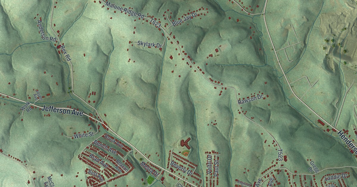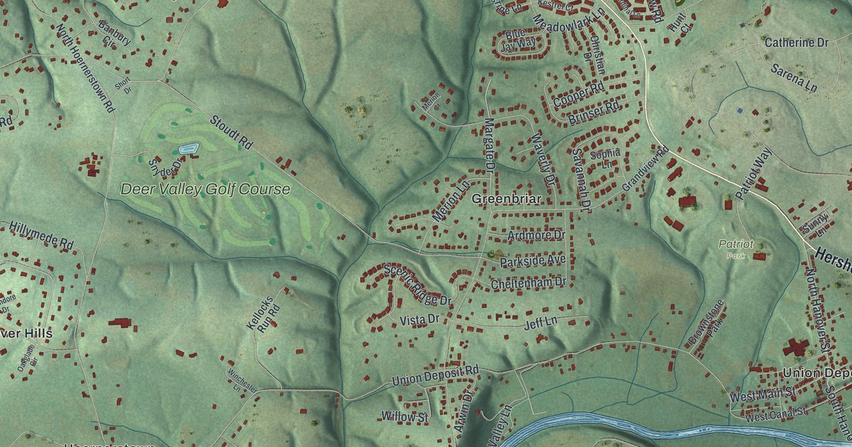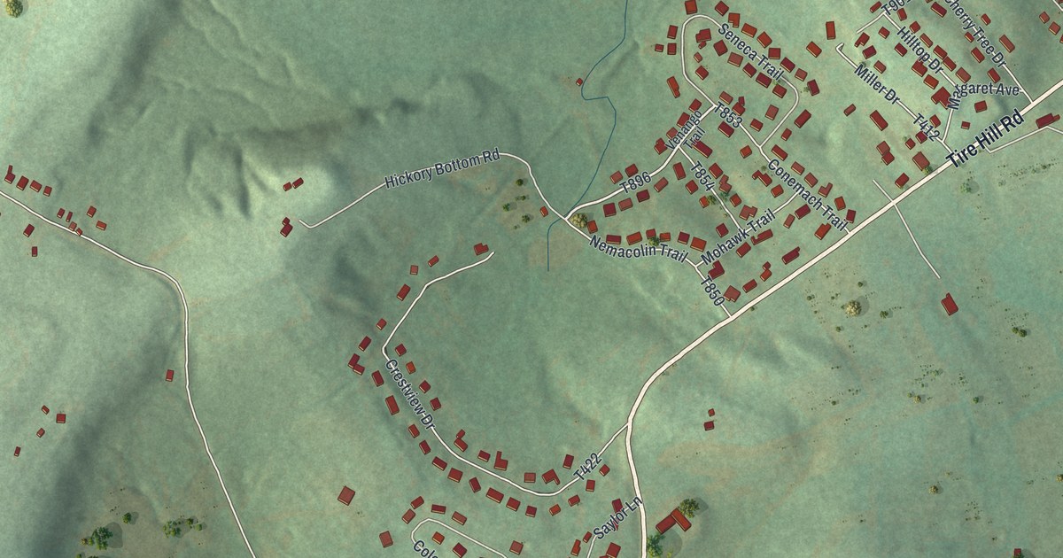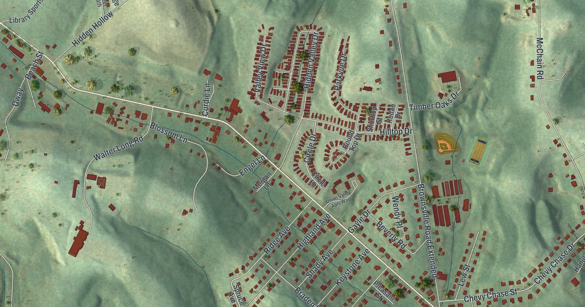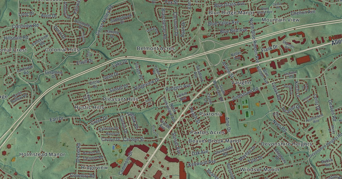
This beautifully detailed map of Lower Paxton, Pennsylvania was created in 2026 using aerial imagery combined with modern topographical, census, street and landmark data. It’s a one-of-a-kind view of Lower Paxton that combines accurate data with a vintage aesthetic. The map shows every building in its true location, many of the roads carry their names, and the shaded topographic relief shows the shape of the land.
Explore an aerial view of Lower Paxton, Pennsylvania
On the map you’ll find Koon’s Park, Lingle Park, Shoops Cemetery, Beaver Brook Manor, Belmont Acres, Bloomburg Village, Blue Ridge Manor, Brandywine Manor, Catalina, Centennial Acres, Clearview Manor, Club Estates, and more. If you look closely you can even find your house accurately drawn in its correct location. Zoom in on the preview to look for yours.
Take a closer look at the Lower Paxton map
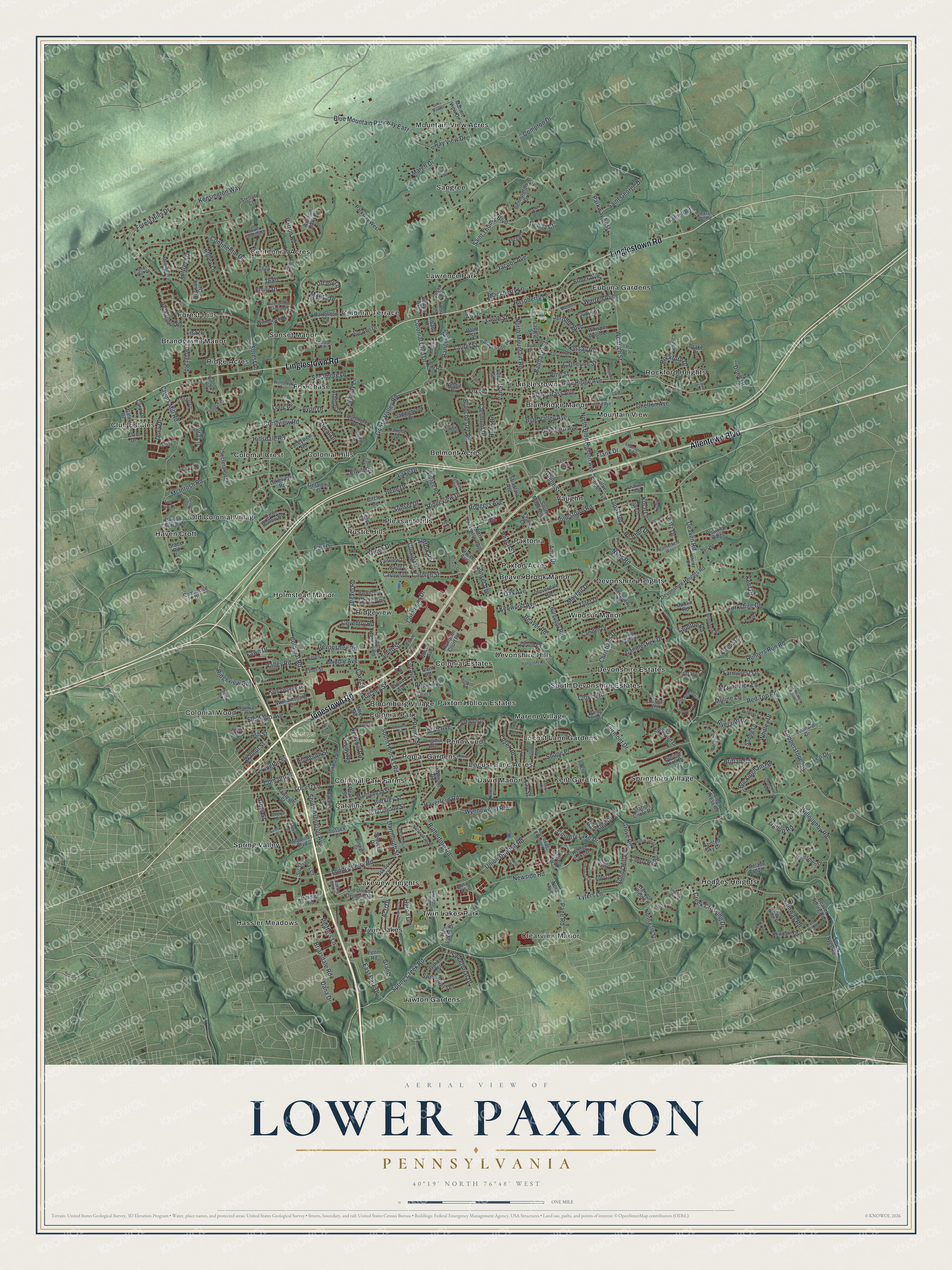
Street and place names on the Lower Paxton, Pennsylvania map
These names are printed on the map of Lower Paxton, Pennsylvania.
Places: Koon's Park, Lingle Park, Shoops Cemetery, Beaver Brook Manor, Belmont Acres, Bloomburg Village, Blue Ridge Manor, Brandywine Manor, Catalina, Centennial Acres, Clearview Manor, Club Estates, Colonial Crest, Colonial Estates, Colonial Hills, Colonial Park, Colonial Park Farms, Colonial Terrace, Colonial Wood, David Manor, Devonshire Estates, Devonshire Heights, Devonshire Hills, Eubuna Gardens, Forest Hills, Fox Chase, Hassler Meadows, Haven Croft, Hodges Heights, Holmstead Manor, Kent Gardens, Lakeview Heights, Lawrence Park, Lawton Gardens, Linglestown, Locust Lane Acres, Locust Lane Gardens, Marene Village, Mountain View, Mountain View Acres, Old Colonial Village, Paxton Acres, Paxton Hollow Estates, Paxtonia, Pennwood, Pleasant Hills, Poplar Gardens, Ridge Acres, Ridgeview, Rockford Heights, Rustic Hills, Sangree, South Devonshire Estates, Spring Valley, Springford Village, Sunset Manor, Twin Lakes, Twin Lakes Park, Vaughn and Windsor Manor.
Streets and roads: Jonestown Road, Linglestown Road, Allentown Boulevard, Forest Hills Drive, Wenrich Street, Blue Ridge Avenue, Dartmouth Street, Saint Thomas Boulevard, Spring Creek Road, South Houcks Road, Wynnewood Road, Colonial Road.
More street names, A to Z
Abbey Lane, Acri Drive, Adams Avenue, Albany Road, Alfano Drive, Allegheny Drive, Alleo Lane, Almari Lane, Amp Drive, Arbys Street, Arlene Street, Ashbury Drive, Ash Street, Aston Court, Augusta Drive, Autumn Oaks Drive, Autumn Vw, Avis Lane, Avon Drive, Balthaser Street, Barley Corn Square, Barnsley Drive, Beaver Road, Beaver Spring Road, Bennington Drive, Berkley Street, Berkshire Lane, Berryhill Road, Birch Knoll Drive, Blackberry Lane, Blanchester Road, Blue Bird Avenue, Blue Grass Avenue, Blue Mountain Parkway East, Blue Ribbon Avenue, Blue Stone Avenue, Blue Valley Avenue, Briarsdale Road, Brittan Road, Buckingham Road, Burgundy Road, Calvary Road, Camden Drive, Candlestick Drive, Cardigan Court, Care Street, Carol Drive, Carolyn Drive, Carolyn Street, Carrollton Drive, Catalina Lane, Catherine Street, Chapel Street, Charlton Road, Chelton Avenue, Cherry Hill Road, Cheryl Drive, Christians Drive, Churchill Road, Cider Press Road, Circle Drive, Clarendon Street, Clermont Drive, Cloverdale Road, Clover Road, Club Drive, Clubhouse Drive, Colonial Club Drive, Colorado Avenue, Commerce Drive, Commons Drive, Compton Drive, Concord Street, Continental Drive, Conway Road, Copperstone Road, Cornell Road, Country Lake Drive, Coventry Road, Creek Crossing Drive, Creek Drive, Creek Run Road, Creekwood Drive, Crestview Road, Crown Avenue, Crums Lane, Crums Mill Road, Curvin Drive, Dana Drive, Danner Road, Deaven Road, Deer Run Court, Delano Boulevard, Devon Drive, Devonshire Heights Road, Devonshire Road, Donna Jane Court, Dora Drive, Doral Drive, Doric Drive, Doris View Drive, Dover Road, Dowhower Road, Drake Drive, Drexel Road, Dublin Road, Dunmore Drive, Earl Avenue, Earl Drive, East Park Drive, Edsel Road, Egret Drive, Elmer Avenue, Elmerton Avenue, Elwill Drive, Emerald Lane, Emily Drive, Eric Drive, Ethel Street, Fairmont Drive, Fairview Drive, Fairway Lane, Farmcrest Lane, Fawn Drive, Fawn Ridge Road, Fenway Drive, Flank Drive, Ford Avenue, Forest Lane, Fox Street, Fritchey Street, Gale Drive, Galion Street, Gallop Road, Genoa Court, Geraldine Drive, Gibbel Road, Glen Street, Goose Valley Road, Grace Road, Grant, Green Tree Road, Grove Road, Hampshire Road, Hampton Court Road, Harvest Field Lane, Harwich Road, Hassler Road, Haverford Road, Heather Drive, Heatherfield Way, Hidden Lake Drive, Hillsdale Road, Hunters Run Road, Huntley Drive, Huntsmen Drive, Huron Drive, Irene Drive, Ironwood Drive, Iru Lane, Jacobs Avenue, Janelle Drive, Jaycee Avenue, Jerome Boulevard, Joya Circle, Judy Lane, Karen Drive, Kay Street, Keller Avenue, Kendale Drive, Kensington Way, Kent Drive, Kenwood Avenue, Keystone Drive, King Avenue, King George Drive, Knacklyn Farms Court, Koch Lane, Lake Drive, Lakeview Road, Lancer Street, Laporte Street, Laraby Drive, Larkin Avenue, Larue Street, Laura Lane, Laurel Lane, Laurel Street, Lemar Avenue, Lentz Drive, Leo Drive, Leonard Drive, Lester Court, Lexington Street, Liptak Drive, Lisa Drive, Locust Lane, Locust Street, Londonderry Road, Long Drive, Loop Drive, Lopax Road, Lori Drive, Lyters Lane, Mance Drive, Marblehead Street, March Drive, Marene Drive, Maria Drive, Marion View Drive, Mayfair Drive, McCormick Lane, McIntosh Road, Megoulas Boulevard, Melbourne Drive, Mercury Road, Middle Avenue, Miller Road, Mindy Drive, Moline Lane, Nassau Road, Nesbit Drive, Newside Road, Noll Road, Nora Avenue, Norfolk Place, North 67th Street, North Blue Ribbon Avenue, North Highlands Drive, North Houcks Road, North Lockwillow Avenue, North Mountain Road, Norwalk Drive, Nottingham Place, Nyes Road, Oak Avenue, Oakmont Road, Oak Park Circle, Oak Park Road, Old Union Deposit Road, Orchard Street, Outerbridge Crossing, Page Road, Page Road Extended, Painted Sky Drive, Palm Street, Parkway East, Parkway West, Patton Road, Paxton Church Road, Peach Street, Pearl Street, Peiffers Lane, Penn Road, Pine Street, Pleasant Hill Road, Plowman Ridge, Plymouth Street, Pond Road, Porche Drive, Prince Street, Quail Hollow Road, Queen Avenue, Ranger Road, Raspberry Lane, Rawleigh Street, Ray View Drive, Red Top Road, Regent Drive, Ridgeview Drive, Ridgeview Road, Ringneck Drive, Rockford Drive, Rodgers Avenue, Rolling Glen Drive, Rowe Lane, Royal Avenue, Rutherford Road, Ryan Drive, Ryecroft Drive, Saddlebrook Drive, Saddle Lane, Saint George Drive, Samoset Drive, Sanibel Drive, Scenery Drive, Scenic Court, Seabiscuit Way, Seattle Slew Drive, Secretariat Street, Sequoia Drive, Shannon Road, Shatto Drive, Shope Place, Sir Thomas Court, Smith Street, South Arlington Avenue, South Carolina Drive, South Mountain Road, South Nyes Road, South Road, Springford Drive, Spring Knoll Drive, Station Circle Road, Stellata Court, Stevenson Avenue, Stirrup Court, Stradford Avenue, Sue Ann Drive, Suffolk Road, Sumner Drive, Sunny Hill Lane, Sunrise Circle, Sunset Avenue, Sunset Drive, Superior Drive, Sussex Drive, Sweetbriar Drive, Sweetbrier Terrace, Sycamore Drive, Tarryton Road, Taunton Road, Tee Road, Temple Road, Terrace Court, Terrace Way, Terrill Road, Thicket Lane, Three Rivers Drive, Tiffany Lane, Tim Tam Drive, Toftree Drive, Trent Road, Trudy Road, Tudor Drive, Twin Lakes Drive, Tyler Drive, Union Deposit Road, Utah Avenue, Valley Road, Valleyview Road, Van Street, Vera Street, Vesta Drive, Vesta Lane, Village Road, Virginia Avenue, Walnut Street, Warren Avenue, Wayne Drive, Wellington Road, West Tilden Road, Whisper Wood Lane, Whitley Drive, Williamsburg Drive, Willoughby Road, Willow Spring Road, Wilshire Road, Wimbledon Drive, Windmere Road, Winfield Street, Winston Road, Winthrop Drive, Withers Court, Woodvale Road, Yorkshire Drive.
See the Lower Paxton, Pennsylvania map on a wall
The Lower Paxton map as an 18 x 24 inch print in a black frame.

This beautifully detailed map of Lower Paxton makes an attractive addition to your office, library, or den, and it can even be used to teach children the geography and history of the area. It also makes a great gift for anyone with Lower Paxton roots. When you’re done exploring, click here to get your copy of the Lower Paxton map.