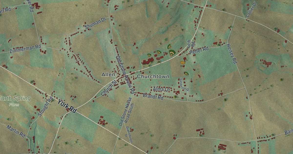
If you grew up around Churchtown or Brandtsville, or you have family out along York Road, this map gives you plenty to find. It's a modern aerial view of Monroe Township in Cumberland County, Pennsylvania, made from modern data and given a vintage artistic feel. Green and tan farm fields cover most of the sheet, and more than 12,000 buildings are drawn in dark red. A blue creek winds across the lower half, and steep, shaded hills rise along the bottom edge.
Churchtown, York Road and Williams Grove
Start at Allen and Churchtown, printed side by side near the middle of the map. Church Street runs through them, between Boiling Springs Road and Zimmerman Road. Brandt Road heads east from there toward Heisey Road. Just south, York Road crosses the sheet on a long slant. Follow it southeast, past the turns for Baish Road and Park Place, and you'll reach Brandtsville beside the creek.
From Brandtsville, Park Place runs east to Williams Grove, where Speedway Drive and Steam Engine Hill are printed. From Williams Grove, take Park Place west to York Road, then follow York Road west to Leidigh Drive. Leidigh Drive heads west toward Leidighs. From there, Kuhn Road heads east into the hills to White Rock Acres. Up at the top of the map, West Trindle Road runs past Locust Point, with Roxbury and Trindle Springs farther east. Many roads are labeled, and each red shape is a building, so zoom in on the preview and look for yours.
A plow patent in Monroe Township's history
An 1886 Cumberland County history says Plank came from Lancaster County at an early date. It says he invented what was probably the first plow patented in Pennsylvania. Churchtown and Brandt Road are printed near the middle of this map.
The Grangers' picnic at Williams Grove
Williams Grove has a story of its own. A state historical marker on Williams Grove Road says its railroad connection made Williams Grove the home of the Great Grangers' Interstate Picnic Exhibition. Robert H. Thomas of the Pennsylvania State Grange started it in 1874. By the 1890s, a week of the event drew an estimated 100,000 people or more. The John Williams House, built about 1799, is listed on the National Register; the marker places it nearby. Find Williams Grove on the right side of the map, where Park Place meets Williams Grove Road.
For anyone from Churchtown or Brandtsville
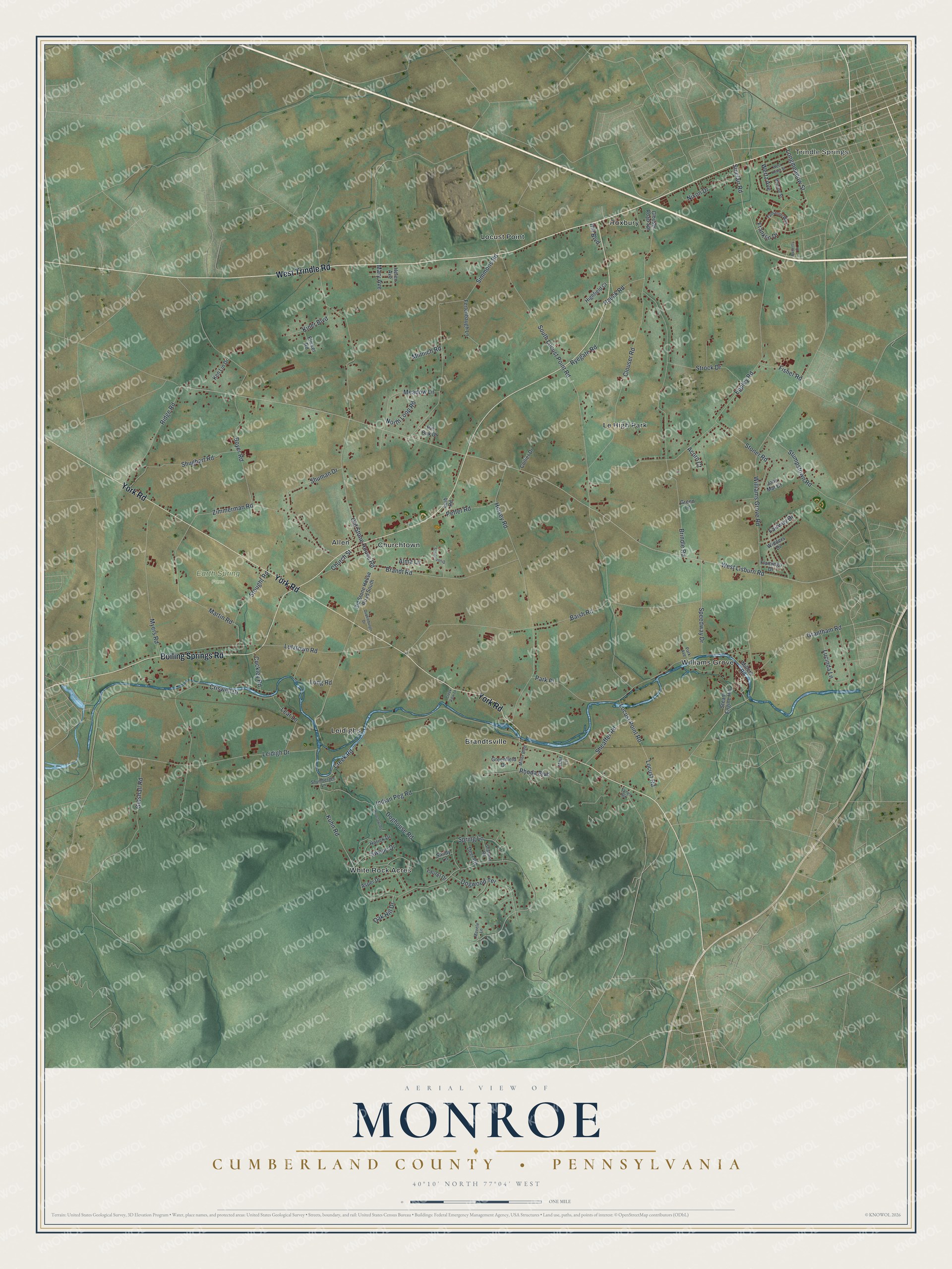
Created by KNOWOL in 2026, this Monroe map shows shaded hills, farm fields in soft green and tan, and buildings in deep red. The title panel names Monroe in Cumberland County, Pennsylvania, and gives the coordinates 40°10' North, 77°04' West. A one-mile scale bar sits below it.
It suits a farmhouse kitchen, a den or an office wall. It's a thoughtful gift for someone who grew up near Churchtown, has family around Williams Grove, or moved away from these farm roads. Open the preview, zoom in and find the road you know. See sizes and frames for the Monroe, Cumberland County map.