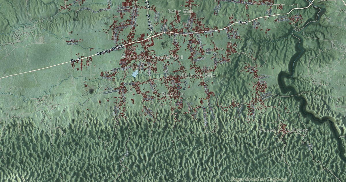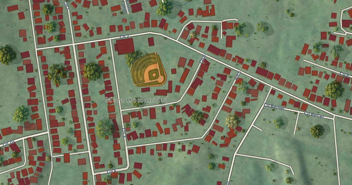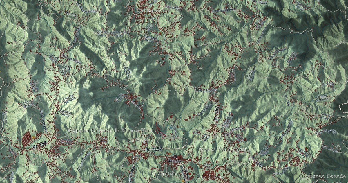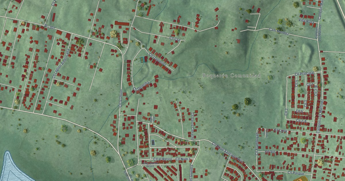
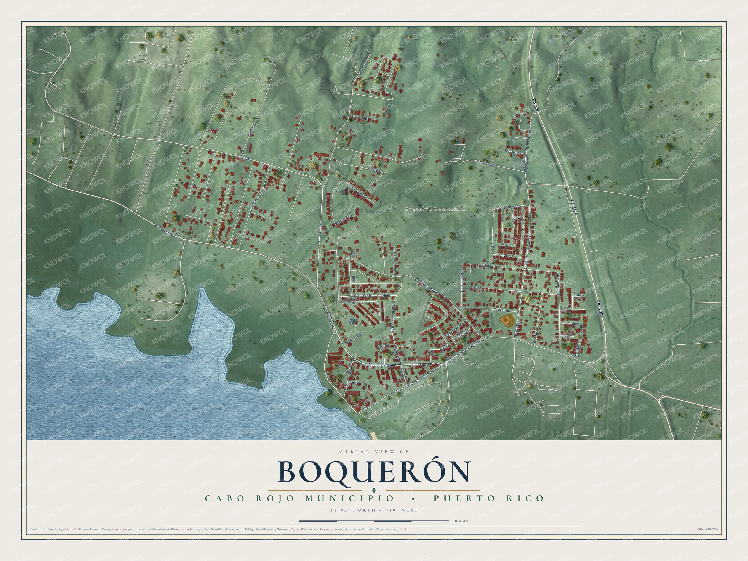
This beautifully detailed map of Boquerón, Puerto Rico was created in 2026 using aerial imagery combined with modern topographical, census, street and landmark data. It's a modern aerial view of Boquerón in Cabo Rojo Municipio, Puerto Rico, that combines modern data with a vintage aesthetic. The roads feature printed names, and if you look closely you can find your exact house accurately shown in its correct location.
Explore an aerial view of Boquerón, Puerto Rico
On this map you'll find Boquerón Comunidad, Pr- 100, Pr- 307, Callejón Gilloty, Cam del Tren, Cll Estacion, Cll Juan Silvestry Franqui, Cll Manuel Guilloty, Cll Jose de Diego, Cll Drive Santiago Ruiz, Cll Num 1, Cll el Retiro, and more. Each red shape is a building, so zoom in on the preview and look for yours.
Boquerón is a community in Cabo Rojo Municipio. The Census Bureau counted 1,964 people here in 2020. Boquerón sits about 3 miles west of Betances, 3 miles south of Puerto Real and 4 miles southwest of Cabo Rojo. The map prints the town name in its title panel, with the coordinates below it.
Looking for a different Boquerón? Puerto Rico also has Boquerón in Las Piedras Municipio.
Take a closer look at the Boquerón map
Names on this map
These names are printed on this map.
Places: Boquerón Comunidad.
Streets and roads: Pr- 100, Pr- 307, Callejón Gilloty, Cam del Tren, Cll Estacion, Cll Juan Silvestry Franqui, Cll Manuel Guilloty, Cll Jose de Diego, Cll Drive Santiago Ruiz, Cll Num 1, Cll el Retiro, Cll Cofresi.
More street names, A to Z
Cabo Queron Resort, Callejón Interior, Callejón Los Marinez, Callejón Los Martinez, Callejón Martinez, Cam Mendez, Carr 101, Cll 2, Cll 2-A, Cll 2-B, Cll 3, Cll 4, Cll 5, Cll 7, Cll Aluaro Creitofrt, Cll Alvaro Creittoff, Cll Anfel Doitteau, Cll Angel Doiteau, Cll Aymat, Cll Barbosa, Cll Carmen Vignals, Cll Csn, Cll Derecha, Cll Fermin Morales, Cll Flamboyan, Cll Garcia Camacho, Cll Gil Bouyet, Cll Izquierda, Cll José de Diego, Cll Juan Silvestri Franqui, Cll Julio Marini, Cll la Union, Cll Legion Americana, Cll Lucia Morales, Cll Luis Munoz Rivera, Cll Luna, Cll Luna Int, Cll Mirasol, Cll Pancha Matos, Cll Parque, Cll Principal, Cll Recoleta, Cll Rivavil, Cll Sol, Cll Tamarindo, Cll Union, Cll Unión, Cll Vinals, Pr- 101, Villa Rosa.
See it on a wall
The Boquerón, Cabo Rojo Municipio map as a framed print. Swipe for more.


Created by KNOWOL in 2026. The buildings are small red shapes, the roads carry their printed names, and shaded relief shows the shape of the land. The title panel reads "AERIAL VIEW OF BOQUERÓN, CABO ROJO MUNICIPIO • PUERTO RICO" with 18°02' NORTH 67°10' WEST.
It suits a den, a classroom or a front hall, and it makes a gift for anyone with Boquerón roots. Open the preview and find the block you know. See sizes and frames for the Boquerón map.