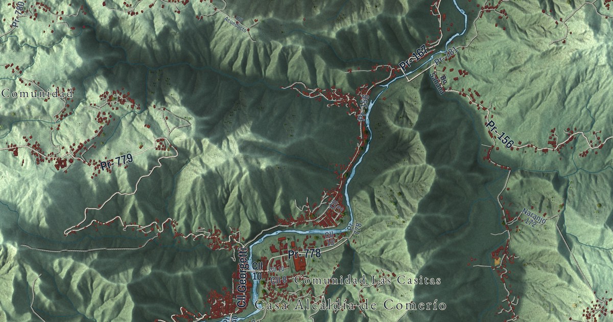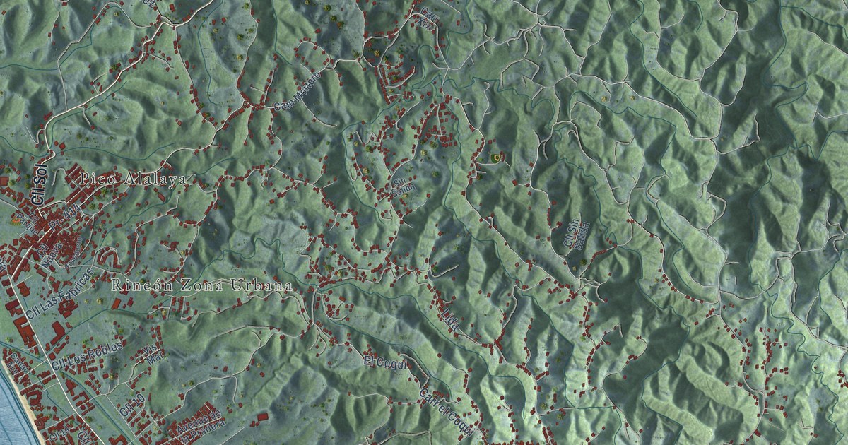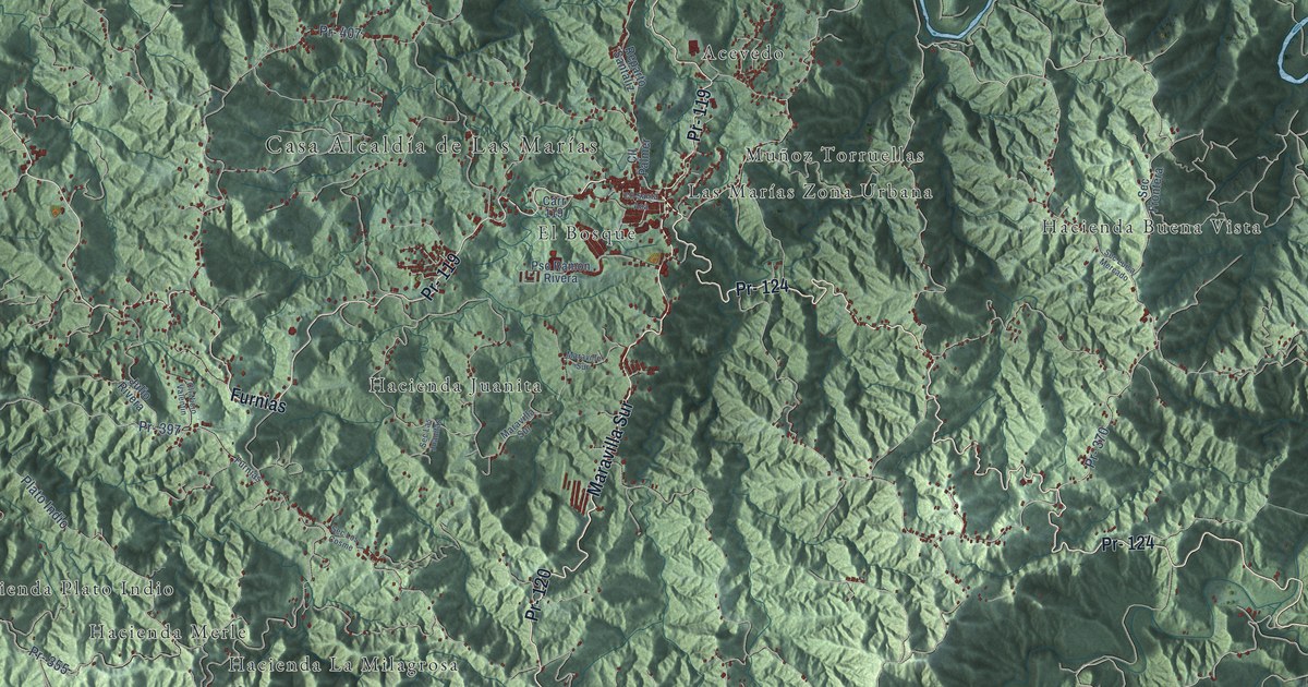
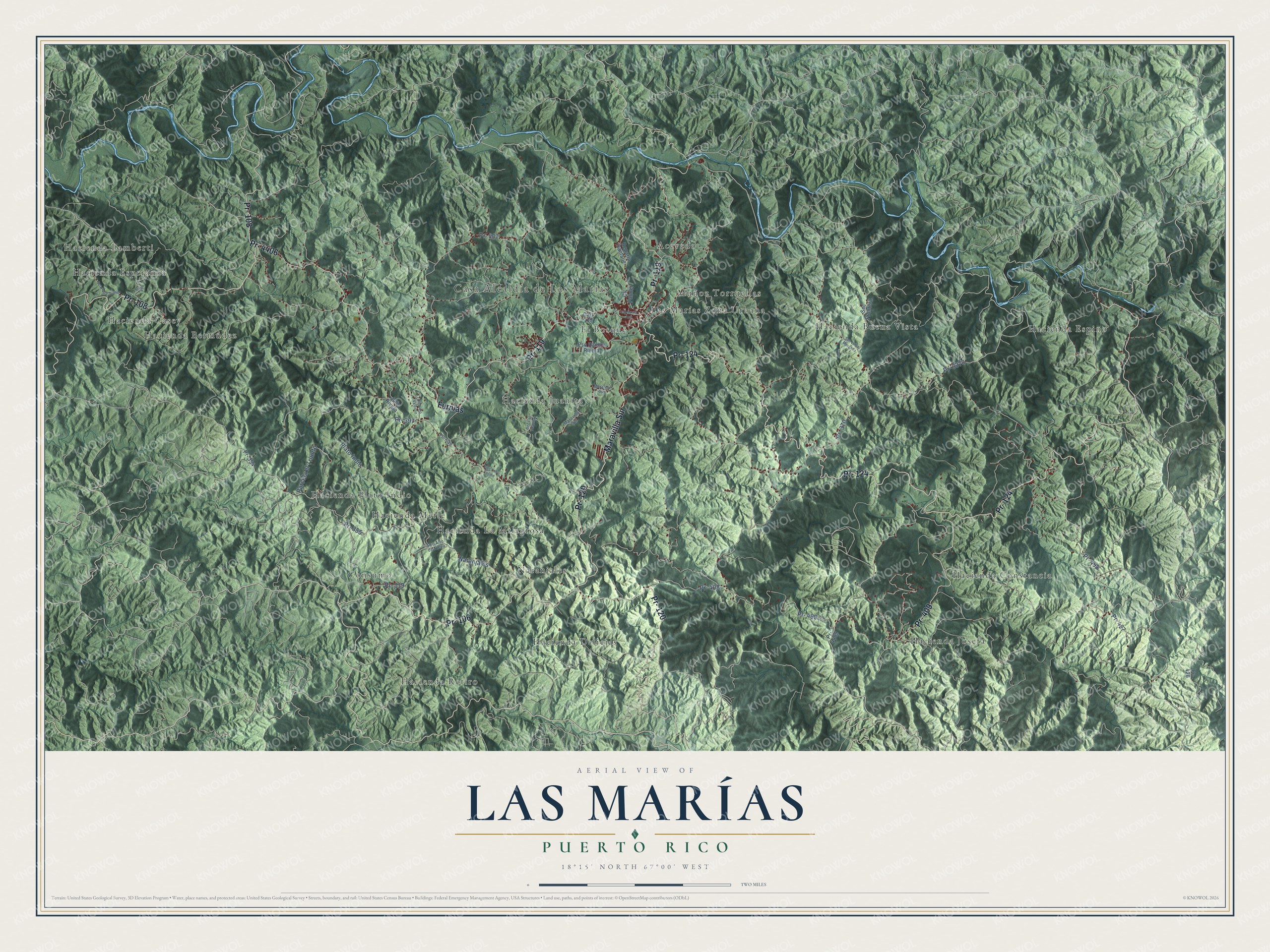
This beautifully detailed map of Las Marías, Puerto Rico was created in 2026 using aerial imagery combined with modern topographical, census, street and landmark data. It's a modern aerial view of the municipio of Las Marías, Puerto Rico, that combines modern data with a vintage aesthetic. The roads feature printed names, and if you look closely you can find your exact house accurately shown in its correct location.
Explore an aerial view of Las Marías, Puerto Rico
On this map you'll find Casa Alcaldía de Las Marías, Acevedo, Consumo, El Bosque, Hacienda Bermúdez, Hacienda Buena Vista, Hacienda Casey, Hacienda Constancia, Hacienda Delicias, Hacienda Esperanza, Hacienda Espino, Hacienda Josefa, and more. Each red shape is a building, so zoom in on the preview and look for yours.
Las Marías has a story worth telling. The 1899 Report on the Island of Porto Rico puts it this way: "The principal coffee districts are Yauco, Mayaguez, Las Marias, Maricao, Lares, and Utuado."
Las Marías is one of the 78 municipios of Puerto Rico. The Census Bureau counted 8,874 people here in 2020.
Take a closer look at the Las Marías map
Names on this map
These names are printed on this map.
Places: Casa Alcaldía de Las Marías, Acevedo, Consumo, El Bosque, Hacienda Bermúdez, Hacienda Buena Vista, Hacienda Casey, Hacienda Constancia, Hacienda Delicias, Hacienda Esperanza, Hacienda Espino, Hacienda Josefa, Hacienda Juanita, Hacienda La Milagrosa, Hacienda Lamberti, Hacienda Merle, Hacienda Plato Indio, Hacienda Retiro, Las Marías Zona Urbana, Muñoz Torruellas and Naranjales.
Streets and roads: Pr- 124, Pr- 120, Pr- 108, Pr- 409, Pr- 119, Pr- 4406, Pr- 106, Maravilla Sur, Furnias, Pr- 370, Pr- 498, Pr- 427.
More street names, A to Z
Carr 119, Cll Nicio Valentin, Cll Palmer, Cll Santa Ana, Julio Rivera, Maraville Sur, Parcela el Triunfo, Plato Indio, Pr- 354, Pr- 355, Pr- 397, Pr- 406, Pr- 407, Pr- 408, Pr- 426, Pr- 3370, Pr- 4409, Pso Ramon Rivera, Reparto Santaliz, Sec Alto de Nieva, Sec Frontera, Sec Las Juanitas, Sec Los Cosme, Sec Luisa Mercado, Sec Pepe Trabal.
Created by KNOWOL in 2026. The buildings are small red shapes, the roads carry their printed names, and shaded relief shows the shape of the land. The title panel reads "AERIAL VIEW OF LAS MARÍAS, PUERTO RICO" with 18°15' NORTH 67°00' WEST.
It looks right in a kitchen, an office or a den, and it's a gift for anyone who grew up in Las Marías or moved away. Open the preview and find your street. See sizes and frames for the Las Marías map.