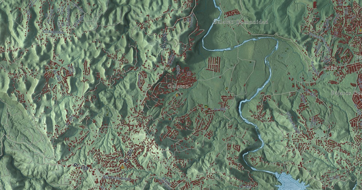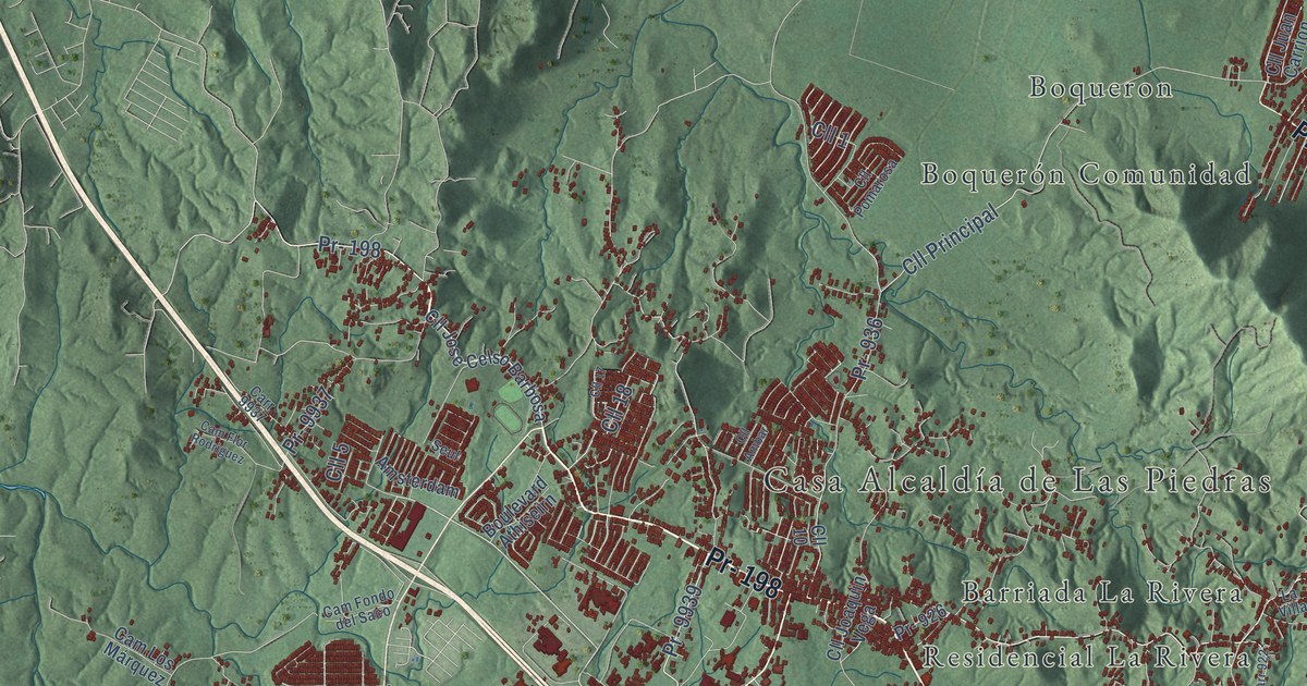
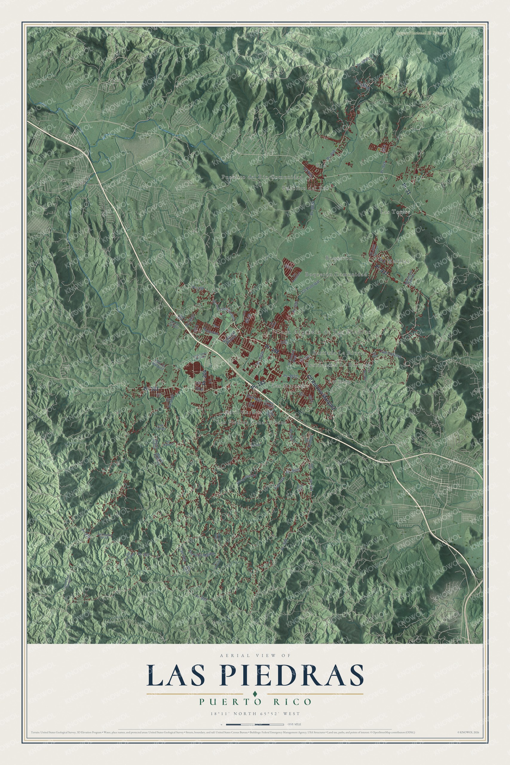
This beautifully detailed map of Las Piedras, Puerto Rico was created in 2026 using aerial imagery combined with modern topographical, census, street and landmark data. It's a modern aerial view of the municipio of Las Piedras, Puerto Rico, that combines modern data with a vintage aesthetic. The roads feature printed names, and if you look closely you can find your exact house accurately shown in its correct location.
Explore an aerial view of Las Piedras, Puerto Rico
On this map you'll find Casa Alcaldía de Las Piedras, Bosque Nacional El Yunque, April Garden, Barriada La Rivera, Boqueron, Boquerón Comunidad, Fermina, Las Mercedes, Las Piedras Zona Urbana, Las Torres, Melillas, Pueblito del Rio, and more. Each red shape is a building, so zoom in on the preview and look for yours.
Every town has a first chapter, and Las Piedras is no exception. The 1940 WPA Guide to Puerto Rico puts it this way: "Although founded in 1801, the area had been settled as early as 1759 under the name of La Ribera de Las Piedras (Sp. the bank of the stones), and its jurisdiction was very extensive up to the end of the eighteenth century when the municipalities of Humacao, Gurabo, and Juncos were incorporated."
Las Piedras is one of the 78 municipios of Puerto Rico. The Census Bureau counted 35,180 people here in 2020.
Take a closer look at the Las Piedras map
Names on this map
These names are printed on this map.
Places: Casa Alcaldía de Las Piedras, Bosque Nacional El Yunque, April Garden, Barriada La Rivera, Boqueron, Boquerón Comunidad, Fermina, Las Mercedes, Las Piedras Zona Urbana, Las Torres, Melillas, Pueblito del Rio, Pueblito del Río Comunidad, Residencial La Rivera and Río.
Streets and roads: Pr- 198, Cll Antonio Marquez, Pr- 204, Pr- 183, Pr- 31, Pr- 937, Cam Collores, Cll 1, Cll 5, Cll Principal, Pr- 9948, Cll 18.
More street names, A to Z
Amsterdam, Boulevard Athiseirn, Cam Flor Rodriguez, Cam Fondo del Saco, Cam Los Márquez, Carr 905, Carr 908, Carr 914, Carr 922, Carr 9917, Carr 9937, Carr 9948, Carr Tejas, Cll, Cll 2, Cll 3, Cll 4, Cll 6, Cll 8, Cll 9, Cll 10, Cll 17, Cll 19, Cll Ambar, Cll Auadola, Cll Bambu, Cll Eucalipto, Cll Joaquin Vega, Cll Jose Celso Barbosa, Cll Juan Carrion, Cll Nilo, Cll Pomarosa, Cll Rey Enrique, Ilan Ilan, La Villa, Los Cruces, Los Márques, Miguel Ramires, Miguel Ramirez, Pr- 905, Pr- 908, Pr- 914, Pr- 916, Pr- 917, Pr- 921, Pr- 922, Pr- 926, Pr- 936, Pr- 948, Pr- 949, Pr- 9921, Pr- 9922, Pr- 9936, Pr- 9937, Pr- 9939, Privado, Quenbrada Arenas, Sec Asomante, Sec la Pr, Sec Lupito, Sec Montellano, Sec Poupal, Sec Puesta del Sol, Sectur Los Castros, Sec Yeyo Malavé, Seul.
See it on a wall
The Las Piedras map as a framed print. Swipe for more.


Created by KNOWOL in 2026. The buildings are small red shapes, the roads carry their printed names, and shaded relief shows the shape of the land. The title panel reads "AERIAL VIEW OF LAS PIEDRAS, PUERTO RICO" with 18°11' NORTH 65°52' WEST.
Hang it in the hallway, the office or the cabin, or give it to someone who left Las Piedras and still calls it home. Open the preview and look for a street you know. See sizes and frames for the Las Piedras map.